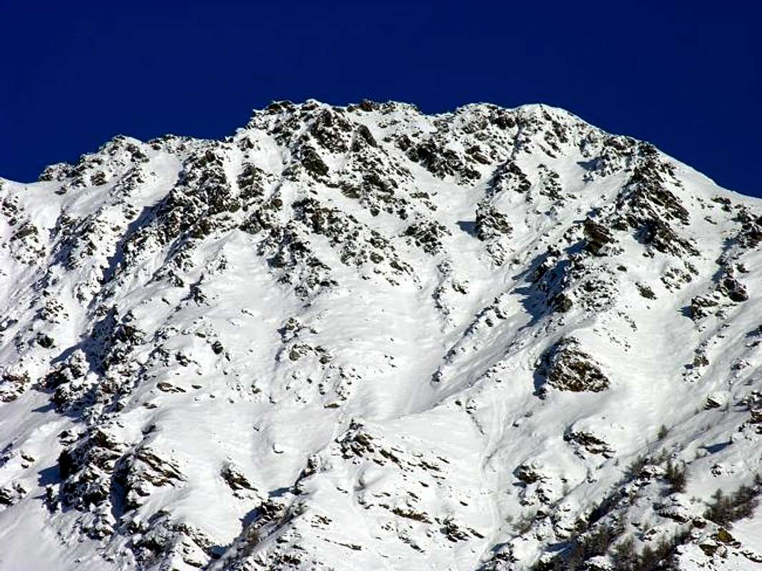
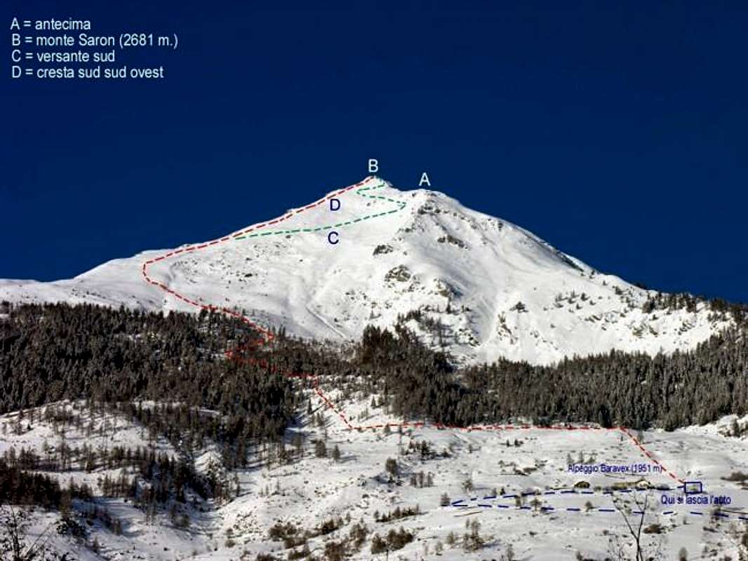
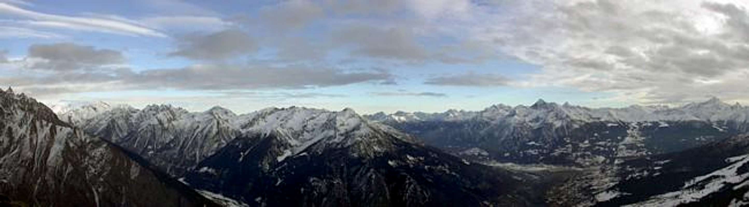
Monte Saron, a modest summit in the shape of a squat pyramid, is almost at the center of the Valle d'Aosta Region. Easily seen from the City of Aosta (583m), this peak is simply the southernmost ramification of Mont Vélan. This summit is very popular in both summer and winter for the easy ascents of its South face and South-Southwest ridge. These routes provide excellent training for more demanding itineraries. From the Summit of Monte Saron one enjoys grand vistas encompassing Monte Rosa and Mont Blanc.
First Ascent
First on the summit: Unknown.
In Winter: Unknown.
Getting There
BY CAR:
From Torino, Milano, etc: Motorway A5. Exit Aosta Est.
From Switzerland: through the Grand St. Bernard Tunnel or the homonym Pass).
From France: through Mont Blanc Tunnel or Petit St. Bernard Pass. It isn't necessary to enter in Motorway A5, you can drive through SS.26 Aosta direction.
BY PLANE:
Aeroporto "Corrado Gex" Saint Christophe (Aosta).
Route
From the City of Aosta (583m) follow the road for Gran San Bernardo SS.27 for about 10 Km. At the fork for the Village of Allain (1.251m) turn left and go past the village itself and the nearby Hamlet of Villa to reach the Pasture of Baravex (1.914m), where a sign prohibits access to unauthorized vehicles. Park there and begin the ascent of the easy slopes. In about 2 hours you'll reach a false summit, marked by a cross. Skirt this false summit and in another half hour reach the true one (2.681m), marked by another, large wooden cross. (Total time from the Baravex Pasture 2h'30).
Difficulties
The route is classified E/F.
Equipment
Normal hiking gear.
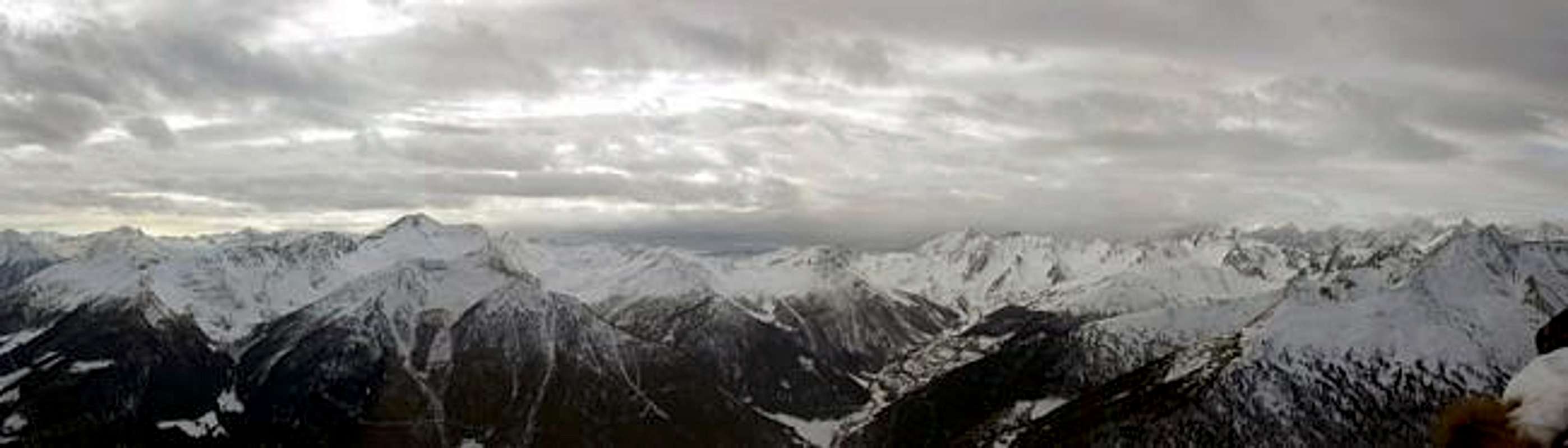
Panoramic views from the summit
Campings
Remember that free camping is forbidden (except for emergency reasons, over 2.500m, from darkness until dawn).
Mountain conditions
Meteo: you can find all the needed informations at the official site of the Valle d'Aosta Region:
FONDAZIONE MONTAGNA SICURA Villa Cameron, località Villard de la Palud n° 1 Courmayeur (AO) Tel: 39 0165 897602 - Fax: 39 0165 897647.
SOCIETA' DELLE GUIDE DELLA VALPELLINE Etroubles-Strada Nazionale, n° 13 - Tel +39 0165 78559 - Valpelline-Loc Capoluogo, n° 1 - Tel +39 0165 713502 (AO) Italia.
A.I.NE.VA. (Associazione Interregionale Neve e Valanghe).
Useful numbers
Protezione Civile Valdostana località Aeroporto n° 7/A Saint Christophe (Ao) Tel. 0165-238222.
Bollettino Valanghe Tel. 0165-776300.
Bollettino Meteo Tel. 0165-44113.
Unità Operativa di Soccorso Sanitario Tel. 118.
External Links
Another description, for Ski-Mountaineering Mont Saron. A more detailed page for Ski-Mountaineering this mountain. Great descent on South face. Description only in italian.
Parents refers to a larger category under which an object falls. For example, theAconcagua mountain page has the 'Aconcagua Group' and the 'Seven Summits' asparents and is a parent itself to many routes, photos, and Trip Reports.

 9397 Hits
 88.61% Score
 27 Votes