
-
 9755 Hits
-
 75.81% Score
-
 6 Votes
|
|
Mountain/Rock |
|---|---|
|
|
35.85000°N / 115.509°W |
|
|
Clark |
|
|
Hiking |
|
|
5864 ft / 1787 m |
|
|
Overview

Shenandoah Peak lies at the southern end of the Spring Mountains of Southern Nevada. It is part of the North Mesquite Wilderness Area. It rises to the west above the community of Good Springs, NV. This classic desert peak offers great views of Mt. Potosi to the North, Clark Mountain south into California, McCullough Mountain to the East, and you can get a glimpse of Mt. Charleston and Griffith Peak to the NW.
Shenandoah Peak, located west of Goodsprings in the Spring Mountains, was named to commemorate Confederate victories in VA in 1862.

Getting There
From Las Vegas drive south on I-15 to exit 12 at Jean. Turn East towards Good Springs.Drive for 6.8 miles to a stop sign at Esmeralda. Turn Right.
Drive 0.2 miles (7.0 total) to Pacific, turn left.
Drive on this main road, which has a curve after about a half mile. After 2.7 miles (10.7 total) there is a fork in the road. Take the left fork.
Drive another 1.2 miles (11.9 total) and then turn left on a dirt road, drive less than 100 yards and you will see a place to park in front of the ridge straight in front of you. You do not need to continue up the road any further.
Red Tape - Camping
There is no red tape. Camping is permitted anywhere within 100 feet of a designated road as long is it is not within 1/4 mile of a water source. Campfires are permitted using dead wood.The Hike
Refer to the Shenandoah from the North route. This is the shortest route to the summit.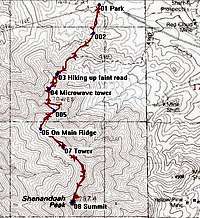 GPS Trace
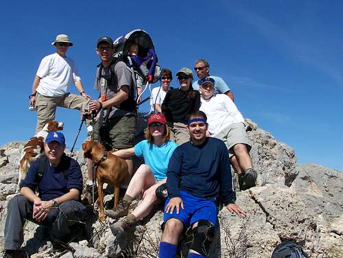
Summit Shots

Weather Report
