
|
|
Mountain/Rock |
|---|---|
|
|
39.76790°N / 106.3854°W |
|
|
12426 ft / 3787 m |
|
|
Overview
Meridian Peak is the northern-most 12,000 foot peak in the Gore Range. In contrast to most peaks in the Gores, Meridian Peak is a gentle ridge instead of a jagged peak. It is probably the easiest 12,000 foot peak in the Gores.Even though the peak is not rugged, it is a very worthwhile climb, as there are many jagged peaks and ridges visible from the summit. Since you follow the ridge for a long distance (especially from the Elliot Ridge Route), the views are very spectacular along most of the hike. The route from Cataract Lake has many scenic lakes along the way.
One aspect of the Elliot Ridge-Meridian Peak that there are usually many long snowfields along the east side of the ridge all the way to Meridian Peak through the summer, despite the fact than many of the much higher peaks in the area are snow free in summer. Though the topos show permanent snowfields all along the ridge, during the terribly dry winter and record warm summer of 2002, most melted. Only the snowfield east of Meridian Peak survived through August and September. In most years however, snowfields are present throughout the summer along most of the Elliot Ridge to Meridian Peak.
 Meridian Peak and elk as viewed on July 23 2011.
Getting There
Elliot Ridge Trailhead:Follow Highway 9 north of Silverthorne or south of Kremmling, to County Road 10-Spring Creek Road which branches to the west of Highway 9 between mile post 128 and 129. (This is 2.5 miles north of Green Mountain Reservoir). Follow the gravel road (County Road 10) west turning right after a short distance at a "public access" sign. Go straight at the intersection at 6.3 miles from the highway. After another 1.1 miles, turn right at the road posted for "Sheephorn Drive" and "Mahan Lake". Stay on the main track until you reach an intersection 10.4 miles from the highway (3 miles from the Sheephorn Drive sign). Stay left following the road posted for Mahan Lake. In another 1.6 miles, turn right at the fork. After another mile turn left and follow the short track to Blue Lake. This is the trailhead. The road to the trailhead is pretty rough for passenger cars.
Cataract Lake Trailhead:
From Highway 9 16 miles north of Silverthorne (16.7 miles from exit 205 off I-70) turn west on County Road 30 (at the south end of Green Mountain Reservoir) posted for Heeney. Follow the road 5.4 miles to County Road 1725 (Cataract Creek Road) and turn left following the road 2.3 miles to the Surprise Trailhead. Or from Kremmling, follow Highway 9 south for 12.4 miles to the Green Mountain Reservoir. Follow County Road 30 passing along Green Mountain Reservoir and through Heeney for 5.1 miles to County Road 1725 (Cataract Creek Road) and turn right following the road 2.3 miles to the Surprise Trailhead at Lower Cataract Lake. There is a small fee for parking at the trailhead. The road is gravel, but any car should be able to make it to the trailhead.
Routes Overview
The Elliot Ridge Route is the easiest route up Meridian Peak. Breifly put (see the route page for more details): From the trailhead at Blue Lake, the route follows the trail, which is an old blocked off 4wd road, along the west side of Elliot Ridge. The trail is an up-and down route and passes over or near several highpoints along the way. The route follows the ridge all the way to Meridian Peak. Looking along the Elliot Ridge on the way to Meridian Peak.
The Cataract Lake Route is a scenic route that has more elevation gain (but is still easy). Breifly put (see the route page for more details): From the trailhead this route follows the Surprise Trail south to a junction with the Gore Range Trail before turning left and following the trail a short distance to Surprise Lake. The route continues west along the Gore Range Trail reaching another junction and turns left and heads to Upper Cataract Lake. From Cataract Lake, the route continues along the trail with some up and downs before descending to Mirror Lake. The trail then switchbacks and climbs up to Elliot Ridge to where it joins the route above.
 Meridian Peak from the southeast.
Maps indicate that there are trails that access the Elliot Ridge from the west, and also Meridian Peak from the south. The route from Piney Lake seems to be the shortest of all routes to the summit, but I am unfamiliar with the west and south sides of the mountain.
Red Tape
No permits are required for climbing the peak. Parking at the trailhead at Cataract Lake requires a small fee. The peak and surrounding areas are located in the Eagles Nest Wilderness Area and all wilderness regulations apply.Time Needed for Hike
Most hikers should be able to complete the Elliot Ridge Route to the summit of Meridian Peak in one day. The Cataract Lake Route to the summit is usually a two-day hike.When To Climb
July through September is the normal season and also the only time when the road to the Elliot Ridge is open. The road to Lower Cataract Lake will be open earlier and later, but expect lots of snow on the trail outside the summer season.Elliot Ridge could make an interesting ski tour, but it would be a really long way to ski up the road just to reach the trailhead. Lower Cataract Lake is more accessible in winter than Elliot Ridge and is usually plowed to fairly close to the trailhead. The east slopes and face of Meridian Peak have some avalanche danger, but if you head north on the marked trail and approach from the north ridge there should never be any avalanche danger at any time making this a safe winter ascent as long as you stay on route.
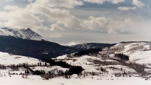 Winter on Meridian Peak (center) and Eagles Nest (left) from the east
Camping
Elliot Ridge Route:There are several informal campsites along the road to the trailhead after reaching public land, including a site right at the trailhead.
There are no really good campsites along hike along the Elliot Ridge because of the exposed nature of the ridgetop, though there are some campsites available. You may have to drop off the ridge to look for a campsite. There is also no water available other than the permanent snowfields.
 Camping along the Elliot Ridge.
Cataract Lake Route:
There is a campground at Lower Cataract Lake, as well as several others around Green Mountain Reservoir. Contact the Dillon District of Arapahoe National Forest, Kremmling Office at 970-724-9004 for information on these campgrounds.
There are many good campsites along the trail all the way to the pond at 11,050 feet. Campsites around Surprise Lake, Cataract Lake, and Mirror Lake tend to see over use in the summer time, so if you want solitude camp higher along Cataract Creek.
Mountain Conditions
NORTHERN GORE RANGE WEATHER FORECASTFor more information and trail conditions call the Arapahoe National Forest, Dillon District, Kremmling Station at 970-724-9004.
 Enjoying the summit of Meridian Peak.