-
 13468 Hits
-
 79.78% Score
-
 11 Votes
|
|
Mountain/Rock |
|---|---|
|
|
40.26240°N / 9.45910°E |
|
|
3763 ft / 1147 m |
|
|
Overview
How high does a mountain have to be to be impressive enough to be posted to SP?. This is a question I have been asking myself ever since I joined in November 2003, especially when I considered submitting low ones like Monte Gozzi or Rotenfels. Having spent a fortnight on the mediterrenean island of Sardinia (Sardegna in Italian) I finally know the correct answer: it doesn't matter.
Being the second largest island of the Mediterranean Sardinia is known to most as a country with beautiful bays and beaches with high plain inlands. Great on the coast but somehow boring otherwise. Yes there are climbers - Italian and German - who know that the island is a climbing paradise but regularly the common (and ignorant) question you get after returning is: "Sardinia? Is it called so because there are lots of Sardines?"
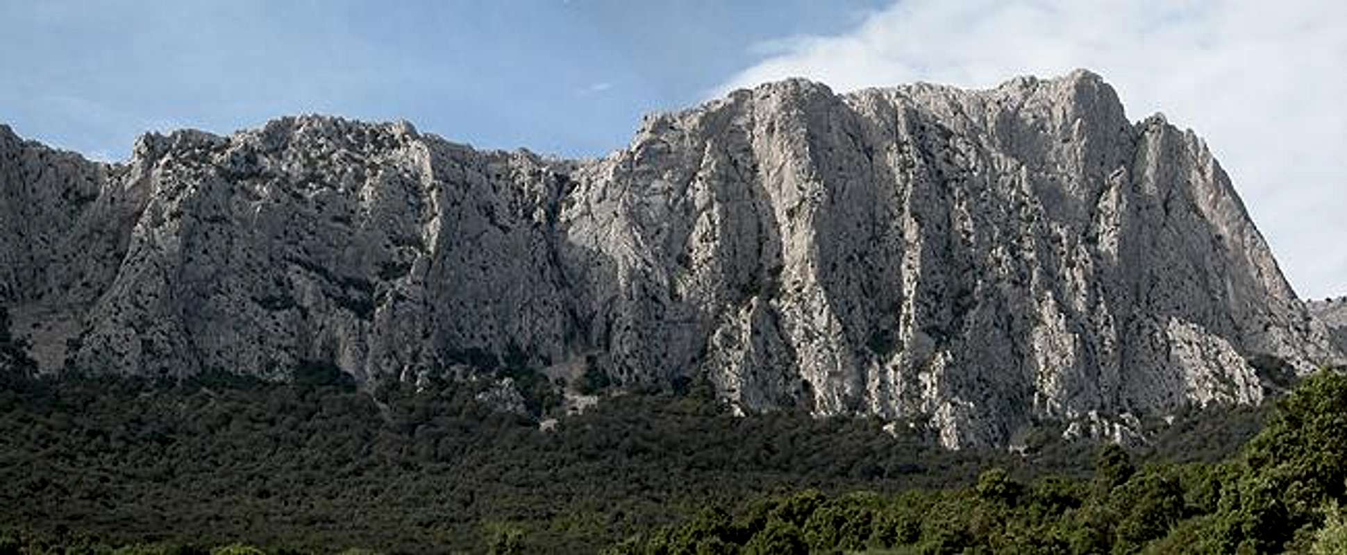
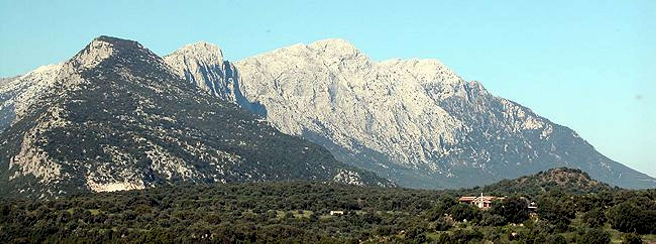
Punta Cusidore is a case in point. Not even by island standards is it a large mountain. With 1147m it is only almost half as high as the island highpoint, Punta La Marmora (1833m). Even the surrounding summits of the Supramonte Group, to which Punta Cusidore belongs are higher with the exception of Bruncu Nieddu, its direct neighbour to the east.
But 500m of these 1147m are (almost) vertical limestone wall. Impressive, when you stand at its base, even more so when you stand on the summit and everywhere you look there is a drop of at least 200m! Either way you are strongly reminded of the Dolomites - the rock is similar (though limestone, not Dolomite) but generally of a more solid composition. The huge gravel, boulder and debris slopes you find in the Dolomites here are already covered with oak forrests - the creation of the summits just dates back a longer time.
In all this makes the mountain one of the main climbing attractions of the island. To be sure: the beautiful climbing crags on the east coast are far more crowded but then: not everyone is able to do a multihour climb up a 300m pillar. Even the normal route is quite demanding. The first half is a regular hike up a large, steep and gravelly couloir, the second half has some easy climbing stretches (class II) strewn in between.
Due to the lack of height the summit views are not quite what makes the summit stand out. You have quite nice views of the Monte Albo chain in the north and towards the surrounding neighbouring Supramonte summits. Farther away all you see is hill country.
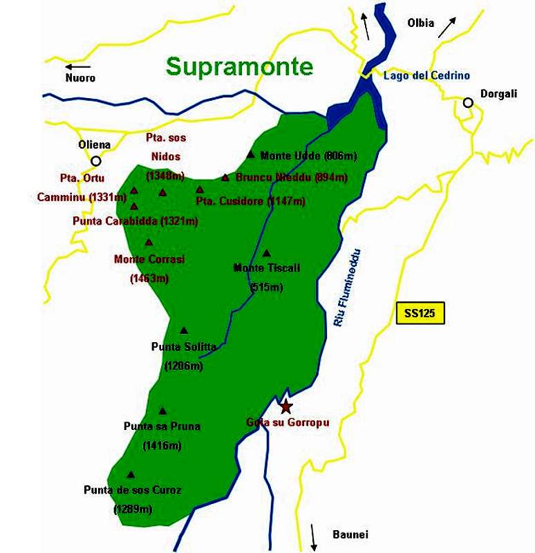
Interactive overview Map of Supramonte. The summits (and gorges) which have been submitted to SP are marked in red.
 |  |  |  | 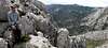 |
Climbing Punta Cusidore
The Supramonte region of Sardinia is among the most attractive climbing locations on the whole island. There are some six routes on Punta Cusidore ranging in difficulty from 6a - 7b+ with a length of up to 370m). Also on neighbouring Monte Maccione you can chose among 30 short routes and almost 20 long ones, difficulties up to 8a/b.
For more information visit the following sites:
 |  |  |  |
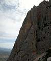
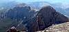
Views from the summit
 |  |  |  |
Getting There
Sardinia can be reached either by plane or by ferry. The main ports are Porto Torres and Olbia in the north and Arbatax and Cagliari in the south. Airports are at Alghero and Olbia in the north as well as (again) Arbatax and Cagliari in the south. For exploring the northeastern part of the island where most of the mountains are the best entry point is Olbia, which is where most flights go anyway.
Approaching the mountain from Olbia airport
Get on motorway SS 131 south in the direction of Siniscola / Nuoro. At the exit Lula / Dorgali get off and turn on SP38 south (again direction Dorgali). Shortly before you reach the town turn right on SP46, direction Oliena. Take this road up to a sign leading to the chapel of Nostra Signora di Monserrata. Here turn off left.
The following description is a little hard to understand on paper - nevertheless it is quite accurate. Follow the country road for 100m, then turn left. After another 600m turn right and head directly for Punta Cusidore. At an intersection the road turns left again and you follow it for another 600m. Here the asphalt ends and a gravel road takes you to a little fount. From here start to look for spaces to park your car. The road goes on for another 500m before the ascent trail (still a dirt road) starts climbing steeply upwards to the right.