Fine and stocky pyramid between the Ayas (W) and Gressoney (E) Valleys; dividing, on the S-N axis, the Chasten and Graines Valleys. This is the highest summit of Frudiera Range and is built by gneiss, mica schist rocks and Kinzigiti so that you can find different rocks on the various routes: the most advisable (the shortest) is the one along the Graines valley even if the normal one follows the Chasten Valley, the SW side and the W ridge.
Bella e massiccia piramide a cavallo tra le Valli d'Ayas (W) e Gressoney (E); sull'asse S/N separa invece i Valloni di Chasten e di Graines. E' la vetta più alta del Sottogruppo di Frudiera, montagna formata da gneiss, micascisti e Kinzigiti ofre una roccia alterna, a seconda dei percorsi. Si consiglia la via per il Vallone di Graines, poichè più breve, anche se la "normale" sale da quello di Chasten, per il versante SW e la cresta W.
First Ascents
First in the summit (from Chasten Pass and SW Slope and W Arête): Abbè Aimè Gorret, Jean Baptiste Bertolin and Jean Ronco, (Oct 02th, 1873).
In winter: G. Bozzo, O. Choquet, F. Freppaz, E. Regis and F. Ronco, (Jan 02th, 1909).
W Arête: G. Corrà and S. Charmintrand, (Mar, 1896).
NW Wall (right couloir): Guido de Rege and Giuseppe Wuillermin, (Jul, 1925).
NW Wall (left couloir): Pier Luigi Ferrero, (May 02th, 1987).
N Arête: Giulio and Tito Zanetti, (Jul 31th, 1923).
N Slope and W Arête: Agostino Ferrari, E. D'Ovidio, Gualtiero and Mario Sarfatti and Luigi Vaccarone, (Aug 18th, 1896).
N Wall (Directly on North Rib): Osvaldo Cardellina, solo (Oct 05th, 2002), from Frudèrecoll with descent to Mont Solaron and Punta di Champlong.
N-NE Arête: Edoardo Ferrero, (1984).
NE Arête: Pier Luigi Ferrero, (1985).
E SE Arête: Giovanni Bozzalla and Giovanni Edelmann, (Sep 08th, 1908).
E Buttress (from N Arête): Maurizio Fasano and Pier Luigi Ferrero, (Jul 10th, 1988).
S Arête: Ezio Capello, (Jul 10h, 1955).
S Wall: Dino Bolardi and Ezio Capello, (Jul 24th, 1954).
Getting There
BY CAR:
From Torino, Milano, etc: Motorway A5. Exit Verrès for then to continue on SR.26 for Champoluc Valley.
From Switzerland: through the Grand Saint Bernard Tunnel or the namesake pass. Drive to Aosta, Verrès and Champoluc Valley.
From France: through Mont Blanc Tunnel or Petit Saint Bernard Pass. It isn't necessary to take Motorway A5: you can drive on SS.26, in the direction of Aosta and Verrès.
BY PLANE:
Aeroporto "Corrado Gex" Saint Christophe (Aosta).
Approaches & Routes from South & North Sides
Approaches from Arcesaz/Tollegnaz and Graines Villages : From Verrès drive to Challand Saint Anselme-Arcesaz (1.146m) and to Graines (1.396m): no thoroughfare mark just at the end of the built up area.
a) - Also from Tollegnaz Village take the path towards Southeast signed n° 2 and reach Pont Chevalier in the vicinity of the Pastures of Ciavanisse (1.403m), where it crosses the creek. After this descent to the valley floor itself definitely continue East through the wood and after passing it again to continue to the bottom of that approaching the Alps Grun (1.501m) and Pra Baluard (1.709m) up to a junction at about 1.830/40 meters. From here continue to the South with the path n° 1 to the Alps of Merendiù Lower and Higher (1.915m, 2.184m); the path, with the remains of an ancient pavement, turns sharply to the left (Northeast) to reach a basin formed by rocks below the hill; via a small track and some rocks in the final part, easily achieve the same (1h'00/1h'15 from Merendiù).
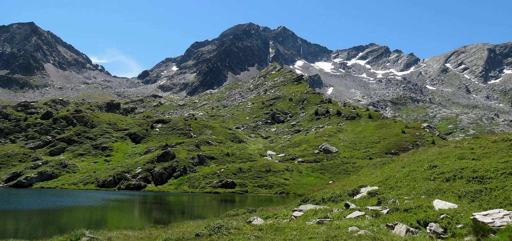
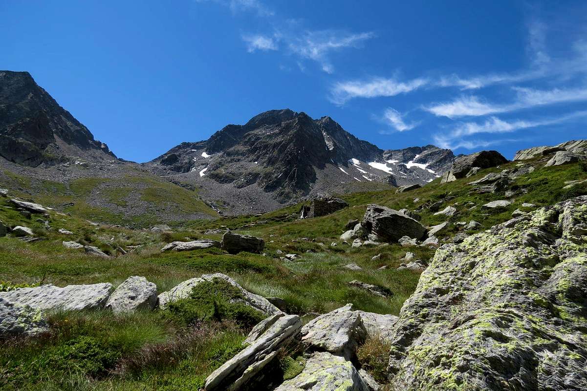
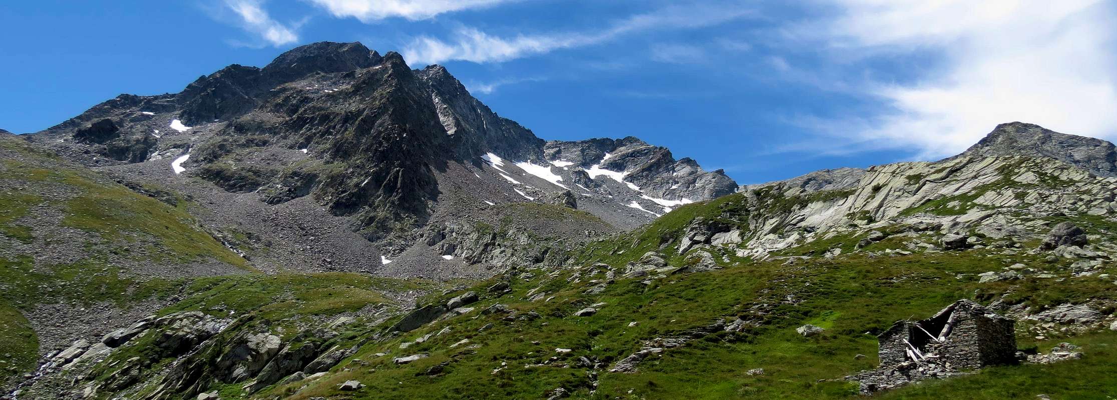
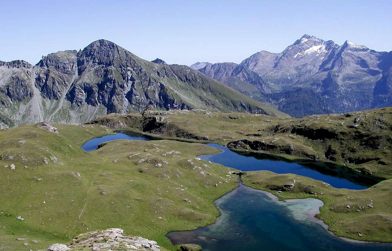
b) - Follow the farm road along the Graines Valley, keeping the N side of the stream, up to the fork 1.508m where you can enter a short cut that crosses it leading to the Charbonniére Pasture (1.628m); cross the Pastures of Restoly (1.682m), Champcharlec (1.766m) and Frudière (1.849m), walk along the right side of the Lower Lake of Frudière (2.035m, 2h'00), ascend the steep slopes to get the Upper Lake of Frudière (2.230m) and the Frudière Pass (2.265m, path n° 9), directed to the South-southwest to a stony valley, below the North Face of Marienhorn also Corno Maria. From this point the trail descends to the Valley of Gressoney, but since 2000 it is closed because it dangerously exposed to falling stones, for which I need to go back to Mount Taf with trail n° 1A and then down to Gressoney St. Jean.
Route A: from Chasten Pass through a small track to the North; continue climbing on rocky slabs, to small saddle around 2.640/50 metres. Through the South-southwestern Slope of large Saddle about 2.890/5 meters and West Ridge to the Western Ante Top (3.027m) and Top (EE/F+; from F+ to PD-; 2h'00/2h'15 from pass; 6h'00/6h'15 from Tollegnaz Village).
Route B: now to South-southwest and, on scree and a hollow under the Nortern Side, follow on snow slopes and debris up to the triangular snow-ice field below the Summit and the secondary one (3.027m). Along it (steepness ~38° and a short couloir a little steeper) up to the W ridge between the secondary and the main Summit: along tracks on debris reach enough easily the Summit (6h'00/7h'00 from Graines Hamlet).
Avvicinamenti dai Villaggi di Arcesaz/Tollegnaz e Graines: Dal Villaggio di Arcesaz (1.146 m), tra Challand Saint Anselme e Brusson (raggiungibile da Verrès), prendere la carrozzabile per Graines (1.396 m, palina di divieto di transito alle auto subito dopo l'abitato).
a) - Oppure da Tollegnaz prendere il sentiero verso Sudest siglato n° 2 e raggiungere Pont Chevalier in prossimità dei pascoli di Ciavanisse (1.403 m), dove si attraversa il torrente. Dopo questa discesa verso il fondo del vallone stesso continuare decisamente ad Est attraverso il bosco e dopo averlo passato nuovamente proseguire sul fondo del medesimo avvicinandosi alle Alpi di Grun (1.501 m) e Pra Baluard (1.709 m) fino ad un bivio a quota 1.830/40 metri circa. Da qui proseguire verso Sud con il sentiero n° 1 verso le Alpi di Merendiù Bassa ed Alta (1.915 m, 2.184 m); il sentiero, con i resti di un antico lastricato, volge decisamente a sinistra per raggiungere una conca formata da pietraie sottostanti il colle; tramite una piccola traccia ed alcune roccette nella parte finale, facilmente raggiungere lo stesso (1h'00/1h'15 da Merendiù).
b) - Seguire la strada poderale lungo il Vallone di Graines a Nord dell'omonimo torrente sino al bivio 1.508 m, dove una scorciatoia lo guada e porta all'Alpe di Charbonniére (1.628 m); superati gli Alpeggi di Restoly (1.682 m), Champcharlec (1.766 m) e Frudière (1.849 m) costeggiare sulla destra il Lago Inferiore di Frudière (2.035 m, 2h'00); risalire il ripido gradone che porta al Lago di Frudière Superiore (2.230 m) e, raggiunto il Passo di Frudière (2.265 m, sentiero n° 9), indirizzarsi a Sud-sudovest per pietraie ad un avvallamento, sottostante il versante Nord del Corno Maria altrimenti Marienhorn. Da questo punto scende il sentiero verso la Valle di Gressoney, ma dal 2000 é chiuso perché pericolosamente esposto a cadute di pietre, per la qual cosa bisogna risalire verso il Monte Taf con il sentiero n° 1A, dopodichè scendere verso Gressoney Saint Jean.
Via A: dal Colle di Chasten passare attraverso un piccolo sentiero verso Settentrione; continuare a salire su lastre rocciose verso una selletta a circa 2.640/50 metri. Da questa, attraverso il Versante Sud-sudovest della più grande Sella circa 2.890/5 metri e tramite la Cresta Ovest si raggiunge l'antecima Occidentale (3.027m) e subito dopo la Vetta (EE/F+; 2h'00/2h'15 dal colle; 6h'00/6h'15 dal Villaggio di Tollegnaz).
Via B: da immediatamente al di sotto del Passo di Frudière, continuare tra nevai e sfasciumi sino a raggiungere il glacio-nevato triangolare sottostante la vetta e l'antecima Ovest (3.027 m). Percorrerlo con pendenze da 30° a 35° e con un breve canalino (38°) uscire sulla cresta Ovest all'intaglio tra la vetta e antecima; in breve su tracce e detriti si raggiunge abbastanza facilmente la Cima (6h'00/7h'00 dal Villaggio di Graines).
Difficulty
The route can be classified as F+ or PD-.
L'itinerario è classificato da F+ a PD-.
Gear
Rope, ice axe and crampons.
Corda, picozza e ramponi.
Campings
Remember that free camping is forbidden (except for emergency reasons, over 2.500m, from darkness until dawn).
Mountain Conditions
You can get meteo information at the official site of the Regione Valle d'Aosta:
FONDAZIONE MONTAGNA SICURA Villa Cameron, località Villard de la Palud n° 1 Courmayeur (AO) Tel: 39 0165 897602 - Fax: 39 0165 897647.
A.I.NE.VA. (Associazione Interregionale Neve e Valanghe).
Useful numbers
Protezione Civile Valdostana località Aeroporto n° 7/A Saint Christophe (Ao) Tel. 0165-238222.
Bollettino Meteo (weather info) Tel. 0165-44113.
Unità Operativa di Soccorso Sanitario Tel. 118.
Acknowledgements
I am greatly indebted to my friend "Osva" for the detailed description of the route. In addition i want to thank Gabriele Roth for the translation of the text from italian.
Parents refers to a larger category under which an object falls. For example, theAconcagua mountain page has the 'Aconcagua Group' and the 'Seven Summits' asparents and is a parent itself to many routes, photos, and Trip Reports.

 9727 Hits
 88.19% Score
 26 Votes