
-
 5400 Hits
-
 81.84% Score
-
 14 Votes
|
|
Mountain/Rock |
|---|---|
|
|
47.32477°N / 10.42431°E |
|
|
Mountaineering |
|
|
Summer, Fall |
|
|
8501 ft / 2591 m |
|
|
Overview
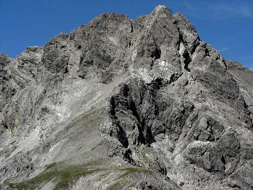 Kreuzkarspitze as seen from south ridge (16-08-2009)
The Hornbach range of the Allgäu mountains is bearing the highest peaks of this wellknown region and - most astonishingly -those peaks are seldomly visited.
One of those peaks is Kreuzkarspitze, which, in this case, might be due to the inapproachable appearance of this mountain or the fact that there is no marked and maintained trail leading up to its airy hight.
Standing between the equally seldom visited Balschtespitze to the west and the more difficult Noppenspitze to the east, Kreuzkarspitze shows steep rockfaces down into Kreuzkar to the north and a rugged appearance to the south, limitating with its aretes and ridges the wide and huge Balschtekar to the west and Noppenkar to the east, the southern cirques of Kreuzkarspitze. There is a ridge running down in southern direction which bears some other interesting minor summits: Nördlicher Söllerkopf, Südlicher Söllerkopf and tiny Rotwand. This arete divides Balschtekar from Noppenkar, the connecting col is Balschtejoch between Rotwand and Südlicher Söllerkopf.
The normal route uses the south ridge, the south side of the summit rocks and the western arete in its uppermost parts. It is a more or less off - trail - challenge and includes exposed rock climbing which does not exceed UIAA grade I / I+. This is astonishing because it looks a lot more difficult when you approach the summit through Balschtekar.
  |
Getting There
 Summit view to Kreuzkarsee (16-08-2009)
The main trailhead for Kreuzkarspitze is Elbigenalp in the Lechtal valley.
You reach Lechtal valley
Follow Lechtal valley road number 198 from Reutte or from Lech / Warth until you reach Elbigenalp. The trailhead is at the western end of Elbigenalp where the Geierwally parking area is signposted. Leave your car here (2009: free parking).
Red Tape
No red tape as far as I know.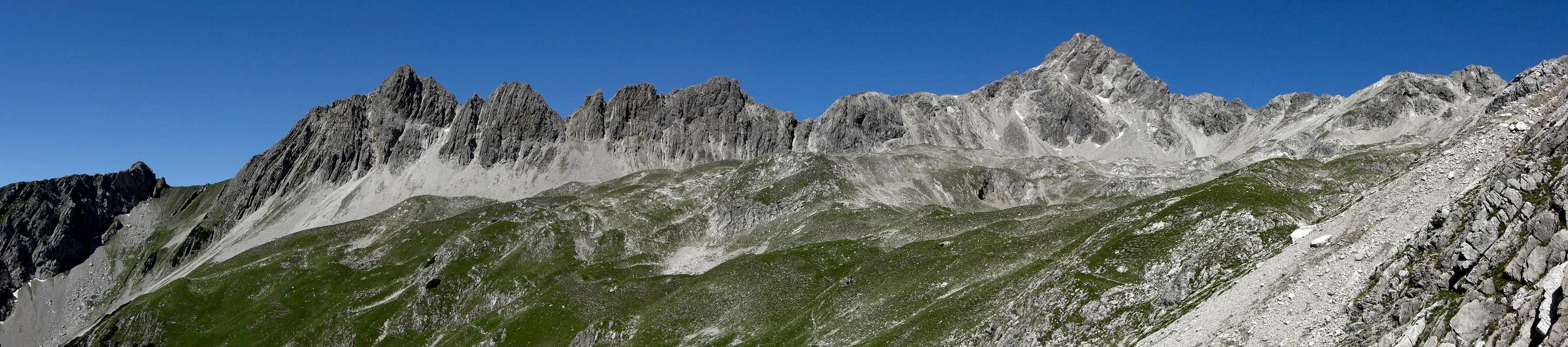 |
Main Routes Overview
To summit Kreuzkarspitze you have to reach the Enzensperger Weg / trail number 432 / 435 in the eastern part of Balschtekar.From Elbigenalp follow the mountain road to Kasermandl Inn and to the resupply cableway of Herrman-von-Barth Hütte. At the end of this road you have three possibilities:
 Balschte tower near Kreuzkarspitze (16-08-2009) Balschte tower near Kreuzkarspitze (16-08-2009) |  Ascent along Balschte creek (16-08-2009) Ascent along Balschte creek (16-08-2009) | 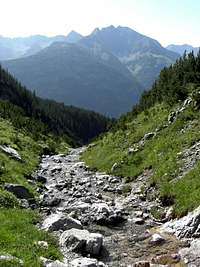 Ascent along Balschte creek (16-08-2009) Ascent along Balschte creek (16-08-2009) |
Climb the rock and meadow slopes up to a notch left of Nördlicher Söllerkopf and right of Kreuzkarspitze in the north – south running connecting ridge. This notch is right of a level part of this ridge. At the notch turn left to the scree field below a rock step which leads up to the level part of the Kreuzkarspitze south ridge. Climb this rock step best on its right side near the ridge line. It is a nice UIAA grade I scramble in sufficiently firm rock. There are some cairns leading you more to the left side of the ridge – there is much loose scree and more instable rock, so I think the right part of the ridge is better.
Cross the level part of the ridge in northern direction and follow a narrow path up to the huge and difficult looking summit block. It is by far easier to overcome than it looks like.
At a certain point the feeble trail leaves the ridge line and traverses into a scree field on the west side of the south ridge. Follow this scree field steeply up to a rock chute which comes down from a notch between the western (left) subsummit and the eastern (right) main summit.
I think is is possible to climb this chute up to the summit arête but it is full of loose scree and the rocks left and right of the chute do not look firm and secure. So that is my advice:
 Summit block route overview (16-08-2009)
Climb up this chute some meters and leave it immediately to its left limitation when this is easily possible. Follow then this left limitation in sufficiently firm rock (UIAA grade I) up to a steep part of the summit block. Below this steep rockface there is a scree littered ledge leading up to the left to a southern subridge. Follow this ledge – there are again some cairns – to the subridge. Climb the subridge up to the western subsummit near or over green meadow rocks. This climb is quite enjoyable (UIAA grade I). You can climb the subsummit by leaving the ledge earlier (again some cairns) and use some shallow chutes and steep ledges (UIAA grade I – II).
Follow the west arête from the subsummit to the notch before the main summit. There is a huge crack in the arête rocks; climb down into the crack and arrive at the notch.
The notch consists of a huge rock slab which should be traversed nearly level on its south side; there is a small ledge below the crest line. Pay attention: the rocks are very loose up there ! The traverse is exposed but easy.
 Detail of summit ascent (16-08-2009) Detail of summit ascent (16-08-2009) | 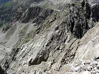 Detail of summit ascent (16-08-2009) Detail of summit ascent (16-08-2009) |  Detail of summit ascent (16-08-2009) Detail of summit ascent (16-08-2009) |
Follow the steep and scree littered west ridge shortly up to the exposed summit with its beautiful view down to Kreuzkar lake. Descend on the same route.
Accomodations
In Lechtal valley there are all sorts of accomodations: Hotels, Inns, private Bed & Breakfast and Camping areas.For general infomations please refer to: Lechtal tourist page
More detailed informations about accommodations in the nearest villages can be found on the homepages of
Nearby mountain huts (alpine club or private huts) are:
 View to Noppenspitze (16-08-2009) View to Noppenspitze (16-08-2009) |  View to Hochvogel(16-08-2009) View to Hochvogel(16-08-2009) |  View to eastern Hornbach chain with Bretter- and Urbeleskarspitze(16-08-2009) View to eastern Hornbach chain with Bretter- and Urbeleskarspitze(16-08-2009) |
Gear & Mountain Conditions
Kreuzkarspitze is a summer and autumn hike. As far as I know there are no winter and spring ski hike activities though Balschtekar can be an interesting ski hike aim.It is a strenuous and in some parts off-trail day hike from the valley trailheads or a moderate hike from Hermann-von-Barth Hütte.
You need normal hiking gear with good shoes. In addition you should be used to off-trail hikes, have a good sense for orientation and you should be used to in some parts very exposed rock climbing up to UIAA grade I / I+. A short rope and some gear for belaying can be useful to secure less experienced people at the summit block.
Check the current weather here.