
|
|
Route |
|---|---|
|
|
38.86930°N / 105.07538°W |
|
|
Mountaineering, Scrambling, Skiing |
|
|
Spring, Winter |
|
|
Half a day |
|
|
Intermediate to Extreme |
|
|
I |
|
|
Ski America's Mountain!
Pikes Peak
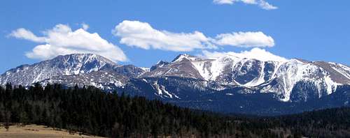
The North Side of Pikes Peak offers skiers several road-served lines to ski in spring and winter. Do not confuse the North Face of Pikes with this area – the North Face is below the actual summit. Because these ski runs are generally north-facing, they hold snow much later in the season than the rest of Pikes Peak, which is very dry. This area is directly adjacent to the Pikes Peak Highway, offering great access year-round. The focus of this page will be skiing, but the couloirs featured are also fantastic places to learn or hone your snow climbing skills. One could also climb Pikes Peak from here by snow climbing a couloir and then hiking to the top.
This route page will focus on the couloirs above Glen Cove and below Devil’s Playground, both of which are stops along the Pikes Peak Highway. The terrain above Glen Cove is an alpinist’s playground, and offers at least 6 distinct couloirs in a relatively small area. The couloirs range from relatively easy to extreme. Access could not be better – the highway serves all these couloirs. Also, winter closure on the Pikes Peak Highway is typically at Glen Cove, making these skis available year-round with easy access. Once spring arrives and the highway opens up, you can drive to the top of these ski runs and park. If you have enough partners and cars, you can even shuttle skiers up for their runs (which is cheating, of course!). The quality of the snow here varies from year to year depending on snowfall, but the northerly aspect of most couloirs will usually keep snow here until late May.
Getting There
From the East: From Colorado Springs, take US 24 west through Ute Pass. At a stoplight on US 24 at the town of Cascade, turn south onto the well-marked Pikes Peak Highway. Follow signs to the gated entrance.
From the West: Take US 24 past the towns of Divide and Woodland Park. At a stoplight on US 24 at the town of Cascade, turn south onto the well-marked Pikes Peak Highway. Follow signs to the gated entrance.
NOTE: The Pikes Peak Highway charges a $10 fee per person, valid for two consecutive days. Click here for a $2 coupon for the road.
Route Description
Refer to the following photographs for these routes (both open in "original" size):
Route Photograph
TOPO! Map
The Bowl:
The Bowl is closest to the Pikes Peak Highway, and is probably the easiest area to ski. The Bowl has two sides, separated by a slight ridge. For ease, I’ll refer to them as Bowl, Skier’s Left and Bowl, Skier’s Right.

Bowl, Skier’s Right:
This run begins from a straightaway on the PP Highway. Park at Devil’s Playground, and skirt the road to access skiing. From the bottom, park at Glen Cove and walk straight to the run.
This run is 0.5 mile and 1025 vertical feet. This run is intermediate, and is an easy snow climb.

Bowl, Skier’s Left:
This run begins (in season) at the top of a small bump behind Devil’s Playground parking. Walk 100 yards from parking and click in. You can also access this run, albeit lower, by dropping in near a sharp turn in the PP Highway. This is just below Devil’s Playground parking. This run is the longest in the area, and ends in the same spot as Right side.
This run is 0.6 miles and 1300 vertical feet. This run is advanced, and is a moderate snow climb.

The Flying W:
These runs are named for a cheesy faux-western tourist trap in Colorado Springs because of the couloirs' 'W' shape. (Also called the “Three Little Pigs” and “The Fingers.”)These three couloirs are to the west of the Bowl. They are extremely difficult, and the easiest one will require you to huck at least a 15 foot cliff to exit. Don’t even think about skiing these unless you’ve proven yourself on extreme terrain. I’ve never skied these couloirs, but I understand that they increase in difficulty as you go from east to west. Access the W by parking at Devil’s Playground and skirting around the small bump behind parking to the north. Walk 100 feet past the bump and the entrances will be obvious.
These runs are 0.4 miles and 1100 vertical feet. If you thought the North Face of Crested Butte was boring, then this is for you. It is an advanced snow climb that might require ice and rock protection.

The Chimney:
As the name suggests, this is a steep, tight couloir. It is to the west of the Flying W. To access the Chimney, see the directions above for the W and continue along a broad ridge to the top of the Chimney. Use your map, but you’ll know it when you see it. It’s possible to go past the Chimney and ski Little Italy by mistake, so be careful.
This run is 0.5 mile and 1100 vertical feet. It is an expert ski, and a moderate snow climb.

Little Italy:
This is probably the most famous feature above Glen Cove. When viewed from the correct vantage, it resembles the famous boot shape of the nation of Italy. It is pretty steep, and is an expert ski. To access it, continue along the ridge (see above) until you hit the obvious entrance.
This run is 0.5 mile and 1100 vertical feet. It is an expert ski, and a moderate snow climb.

Rock Garden:
Rock Garden is the area to the west of Little Italy, but before the Cornice. It is rarely in good shape (as the name suggests), but will offer the skier some fun lines. It might be necessary to traverse across this slope to find continuous snow. Bring your rock skis!
This run is 0.5 mile and 900 vertical feet. It is an expert ski, and a moderate snow climb.

Cornice:
Cornice is very easy to spot. It is the westernmost area above Glen Cove, and always has a giant cornice hanging above it. Cornice is a fairly easy, broad slope. This is of similar difficulty to the Bowl, if not easier. Take care when negotiating a path around or through the cornice when skiing. Below the cornice, you have many wide-open lines. Cornice faces east, so factor that into your ski and climb times.
This run is 0.4 mile and 700 vertical feet. It is a moderate ski and an easy snow climb.

General Information
Essential Gear
Skis, of course.
If you use Randonee gear or Telemark gear, it may be possible to skin parts of these slopes. Ensure you have full-coverage skins if you try this.
If you use standard alpine gear, then this is a great place because of the short approaches. For all climbers, an ice axe is a necessity for the couloirs. In frozen conditions, crampons would also be necessary.
For backcountry skiing, a beacon, probe, and shovel are mandatory. This should be obvious...
Safety
Ensure you are aware of the difficulty ratings that I've attached to each route above. Some of these couloirs look pretty tame from the top, and then drop off precipitously. If you're here for the first time, you might consider climbing up first and skiing down. Remember: "Ski what you Climb!"
Avalanches are always a concern when backcountry skiing. These steep couloirs can be very dangerous. Ensure you contact the Colorado Avalanche Information Center for current info, and as always, ensure that you have the requisite avalanche knowledge before heading out.
Contact Info
Information:
719-385-PEAK
800-318-9505
Emergency:
Pikes Peak Rangers - 719-684-9138
Internet:
Official Pikes Peak Highway Website
Email
wbarrett@springsgov.com
The Pikes Peak Highway and Amenities
Driving the Pikes Peak Highway is pretty easy. Any car can make it. There are lots of parking areas, hiking trails, and amenities. If you're looking for a cheesy souvenir, a flush toilet, or food visit the summit or Glen Cove.
Backcountry Ski Ratings and Disclaimer
Skiing in the backcountry is nothing like skiing at a resort. Ratings of "beginner," "intermediate," and "advanced" are backcountry ratings. They do not correspond to ski resorts. At ski resorts, beginner and intermediate runs are almost always groomed and cleared of obstacles. Not so in the backcountry. Expect to find rocks, trees, patchy snow, and all sorts of obstacles on the easiest of runs. Route selection and avalanche avoidance are also key to your safe navigation of backcountry ski terrain.
Don't think that you can safely ski a "beginner" backcountry route if you can ski green runs at resorts. It's like comparing apples and oranges. Being a "no falls" skier in all types of snow conditions is usually necessary before tackling backcountry terrain. Find an experienced partner or become an expert in resort terrain before trying backcountry.
Ok, lecture over. I just don't want anyone to get the wrong idea here and get hurt.
Red Tape
There’s plenty of Red Tape, unfortunately. The crux of your day might very well be dealing with the Pikes Peak highway. If you are accustomed to places like the Mount Evans Highway, you’ll be disappointed. The Pikes Peak Highway is owned and operated by the City of Colorado Springs. They control access very tightly, and don’t really have much love for outdoor enthusiasts. The purpose of the highway is tourism, and that’s all they really care about. The people who run the road won’t make any special arrangements for climbers, even if you are attempting to travel more safely. I’ve tried several times to no avail.
So, without further ado, the Red Tape…
Hours
- Open all year, weather permitting
- Memorial Day – Labor Day: 7am – 7pm
- Labor Day – October 1: 7am – 5pm
- October 1 – Memorial Day: 9am – 3pm
- No overnight parking is permitted on the road.
- Parking is authorized in designated areas only.
- Cost is $10 per person, valid for two consecutive days.
Comments on the Red Tape: Obviously, most of the Spring leaves you with a 9am start, which severely limits you. When you add in the fact that you can’t park overnight (or camp near the road), things get logistically interesting. Since most of the skiing is north-facing, you can fool around a little later in the day than if they faced a different direction, so that helps, but if you are planning a big day, then you are left with few options. One great way is to get dropped off the night prior and camp.
Another big problem is unplanned road closures. Some are unavoidable, such as high winds, but others are man-made and harder to plan for. Construction on the road is the biggest problem I have encountered. I’ve been at the gate at 7am several times only to be thwarted by construction. For some reason, the people that work on the road and the people that run the gate don’t ever talk to each other, and you can’t get a schedule for construction from anyone. This problem has ruined several days for me.
Finally, parking can be a pain. Like I said above, 99.9% of the people that use the Pikes Peak highway don’t use it to access climbing. So, if the rangers see a car on the side of the road, they’ll likely assume the worst. Make sure you leave an easily visible note about where you are and when you’ll return. I once returned to my car to find two rangers peering in the windows to see what was what. They might have towed my car if I had been a couple hours later. Also, make sure you park in a marked, acceptable space.