
-
 29439 Hits
-
 81.16% Score
-
 13 Votes
|
|
Route |
|---|---|
|
|
39.02940°N / 106.4725°W |
|
|
Scramble; some rock climbing |
|
|
A long day |
|
|
III, Class 3-5, depending on your exact route |
|
|
Background
Distance: 9.5 miles, (with descent of standard route.)Elevation Gain: 6,000 feet
  |
GPS Files, provided by 14ers.com member Huskerdog:
GDB file
GPX file
Approach
Lake Creek Trailhead is along Colorado 82. According to Gerry Roach, this trailhead is 14.5 miles west of the U.S. 24-Colorado 82 junction. If you need to camp overnight, stay at the pull-off next to Colorado 82 or right next to it to avoid the private property along the (dirt) South Fork Lake Creek Road.To begin the hike, walk back the South Fork Lake Creek Road for .3 mile, where the road turns to the right. The La Plata Trail goes straight (east) from here. There is a metal sign announcing to stay on the trail to avoid trespassing private property.
Continue over a small hump of land and go down to cross the South Fork of Lake Creek on a solid wooden bridge. After crossing the bridge, stay on the main trail for about half a mile. Then you'll come to a second creek, La Plata Gulch Creek. Here there is a smaller but sturdy bridge of logs on which to cross the creek. Almost immediately after crossing this second bridge, you will come to a sharp right (south) turn in the main trail. A less-used but evident trail continues straight from this corner. This is where you will leave the main trail and begin your journey to Ellingwood Ridge.
Once you are on the trail to Ellingwood Ridge, follow it east toward La Plata Basin Gulch. The next creek you come to will be the La Plata Basin Gulch Creek. Cross this creek and turn uphill (south), following the gulch until you come to a sharp, narrow ridge. Follow the top of this ridge; A noticeable trail along its crest leads the way. This section of trail is mostly steeper class 1.
At about 11,200 feet, you will come to timberline. Here is a huge boulder field. This is where the trail hiking more or less ends.
Route Description

Once at the top of the first steep slope above timberline, the terrain relents a bit and beomces more grassy and gentle. The view of La Plata opens up again at this point (not looking any closer), and to the east Twin Lakes loom large below.
The first tower of rock stands at the top of this grassy knoll. Resting at this spot, the climber has a great view of what lies ahead.
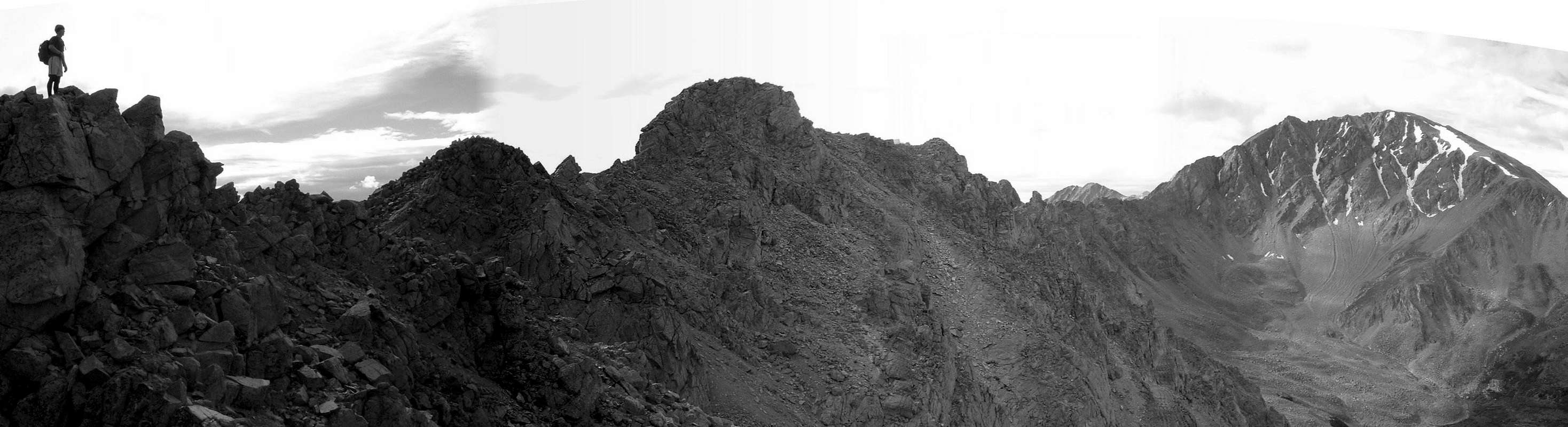 |

From Point 13,138, the climbing gets more involved. Route-finding from here becomes much more complicated, as there are a number of ledges that must be traversed leading to blind corners, gulleys and cliffs. This section of the climb also involves a lot of downhill to keep the difficulties to class 3 or class 4. There is a fair amount of exposure in some places. Extra care must be paid to footholds and handholds, as there is plenty of rotten rock and scree thrown into the equation. There are minimal cairns, at least as of 2004.

One more obvious descent is required to pass to the left (south) of a number of more rock towers. Scramble up to the saddle (class 2+) and continue west for the remaining hundred or so yards until you come to the 14,336-foot summit of La Plata Peak!
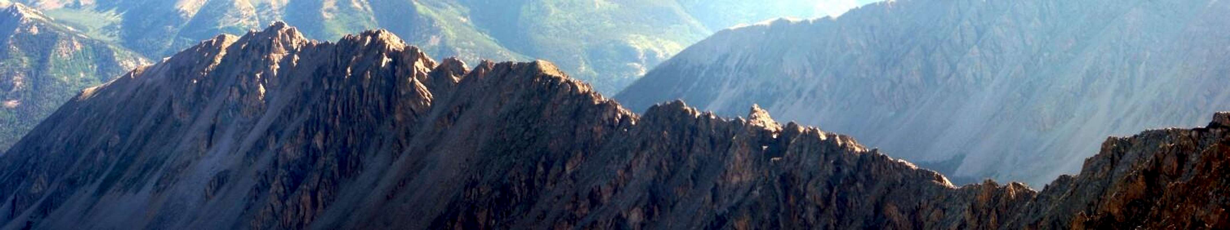
This jagged ridge is fun to traverse, but beware of how long it will take--many have underestimated its difficulties. Always allow more time than you think necessary, for getting stuck in a storm on this exposed ridge is a scary and dangerous experience. Trust me, I know! Always be careful and go prepared, so you can enjoy this amazing place!
Essential Gear
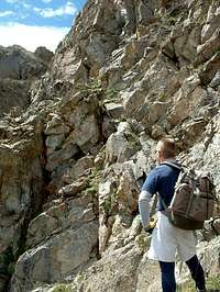
I highly recommend wearing a helmet. There are lots of loose rocks and areas of climbing and downclimbing. I think I got bonked twice on the helmet with baseball-sized rocks.Climbing gear for technical terrain is optional.
Take a LOT of water, and enough clothes to prepared for any kind of weather.
RyanS - Aug 16, 2004 6:18 pm - Voted 10/10
Route CommentIf you're interested in such minutiae, one of Gerry Roach's "soft-ranked" peaks is located on Ellingwood Ridge. It's interpolated summit elevation is 13,220, and Roach hand-leveled to ensure that this summit is higher than the surveyed Point 13,206, which can be seen on the Mount Elbert quad. The summit is the first high-point (the northernmost) encountered on the ridge. It's best accessed from its eastern side. Attacking it directly from the north brings you to a deep notch that many won't feel comfortable negotiating.