
|
|
Mountain/Rock |
|---|---|
|
|
46.72840°N / 8.42667°E |
|
|
Uri Alps |
|
|
Sport Climbing |
|
|
Summer |
|
|
8248 ft / 2514 m |
|
|
Overview
Pfriendler
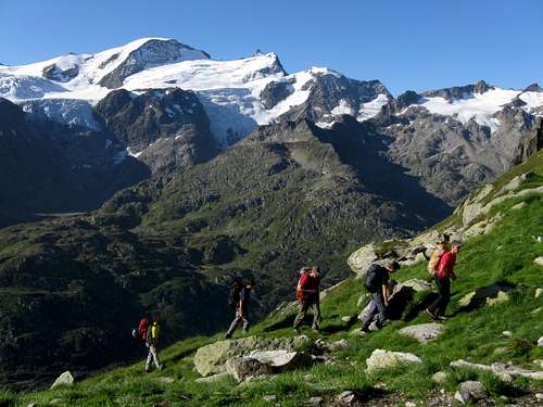
The Susten Pass 2224 m is an alpine col in the Uri Alps Group located on the road connecting the Canton Uri with the Canton of Bern, open only during Summer (from June to October).
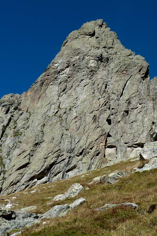
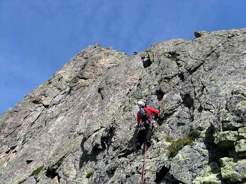
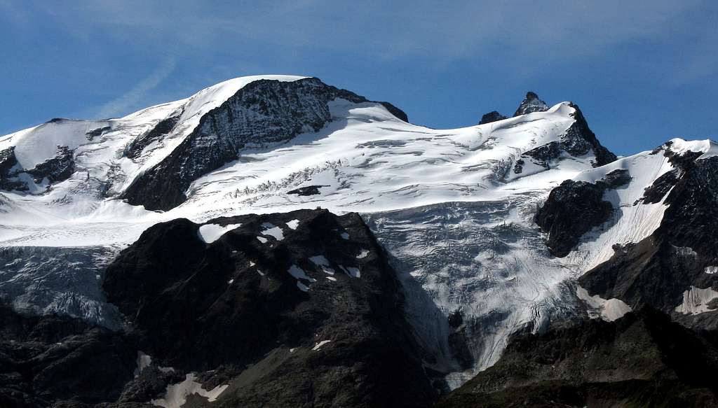
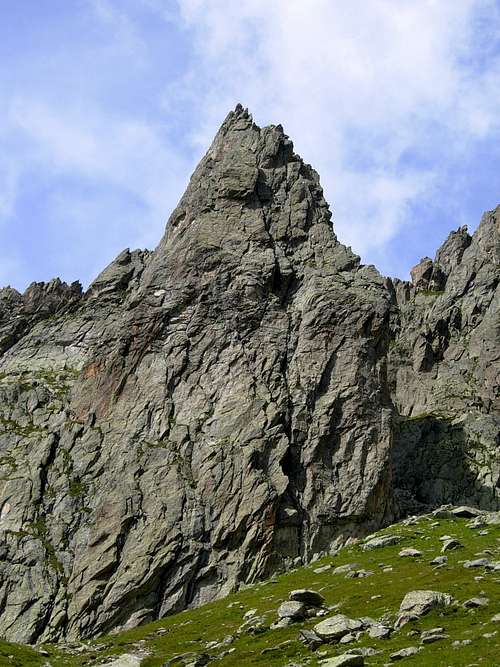
The road starts in Wassen (Uri) near the Gotthard Pass and leads to Innertkirchen (Bern). There are some various climbing areas at the Sustenpass, very differentiated amongst them, from the extreme climb on the impressive limestone wall of Wenden to the full equipped cliffs suitable for children and beginners. Along this road it's located the structure of the Pfriendler, a fine rocky spur of gneiss mainly South oriented in a fine situation above the Steingletscher, with a large number of routes on excellent gneiss.
The "Pfriendler" is situated in the Steingletscher sector and it is one of the most frequented multi-pitch areas of middle difficulty levels. Its high reputation among the climbers is due to the best rock and good accessibility. The grades of difficulty have a range from 5th to 7th degree. Excellent terrain for climbing adherence on the articulated ground, there are numerous cracks, blades, and dihedrals that make climbing varied and fun. The length of the routes is limited, from 4 to 6 pitches, this latter only for the routes reaching the summit. The routes have all the stops very well equipped with bolts to be connected and a mailon for possible downhills. The descent is advisable on foot, especially when the wall is crowded, but numerous pull-down rings also allow abseiling.
Getting There
Road approach
- From Wassen: follow the signpost to the Susten pass. After the pass, go back down on the opposite side about a hundred meters and stop before a tunnel with a waterfall. The parking lot is exactly in front of the 25 km milestone.
- From Innertkirchen: drive towards the Susten pass, pass the hotel Steingletscher, make a hairpin bend and pass a tunnel with a waterfall over it. Before arriving at the next gallery, park on the left (Km. 25 of the Sustenpass road).
Route Tröimli
Difficulty: 5b+ (5b obbl.)
Length: 180 m, 6 pitches
Exposition: South
First ascent: R. Bleuer, C.Bleuer 1992
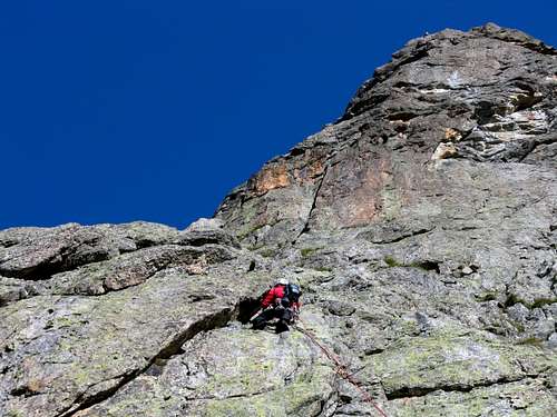
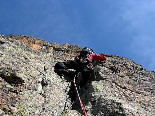
Very fine, advisable and well protected route on well-worked and excellent gneiss. The approach is fun and brief. The climbing style is varied (slabs, roofs, dihedrals, blades), always interesting and pleasant in an alpine environment.
Road approach
Driving towards the Susten pass from Innertkirchen, pass the hotel Steingletscher, make a hairpin bend and pass a tunnel with a waterfall over it. Before arriving at the next gallery, park on the left (Km. 25 of the Sustenpass road).
Walking approach
Take the path with many cairns leading directly under the structure (a bit rounded) which is clearly identifiable on the left watching from the parking lot. The starting point of the routes is below a sloping slab slightly to the left (name written at the start). 45 min. from the parking lot.
L1 - A sloping slab and a dihedral to be climbed to the left after the first stretch, 5b+
L2 - Slanting to the right, then climb a vertical wall. Under a small pillar, exit to the left to the belay, 5b
L3 - A dihedral rising to the right, then a wall, 5b+
L4 - Sloping slab, then an overhang with good holds, 5b+
L5 - Move to the left following the bolts, then enter a small chimney. Climb up on the left a detached blade on good holds, 4c
L6 - Up some vertical walls with good holds reaching the top, 4a
With another pitch (4b) on the ridge get the summit.
Descent: from the summit with a 60 m rope you can descend the ridge on the opposite side and reach a saddle from which it begins the steep descent paths. Follow it and with a short downclimb reach the base of the wall. Alternatively it's possible to abseil down along various equipped lines.
Other routes
See here the topo-routes: Pfriendler topo
- Fritz
- Gradufe
- Paris Bercy
- Neue Südwand
- Promenade
- Quereinsteiger
- Quai
- Hitch
- Goldküste
- Vergine
- SE Pfeiler
Two shorter routes start higher at the left end of the wall: Uswäg and Näbädra
Red Tape
No fees no permits required
When to Climb
Summer and early fall are the best periods.
Accommodation
Different kind of accommodation both in Innertkirchen and Wassen
Bibliography
Schweiz-Plaisir Ost, Filidor Verlag, 2015 - filidor.ch
Kletterführer Steingletscher, Filidor Verlag
Meiental 1222 Swiss maps 1: 25000