
-
 6297 Hits
-
 85.87% Score
-
 21 Votes
|
|
Mountain/Rock |
|---|---|
|
|
46.62161°N / 8.43338°E |
|
|
Canton Uri |
|
|
Trad Climbing, Sport Climbing |
|
|
Summer |
|
|
10745 ft / 3275 m |
|
|
Overview
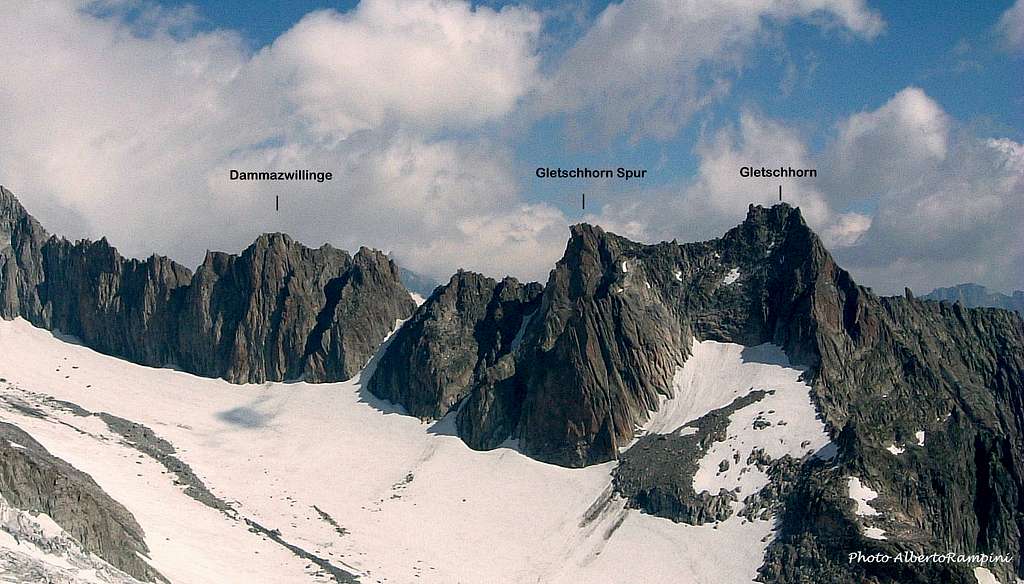
Dammazwillinge 3275 m
The Urner Alps - or Uri Alps - are located in the district of Uri, in Central Switzerland. The massif is located amongst the three most popular passes in Switzerland: Sustenpass to the North, Furkapass to the South and Grimselpass to the West. This group is famous in reason of its compact and fine granite, that can stand comparison with Mt. Blanc. Dammazwillinge is an attractive peak located on the Gletschorn- Schöllenen ridge, just North-West to Gletschhorn-Spur, a fine granite climbing destinations in the Uri Alps Group in a superlative environment. After the super-classic SW Pfeiler, some other interesting routes have been climbed on its South-West face. The granite is excellent and reddish, alternating rough slabs and fine cracks.
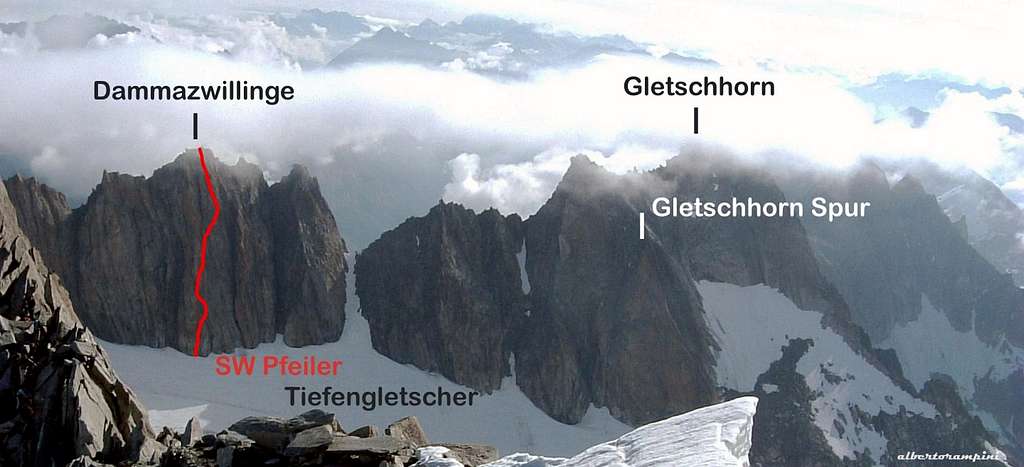
Gletschorn- Schöllenen ridge
Getting There
Road Access

The main town in the Furka Pass Area is Andermatt, a little town lying at St. Gotthard Tunnel northern exit. Andermatt can be suitably approached:
- From the Wallis via Sion, Brig, Gletsch and Furkapass
- From Luzern via Altdorf
- From Bern via Interlaken , Meiringen, Grimselpass, Gletsch and Furkapass
- From Milan (Italy) via Chiasso, Lugano, Bellinzona and the St. Gottard Tunnel
- From Chamonix (France) via Martigny, Brig and Furkapass
The starting point to climb Dammazwillinge is the Furka pass road, connecting Andermatt on the Eastern side of the pass and Gletsch, on the Western side. From Andermatt take the Furkapass road, reaching the Hotel Tiefenbach m. 2110 along the same road. It’s possible to park here or alternatively take a military toll-road (7 CHF to be payed before taking the road), starting on the right a few hundred meters past the hotel. The gravel road cuts the walking approach time by about 20 minutes and rises with some hairpins to the Tatsch parking m. 2270. Dammazwillinge is often climbed in one day from Tatsch, a longer approach than the one from the Albert-Heim-Hütte. If you want to take it easy, you can eventually spend the night at the shelter.
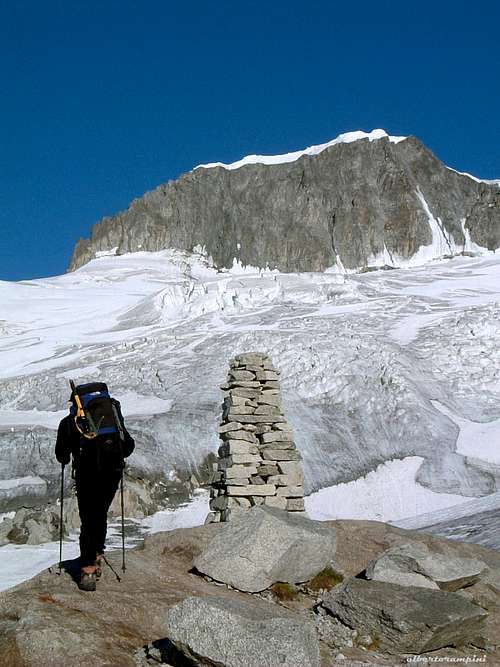
Huge cairn before Tiefengletscher |
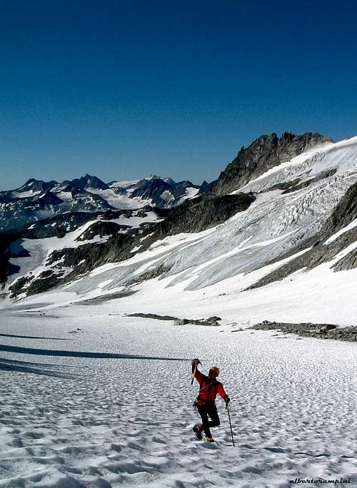
On the glacier waiting for the sun |
Walking Approach from Tatsch
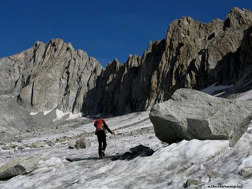
From Tatsch follow the path to the Albert Heim Hut. After about 1 hour by walking, the path forks. The right track leads to the hut, just above. If you want to climb the route in one day, leave the path to Albert Heim on the right-hand side and follow a red-white marked path in the main valley, heading left (North-West). The trail rises between big blocks along the moraine, reaching a huge cairn on a shoulder close to the Tiefengletscher. Enter the glacier and follow long it towards right, leaving on your right hand side at first the obvious Gletschhorn ridge, then the equally obvious Gletschhorn Spur orange triangle, departing from the Gletschhorn summit ridge. After about 10 minutes by walk, a reddish tower is visible on your right side, about 15 meters before a zone of grey broken flakes. (2,30 hours from Tatsch).
Main Routes overview
Dammazwillinge main routes - French scale
- Estonia 6a (5c obbl.) Ruedi Büschlen – Peter Büschlen 1994
- SW Pfeiler 6a+ (or 5c and A0), 220 m. Peter Arigoni – Hanspeter Geier 1962 re-equipment Richi Arnold-Ueli Arnold 1999
- Moderne et classique 6a Ruedi Büschlen – Claude Heckly 1995
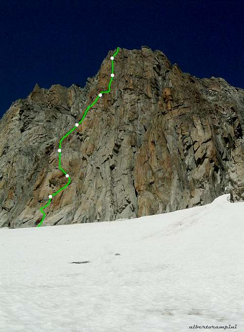
SW Pfeiler report
SW Pfeiler
Summit altitude: m. 3275
Difficulty: F6a+ (or F5c and A0)
Equipment: fix and pitons, equipped belays
Climbing length: 220 m.
Exposure: South-West
First ascent: Peter Arigoni – Hanspeter Geier 1962
Starting point: Tatsh parking or Albert Heim Hut
A beautiful route on first class red granite in a wonderful place. The original route - opened on 1962 - was re-equipped with some bolts in the year 1999 and more recently with some variants after the strong glacier-retreat at the bottom of the first pitch.
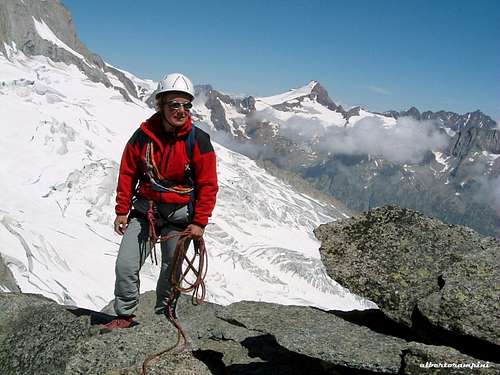
Signing the summit book |
Beautiful granite wall |
SW Pfeiler report - French scale
L1 Start on light grey rock under a red block and climb a wide corner, getting to the block. This was the original starting point of the route, before the glacier’s retreat. Slanting right (spit) traverse a difficult slab, then take a cracks’ system leading to a chimney, then to the first belay. 55 mt.
L2 Up directly a few meters, then traverse the slab towards left, climb an edge to the second belay. 30 m.
L3 Directly up a corner and fine cracks. 40 m.
L4 Still directly climb a wonderful wall cut by crack to a corner, then traverse right crossing an obvious chimney. Now climb directly, then traverse right to a small belay under a vertical wall 45 m.
L5 Traverse a few meters right, then directly on fine cracks. 40 m.
L6 Up the wonderful steep crack, reaching a slab. Climb the slab to the belay. 40 m.
L7 Climb another fine slab, reaching the summit flakes 30 m.
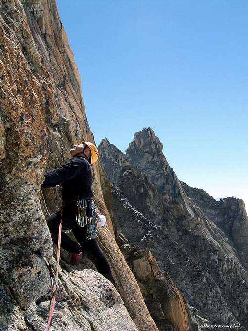
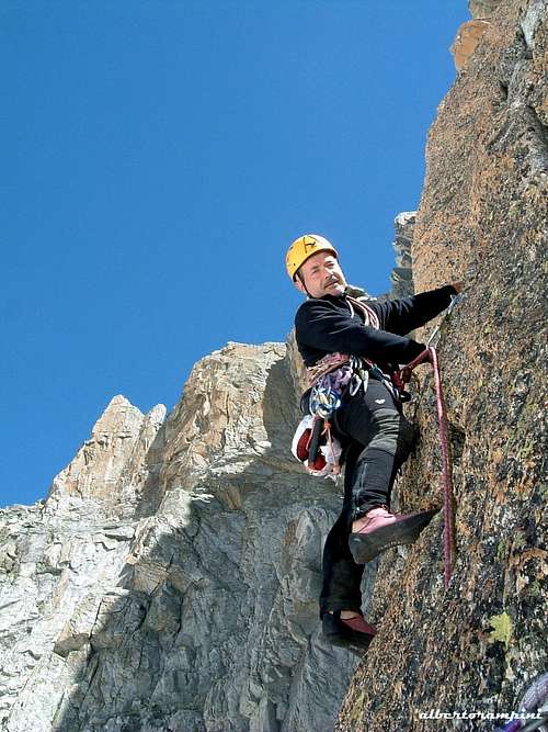
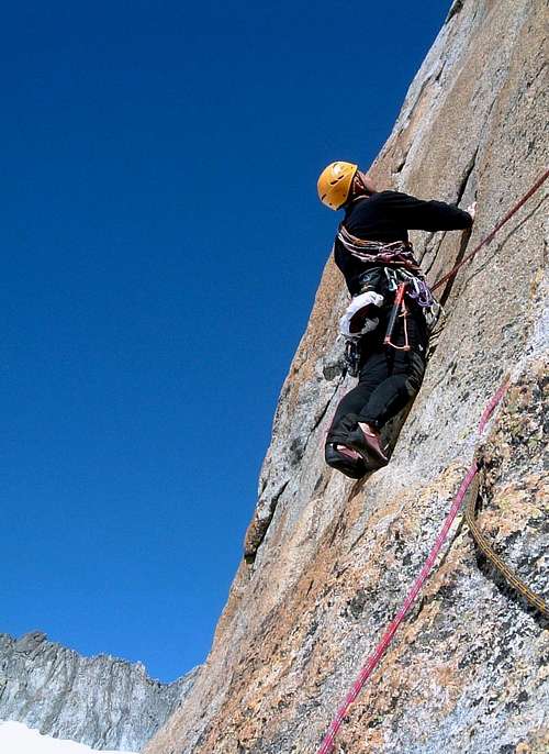
On SW Pfeiler |
Beta of Dammazwillinge SW Pfeiler |
Red Tape
No particular restrictions in climbing and hiking. Anyhow, pay attention to these two rules: - Free camping is not allowed in Tatsch - Pay the ticket at the starting of the road to Tatsch
Hut

Albert Heim Hutte 2542 m. - The refuge was built in the year 1918 and called in honour of the Swiss geologist and glaciologist Albert Heim
Owner: SAC Sektion UTO
Size: 64 people
Phone: +41 (0)41 887 17 45
Mail: info@albertheimhuette.ch
Starting point: Tiefenbach (Realp) or parking lot in the "Tätsch" area (toll road).
Albert Heim on Summitpost: Albert Heim Hut
When to climb
Best season goes from July to September
Where to stay

- Hotel Tiefenbach m. 2110
- Albert Heim Hütte m. 2541
Other accomodations are possible in Andermatt, where you can find some hotels and campgrounds.
Meteo
Guidebooks and Maps
- Guidebooks
 |
 |
- "Schweiz Plaisir Ost" by Sandro von Känel - Edition Filidor 2015
- "Schweiz Plaisir Ost" by Jurg von Kanel - Edition Filidor
- “Arrampicare in Svizzera” Ed. Versante Sud
- "SAC Guidebook - Urner Alpen" by T. Fullin - A. Bahnholzer
- "Ascensioni scelte nella Svizzera Centrale" - Franco Malnati 1981
- Maps
Official Maps of Canton Uri:
CNS - Urseren 1231 1:25.000
CNS - Sustenpass 255 1:50.000