


-
 5140 Hits
-
 90.81% Score
-
 33 Votes
|
|
Mountain/Rock |
|---|---|
|
|
45.87590°N / 7.09511°E |
|
|
Courmayeur Commune/Switzerland (Grand Golliaz Group) |
|
|
Mountaineering |
|
|
9058 ft / 2761 m |
|
|
Note
|
La montagna chiama i suoi figli, ed essi rispondono fedelmente al suo appello… Osvaldo Cardellina, Diario alpinistico, 1964-65 Page texts: @ OsvaldoCardellina "Osva", passed away on May 2, 2022. Page owners: Christian Cardellina e Osvaldo Cardellina. Any updates from September 12, 2022: Antonio Giani, page administrator, friend and climbing companion. Testi della pagina: @ OsvaldoCardellina "Osva", scomparso il 2 maggio 2022. Proprietari pagina: Christian Cardellina e Osvaldo Cardellina. Eventuali aggiornamenti dal 12 settembre 2022: Antonio Giani, amministratore della pagina, amico e compagno di salite. |
Overview
Just to the N of Col Du Ban Darrey (2.696m), on the border ridge between Italy and Switzerland, this mountain is the summit of the homonimuos valley descending toward Prè de Bar Pastures and Rifugio Elena, in Val Ferret: Small summit with good views on Mont Blanc Group and especially on the Grand Jorasses (from South to North) Petites Jorasses - Aiguille de Leschaux/Mont Greuvetta - Aiguille de Talèfre - Aiguille de Triolet - Mont Dolent and in Switzerland/French, Grand Tour Noir (=Great Black Tower) branch.
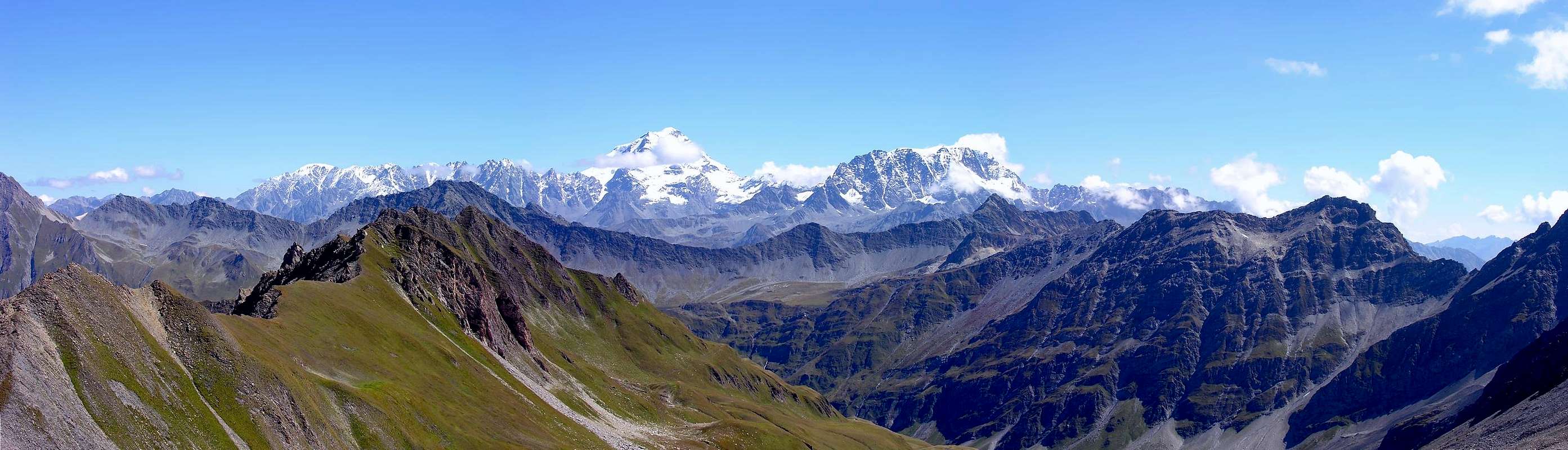
Situata subito a N del Col Du Ban Darrey, (2.696 m), sulla cresta di confine italo-elvetica, costituisce il vertice dell’omonimo vallone, che scende verso l’Alpe di Prè de Bar e l’attiguo Rifugio Elena in Val Ferret. Piccola punta di interesse panoramico-fotografico sulla Catena del Monte Bianco, specificatamente nel tratto Grandes Jorasses (da Sud a Nord) Petites Jorasses - Aiguille des Leschaux/Mont Greuvetta - Aiguille de Talèfre - Aiguille de Triolet - Mont Dolent e in Svizzera/Francia, Grand Tour Noire (= Grande Torre Nera).
First Ascent
First on the summit: Unknown.In winter: Unknown.
- From Torino, Milano, etc: Motorway A5. Exit at Morgex.
- From Switzerland: through the Grand St. Bernard Tunnel or the homonym pass.
- From France: through Mont Blanc Tunnel or Petit St. Bernard Pass.
BY PLANE:
- Aeroporto "Corrado Gex" Saint Christophe (Aosta).
Route
From Arnouva follow along the road (open only to the cars of the ones that have a booking at Rifugio Elena) and along the path 25 get the Prè de Bar Pasture (2.062m - 1h'30) and the Rifugio Elena (views to Pré de Bar Glacier and Mont Dolent, frontally). Along the path up to Tramail (2.264m) and at the following fork (2.316m) follow, toward N to get the Colle del Grand Ferret (2.531m). Following toward SE the long (more than 2 km) ridge, named Arête des Econduits, walking on grass and schists, up to the summit (4h'00/5h'00).Descent: Along the easy SW ridge down to Colle du Ban Darrey (2.696m) and, along the whole Combette Valley, walking close to the small strain, on debris, a short rocky band and tracks down to the path leading to the fork (2.316m).
 |
 |
 |
Da Arnouva (1.769 m) in Val Ferret si segue la strada carrozzabile, chiusa al traffico alle auto, sino ai Casolari di Prè de Bar (2.062 m 1h'30) e all’attiguo Rifugio Elena, ristrutturato, con gran vista sull’omonimo ghiacciaio e sul Mont Dolent, a fronte. Prendere il sentiero a monte e, con percorso abbastanza faticoso, percorrere la soprastante dorsale detritica sino al Tramail (2.264 m) ; risalire il fondo del Vallone di Combette dominando una piccola fascia rocciosa sul torrente sino al bivio (2.316 m). Qui volgere, lasciando a destra il sentiero per il Colle du Ban Darrey (2.696 m), decisamente a N raggiungendo per un dosso e un traverso il Colle del Grand Ferret (2.531 m); con direzione SE percorrere la lunga cresta di confine detta Arête des Econduits di oltre 2 km e, con passo abbastanza agevole, superando alcune quote su erba e rocce scistose si guadagna la vetta (4h'00/5h'00).
Discesa: Rapidamente per la facile cresta SW al Colle du Ban Darrey (2.646 m) e da questo verso W percorrere tutto il Vallone di Combette presso il piccolo torrente, prima per detriti e una fascia rocciosa breve, poi per tracce ed infine su sentiero fino a ricongiungersi al bivio (2.316 m).
Difficulty
For experienced hikers E/F.L’itinerario è considerato da E/F.
Huts
Tel.: (+39) 0165844688 (Refuge - Rifugio) (+39) 0165861127 (House - Abitazione) (+39) 0165862503 (Fax) e-Mail: rifugioelena@virgilio.it
Da escursionismo.
MAPS:
Campings
Remember that free camping is forbidden (except for emergency reasons, over 2.500m, from darkness until dawn).Mountain Conditions
- You can get meteo information at the official site of the Regione Valle d'Aosta:
- Valle d'Aosta Meteo
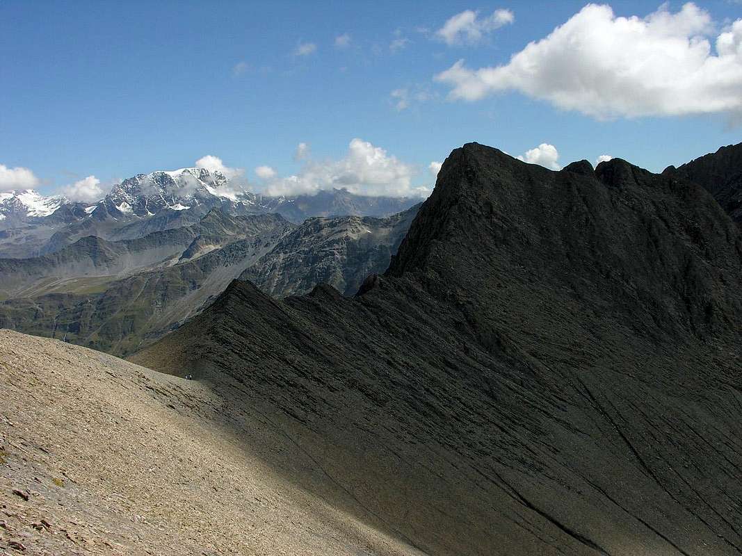
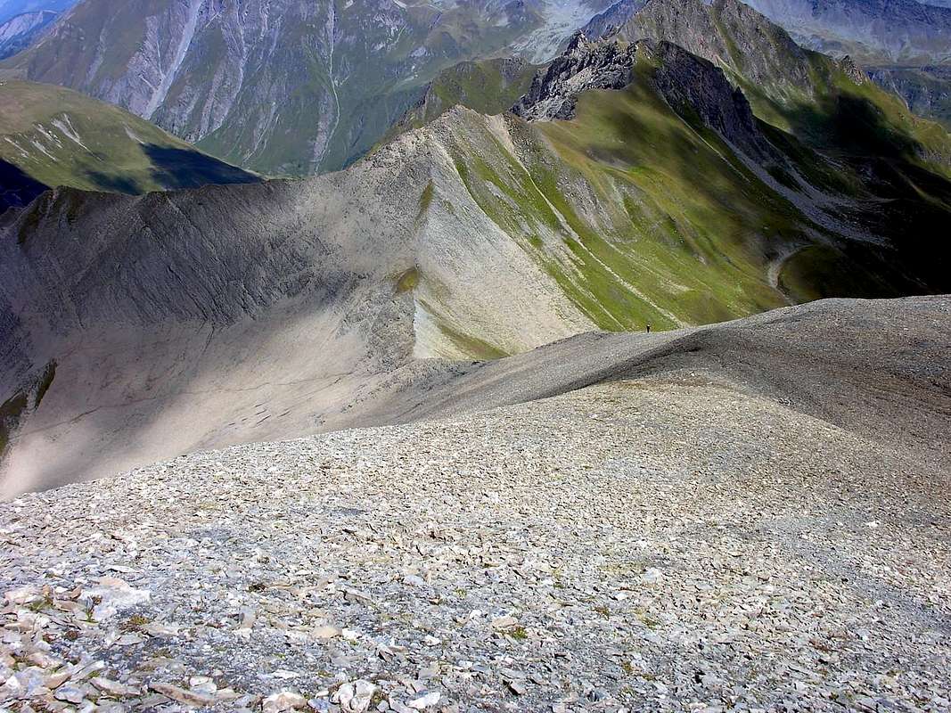
![Punta Combette and Ban Darrey Pass...]()
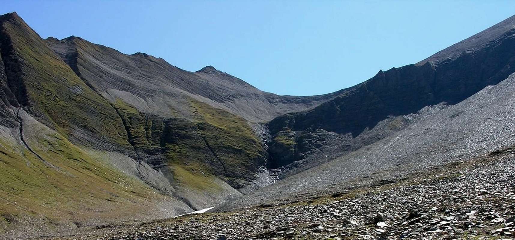
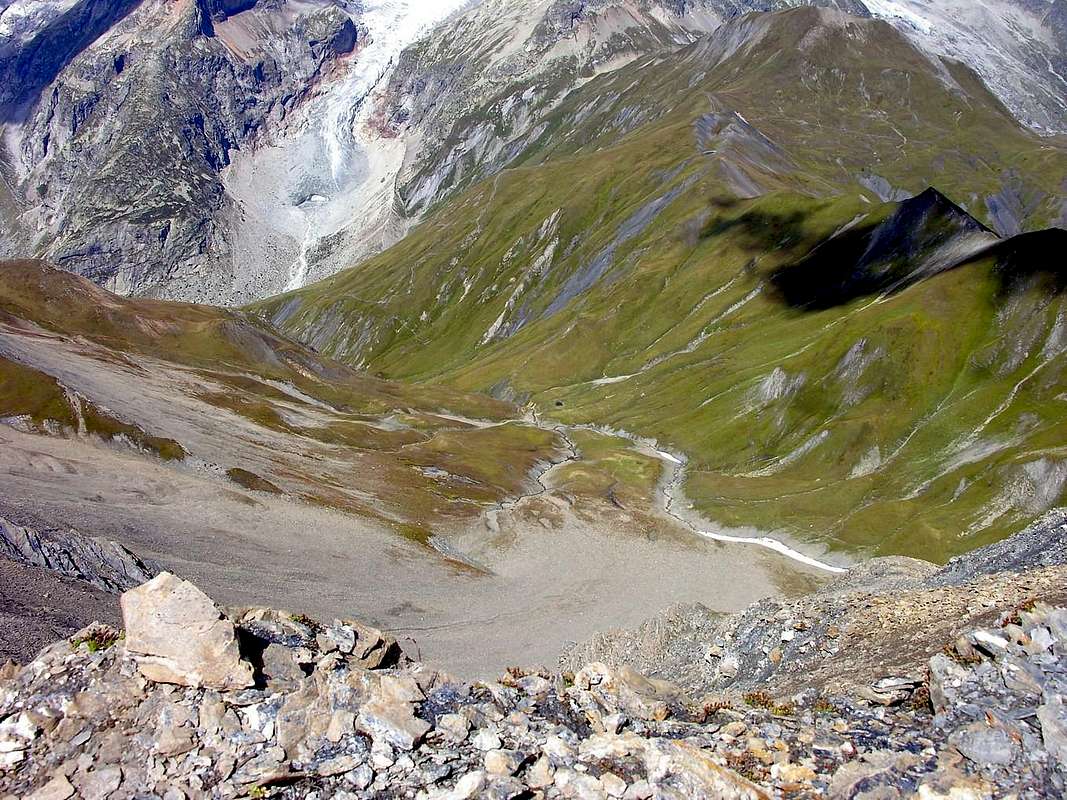
![Combette Valley]()
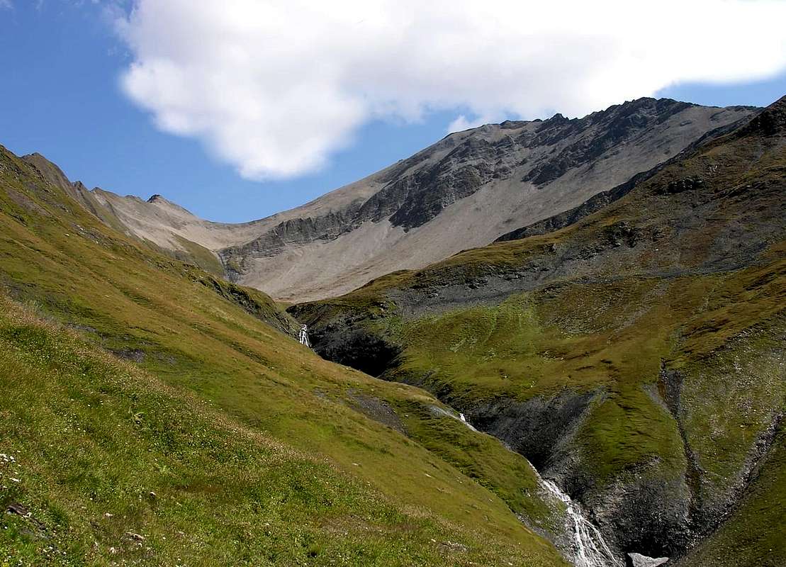
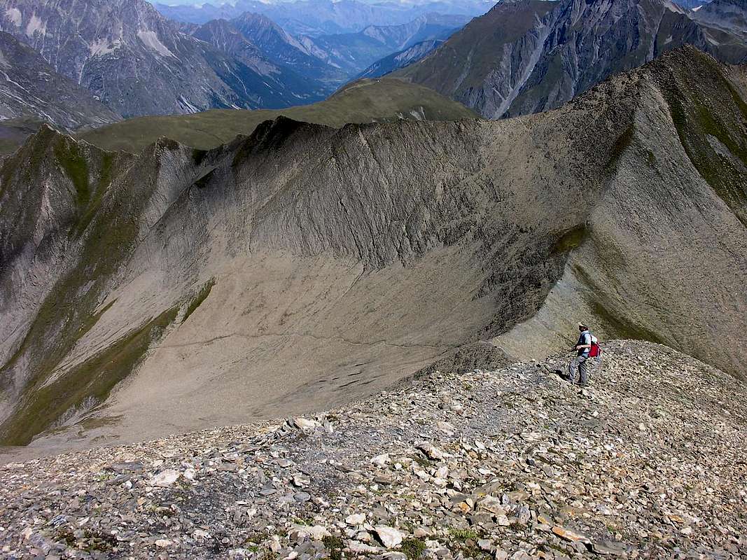
![Livioz, nei pressi della punta Combette...]()
Webcam
- WEBCAM on Aosta Valley:
- Webcam
Books and Maps
BOOKS:- "Guida delle Alpi Occidentali", di Giovanni Bobba e Luigi Vaccarone C.A.I. Sezione di Torino Volume II (parte II), 25 Maggio 1896.
- "Guida dei Monti d'Italia-Alpi Pennine" (Vol. I°) di Gino Buscaini-Club Alpino Italiano/Turing Club Italiano, Luglio 1971 (in Italian).
- "Guida della Regione Autonoma Valle d'Aosta" di Mario Aldrovandi; Ed. S.P.E. di Carlo Fanton, Torino 1964.
- "I Rifugi della Valle d'Aosta" di Stefano Ardito, Ed. Guide iter, Febbraio 2003.
- "A piedi in Valle d'Aosta" (Vol. 1), di Stefano Ardito, Ed. Guide iter, Giugno 2003.
- "Diari Alpinistici" di Osvaldo Cardellina e Indice Generale accompagnato da Schedario Relazioni Ascensioni 1964-2021 (inediti).
 |
 |
 |
 |
- Kompass "Massiccio del Monte Bianco Valle d'Aosta Sentieri e Rifugi" Carta turistica 1:50.000.
- I.G.C. Istituto Geografico Centrale Torino "Massiccio del Monte Bianco" (n° 4), Torino, 1998 1:50.000.
- I.G.C. Istituto Geografico Centrale Torino "Monte Bianco-Courmayeur-Chamonix-La Thuile" (n° 107), 1:25.000.
- L’Escursionista "Monte Bianco Courmayeur" (n° 1) Edizioni Rimini 2004 1:25.000.
- L'Escursionista "Gran San Bernardo Ollomont" Ed. Rimini ( n° 5) 1: 25.000.
- Edizioni Tabacco "Mont Blanc" Udine, 1978 1:50.000.
- Studio F.M.B. Bologna 1988 "Monte Bianco-Mont Blanc" 1:50.000.
Important Information
- REGIONE AUTONOMA VALLE D'AOSTA the official site.
- FONDAZIONE MONTAGNA SICURA Villa Cameron, località Villard de la Palud n° 1 Courmayeur (AO) Tel: 39 0165 897602 - Fax: 39 0165 897647.
- Società Guide Alpine Courmayeur www.Guidecourmayeur.com - Strada Villair n° 2 - 11013 Courmayeur (Aosta) Italy - Tel. +390165842064 Fax. +390165842357 - P.I. 01022640070
- A.I.NE.VA. (Associazione Interregionale Neve e Valanghe).
Useful numbers
- Protezione Civile Valdostana località Aeroporto n° 7/A Saint Christophe (Ao) Tel. 0165-238222.
- Bollettino Meteo (weather info) Tel. 0165-44113.
- Unità Operativa di Soccorso Sanitario Tel. 118.