


-
 3063 Hits
-
 82.48% Score
-
 15 Votes
|
|
Mountain/Rock |
|---|---|
|
|
45.76210°N / 7.24148°E |
|
|
Hiking |
|
|
Spring, Summer, Fall, Winter |
|
|
8376 ft / 2553 m |
|
|
Note
|
La montagna chiama i suoi figli, ed essi rispondono fedelmente al suo appello… Osvaldo Cardellina, Diario alpinistico, 1964-65 Page texts: @ OsvaldoCardellina "Osva", passed away on May 2, 2022. Page owners: Christian Cardellina e Osvaldo Cardellina. Any updates from September 12, 2022: Antonio Giani, page administrator, friend and climbing companion. Testi della pagina: @ OsvaldoCardellina "Osva", scomparso il 2 maggio 2022. Proprietari pagina: Christian Cardellina e Osvaldo Cardellina. Eventuali aggiornamenti dal 12 settembre 2022: Antonio Giani, amministratore della pagina, amico e compagno di salite. |
Confusing Overview Double
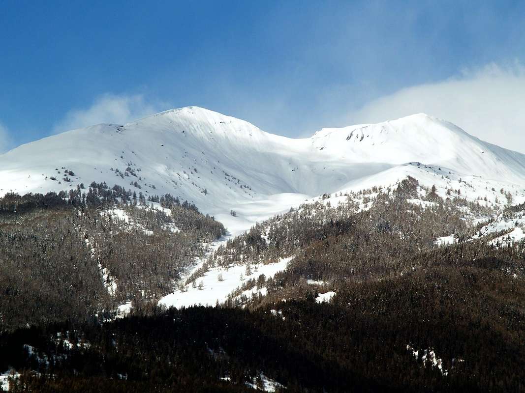
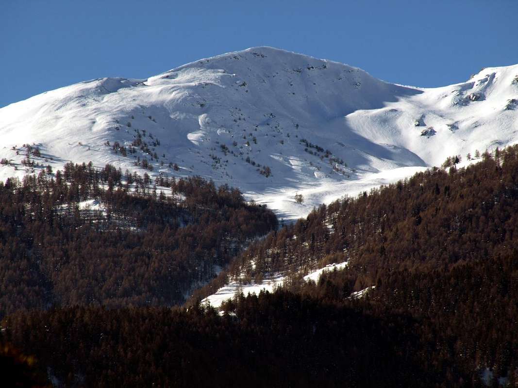
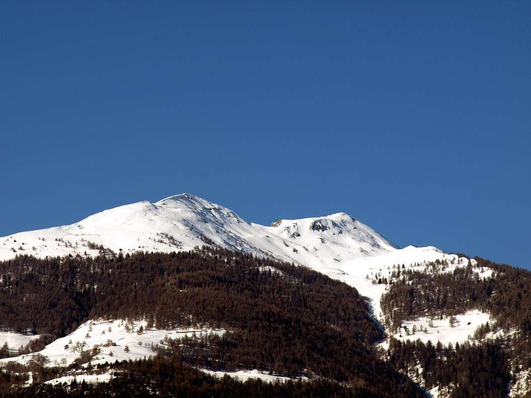
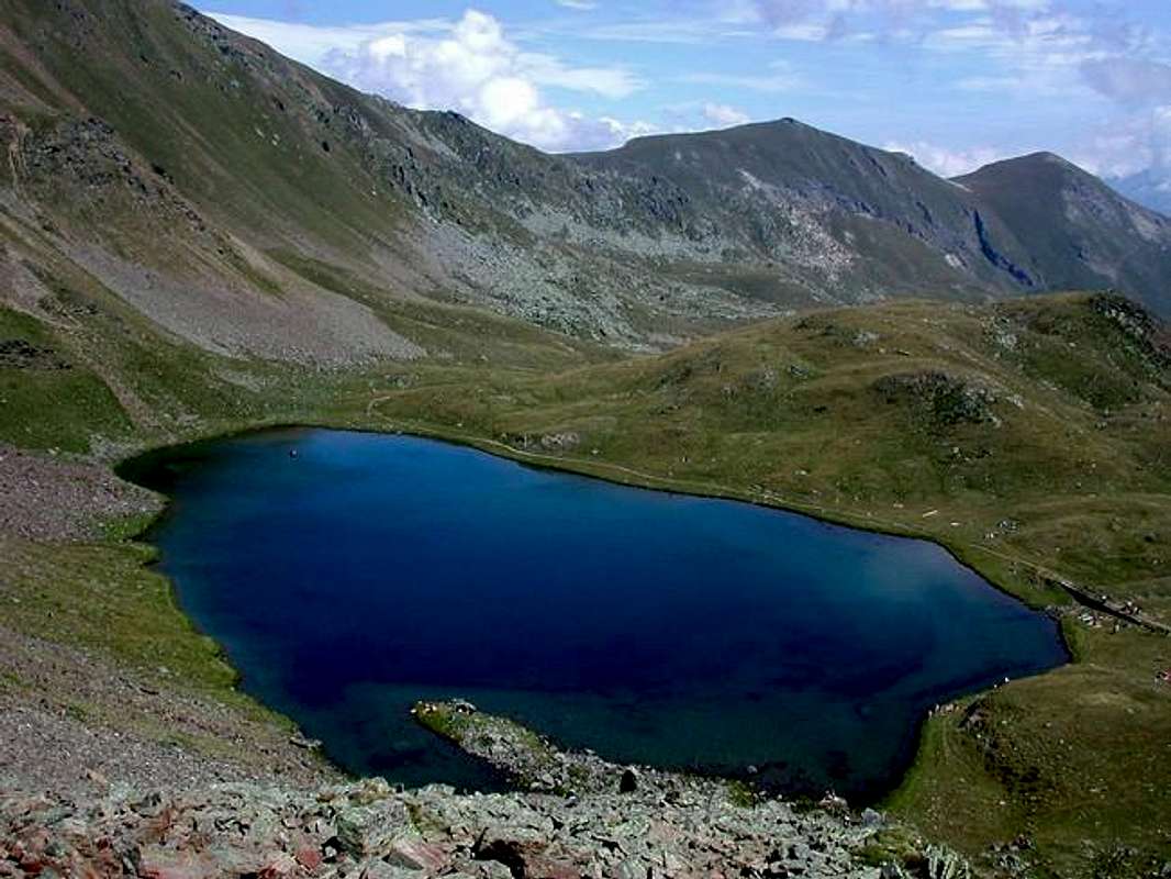
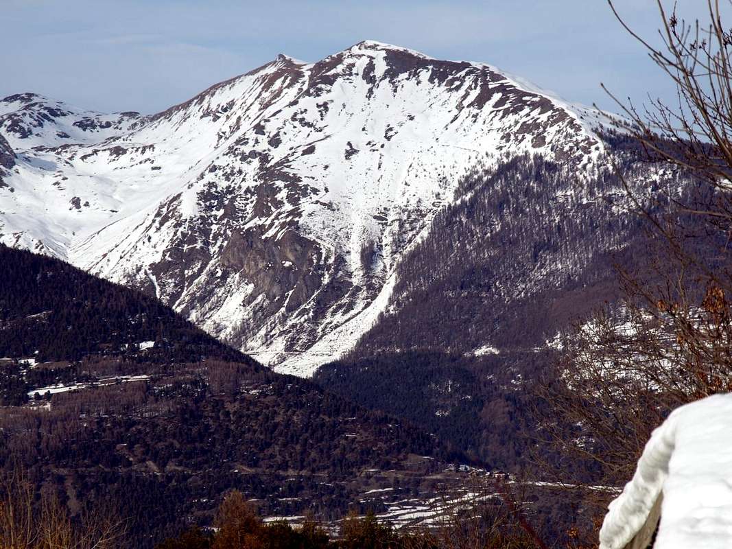
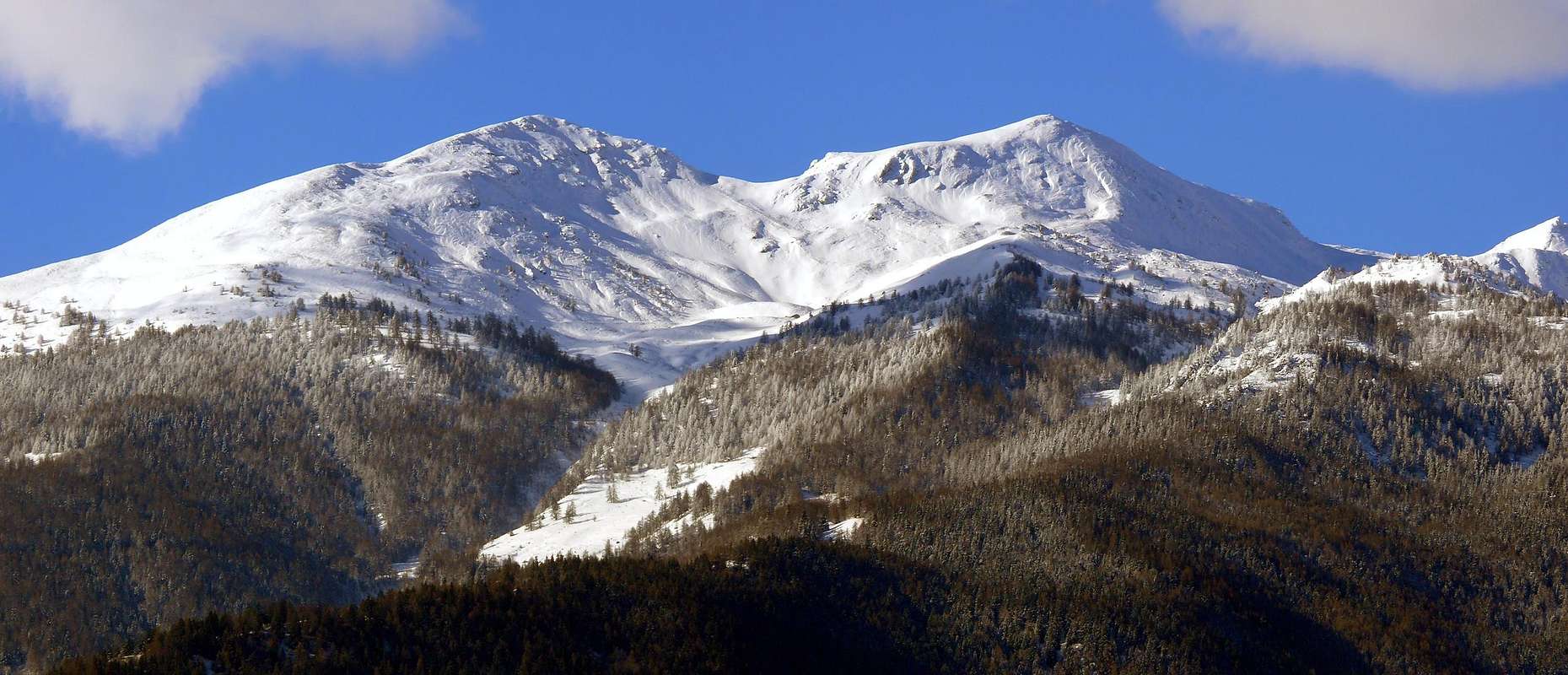
This Summit is a elevation of secondary importance. Some confusion is created in time with equal to the nearby Punta Chaligne (+; 2.608m) slightly higher and immediately to the North. In fact those who are commonly called Tips Chalignes or Saline are two distinct peaks and separated from each other by the Met or Metz Hill (2.492m), located on the ridge separating the Valley of Clusella or Clusellaz (West) between the Communes of Aosta (East) and Sarre and the Eastern slopes of the latter above the Comba Labe between those of Aosta Gignod, now at the beginning of the Valley of the Gran San Bernardo. All those zeta (Metz, Tzaligne, Clusellaz) have then doubles the confusion due to a process of forced Frenchification reported from recent Cards and Maps while on the older times are only the names of Clusella, Chaligne or Tsaligne and Met, as all pastures located in the South of the latter. To complete the opera then the populace and the neophytes and novice apprentices, at least until the Sixties, had coined the nickname of Saline, although the same have nothing to do with the salt but the name is intended to Tsa (last and highest mountain pasture) and the frequent presence of thelightning, brought by the cold currents of the "Coumba Freida" (basin or downstream cold) and from the various hills of the Great St. Bernard, in this area very exposed to the North and rather "hot" in the South because of the nearby presence of the town. A closeness that has made this small "Cima" is the subject of frequent visitations by Walkers of Aosta and Sarre, especially in early season when the snow is transformed here in advance; but also at the end of the same in late autumn or in early winter for to "close" the same. A tiny Top for everyone because of the easiness of his ascent and scenic views to over 220°, as well as on the city below relaxed at his feet. It is typically climb starting from the Village of New Thouraz and through the easy Ridge South, but also from the opposite direction towards the Colle di Met with the same start and also by the Commune of Gignod, although for the latter the favorite destination is made up of the adjacent more "renowned" Punta Chaligne which also addresses a popular Procession in August. The climb instead, using the same hill and the Northern Crest, is somewhat more rare on the other side or along the Vallon of Clusella. On this side, in fact the primary goal is the trip to Lake Fallère (2.415m) and for the most prepared to Mount Fallère (3.061m), higher Summit in this subgroup. The passage of the Hill of Met was reserved in the past to the connection between the Alps Morgnoz, Nouva and Chesère (West) with those of Les Arpes Vieilles, Baou de Bouque and Met East. Transhumances that the current farm roads have completely disappeared. Unless you want to, as it was until the Sixties, starting walk from Aosta, bypassing the same to get towards the above Fallère. But what is of another era and was built exclusively for lack of resources (cars) and money ...
Questa Sommità costituisce una elevazione di secondaria importanza. Una certa confusione si é creata nel tempo associando la medesima alla vicina Punta Chaligne (+; 2.608 m) di poco più alta ed immediatamente a Settentrione. In realtà quelle che comunemente vengono chiamate Punte Chalignes o Saline sono due Cime ben distinte e separate tra di loro dal Colle di Met o Metz (2.492 m), sito sulla cresta spartiacque tra il Vallone di Clusella o Clusellaz (Ovest) tra i Comuni di Aosta (Est) e Sarre e le pendici Orientali di quest'ultima al di sopra della Comba Labe tra quelli di Aosta e Gignod, ormai all'inizio della Valle del Gran San Bernardo. Tutte quelle zeta (Metz, Tzaligne, Clusellaz) han poi più che raddoppiata la confusione a causa di un processo di forzata francesizzazione riportato dalle Carte recenti mentre su quelle più vecchie troviamo esclusivamente i toponimi di Clusella, Chaligne o Tsaligne e Met, come tutti gli alpeggi posizionati a Meridione di quest'ultima. Per completare l'opera poi il popolino e gli apprendisti alpinisti, ameno fino agli Anni Sessanta, aveva coniato il nomicciuolo di Saline, anche se le medesime nulla hanno da spartire con il sale ma piuttosto il toponimo é rivolto alla Tsa (ultimo e più elevato alpeggio) nonché alla presenza frequente di fulmini, portati dalle correnti fredde della "Coumba Freida" (bacino o valle fredda) e provenienti dai vari Colli del Gran San Bernardo, in questa zona alquanto esposta a Settentrione e piuttosto "calda" a Mezzogiorno per la vicina presenza della città. Una vicinanza che ha fatto sì che questa piccola Cima sia oggetto di frequenti visitazioni da parte degli Escursionisti di Aosta e Sarre, soprattutto in inizio di stagione quando la neve qui si trasforma in anticipo; ma anche al termine della medesima nel tardo autunno o nei primi giorni d'inverno per "chiudere" la medesima. Una Cimetta alla portata di tutti a motivo della facilità della sua salita e delle splendide viste ad oltre 220°, oltreché sulla sottostante città che si distende ai suoi piedi. In genere viene salita partendo dal Villaggio di Nuova Thouraz e tramite la facile Cresta Sud, ma anche da quella opposta verso il Colle di Met con medesima partenza ed inoltre dal Comune di Gignod, anche se per questo ultimo la meta prediletta é costituita dall'adiacente e più "rinomata" Punta Chaligne alla quale si rivolge anche una popolare Processione nel mese d'Agosto. L'ascensione invece, per mezzo dello stesso colle e per la Cresta Nord, é alquanto più rara sul lato opposto e lungo il Vallone di Clusella. Da questo lato infatti l'obiettivo primario risulta la semplice gita al Lago Fallère (2.415 m) e per i più preparati al Monte Fallère (3.061 m), la Cima più elevata di questo sottogruppo. Il passaggio del Colle di Met era riservato in tempi passati al collegamento tra le Alpi Morgnoz, Nouva e Chesère (Ovest) con quelle di Tsa de Metz o Les Arpes Vieilles, Baou de Bouque e di Met ad Oriente. Antiche transumanze che le attuali strade poderali han fatto completamente scomparire. A men si voglia, come avveniva sin Anni Sessanta partendo addirittura a piedi da Aosta, scavalcare lo stesso per recarsi al soprastante Fallère. Ma é cosa d'altri tempi e veniva realizzata esclusivamente per mancanza di mezzi e di dané ...
BY CAR:
- From TORINO, MILANO, etc: Motorway A5. Exit at IVREA or Quincinetto (PIEDMONT).
- From IVREA: in West towards Pont St. Martin, Donnas, Bard, St. Vincent, Chatillon, Nus, Quart, St. Christophe, Aosta Sarre (in West) or Gignod (North) Municipalities.
- From Courmayeur Resort: in East to Pré St. Didier, Morgex, La Salle, Saint Pierre, Villeneuve, Sarre, Aosta or in North to Gignod Municipalities.
- From Sarre Municipality in Central Baltea Valley towards Aosta City and Gignod Common at the entrance on Gran San Bernardo Valley From Sarre (657m), with Regional Road, towards Plèod, Vert Dessous and Dessus, Vareille, Caillod/Ville sur Sarre/Remondet, Moulin/la Cort, forks 1.225m, 1.301 meters, Salet, Chavalançon (1.426m) small Villages to Thouraz Dessous and Dessus Hamlets (1.652m); from the last to Closella and Met small Valleys. From Aosta North Town with Main Route of From Aosta City towards the Great Saint Bernard Valley to alternative nearby Grand Signayes Hamlet (737m); through the deviation, in asphalt, to Arpuilles (1.010m), Excenex (1.046m) Fractions. From these by farm dirt roads or various paths, numbered or not, to Tsa de Metz or "Les Arpes Vieilles" (1.419m), below Checotteyes (1.715m) Alp on Arpilles small Valley. From this point to Met Hill, Met Summit and Croix de Chaligne. From Gignod Commune (988m) with Great St. Bernard SS.27 to alternative nearby Condemine Hamlet (1.137m); leaving left through Municipal Road to Grand e Petit Buthier Villages (1.302m, 1.439m) in Chaligne Comba. From this last, with private dirt farms roads and through Mendey, Roncaille, Rombason Pastures up to the Chaligne Shelter (1.936m), below Costa Tardiva (2.380m), Tardiva Hill (2.410m) and neighboring of Punta Chaligne (2.608m), Col and Pointe de Met (2.492m, 2.553m).
- From FRANCE: through the Mont Blanc Tunnel to Entrèves-crossroads to Vény/Ferret Valleys - Mountain Guides of Courmayeur - La Saxe Rock Gym - Courmayeur. By Little Saint Bernard Pass, closed since November until half May to La Thuile Valley - Pré Saint Didier - Courmayeur. It is not necessary to take Motorway A5: you can drive on SS.26, in the direction of AOSTA - IVREA - TURIN.
BY PLANE:
- Aeroporto "Corrado Gex" Saint Christophe (Aosta).
Approaches & Routes
 |
 |
 |
 |
 |
Basically there are five ways that lead to this small mountain. They, analyzing clockwise from the North East and, starting from the Hill of Met (2.492m) between it and the neighboring Punta Chaligne (2.608m) , goes up through self vallons which are also the single approach, but then are connected by a thick network of farm dirt roads:
1) - Arpilles small Valley: from Aosta Town Northern sector with Main Route of Valley Great Saint Bernard Valley to alternative nearby Grand Signayes Hamlet (737m); through the deviation, always in asphalt, to Arpuilles (1.010m) and Excenex (1.046m) Fractions. From these by farm dirt roads or various paths numbered or not, to Tsa de Metz or "Les Arpes Vieilles" (1.419m), above Checotteyes (1.715m) Alpage. From this point to Met Hill with the path n° 3 then by Northern Crest through a small trace n° 7B.
2) - Clou-Met(z)-Chaligne small Valleys always through Met Pass and Northern Crest: from Touraz new Hamlet (1.593/1.652m; Horses Ranch; no transit signal immediately after) in East-northeast through private dirt farms road concomitant with the path n° 6 towards Metz Bionaz (1.731m), Vignon (1.789m), Condemine de Metz (1.874m) Pastures and Metz Alp (2.261m), nearby Labe Torrent. From Alpage always with the trail n° 6 towards Met Hill, between Chaligne Met Summits, and preceding route.
3) - By Thouraz Dessus or from Tsa de Chesère through the route towards "la Tsitra" and along Southern Crest:
a) - always from Touraz Dessus (1.652m) continue with the small path n° 7B directly to the North and through the Bois de Thouraz up to reach the location called as "la Tsitra" (2.176m); this go up through South-southwestern Crest that progressively it leads to a more open path. Passing an area with large avalanche barriers in wood, in a short time you can easily reach the small cairn.
b1) - with larger circle first Eastward with the farm road and past Vignon, Condemine de Metz and Moulin Pastures (1.794m, 1.876m, 1.880m) to the town named "Berrio Bat" (1.954m) in the Bois de Ban and then to the West you reach the hairpin 2.140 meters, just below "the Tsitra" and quickly with small crossing to the West the Southern Crest.
b2) - or from the hairpin bend continue towards the North through the same, concomitant to route n° 8C, coming to Tsa de Met whence the Hill and the Pointe de Met.
Note: these two itineraries are the most advisable route in the forest when there is too much snow covering the trail; agrees therefore a turn wider but also more open and identifiable reference points, as well as more exposed to the sun before that transforms it. In the second, however, we have to be more attentive to the overlying slopes East, as well as the ascent of the hill. In any case in the presence of high snow you have to be absolutely far from the same, climbing only the two ridges, of which the better the Southern. Of note in fact the advent of fairly recent for avalanche fatalities in the slopes of Pointa Chaligne (especially the East-northeast Slope above Alp and Refuge Chaligne).
Variant a) - from Moulin fording towards the small West Torrent de Conclonaz through the path not numbered nor reported meet the quota in 2008 between the Bois de Thouraz and Montagnetta; from here with the trail n° 7B to the Summit.
Variant b) - here it's more directly also by Condemine de Metz with a little track-path in the forest.
c) - Or starting from the fork 2.277 meters nearby the Tsa di Chesère (see the following itinerary) to cross towards Southeast with the path n° 8C always reaching "la Tsitra".
4) - Clusella Valley, Western Slope of hill and Northern Crest: from Ville sur Sarre through Municipal Road in asphalt to Touraz Dessus (1.652m; signal no transit; in foreground the remains of enourmous landslide from Becca France of July 06th, 1564, with 600 deads, all the inhabitants). Through the dirt road, concomitant with trail n° 8A/8B and along the entire valley towards Morgnoz (2.052m), Frumière (2.062m), Chaz de Morgnoz (2.271m) Pastures. From Tsa continue Eastward-northeast to the Alps Chesère (2.178m) and Tsa of Chesère (2.418m), but not reaching the latter; instead from the junction 2.277 meters leave the private dirt road, taking the path n° 8F/7B to the South-southeast that with semicircular around and returning to the East-northeast towards the hill along the West Slope. This with the previous ways through North Crest.
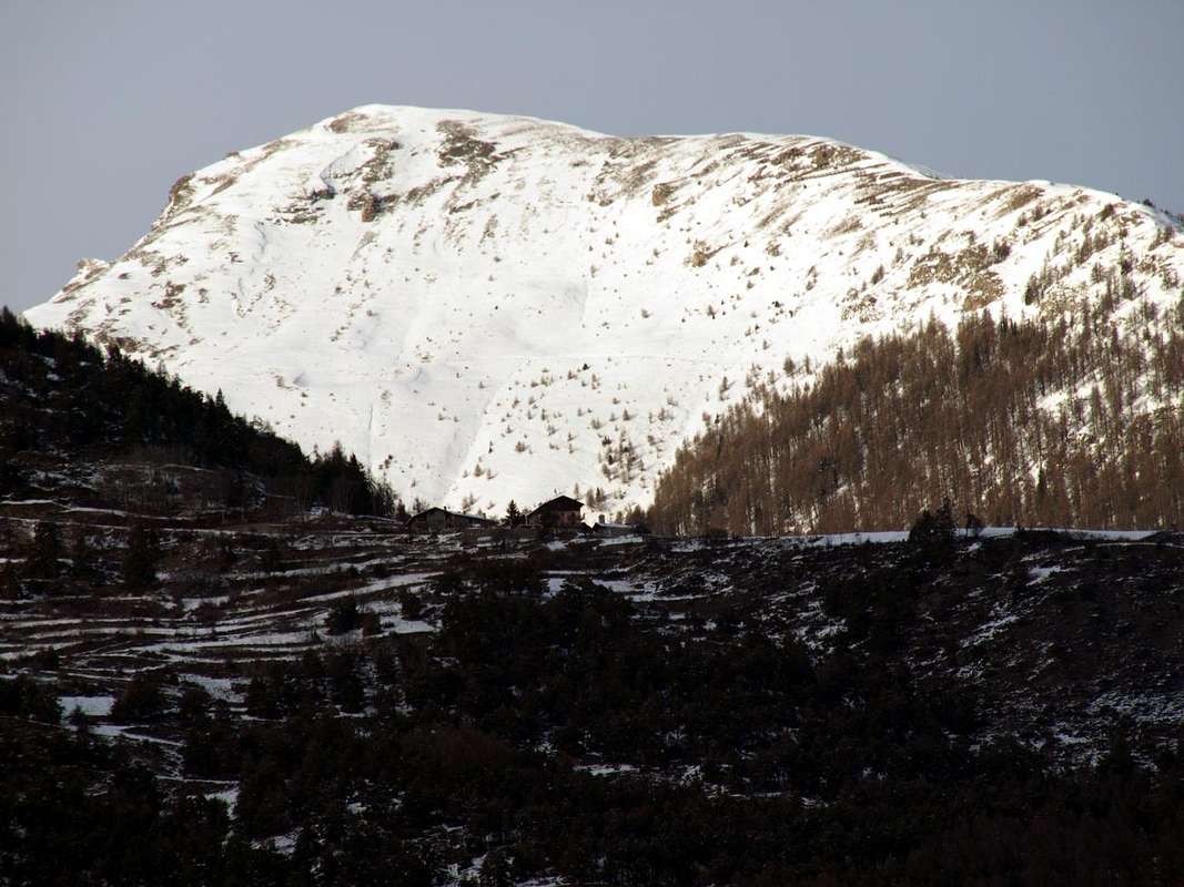
5) - By Refuge Chaligne through the little Saddle 2.126 meters below Plan du Debat: Furthermore it is possible to climb to the Pointe de Met with a larger circle passing from the Valley of the Gran San Bernardo, but having as a base the new Shelter Chaligne just below the homonymous Tsa (1.936m, 2.225m). In this case it is necessary to reach the Common of Gignod (988m) and the next junction near Condemine (see details in Getting There). Reached the refuge continue South through the forest path n° 2A/2B until you reach the above small pass 2.126 meters; left to right the path that goes back to the West at the Plan de Debat, in the Eastern Slope of Chaligne, cross to the South instead coming up with a small path not numbered towards the Tsa de Metz (2.251m). This briefly with the path n° 6/7B to Colle di Met and North Crest in final part.
In pratica sono cinque le vie che conducono a questa piccola Montagna. Esse, analizzando in senso orario da Nordest e partendo dal Colle di Met (2.492m) tra la medesima e la vicina Punta Chaligne (2.608m) , risalgono tramite autonomi valloni che costituiscono il singolo approccio, anche se poi risultano collegati da fitta rete di poderali:
1) - Valloncello di Arpilles e Comba Labe tramite il Col de Met e la Cresta Nord: partendo dal lato Settentrionale della Città d'Aosta con la SS.27 per la Valle del Gran San Bernardo insino al bivio per Grand Signayes (737 m); per mezzo della strada sempre in asfalto verso le appena soprastanti Frazioni di Arpuilles (1.010 m) ed Excenex (1.046 m). Da queste con poderali oppure tramite sentieri vari numerati e no salire la grande foresta sulla collina Orientale insino alla Tsa de Metz o "Les Arpes Vieilles" (1.419 m), al di sopra dell'Alpeggio di Checotteyes (1.715 m). Da questo punto al Colle di Met con il sentiero n° 3 e quindi con la Cresta Nord tramite una piccola traccia n° 7B.
2) - Valloncelli di Clou-Met(z)-Chaligne sempre dal Col de Met e lungo la Cresta nord: dal Villaggio di Nuova Touraz (1.593/1.652 m; Ranch dei cavalli; segnale di divieto ai mezzi immediatamente dopo) in direzione Est-nordest tramite la privata poderale concomitante al sentiero n° 6 alle Alpi Metz di Bionaz (1.731 m), Vignon (1.789m), Condemine de Metz (1.874 m) e Metz (2.261 m), nei pressi del Torrent Labe. Dall'Alpeggio sempre tramite il sentiero n° 6 verso il Col de Met, tra Chaligne e Pointe de Met, e via precedente.
3) - Da Thouraz Dessus o dalla Tsa de Chesère per la via de "la Tsitra" e lungo la Cresta Sud:
a) - sempre da Touraz Dessus (1.652 m) proseguire col sentiero n° 7B direttamente a Settentrione attraverso il Bois de Thouraz fino a raggiungere la località cosiddetta "la Tsitra" (2.176 m); da questa continuare con la Cresta Sud-sudovest che progressivamente conduce ad un percorso più aperto. Oltrepassando una zona con grandi paravalanghe in legno, in breve si raggiunge facilmente l'ometto in pietra della Cima.
b1) - con giro più largo dapprima ad Est con la poderale ed oltrepassando gli Alpeggi di Vignon, Condemine de Metz e Moulin (1.794 m, 1.876 m, 1.880 m) fino alla località detta "Berrio di Bat" (1.954 m) nel Bois de Ban e poi ad Ovest si raggiunge il tornante 2.140 metri, subito sotto "la Tsitra" ed in breve con traversatina verso Ovest alla Cresta Sud.
b2) - oppure dal tornante continuare verso Settentrione tramite la medesima, concomitante al sentiero n° 8C, arrivando alla Tsa de Met donde al Colle ed alla Pointe de Met.
Nota: questi due itinerari sono più consigliabili quando nella foresta esiste troppa neve ricoprendo il sentiero; conviene quindi un giro più largo ma anche più aperto ed individuabile nei punti di riferimento, nonché maggiormente esposto al sole che prima trasforma la medesima. Nel secondo però bisogna stare più attenti ai soprastanti pendii Orientali, nonché nella salita al colle. In ogni caso in presenza di neve alta bisogna stare assolutamente lontano dai medesimi, percorrendo esclusivamente le due creste, delle quali meglio la Sud. Da segnalare infatti l'avvento di incidenti mortali abbastanza recenti per valanga nei vicini pendii della Pointa Chaligne (soprattutto sul Versante Est-nordest).
 |
 |
 |
 |
 |
Variante a) - da Moulin guadare verso Ovest il piccolo Torrent de Conclonaz e con sentierino non numerato e neppur segnalato raggiungere la quota 2.008 tra i due Bois de Thouraz e Montagnetta; da qui con il sentiero n° 7B alla Vetta.
Variante b) - qui si giunge in modo più diretto anche da Condemine de Metz con piccola traccia nella foresta.
c) - Oppure partendo dal bivio 2.277 metri presso la Tsa di Chesère (vedi itinerario successivo) attraversare verso Sudest con il sentiero n° 8C raggiungendo sempre "la Tsitra".
4) - Vallone di Clusella, Versante Occidentale del colle e Cresta Nord: da Ville sur Sarre con la Strada Municipale in asfalto a Touraz Dessus (1.652 m; segnale di divieto; in primo piano i resti dell'enourme frana dalla Parete Sudest della Becca France del 6 Luglio 1564, con 600 morti, ovvero tutti gli abitanti dell'antica Thora). Tramite la poderale concomitante al sentiero n° 8A/8B e lungo l'intero vallone, alle Alpi di Morgnoz (2.052 m), Frumière (2.062 m), Chaz de Morgnoz (2.271 m). Dalla Tsa proseguire ad Est-nordest fino all'Alpi Chesère (2.178 m) e Tsa di Chesère (2.418 m), ma non raggiungere quest'ultima; bensì dal bivio 2.277 metri abbandonare la poderale prendendo verso Sud-sudest il sentierino n° 8F/7B che con largo giro semicircolare e tornando ad Est-nordest raggiunge il colle sul Versante Ovest. Da questo alle precedenti tramite Cresta Settentrionale.
5) - Dal Rifugio Chaligne tramite la Selletta 2.126 metri sotto Plan de Debat: inoltre é possibile salire alla Pointe de Met con un giro più largo passando dalla Valle del Gran San Bernardo, ma avendo come punto di appoggio il nuovo rifugio Chaligne appena al di sotto dell'omonima Tsa (1.936 m, 2.225 m). In questo caso risulta necessario raggiungere il Comune di Gignod (988 m) ed il successivo bivio di Condemine (vedi in dettaglio Getting There). Raggiunto il rifugio proseguire a Sud nella foresta tramite il sentiero n° 2A/2B fino a raggiungere la soprastante piccola sella 2.126 metri; lasciato a destra il sentiero che risale verso Ovest al Plan de Debat, sotto il Versante Orientale della Chaligne, attraversare invece a Sud arrivando con un piccolo sentiero non numerato alla Tsa de Metz (2.251 m). Da questa in breve col sentiero n° 6/7B al Colle di Met.
 |
 |
 |
 |
 |
Difficulty Equipment & Climbing Time
This route can be considered E or EE/BSA (Experts Hikers or Good Skiers-Montaineers) in winter by Ski-Mountaineering or Snowshoeing.L'itinerario è classificato E oppure EE/BSA (Buoni Sciatori Alpinisti) in inverno tramite Sci-Alpinismo od in Racchette da neve.
Hiking gear or in winter with ski and snowshoes (better with ARVA).
Da Escursionismo oppure in inverno tramite Sci oppure in Racchette da neve (meglio con ARVA).
Times: Calculating an average between the 400/50 meters per hour or in winter by Ski or Snowshoe of 250/300). Time basis: by Thouraz Village or Chaligne Shelter 3h'00/4h'00.
Tempi: Calcolare una media tra i 400/50 metri all'ora oppure in inverno tramite Sci o in Racchette da neve di circa 250/300). Tempo base: da Thouraz o Chaligne 3h'00/4h'00.
Campings
Outside Aosta, along the road that brings to Gran San Bernardo Pass, close to Buthier, there is a camping area.Mountain Conditions
- Meteo: you can find all the needed informations at the official site of the Valle d'Aosta Region:
- Valle d'Aosta Meteo
Books and maps
- "Guida dei Monti d'Italia-Alpi Pennine" (Vol. I°) di Gino Buscaini-Club Alpino Italiano/Turing Club Italiano, Luglio 1971.
- "Dove si specchia il cielo - i laghi della Valle d'Aosta", di Sergio Piotti, Ed. Ferrari Luglio 1996.
 |
- Kompass "Monte Bianco Valle d'Aosta Sentieri e Rifugi" Carta turistica 1:50.000.
- Kompass "Gran Paradiso Valle d'Aosta Sentieri e Rifugi" Carta Turistica 1:50.000.
- I.G.C. Istituto Geografico Centrale Torino "Massiccio del Monte Bianco" (n° 4), Torino, 1998 1:50.000.
- Studio F.M.B. "Monte Bianco-Mont Blanc", Bologna 1988 1:50.000.
- I.G.C. Istituto Geografico Centrale "Carta dei sentieri e dei rifugi" 1:25.000.
- I.G.M. Istituto Geografico Militare 1:25.000.
![Punte Chaligne...]()
Important Information
- REGIONE AUTONOMA VALLE D'AOSTA the official site.
- FONDAZIONE MONTAGNA SICURA Villa Cameron, località Villard de la Palud n° 1 Courmayeur (AO) Tel: 39 0165 897602 - Fax: 39 0165 897647.
- A.I.NE.VA. (Associazione Interregionale Neve e Valanghe).
Useful numbers
- Protezione Civile Valdostana località Aeroporto n° 7/A Saint Christophe (Ao) Tel. 0165-238222.
- Bollettino Meteo (weather info) Tel. 0165-44113.
- Unità Operativa di Soccorso Sanitario Tel. 118.
hgrapid - Jan 26, 2016 11:40 am - Voted 10/10
Re: 778 meters?No worries. Great page!