


-
 2719 Hits
-
 75.81% Score
-
 6 Votes
|
|
Mountain/Rock |
|---|---|
|
|
45.81830°N / 7.42288°E |
|
|
Mountaineering |
|
|
Summer, Fall |
|
|
9432 ft / 2875 m |
|
|
Note
|
La montagna chiama i suoi figli, ed essi rispondono fedelmente al suo appello… Osvaldo Cardellina, Diario alpinistico, 1964-65 Page texts: @ OsvaldoCardellina "Osva", passed away on May 2, 2022. Page owners: Christian Cardellina e Osvaldo Cardellina. Any updates from September 12, 2022: Antonio Giani, page administrator, friend and climbing companion. Testi della pagina: @ OsvaldoCardellina "Osva", scomparso il 2 maggio 2022. Proprietari pagina: Christian Cardellina e Osvaldo Cardellina. Eventuali aggiornamenti dal 12 settembre 2022: Antonio Giani, amministratore della pagina, amico e compagno di salite. |
Overview
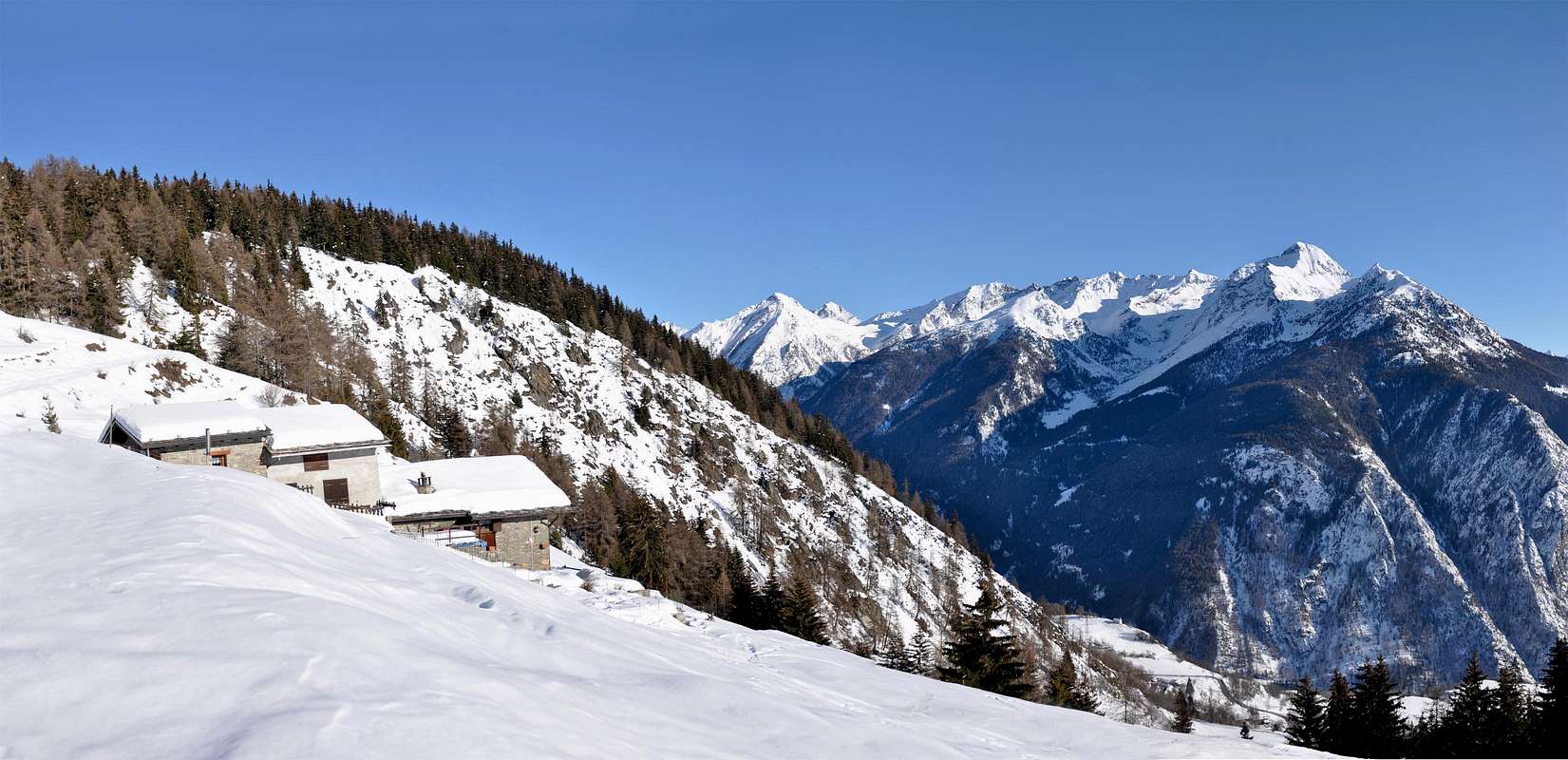
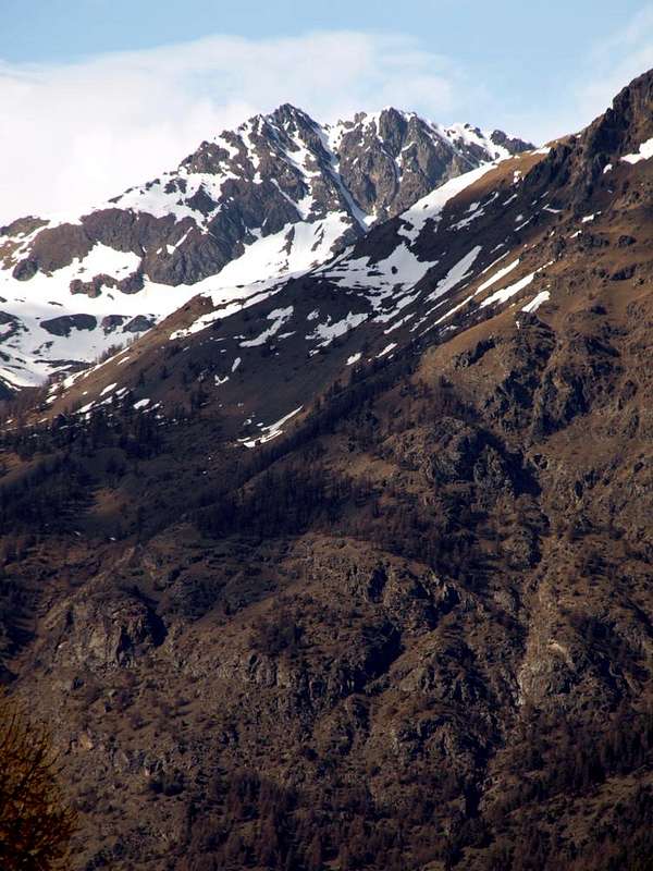
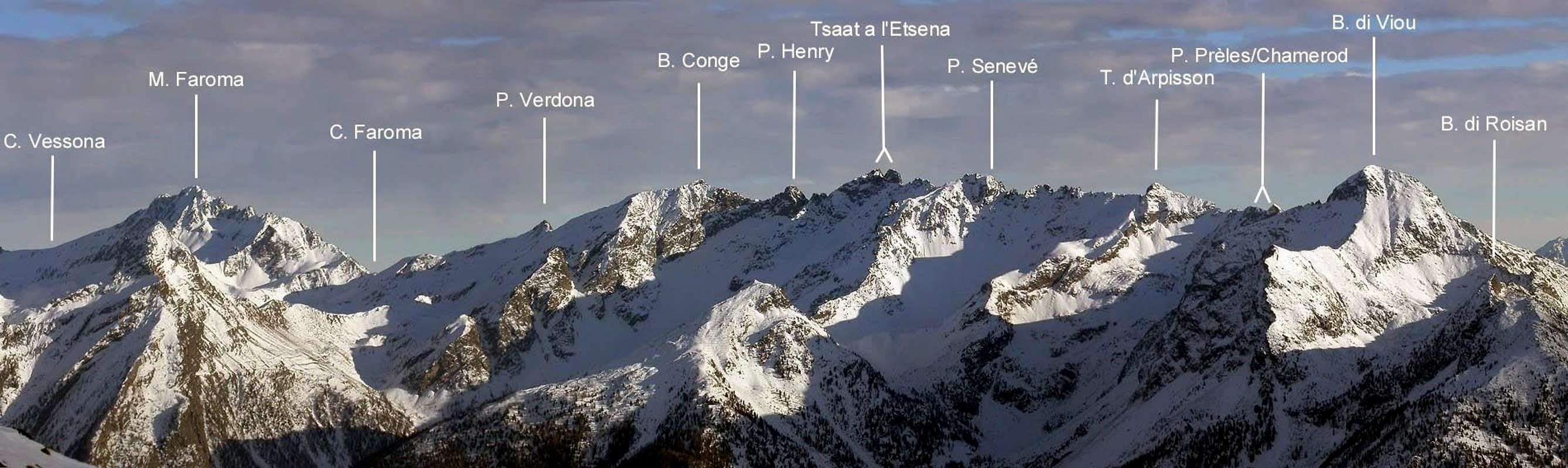
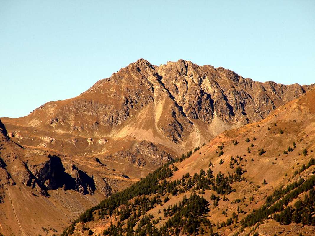
Questa piccola Sommità é collocata tra la Becca Conge (2.954 m) ed il Monte Faroma (3.073 m) tra la Comba Dèche nella Valle di St. Barthélemy e la Valpelline. Tra queste due vallate é collocato il Colle di St. Barthélemy (2.639 m), famoso e molto frequentato in passato. In loco viene chiamata anche Pointe de la Seyva oppure Seyvaz, poiché sovrasta l'omonima alpe, intermedia nella Comba Dèche raggiungibile sia dalla Frazione di Trois Villes nell'Alta Collina del Comune di Quart che da quella di Lignan in Valle di Saint Barthélemy. Disposta sull'asse Ovest/Est rispetto al colle, presenta inoltre una terza breve cresta che scende a Nord-nordovest sopra il Col du Coteau de Fond (2.681 m) e la Gran Coutà (2.864 m) sullo spartiacque tra i Valloni di Verdona (ad Occidente) e Vessona (ad Oriente) entrambi perpendicolari al Comune di Oyace (1.377 m) in Valpelline. Questo divisorio termina, dopo la Punta di Vameà , con la Becca di Nona (2.898 m) che, piccola ma imponente e suggestiva, sovrasta questa località. Quest'ultima cresta inoltre divide in due parti il frantumato Versante Settentrionale con una rivolta a Nordovest sopra la Tsa de Verdonaz e l'Alpe di Brollier (2.317 m, 2.268 m) e l'altra a Nord-nordest sopra Plan Barmé o Barmet e l'Alpe di l'Ardamùn o Arp Damon (2.379 m, 2.207 m). Invece l'intero Versante Meridionale si distende tra il Colle di St. Barthélemy ed il Colle Faroma (2.721 m) divisorio con la Cresta Nordovest della Quota 2.936/7 metri appena ad Ovest del Monte Faroma. Il medesimo si presenta come una larga faccia rocciosa solcata da diversi anfratti e canaloni più o meno paralleli, il più in vista dei quali lo solca salendo in diagonale da destra a sinistra e separando le due distinte Sommità (2.875 m la Ovest, 2.862/8 la Est) con un ripido e parallelo spigolo rivolto a Sud-sudest sopra l'Alpe di Valchourda (2.380/92 m). Alcuni settori rocciosi sono ancora da esplorarsi, ma dovunque la roccia risulta piuttosto rotta e spesso ricoperta da strati erbosi o detritici, per la qual cosa richiede molta prudenza, mentre i canaloni son da evitarsi poiché sovente esposti a cadute di pietre. Compensano belle vedute diametralmente opposte verso le Alpi Graie a Sud sopra il corso della Dora Baltea ed a Settentrione sulle Pennine.
 |
 |
 |
First Ascents
- First on the summit: unknown.
- In winter: unknown.
- Southwest Ridge (Normal Route): unknown.
- North-northwest Crest: Osvaldo Cardellina, lone; August 31th, 1999, in ascent from Col Coteau du Fond.
- North-northeast Slope: probably Gino Buscaini; summer 1970, in ascent through the Comba Vessona.
- East Ridge: Osvaldo Cardellina, lone; August 31th, 1999, in descent to Col Faroma and Valchourda Alp.
- South-Southeast Edge: Osvaldo Cardellina and Giuseppe Lamazzi; May 01th, 1997, with descent through Southwest Crest to St. Barthélemy Hill.
- Southern Face: unknown.
Getting There
BY CAR:
- From TORINO, MILANO, etc: Motorway A5. Exit at IVREA or Quincinetto (PIEDMONT).
- From IVREA Town: in West to Pont Saint Martin, Donnas, Bard, Verrès, St. Vincent, Châtillon, Nus, Quart, St. Christophe, Aosta and Roisan Municipalities.
- From Courmayeur Resort: in East to Morgex, La Salle, Saint Pierre, Sarre, Aosta, Roisan and Saint Chistophe Municipalities.
- From Aosta Town towards Quart and Nus Municipalities 1) - By Quart-Villair to Epilaz, Argnod Villages or from SS.26 nearby La Plantaz (540m), with Regional and Municipal Roads, towards Chétoz, Vignil, Fornail, Ville sur Nus-Planeville, Buignod, Porsan Villages to Trois Villes-Avisod Village (1.398m). From this towards La Seyvaz, Valchourda Alps (2.206m), in Comba Dèche. 2)-: From Quart to Fonteil with previous route; this through dirt road, towards La Seyvaz (2.184m), Valchourda Alps (2.392m), in Comba Dèche. From Nus-La Plantaz in State Road to Ville sur Nus-Planeville (1.113m); from this, towards Buignod, Avion (1.312m) Villages. Also from Porsan through Trois Villes (1.398m), Avion, fork (1.250m) to Effraz Village (1.487m), with Municipal Roads. From this to Ronc (1.737m), Machaussy Alps, in Effraz Comba.
- From Aosta towards Valpelline Valley 3) - From Aosta City with SS.26 towards the alternative before Gignod Municipality; from this through the Regional Road in Northeast towards Valpelline Commune (580m) and always through Regional Road, towards Oyace Commune (1.316-1.377m). From these to Southern Vallons: a) - by Valpelline towards Verdzignola and b) - by Oyace towards Verdona Vallon.
- From FRANCE: through the Mont Blanc Tunnel to Entrèves-crossroads to Vény/Ferret Valleys - Mountain Guides of Courmayeur - La Saxe Rock Gym - Courmayeur. By Little Saint Bernard Pass, closed since November until half May to La Thuile Valley - Pré Saint Didier - Courmayeur. It is not necessary to take Motorway A5: you can drive on SS.26, in the direction of AOSTA - IVREA - TURIN.
BY PLANE:
- Aeroporto "Corrado Gex" Saint Christophe (Aosta).
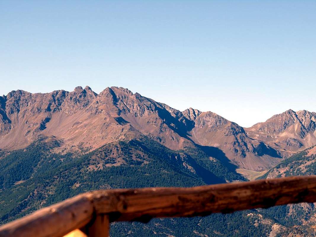
![From Vessona's Hill/Mount Faroma the watershed to Becca of Viou & Roisan]()
Approach & Route
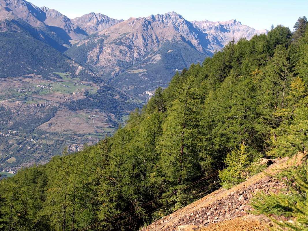
By Fonteil Village immediately at the entrance on Comba Dèche just left or West by Monte Faroma (3.073m): over the triple Village of Trois Villes, and now the interior of St. Barthélemy Valley, opens the Comba Dèche, that has a vertical depth reaching the hill with the same name. As well as very important Pass (2.639m) towards the Valpelline and Oyace Common, between Becca Conge (2.954m) and Punta Verdona (2.868/75m) and just before the beautiful pyramid of Mount Faroma, now belonging fully to this valley. An aggregation perhaps, for this comba, somewhat arbitrary but certainly practical for even the farm private dirt road that runs, concomitant with the trail n° 3/4 on valley floor, reaching in succession the Pastures of Nouva, Flemagne, Salé, Cré, Brunier, Clavel towards upper La Seyvaz Valchourda Alpages (2.184m, 2.392m) and finally St. Barthélemy Hill, much popular in the past (2.639m; E/; 4h'00/4h'30 by Fonteil) leave just from Trois Villes beginning immediately above of Fonteil (1.423m; mini parking).
From the Hill of Saint Barthélemy (2.639m) turn right (Northeast) bringing themselves on the Southwest Ridge. Bypassing on several insignificant elevations preceding a grassy hump, go up through debris and easy small rocks on the thread of the ridge until it meets rock a little more steep and challenging. Reached a first rocky prominence of a dozen meters (I°/I°+; II°- on the edge), you get to a small shoulder that precedes a following with more or less the same characteristics, and that leads to a notch, where comes the first channel from Southern Slope. A series of rocky steps in the form of stair leads to a fork where comes always from the South, a branch of the second and most important couloir. These short sections remain fully climbed or avoided with small workarounds on the right or on the left (North). Two small pinnacles followed by three elevations easily lead to the Top, while a rounded saddle, where diagonally comes the third gully, separates from the more Eastern Summit (F/F+; 0h'30/0h'45).
Avvicinamento dal Villaggio di Fonteil (Trois Villes-Quart)
Dal Villaggio Trois Villes-Fonteil posto proprio all'ingresso della Comba Dèche subito a sinistra od Ovest della "cattedrale" rocciosa del Monte Faroma (3.073 m): oltre il triplice Villaggio di Trois Villes (Porsan, Avisod e Fonteil), ed ormai internamente alla Valle di Saint Barthélemy soprastante il Comune di Nus, si allunga la Comba Dèche, che possiede una profondità in verticale raggiungendo l'omonimo nonché molto importante Colle verso la Valpelline (2.639 m), collocato tra la Becca Conge (2.954 m) e la Punta di Verdona (2.868/75 m) ed appena prima della bella piramide del Monte Faroma, ormai appartenente in modo completo a questa valle. Una aggregazione forse, quella di questa comba, un poco arbitraria ma sicuramente pratica poiché anche la strada poderale ed il concomitante sentiero n° 3/4 che la percorrono raggiungendo in successione le Alpi di Nouva, Flemagne, Salé, Cré, Brunier, Clavel, la intermedia di La Seyvaz nonché l'ultima di Valchourda (2.184 m, 2.392 m) ed infine il Colle di St. Barthélemy, molto frequentato in un remoto passato (2.639 m; E/; 4h'00/4h'30 da Fonteil) partono proprio da Trois Villes con inizio dal Villaggetto appena soprastante di Fonteil (1.423 m; mini parcheggio).
Dal Colle di Saint Barthélemy (2.639 m) volgere verso destra (Nordest) portandosi sulla Cresta Sudovest. Oltrepassate alcune asperità insignificanti al di sopra di una gobba erbosa, proseguire tramite detriti e facili roccette sul filo di cresta fino ad incontrare rocce un poco più ripide ed impegnative. Raggiunto un primo risalto di una dozzina di metri (I°/I°+; II°- sul filo), si arriva ad una spalletta che ne precede un successivo con più o meno le stesse caratteristiche e che porta ad un intaglio, dove arriva il primo canale dal Versante Meridionale. Una serie di rocce gradinate conduce ad una forcella dove perviene, sempre da Sud, una ramificazione del secondo e più importante canalone. Questi brevi tratti possono essere percorsi integralmente oppure evitati con piccoli aggiramenti sia a destra che sulla sinistra (Nord). Due piccoli pinnacoli seguiti da tre elevazioni conduconono facilmente alla Vetta più elevata, mentre una sella arrotondata, dove in diagonale arriva il terzo canalone, separa dalla Cima più Orientale ( F/F+; 0h'30/0h'45).
Difficulties & Equipment
This route can be considered EEA/F/F+ (Experts Hikers and Mountaineers); BSA in winter (even by Ski).L'itinerario è da classificare in EEA/F/F+ (Escursionisti Esperti od Alpinisti) BSA in inverno (anche in Scialpinismo).

|

|
|

|
|
Da Alto Escursionismo, in inverno da Scialpinismo.
Campings
Remember that free camping is forbidden (except for emergency reasons, over 2.500m, from darkness until dawn).Mountain Condition
- Meteo: you can find all the needed informations at the official site of the Valle d'Aosta Region:
- Valle d'Aosta Meteo
Books and Maps
- "Guida dei Monti d'Italia - Alpi Pennine (Vol. 2)" di Gino Buscaini - Club Alpino Italiano/Turing Club Italiano, Luglio 1970 (In Italian).
- "Ascensioni 1964-1969" Diario Alpinistico di Ilario Antonio Garzotto (unpublished).
- "Diari Alpinistici" di Osvaldo Cardellina e Indice Generale accompagnato da Schedario Relazioni Ascensioni 1964-2019 (unpublished).
 |
 |
- Kompass "Breuil/Cervinia-Zermatt" Carta turistica 1:50.000.
- I.G.C. Istituto Geografico Centrale "La Valpelline" (carta n° 115) Map1:30.000.
- I.G.M. Istituto Geografico Militare - Map1:25.000.
- L'Escursionista Ed. Rimini "Gran San Bernardo-Ollomont" (carta n° 5) 1: 25.000.
Important Information
- REGIONE AUTONOMA VALLE D'AOSTA the official site.
- FONDAZIONE MONTAGNA SICURA Villa Cameron, località Villard de la Palud n° 1 Courmayeur (AO) Tel: 39 0165 897602 - Fax: 39 0165 897647.
- SOCIETA' DELLE GUIDE DELLA VALPELLINE Etroubles-Strada Nazionale, n° 13 - Tel +39 0165 78559 - Valpelline-Loc Capoluogo, n° 1 - Tel +39 0165 713502 (AO) Italia.
- A.I.NE.VA. (Associazione Interregionale Neve e Valanghe).
Useful numbers
- Protezione Civile Valdostana località Aeroporto n° 7/A Saint Christophe (Ao) Tel. 0165-238222.
- Bollettino Valanghe Tel. 0165-776300.
- Bollettino Meteo Tel. 0165-44113.
- Unità Operativa di Soccorso Sanitario Tel. 118.