
-
 3103 Hits
-
 79.04% Score
-
 10 Votes
|
|
Mountain/Rock |
|---|---|
|
|
38.00695°N / 107.83122°W |
|
|
Ouray |
|
|
Hiking |
|
|
Spring, Summer, Fall |
|
|
13242 ft / 4036 m |
|
|
Overview
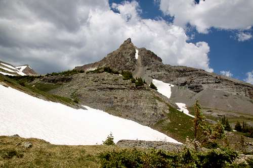 S 4 as seen from the approach of upper basin
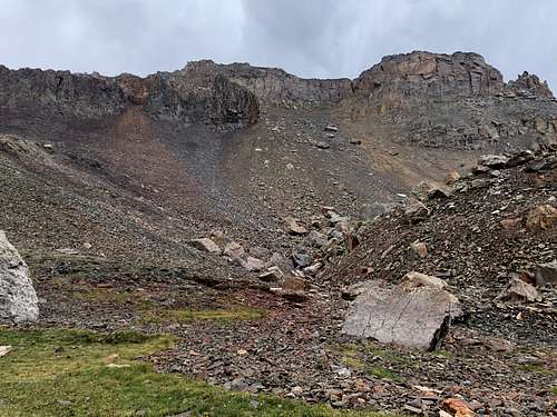 S 4 as seen from the base of orange gully (slightly to the left of the center)
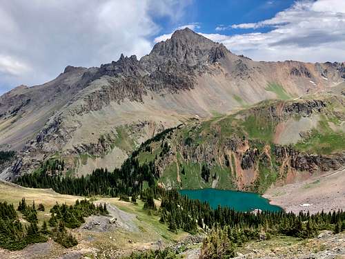 Mount Sneffels as seen from upper basin
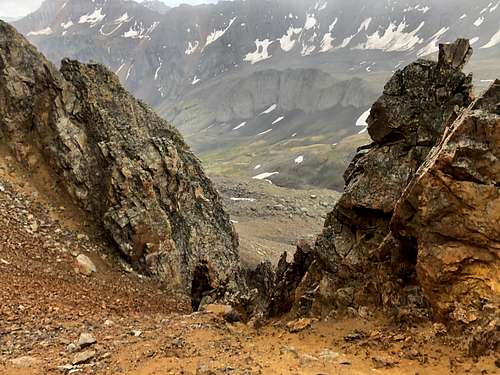 Orange gully on the descent - really loose
Guide to the Colorado Mountain with Robert Ormes provides only a brief mention: "Accessible from the upper cirque 1.2 miles west of lower Blue Lake, S 3 (13,410') and S 5 (13,360') rise on the divide crest. The summit of S 4 (13,242') is perched on a ridge extending 0.5 mile east from S 5, and is also most accessible from the basin west of the lower lake. The SJM (San Juan Mountaineers) designated S4 as Wolcott Mountain. However, the updated USGS map shows that peak as the 13,041' high point of an isolated ridge 1 mile northwest of S4. Today's Wolcott and the massive frontal cliffs of S4 are spectacularly viewed from a clearing about 2 miles up the Blue Lakes Trail from the parking area."
Colorado Rank: 445
Parent Lineage: S 6
Wilderness: Mount Sneffels
Class: 3 (expect a lot of loose terrain).
What is up with those names? There are many summits that have unofficial names that have sprung up because of local usage or traditional agreement in climbing community. Examples of these are some of the "T" or "S" names in San Juans. Even though these names typically do not appear on the USGS topographic maps or in other official sources, those names are used in books, websites (13ers.com and List of John) etc.
S 1 is a little protruding knob between Teakettle and Potosi Peak. It is more known under the name of Coffeepot. S 2 is the older name of Mount Ridgway. And the S peaks continue up to S 9.
Nearby Peaks:
- "S 5" 0.61 miles
- "S 3" 0.70 miles
- "S 6" 0.83 miles
- Dallas Peak 1.35 miles
- "T 0" 1.39 miles
- Mears Peak 1.70 miles
- Campbell Peak 1.88 miles
- Mt. Sneffels 2.13 miles
- "Kismet" 2.55 miles
- "S 7" 2.69 miles
Getting There
Directions for Blue Lakes Trailhead: From Highway 62 between Ridgway and Telluride take Dallas Creek Road (right before Ralph Lauren's ranch). Drive 14 miles on well marked dirt road for 14 miles to the trailhead. The dirt road is in a good condition and passable even for passenger cars. It is well marked - follow signs for Blue Lakes Trailhead. There is camping at the trailhead.
The trailhead is very popular and it may be hard to find a parking or camping on busy summer days.
Route
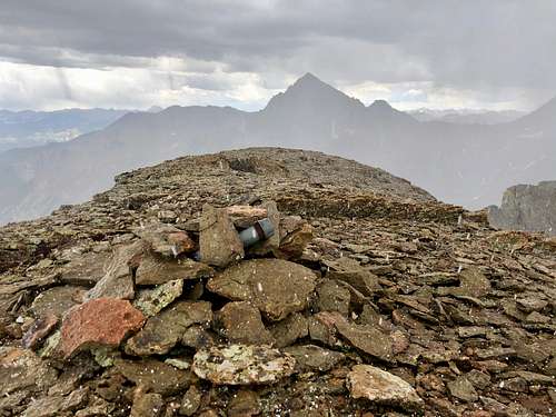 Summit of S 4 with Mount Sneffels in the background
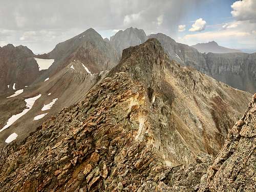 West Ridge of S 4
There is a steep loose orange gully leading to the ridge. Once you reach the ridge, the scramble becomes more fun. The summit has a small cairn and very cool old summit register (2020). I would recommend the climb in early summer, when the approach gully has still snow. I prefer snow ascent over loose scree.
Red Tape
There is no red tape. Hiking the popular Blue Lakes trail, camping, and exploring the area are free. There are some prohibitions listed in Mount Sneffels Wilderness website: 1. Entering the area with more than 15 people per group and maximum combination of people and stock not to exceed 25 per group. 2. Camping within 100 feet of any lake. 3. Building a fire within 100 feet of any lake or trail and above treeline. 4. Storing equipment, personal property, or supplies for longer than 7 days.
When to Climb
Any time is good, but the road to Blue Lakes Trailhead is closed in the winter. Summer is the easiest. Early summer may be better since the upper slopes will be covered with snow and you can snow climb instead of scree hike.
If traveling during the winter, always check northern San Juan Avalanche forecast.
Camping
There is free dispersed camping at the trailhead, but the area if very popular and may be hard to find a spot during the summer weekend. You can sleep in a car at the parking area. Backpacking camping is available at the Lower Blue Lake.