
-
 3728 Hits
-
 81.84% Score
-
 14 Votes
|
|
Mountain/Rock |
|---|---|
|
|
38.00104°N / 107.8416°W |
|
|
Ouray&San Miguel |
|
|
Hiking, Mountaineering, Scrambling |
|
|
Spring, Summer, Fall, Winter |
|
|
13410 ft / 4087 m |
|
|
Overview
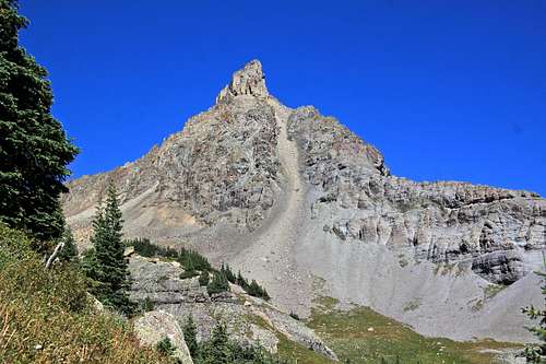
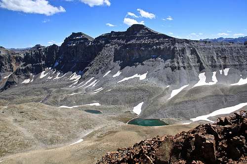
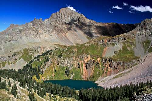
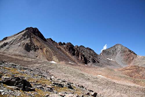 S 3 and S 5 from east
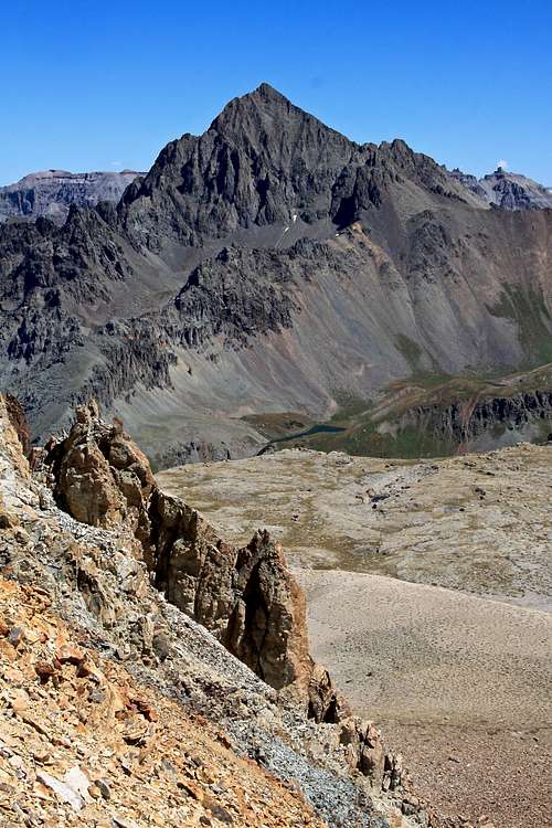 Scree slopes on S 3. Mount Sneffels in the background
I chose S 3 because I wanted a solitude and also was exploring the area with the idea of scouting out new routes, e.g. West Dallas from Upper Blue Lakes (scree, scree - will wait for the snow). S 3 gave me also a great overview of routes up Mears Peak from Deep Creek Drainage, S 4 and S 5. Expect off trail hiking and a lot of scree higher up. The views of Mount Sneffels from this tour are amazing! and you get to hike the popular Blue Lakes Trail.
What is up with those names? There are many summits that have unofficial names that have sprung up because of local usage or traditional agreement in climbing community. Examples of these are some of the "T" or "S" names in San Juans. Even though these names typically do not appear on the USGS topographic maps or in other official sources, those names are used in books, websites (13ers.com and List of John) etc.
S 1 is a little protruding knob between Teakettle and Potosi Peak. It is more known under the name of Coffeepot.
S 2 is the older name of Mount Ridgway.
And the S peaks continue up to S 9.
Guide to Colorado Mountains with Robert Ormes (sort of a bible of Colorado mountains) provides only a very brief mention: "Accessible from the upper cirque 1.2 miles west of lower Blue Lake, S 3 (13,410) and S 5 (13,360) rise on the divide crest".
Nearby Peaks:
- "S 6" 0.5 miles
- "S 4" 0.7 miles
- "T 0" 13,735 feet (bicentennial) 0.72 miles
- "West Dallas" 0.78 miles
- Wolcott Mountain 1.09 miles
- Campbell Peak 13,213 feet 1.26 miles
- Mears Peak 1.26 miles
- Dallas Peak 13,809 feet (centennial) 1.31 miles
- Gilpin Peak 13,694 feet 2.81 miles
- Mount Sneffels 14,150 feet (fourteener) 2.69 miles
Getting There
From Highway 62 between Ridgway and Telluride take Dallas Creek Road (right before Ralph Lauren's ranch). Drive 14 miles on well marked dirt road for 14 miles to the trailhead. The dirt road is in a good condition and passable even for passenger cars. It is well marked - follow signs for Blue Lakes Trailhead. There is camping at the trailhead.Route
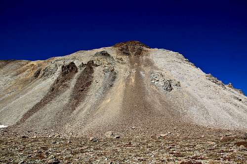 S 3 and the loose scree on its slopes
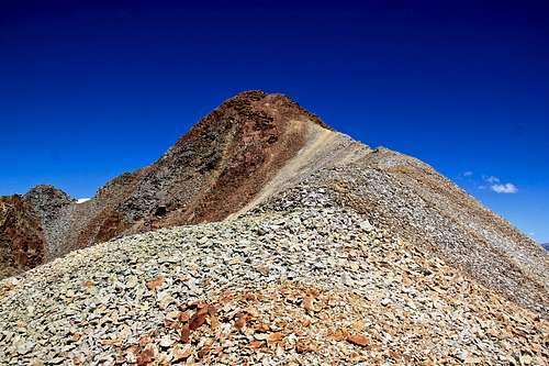 South ridge up S 3
Rise: 270 feet (almost a ranked peak, 300 feet is the Colorado rule)
Saddle: 13,140 feet
Parent Lineage: "T 0"
Class: 2
I ascended the loose scree between S 3 and T 0 ridge (much closer to S 3). Find the easiest path and go up. I have caused a few little rock slides since the terrain is unstable. Once you reach the ridge the walking is easy - see photo on your right.
I did not see any route which could avoid the scree.The summit had a small cairn. There was no sign in register.
 S 4 is actually a ridge mountain, but from this profile it looks like a tower S 4 is actually a ridge mountain, but from this profile it looks like a tower | 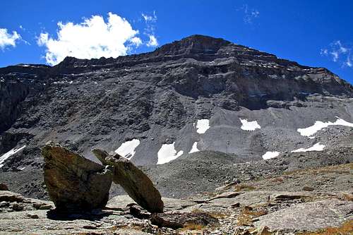 West Dallas Peak West Dallas Peak |
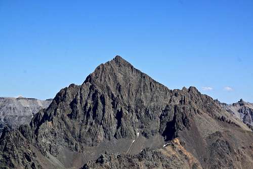
 Mears Peak Mears Peak |  T 0 T 0 |
 Dallas and West Dallas Peaks Dallas and West Dallas Peaks | 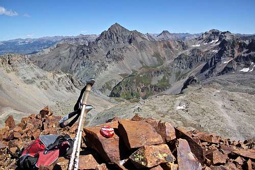 S 3 summit cairn S 3 summit cairn |
 Mount Sneffels Mount Sneffels | 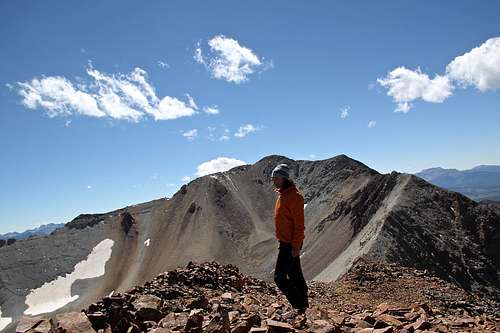 Windy summit with T 0 in the back Windy summit with T 0 in the back |
Red Tape
There is no red tape. Hiking the popular Blue Lakes trail, camping, and exploring the area are free.There are some prohibitions listed in Mount Sneffels Wilderness website: 1. Entering the area with more than 15 people per group and maximum combination of people and stock not to exceed 25 per group.
2. Camping within 100 feet of any lake.
3. Building a fire within 100 feet of any lake or trail and above treeline.
4. Storing equipment, personal property, or supplies for longer than 7 days.
 Mount Sneffels