Overview
Whitehouse Mountain forms the large northeast corner of the Sneffels range west of Ouray. It is most noticeable from US-550 just south of Ridgeway. Its large flat summit is protected with battlements of dramatic chalk-white cliffs and spires. Isolated by the area’s craggy canyons, the mountain is difficult to approach.
Photos below are taken from the north. Below described approach is from the south. This is the view you get when driving to Ouray. I looked at massive Whitehouse Mountain so many times, and finally I was able to stand on its top. The views down to Ouray and over surrounding peaks from the top are amazing.
![Whitehouse Mountain]() As seen from US 550 between Ridgeway and Ouray As seen from US 550 between Ridgeway and Ouray | ![Whitehouse Mountain]() Photo taken just south of Ridgeway Photo taken just south of Ridgeway |
Getting There
From the downtown Ouray drive south out of Ouray and take the first main road going off to the right. This is County Road 361 and marked Camp Bird and Yankee Boy Basin. From the turn off drive 2.7 miles up the Camp Bird Road, over the Uncompaghgre Gorge Bridge (=
Ice Park in the winter) and up past another bridge spanning Canyon Creek. Proceed another 0.7 mile and look for the
Weehawken Trailhead on the right. It is well marked and there is ample room to park here. You don’t need a 4WD vehicle to reach this place.
![TOPO map]() TOPO map of the area
TOPO map of the area: 8,700 feet
Elevation Gain: 4,792 feet
Round trip distance: 15 miles
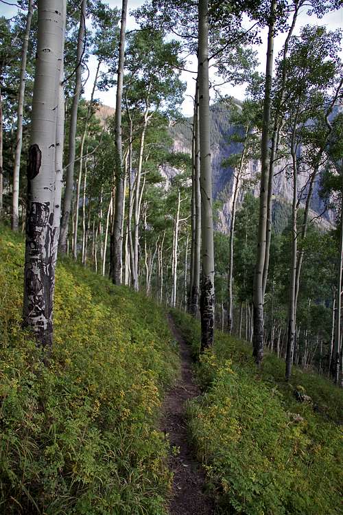
From the Trailhead, hike up past a couple of switchbacks to the sign-in box and up through the open areas, onto trees. Almost immediately, great views open up across the valley to parts of Hayden Mountain. Continue for about 45 min, keeping on the main trail and ignoring offshoots until you can start to see towering cliffs, which form part of the south walls of Weehawken Creek. The trail then meanders up through a fine stand of aspen to a definite little pass and signpost. This is usually reached in about 1 hour. You continue on the main trail, posted as Weehawken Creek. The turn to the right lead to the Alpine Mine Overlook.
![Weehawken Trail]()
The next section starts fairly level and crosses small creeks. The trail is easy to follow.. If you look back, you should be able to see two 13,000 feet peaks of Hayden Mountain and its great ridgeline. Across the Weewhaken Creek the rock formations begin to assume their unusual shapes and compositions and you can see part of the drainage system from Potosi’s eastern flanks.
The trail now climbs again with a nice waterfall on the left. The spruce becomes dense and you have to cross a drainage coming in from the right. The trail starts to veer left a little as it exits the dense tree area and crosses an extended area of mostly dry wash. There are cairns at this section marking your way. Continue on a trail, which higher up will disappear, but you will start to get oriented with surrounding peaks. You will see a beautiful north face of Potosi, and the east face of Teakettle. Hike up on grassy slopes (sometimes seeing a faint trail) towards the saddle between Mount Ridgeway and Whitehouse Mountain.
![Duchess posing in the NW couloir]()
At the pass, look to your right, you will see a couloir facing northwest. This is your way up the mountain. This is the most technical part of your climb, mostly class 2 , with some class 3 moves. Finally, you exit the couloir and have to continue up the scree and loose rock to reach a summit. No, this is not the main summit. If you will look east, you will see a long ridge leading to the main summit of Whitehouse Mountain. This walk along the ridge is 1 mile long! The summit is huge and flat, and there is a cairn with a summit log.
There were only about 6 climbers signed in this year (2011). Whitehouse is a beautiful mountain, but to reach its summit requires a long approach hike. It is among the top 300 peaks on Colorado, so no as popular as centennial or bicentennial peaks.
Distances to other peaks
Teakettle Mountain 1.86 miles
Coffeepot 1.94 miles
Mt. Ridgeway 0.93 miles
Corbett Peak 0.52 miles
Mt. Sneffels 3.16 miles
Images from the hike
<![Weehawken Trail]() Trail and Hayden Mnt. seen through the trees Trail and Hayden Mnt. seen through the trees | ![Duchess exploring the cairn]() Duchess exploring the cairn Duchess exploring the cairn |
![Birds in the tree]() Birds in the tree Birds in the tree | ![North Face of Potosi Peak]() North Couloir on Potosi Peak North Couloir on Potosi Peak |
![Path towards the saddle]() Path leading to the saddle Path leading to the saddle | ![Mount Ridgeway]() Mount Ridgeway Mount Ridgeway |
![Western part of Whitehouse]() Western part of Whitehouse Mountain Western part of Whitehouse Mountain | ![On the way to the saddle]() Just below the saddle Just below the saddle |
![North Side of Potosi Peak]() North Face of Potosi as seen from the saddle North Face of Potosi as seen from the saddle | ![Potosi Peak and Coffeepot]() Potosi and Coffeepot from the saddle Potosi and Coffeepot from the saddle |
![View towards Ridgeway]() View north from the saddle, Ridgeway reservoir View north from the saddle, Ridgeway reservoir | ![Whitehouse - Ridgeway saddle]() Whitehouse-Ridgeway saddle Whitehouse-Ridgeway saddle |
![Northwest Couloir]() Northwest Couloir Northwest Couloir | ![Northwest Couloir - higher up]() Northwest couloir higher up Northwest couloir higher up |
![A short stroll to the summit]() Nearly at the top Nearly at the top | ![Above the couloir]() Above the couloir with Ridgeway in the background Above the couloir with Ridgeway in the background |
![Rock spires]() Looking down to the north - summit hike Looking down to the north - summit hike | ![1 mile summit hike]() 1 mile long summit hike 1 mile long summit hike |
![Sneffels]() Sneffels as seen from the summit hike Sneffels as seen from the summit hike | ![The highest point]() Cairn at the summit with a log registry Cairn at the summit with a log registry |
![Corbett Mountain]() Corbett Mountain 13,100 ft Corbett Mountain 13,100 ft | ![Ouray]() Ouray as seen from Whitehouse Mountain Ouray as seen from Whitehouse Mountain |
![Large summit of Whitehouse Mountain]() Large flat summit Large flat summit | ![Wetterhorn and Uncompaghre]() Weterhorn and Uncompaghre Weterhorn and Uncompaghre |
Camping
There are two campgrounds near by.
Thistledown Campground, which is located right across from the Weehawken Trailhead.
2nd campground
Angel Creek Campground is about 0.7 miles away.
There are plenty of lodging opportunities in Ouray.
Red Tape
![Weehawken Trail]() Winter access
Winter access![up slowly, down quickly]() Tree skiing on Weehawken
Tree skiing on Weehawken
Weehawken Trailhead is accessible year round. It is a popular trail in the summer - there is an access to Alpine Mine and Alpine overlook via this trail. The trail is also used for snow shoeing and back country skiing. The back country skiing is relatively safe from avalanches, and is mostly between trees, pretty steep.
There are no fees for parking or hiking. Full services (dining, lodging) are available in
Ouray. And if you have time, you can soak in
hot springs after this long hike :).
External Links
There is not much information on-line about this peak.
Whitehouse Mountain on 13ers.com
![Yankee Boy Trio]() Yankee Boy Trio: Potosi, Coffeepot, and Teakeetle as seen from Whitehouse Mountain
Yankee Boy Trio: Potosi, Coffeepot, and Teakeetle as seen from Whitehouse MountainWeather


 25727 Hits
 95.51% Score
 53 Votes
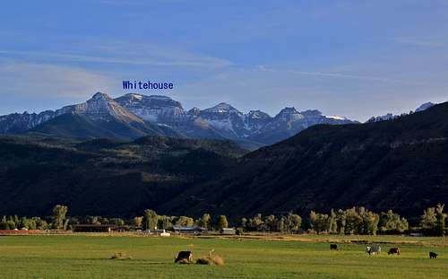 As seen from US 550 between Ridgeway and Ouray
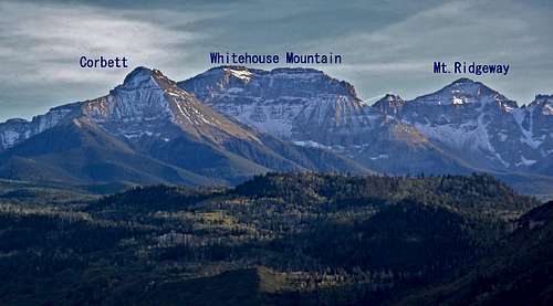 Photo taken just south of Ridgeway
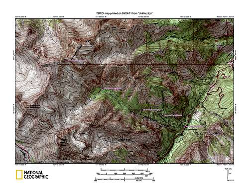 TOPO map of the area


 Trail and Hayden Mnt. seen through the trees
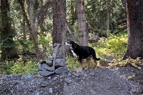 Duchess exploring the cairn
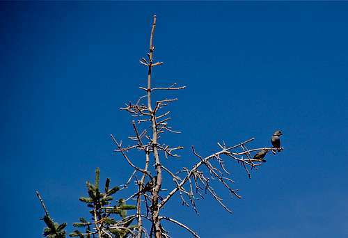 Birds in the tree
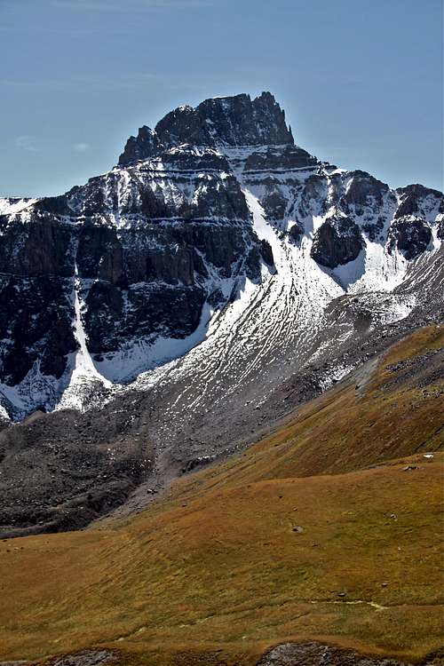 North Couloir on Potosi Peak
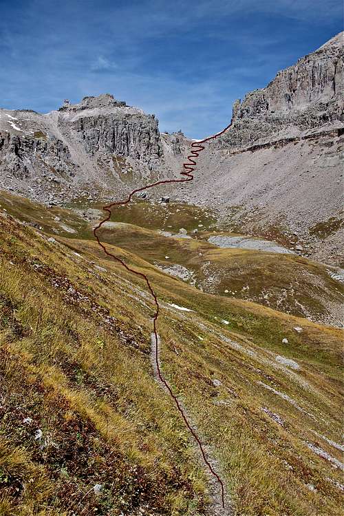 Path leading to the saddle
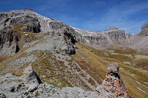 Mount Ridgeway
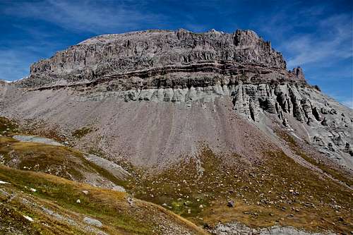 Western part of Whitehouse Mountain
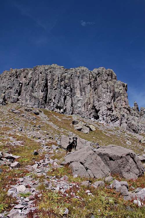 Just below the saddle
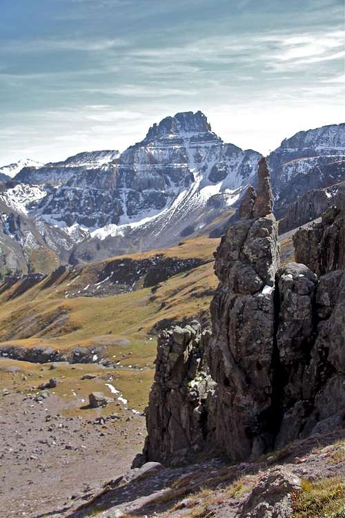 North Face of Potosi as seen from the saddle
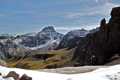 Potosi and Coffeepot from the saddle
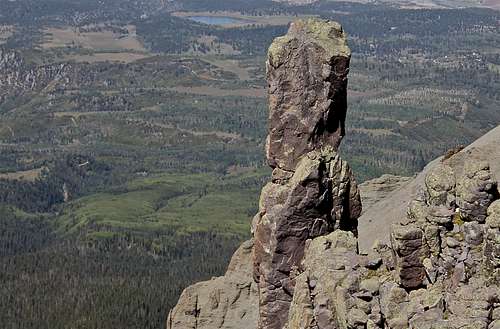 View north from the saddle, Ridgeway reservoir
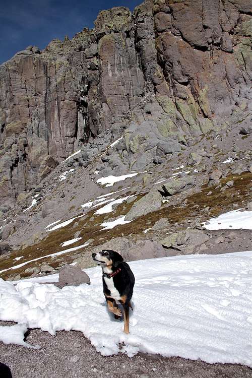 Whitehouse-Ridgeway saddle
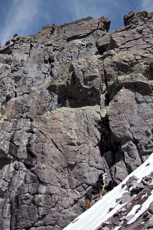 Northwest Couloir
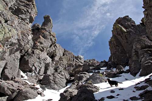 Northwest couloir higher up
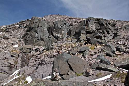 Nearly at the top
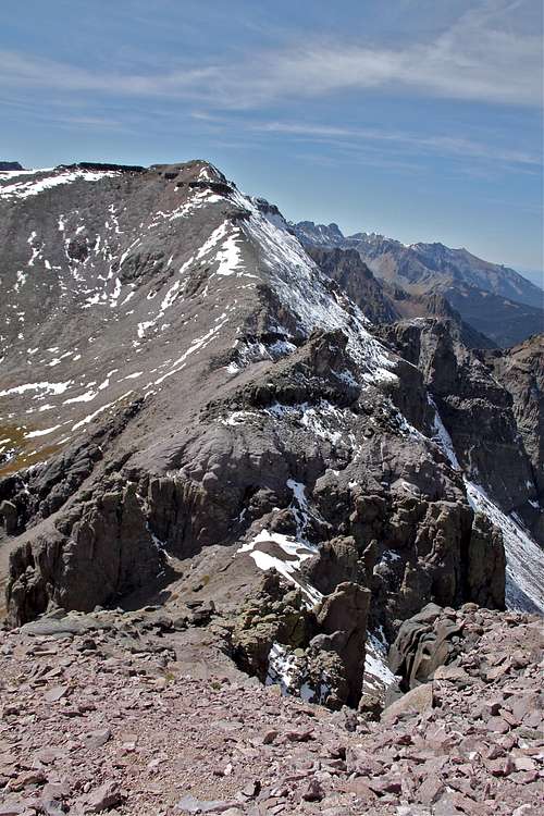 Above the couloir with Ridgeway in the background
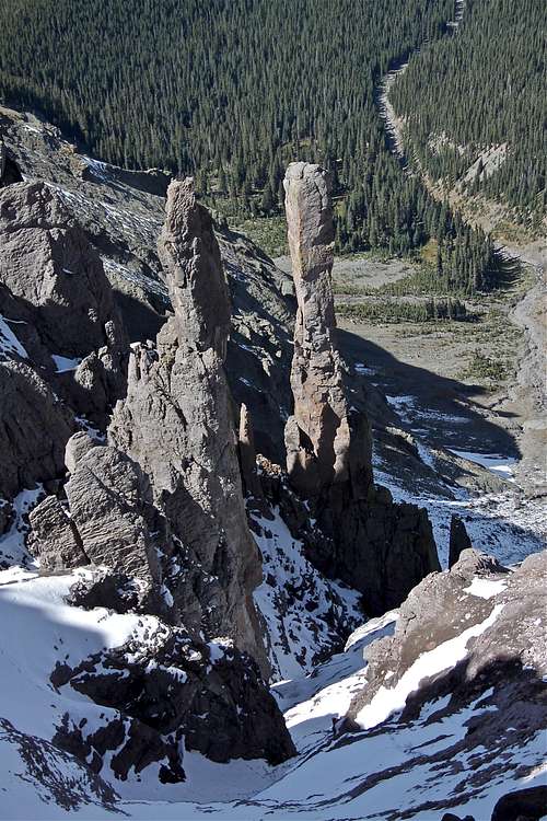 Looking down to the north - summit hike
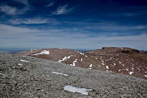 1 mile long summit hike
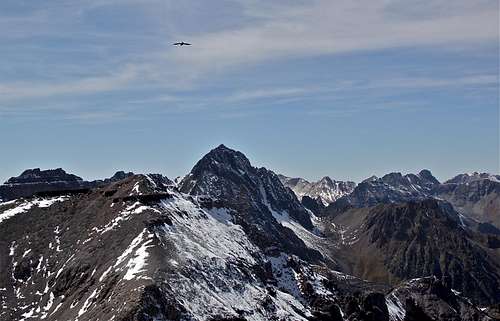 Sneffels as seen from the summit hike
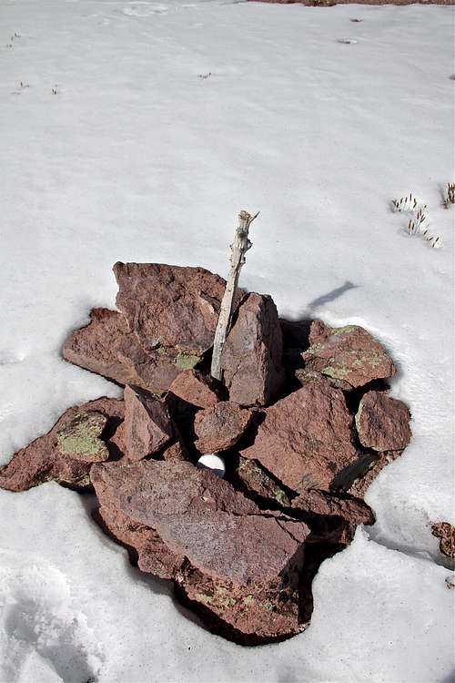 Cairn at the summit with a log registry
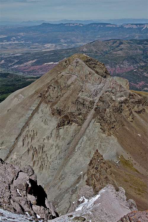 Corbett Mountain 13,100 ft
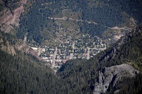 Ouray as seen from Whitehouse Mountain
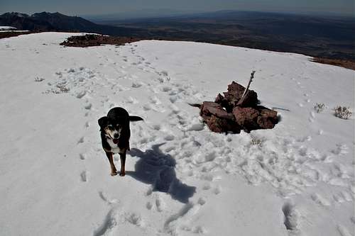 Large flat summit
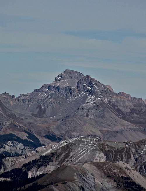 Weterhorn and Uncompaghre
 Winter access
 Tree skiing on Weehawken
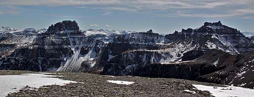 Yankee Boy Trio: Potosi, Coffeepot, and Teakeetle as seen from Whitehouse Mountain