

-
 13212 Hits
-
 84.27% Score
-
 18 Votes
|
|
Mountain/Rock |
|---|---|
|
|
40.02550°N / 105.69°W |
|
|
Hiking |
|
|
Spring, Summer, Fall |
|
|
11979 ft / 3651 m |
|
|
Overview
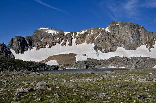
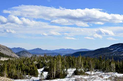
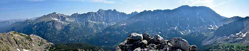 Indian Peaks from Satanta Peak
Satanta Peak is a small, often overlooked summit residing to the North of Mt. Neva and to the West of North Arapaho Peak. But,like any other peak in Indian Peaks Wilderness you wont be disappointed. This 9 miles round trip hike offers more than one can bargain for. Easy and relaxing hike which can be used as great conditioning or training hike/run takes you on top of Caribou Pass and offer you one of the best views of many well known peaks and mountains in this wilderness.
To access Satanta from the 4th of July trail, follow the signs along the trail towards Arapaho Pass. Continue past the 4th of July mine until you are on Arapaho Pass proper. You will reach the junction of Arapaho Pass and Caribou Pass. Travel onto Caribou Pass skirting the North side of Mt. Neva until you reach the ridge highpoint of 12,115'. At this point you are approximately 3.5 miles from the trailhead. The summit is along the ridge just before you reach the chossy towers. From the summit you are directly above Caribou Lake.
Hike Stats:
Summit: 11,979'
Hike Stats:
Summit: 11,979'
Starting Elevation:10,180 ft
Elevation Gain: Approximately 3,157 ft
Roundtrip mileage: Approximately 9 miles
Hike classification: Class 1 or 2
Elevation Gain: Approximately 3,157 ft
Roundtrip mileage: Approximately 9 miles
Hike classification: Class 1 or 2
Season: Early June to October
The Hike:
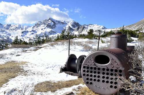
![Unnamed Image]()
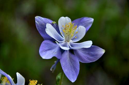 Columbine along the trail. Columbine along the trail. |
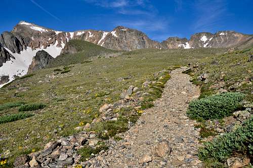
 4th July Trail. 4th July Trail. |
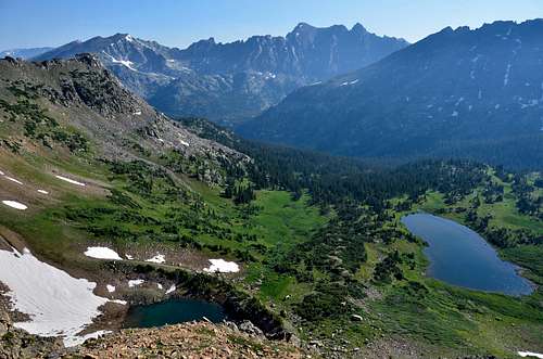 Caribou Lake Caribou Lake |
From trailhead, proceed north and then west from the clearly marked trailhead. Take a right fork after half hour or so (Left fork goes to Diamond Lake) and left fork after another half hour (the right fork goes to the Arapahoe Glacier and Arapahoe Peaks). Continue west above timberline on excellent trail,which now consist of mostly flat talus, to Arapaho Pass, just northeast of Lake Dorothy. From here continue southwest to the vicinity of the Lake Dorothy and then descend west, contouring around the north ridge of Mount Neva. The trail becomes a bit narrow at times, but is adequate. In 15 minutes, the trail brings you to a sign marking Caribou Pass. A trail leads northwest from the pass and Caribou Pass Trail. Follow this trail for only a few hundred feet and then leave the trail, ascending north over tundra to a large cairn atop Satanta Peak.
 Mt. Neva Mt. Neva |
 Arapahoe Pass Arapahoe Pass |
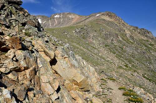 Contouring around the north ridge of Mount Neva Contouring around the north ridge of Mount Neva |
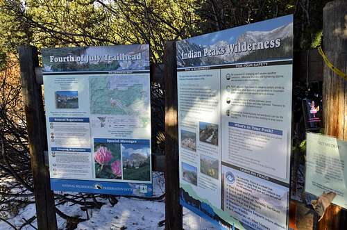
Getting There
 |
 |
 |
Driving Directions:
- From Nederland, turn west off of Highway 119 onto paved County Road 130, following signs for Eldora Ski Resort and the town of Eldora .
- Go through the town of Eldora.
- Continue westward as the pavement ends.
- Go right at the fork in the road (left will lead you to the Hessie Trailhead).
- Another four miles brings you to the Fourth of July Trailhead.
- This portion of the road is rough but passable in a passenger car.
- The Fourth of July Trailhead sees extremely high use, especially on weekends, and parking is limited. Plan to arrive early and watch for signs along the road indicating legal parking spots if the trailhead parking lot is full.
- For information on access from the Monarch Lake Trailhead on the western slope, contact the Sulphur Ranger District in Granby, 970-887-4100.
Red Tape
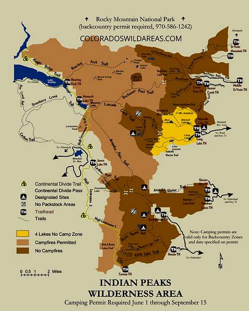
Indian Peaks Wilderness became part of the National Wilderness Preservation System in 1978 and spans 76,711 acres. This wilderness shares borders withJames Peak Wilderness to the south and Rocky Mountain National Park to the north. Elevations range from 8,300 to just over 13,500 feet. Indian Peaks is one of the most visited Wilderness areas in the United States. To encounter fewer people, hike and camp on weekdays and use less popular backcountry zones. Trailhead parking is limited. Always use Leave No Trace techniques to help keep this area wild, clean, and pristine. For recorded information call 303-541-2519.
Groups of more than 12 people or 12 people and packstock (e.g. llamas, horses) combined are prohibited.
Permits: The Indian Peaks Wilderness is divided into backcountry zones. View amap of Indian Peaks Wilderness & Backcountry Zones (pdf, 274Kb). Permits are issued according to zone and required for camping between June 1 and September 15. Large groups (8 - 12 people) and/or organized groups such as scouts, churches, schools, internet outdoor groups and hiking clubs require permits year round for day and overnight trips. Download a wilderness permit application form (pdf 134Kb). Permits are limited and must obtained in advancefrom the Boulder Ranger District (2140 Yarmouth Ave, Boulder, CO 80301) or Sulphur Ranger District (9 Ten Mile Drive, P.O. Box 10, Granby, CO, 80446).
Volunteer Groups: Indian Peaks Wilderness Alliance is a nonprofit organization dedicated to the preservation of the Indian Peaks Wilderness. Grand County Wilderness Group is a non-profit group that works to assist the U.S. Forest Service in the preservation, protection, improvement and public understanding of the wilderness areas in Grand County. They can be contacted at P.O. Box 2200, Fraser, CO 80442, or by phone at 970-726-4626.
Camping
This trailhead is accessed by five miles of rough,two-wheel-drive road. It is exceedingly popular, and parking is limited,especially on summer weekends. In winter, motorized access is typically not possible. Fourth of July Trailhead provides access to Arapaho Pass, Diamond Lake,and Arapaho Glacier Trails inside the Indian Peaks Wilderness.
At this trailhead is a small campground owned and operated by the City of Boulder called Buckingham Campground.
Private property also exists in this area. Do not trespass.
Permit Info:
Camping permits required for all overnight trips between June 1 and September 15. Overnight permits cost $5 per group, per trip from June 1 through
September 15.
Organized groups are required to have a permit for both camping and day-hiking year round. Day-hiking permits are free.
Usage: Heavy
Restrictions: Indian Peaks Wilderness restrictions apply:
Motorized and mechanized vehicles are prohibited.
Pets must be on a hand-held leash at all times.
Campfires prohibited.
Campsites must be at least 100 feet away from water and trail.
Group size is limited to 12 (people and livestock combined).
Fishing and hunting: permitted in accordance with regulations established by the Colorado Parks & Wildlife.
Closest Towns: Nederland,Colorado
Water: North Boulder Creek - treat water for drinking
Operated By: U.S.Forest Service
Information Center: Boulder Ranger District, 2140 Yarmouth Ave, Boulder, CO 80301, Phone 303-541-2500, Fax303-541-2515