
-
 15676 Hits
-
 73.06% Score
-
 3 Votes
|
|
Mountain/Rock |
|---|---|
|
|
40.05528°N / 105.63724°W |
|
|
Boulder |
|
|
Scrambling |
|
|
Summer, Fall |
|
|
13023 ft / 3969 m |
|
|
Overview
Niwot Ridge
Elevation: 13023 ft / 3969 m
Indian Peaks Wilderness
Rank: Unranked
Range: Front Range
Lat/Lon: 40.05522, -105.63525
|
|
|
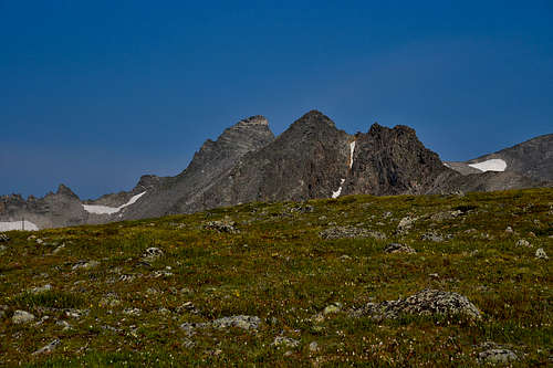
Niwot Ridge is right in the heart of the Indian Peaks. It's not very prominent, and most of the traffic it sees is heading elsewhere. Hell, being on the south half of the ridge is technically illegal. Apparently, my footprints ruin Boulder's water.
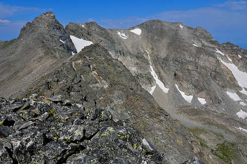
Most of the ridge is fairly long, gentle, and spacious. There's the remnants of some service road, and plenty of weather/atmospheric monitoring goodies. It's a good tundra stroll for pretty much anybody.
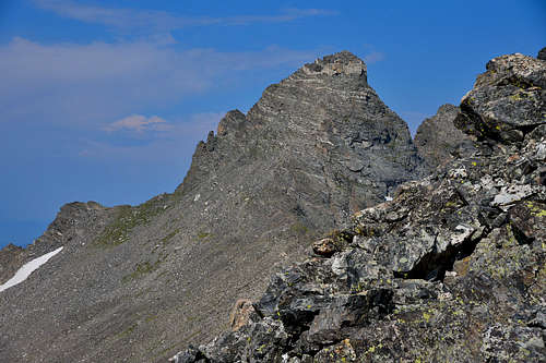
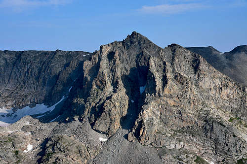
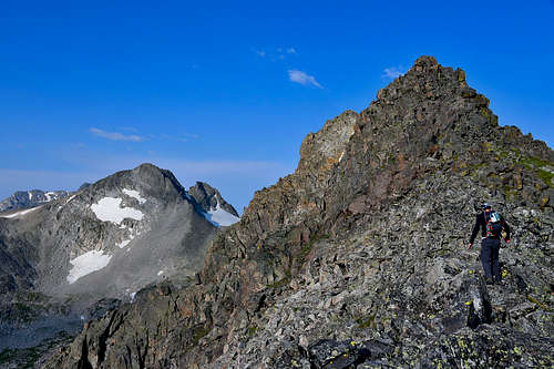
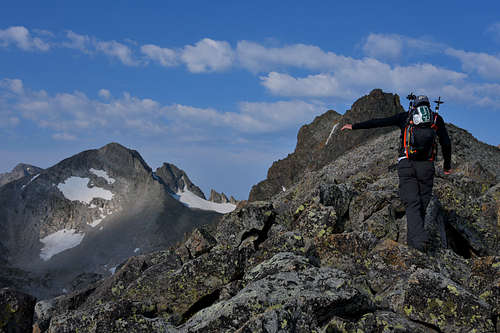
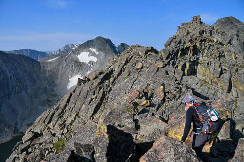
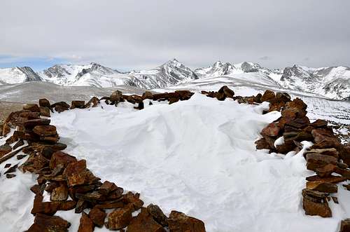
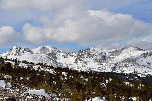
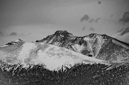
After the weather station is where things change. The whole ridge narrows to a knife edge that tops out just a hair above 13,000 feet in what seems like no time at all. There's also a nice view of the Isabelle Cirque, Navajo and Apache Peaks, and of course the looming face of Kiowa.
The knife edged section offers anything up to some rather edgy 4th class, depending on which route you take. Expect plenty of solitude, despite how busy the Brainerd Lake area can be, and some amount of adventure.
|
|
|
Getting There
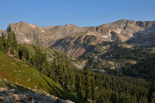
The easiest way to access the ridge is through the Brainerd Lake Recreation Area. There's a trail that branches off the Jean Lunning Trail that's supposed to take you to the top, but I never found it. If you can't find the trail, don't worry. You can just go straight up the side. The whole ridge runs along the valley. It's probably better to go up sooner rather than later, as the further the ridge goes, the steeper the sides get.
There is also another way to access the ridge a bit further south on Highway 72, but I've never tried it and have no idea where it puts you. I believe it's called the Sourdough Trailhead.
|
|
|
Red Tape
If you go in through the Brainerd Lake Recreation Area, you'll have to pay the entrance fee. I swear it changes every year. Just to be safe, expect to pay 10-12 dollars to enter the area. Also, apparently the south edge of the ridge is in the Boulder Watershed. That means, if they catch you trespassing, prepare to pay a rather large fine.
|
|
|
Camping
Brainard Lake Recreation Area closed to motor vehicles and parking reservations ended for the season on October 15. Winter recreators are able to park at the Gateway Trailhead/Winter Parking Lot and access the area by foot, ski, or snowshoe. For more seasonal information, visit https://www.fs.usda.gov/detail/arp/recreation/?cid=FSEPRD1092233.
Camping
Dispersed camping is prohibited May 1 - November 14 in Brainard Lake Recreation Area. Camping is allowed at Pawnee Campground during its open season with a reservation. Visit https://www.recreation.gov/camping/campgrounds/232282.
Brainard Lake Recreation Area is set in a glacially carved valley offering visitors spectacular panoramic views of Brainard Lake, surrounding subalpine forest, and high peaks along the Continental Divide. Because of the area's high elevation, snow typically remains until July. For road updates, check Boulder Ranger District Road Status.
CAUTION: Several trailheads, such as Long Lake and Mitchell Lake trailheads, lead west into Indian Peaks Wilderness. Visitors entering the Wilderness are responsible for following all Indian Peaks Wilderness regulations and permit requirements. Dogs must be on a leash in the Wilderness.
Requirements – A parking reservation is required to park inside Brainard Lake Recreation Area. Visit Brainard Lake Recreation Area Seasonal Information to purchase parking reservations and view seasonal regulations for camping, pets, shooting, skiing, and more.
At a Glance
|
Current Conditions: |
To reduce crowding, the Forest has a parking reservation system for Brainard Lake Recreation Area. |
|
Operational Hours: |
|
|
Fees: |
A parking reservation is required to park in Brainard Lake Recreation Area. There is no fee to park at the Gateway Trailhead and enter Brainard Lake Recreation Area by foot/bike. Please see recreation.gov for all fees and additional information. Visitors with an agency pass receive a discount on parking reservations during checkout at recreation.gov, but they still must purchase a reservation. |
|
Usage: |
Heavy |
|
Restrictions: |
|
|
Closest Towns: |
Ward, Colorado |
|
Water: |
Not yet available |
|
Restroom: |
Vault toilets |
|
Operated By: |
Concessionaire: American Land & Leisure |
|
Information Center: |
Visitor Information: 970-295-6600; Contact Us |