
-
 23217 Hits
-
 89.39% Score
-
 29 Votes
|
|
Mountain/Rock |
|---|---|
|
|
40.16860°N / 105.7133°W |
|
|
12375 ft / 3772 m |
|
|
Indian Peaks Wilderness Overview
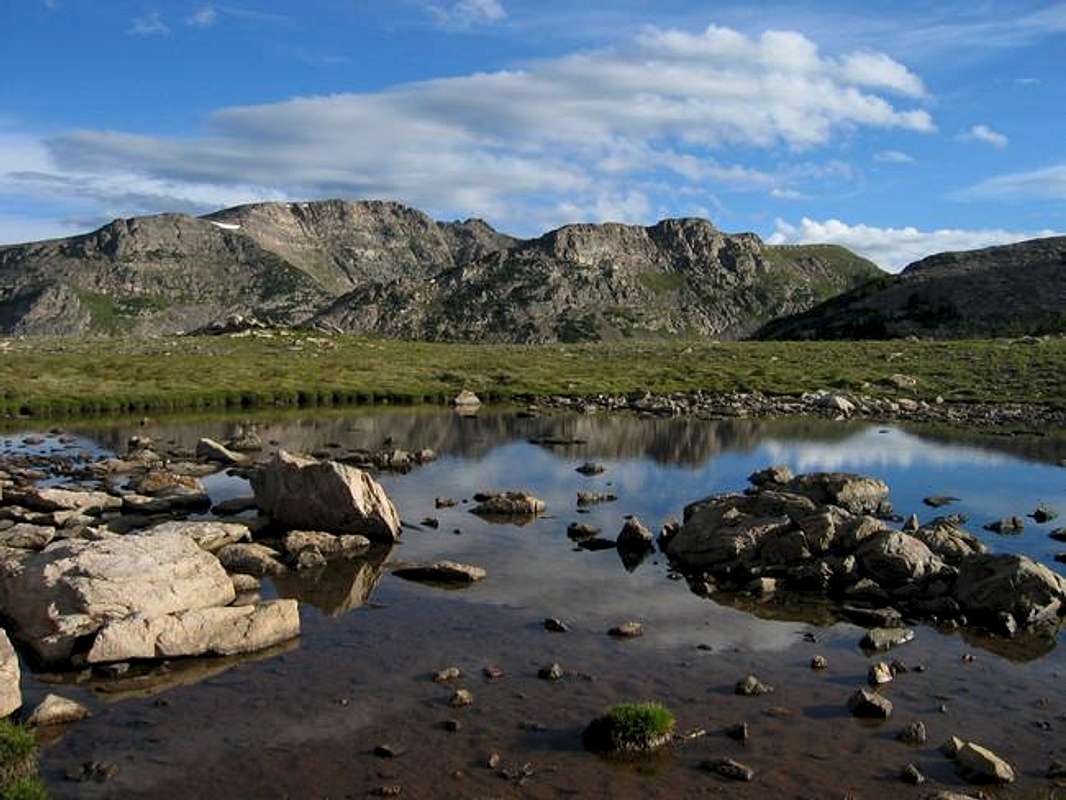
Watanga Mountain from a tarn on the west slope of Hiamovi Mountain, August 2004.
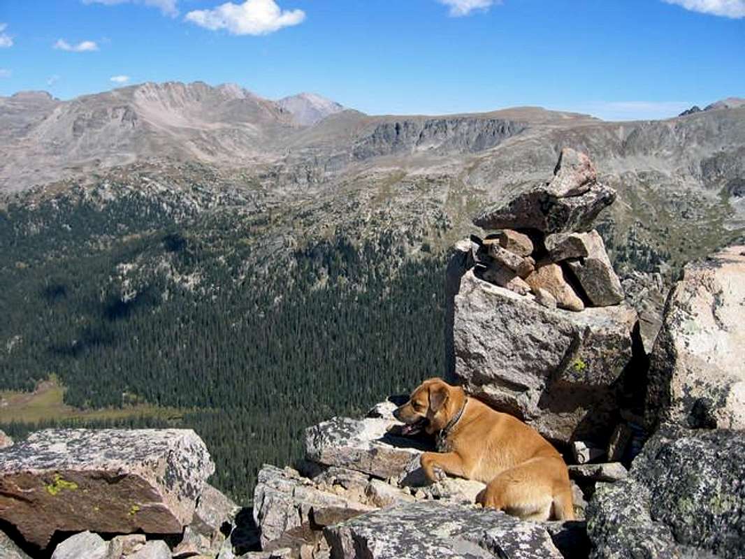
 Watanga and Sopris on Watanga Mountain's Beautiful summit. July 30, 2011
The Indian Peaks Wilderness is amongst the nation's most visited wilderness areas. Established in 1978 it serves as the northwestern backdrop for the Front Range communities of Denver and Boulder. The precambrian granites, schists, and gniesses of this narrow anticline have been eroded by glaciers to form a most spectacular playground. The 173,391 acre wilderness represents a continuation of the continental divide south of the world reknowned Rocky Mountain National Park. In fact it has much in common with the park in that its beauty lies not so much in what is there now... but in what has been stripped away by the hard acting erosion of Pliestecene glaciers. The differential glaciation, expansive cirques, numerous paternoster lakes, endless lateral and terminal moraines, and U shaped valleys demonstrate how the power of ice transformed this region. It is a museum of glaciers past... and indeed it still has a few remnants, the grand Arapaho Glacier being the largest.
Although high visitation rates have impacted the wilderness in the form of beaten down campgrounds, busy trailheads and subsequent mandatory permits, there are still some suprisingly remote locations within this wilderness. Especialy west of the divide, there are valleys and lakes that are only seldom visited. Although within 50 miles of Denver, these places are wild. There are 35 named summits within the wilderness and many more unnamed; if you like mountains this is a place worth exploring.
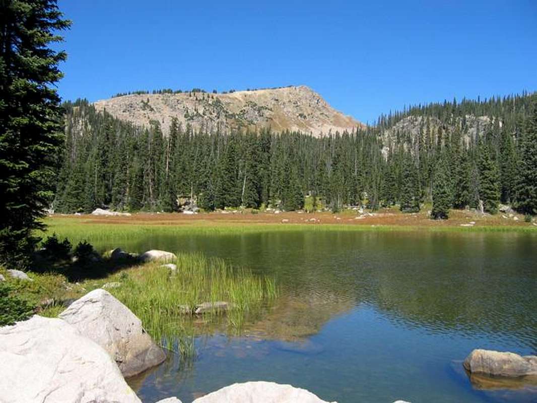
Watanga Lake, September 2005.
Watanga Mountain Overview
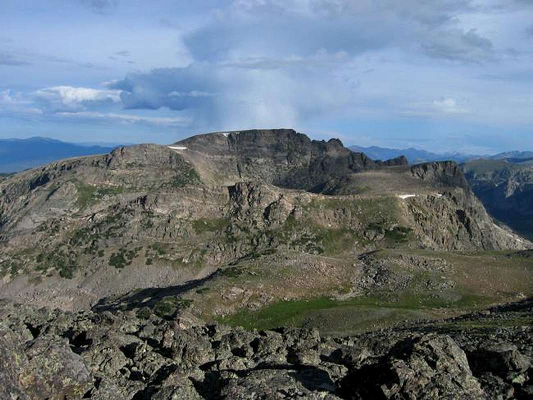
Watanga Mountain's summit. Paradise Park and Isolation Peak lie beyond. September 2005.
Watanga Mountain is a quiet summit located just west of Ogallala Peak and just south of the border with Rocky Mountain National Park. It is in the domain of the the local monarch Hiamovi Mountain. Also in the region are Mount Adams and the Twin Peaks. These summits are mostly of similiar character, that being gentle slopes on the western side that give way to hundred foot drops on the eastern side as a result of glaciation.
Watanga is typical amongst these mountains and it offers a pleasant day excursion (as well as more involved trips if a stay at Watanga Lake is desired). Although much of the mountain will feel like an unending tundra slope the summit is at the edge of existence. Watanga offers solitude at the border of a great national park and yet retains a certain aloofness. It is a serene location. The final aproach to the summit involves walking out on a rocky jetty with nice drops on three sides. The view from here is excellent with both Rocky Mountain National Park and the Indian Peaks Wilderness on display.
Watanga Mountain from the south. August 2004.
Directions, Route, and Map
The Roaring Fork Trailhead is the primary access to Watanga Mountain.To get there travel 5 miles north on Colorado State Highway 34 from Granby or 11 miles south from Grand Lake. Turn onto a road that accesses the southern shore of Lake Granby. You will have to pay the entrance fee ($5) for the Lake Granby Recreation Area. at a pay station just past this turnoff. Follow this well maintained dirt road 9.5 miles. At the Big Rock Campground turn north and follow the road past campsites for 0.8 miles to parking and a well marked trailhead.
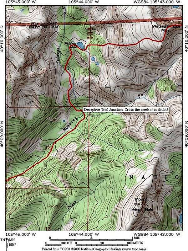
Roaring Fork Route on Watanga Mountain, 10.5 miles and 3,900 ft elevation gain.
Roaring Fork Route on Watanga Mountain: 10.5 miles roundtrip, 3,900 ft elevation gain, Class 2
This scenic route begins at the Roaring Fork Trailhead near Lake Granby. Follow switchbacks up into the Roaring Fork drainage. Continue for approximately 2 miles to the junction of the Watanga Lake Trail and the Roaring Fork Trail. Continue on the Watanga Lake trail which is the left fork... within a tenth of a mile there is a creek crossing that is easy to miss. Cross to the north side of the Roaring Fork at a place that has no signs or a bridge. There is a use trail that continues east... Don't follow this faint trail! On the other side of Roaring Fork the trail again becomes distinct and joins up with Watanga Creek. Follow this trail higher and higher up to scenic Watanga Lake. From here Watanga Mountain lies just to the east. Leave the comforts of the trail and aim for a grassy mini-gulley on the southwest side of the mountain. Once up this the expansive slopes of Watanga Mountain become apparent. Keep trudging on. The reclining nature of this mountain's west side mean that you will not see the summit until you are almost upon it. The summit itself appears suddenly and is very worthwhile.
Red Tape
Here is a summary of the Indian Peak Wilderness Rules and Regulations.When To Climb
June through October would likeley be the best months. Although this mountain does not involve much obvious avalanche terrain the sheer length would make it quite difficult in winter. If it was to be attempted in winter the most avalanche danger would likely be in the region just above Watanga Lake, just above timberline. In spring and summer look out for thunderstorms roaring accross Middle Park.Camping
Car camping is available near the trailhead at the various campgrounds around Lake Granby. For those in search of more seclusion excellent camping is available near the confluence of the Roaring Fork Trail and the Watanga Lake Trail, as well as further up on the banks of Watanga Lake.Mountain Conditions
