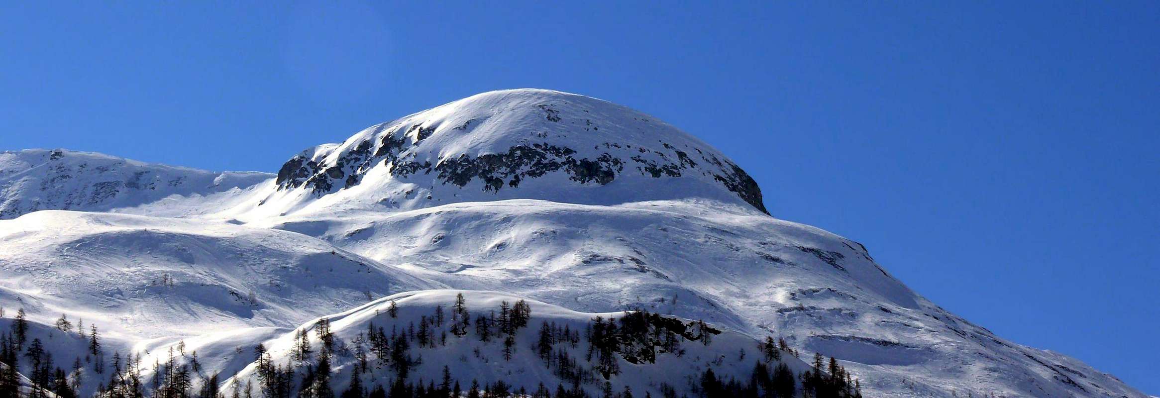
Small and rounded Rocky summit between Tête de la Tronche (2.584 meters east) and Mont de la Saxe (2.348 meters south-southwest) can be reached either from Col Sapin (2.435m) and from this last; Or by crossing from one another with departure or arrival at Rifugio Giorgio Bertone (1.946m), located in a beautiful rock-grassy promontory at the end of the Mont de la Saxe, immediately nearby the Alp de la Praz Pasture (1.946m). Splendid views towards the Mont Blanc Mountain Chain and particularly to the Brenva's Eastern Wall and above the glacier wth the same name and on ridges and walls of Aiguille Noire de Péuterey (3.773m).
Piccola e tondeggiante Sommità erboso-rocciosa collocata tra la Tête de la Tronche (2.584 metri, ad Est) ed il Mont de la Saxe (2.348 metri, a Sud-sudovest) può essere raggiunta sia dal Col Sapin (2.435 m) che da questo ultimo; oppure in traversata dall'uno altro con partenza od arrivo al Rifugio Giorgio Bertone (1.946 m), situato in uno splendido promontorio erboso-roccioso proprio al termine del Mont de la Saxe, immediatamente nelle vicinanze dell'Alpe Praz de la Saxe (1.946 m). Splendide vedute sulla Catena del Monte Bianco e particolarmente sulla parete Orientale della Brenva al di sopra dell'omonimo ghiacciaio, nonché sull'Aiguille Noire de Péuterey (3.773 m).
First Ascents
First on the summit: Unknown.
In winter: Unknown.
Getting There
Specific Road: from Courmayeur Center to each the Villair Dessus (Upper) where this ends for the use without its permission (1.382/1.443m; cartel ban immediately after the Villair's Village).
Approach & Route
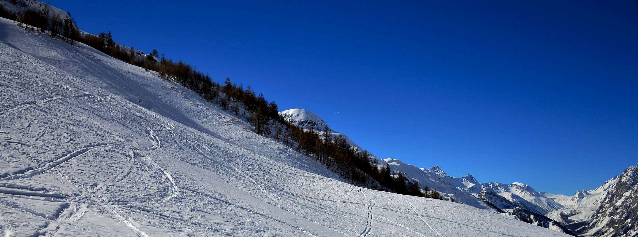
From Tsapy, where both the private dirt road that the concomitant trail n° 38, ends, continue in the same direction, but with a smaller path and unnumbered, going for a short time along the shore hydrographic right of the Torrent de Sapin for then wade the same and continue on the other side until the altitude 1.732 meters, where you will return with a new ford to the West. From this point the trail, always going up next to the same torrent, bends most at Northwest reaching the altitude of 2.164 meters, where it ends; reach through grassy slopes-detrital subsequent to following altitude 2.223 meters at two branches that give rise to the creek and, after crossing a small secondary vallon toward the Northeast, always using the same type of ground in a short time to reach the Sapin Hill (2.435m). From Col Sapin (2.435m), left to right branch that goes down to the Tsa (more high Alp) de Sécheron (2.260m) into the adjacent Armina Vallon, continue with the trail n° 42 in the Northwest Crest, or just under the edge of the ridge, of Tête de la Tronche (2.584m) to reach the same easily and quickly hence the same, down more to the West, reaches a wide saddle (2.495m), after which you reach the nearby Testa Bernarda (2.534m; E/F; 1h'15/1h'30 or 2h'00 from Col Sapin).
Da Tsapy, al termine della poderale e del concomitante sentiero n° 38, si prosegue sempre nella stessa direzione, ma con un sentierino privo di numerazione, salendo per breve lungo la sponda idrografica destra del Torrent de Sapin per poi guadare lo stesso e proseguire sulla sponda opposta fino alla quota di 1.732 metri, dove si ritorna con un nuovo guado ad Ovest. Da questo punto il sentiero, salendo sempre affianco al torrente medesimo, flette maggiormente a Nordovest raggiungendo l'altitudine di 2.164 metri, dove termina; pervenire per mezzo di pendii erboso-detritici alla successiva di 2.223 metri presso due rami che originano il Torrente di Sapin e, dopo aver brevemente attraversato verso Nordest un valloncello secondario, sempre tramite stessa tipologia di terreno, in breve tempo raggiungere il Col Sapin (2.435 m). Dal Col Sapin (2.435 m), lasciata a destra la diramazione che scende alla Alpe di Sécheron, continuare con il sentiero numerato 42 sul filo di cresta oppure subito al di sotto della Cresta Nordovest della Tête de la Tronche (2.584 m) raggiungendo la medesima facilmente ed in breve tempo; da qui lo stesso, scendendo più ad Ovest, raggiunge una larga sella (2.495 m), dopo la quale si raggiunge la viciniora Testa Bernarda (2.534 m; E/F; 1h'15/1h'30 oppure 2h'00 dal Col Sapin).
Difficulty
Easy for Hikers (E).
Facile e per Escursionisti (E).
Essential Gear
For Hiking.
Da Escursionismo.
Camping
Remember that free camping is forbidden (except for emergency reasons, over 2.500m, from darkness until dawn).
Mountain Conditions
You can get meteo information at the official site of the Regione Valle d'Aosta:
Parents refers to a larger category under which an object falls. For example, theAconcagua mountain page has the 'Aconcagua Group' and the 'Seven Summits' asparents and is a parent itself to many routes, photos, and Trip Reports.

 2548 Hits
 79.78% Score
 11 Votes