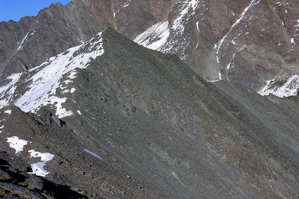
Mountain not in great evidence located 350 meters to the West of the Hill of Hannibal (2.992m) on the ridge dividing that by the Gran San Bernardo Pass continues Eastward, and after the elevation of the Mount Mort, Head and Point Barasson, Bec Noir, Pointes de Molline, Mount Tunnel and Grisa Head back, through the steep West Ridge, towards the Aiguille du Dejeuner (3.346m) and subsequently to the ice cap of Mount Velan (3.734m), the highest elevation from Dolent up to Central Summit of Dents des Bouquetins (3.835/8m) and Tête de Valpelline (3.800m). Top modest but well worth a visit for the wonderful views it offers over the Western Wall of the magnificent Mount Velan falls, crossed by three large frozen couloirs, above the Glacier of Proz, however wonderful the trip to the Pass of Hannibal probably used, together adjacent to other parcels, the General of Carthage to cross the Alps with elephants (on the hill was found by the Scholar and Historic G. Cibrario in 1901 a tip of a spear stuck in a rock of Carthaginian origin 22 centimeters long). In addition, wide view on the Great St. Bernard Pass in the distance always Westward, the Chain of Mount Blanc, especially in the watershed stretch from the Grandes Jorasses declines towards the Dolent-Tour Noir.
Montagna in non grande evidenza posizionata 350 metri ad Occidente del Colle di Annibale (2.992 m) sulla cresta di confine che dal Colle del Gran San Bernardo continua verso Est e, dopo le elevazioni del Mont Mort, Testa e Punta di Barasson, Bec Noir, Pointes de Molline, Mont Tunnel e Testa Grisa risale, tramite la ripida Cresta Ovest, attraverso all'Aiguille du Dejeuner (3.346 m) e successivamente alla calotta ghiacciata del Mont Velan (3.734 m), la più alta elevazione dal Mont Dolent fino alla Punta Centrale delle Dents des Bouquetins (3.835/8 m) ed alla Tête de Valpelline (3.800 m). Cima modesta però meritevole d'una visita per le splendide vedute offrentesi al di sopra della grandiosa Parete Occidentale del Mont Velan che cade, solcata da tre grandi canali ghiacciati, sopra il Glacier de Proz; splendida comunque la gita al Colle di Annibale, probabilmente utilizzato, insieme agli altri colli attigui, dal Generale di Cartagine per oltrepassare le Alpi con gli elefanti (presso il colle è stata rinvenuta, infissa in una roccia, dallo Studioso e Storico Cibrario nel 1901 una punta di una lancia d'origine cartaginese della lunghezza di ben 22 centimetri). Inoltre ampio panorama sul Colle del Gran San Bernardo e, in lontananza sempre verso Ovest, sulla Catena del Monte Bianco, soprattutto nel tratto spartiacque che dalle Grandes Jorasses declina verso il Mont Dolent-Tour Noir.
First Ascents
First on the summit: Unknown.
First ascent in winter: Unknown.
Getting There
BY CAR:
From Torino, Milano, etc: Motorway A5. Exit Aosta Est.
From France: through Mont Blanc Tunnel or Petit St. Bernard Pass. It isn't necessary to enter in Motorway A5, you can drive through SS.26 Aosta direction.
BY PLANE:
Aeroporto "Corrado Gex" Saint Christophe (Aosta).
Road Itinerary
From Aosta to go back to the North with the National Road and the Gran San Bernardo, after the Municipality of Gignod, to reach Etroubles (1.270m) to the west out of the same, and after two bends in a Cross, take a detour to the Northeast leading to Prailles Dessous (the Farm "La Grandze in Tsi Inconnu") where, immediately after in the locality Quaye, is placed in the sign ban on driving and where it is obligatory to the parking lot.
Da Aosta risalire verso Nord con la Strada Nazionale del Gran San Bernardo e, dopo il Comune di Gignod, raggiungere quello di Etroubles (1.270 m); uscendo verso Ovest dallo stesso, dopo due tornanti e presso una Croce, prendere a Nordest una deviazione che conduce a Prailles Dessous (Agriturismo "La Grandze in Tsi Inconnu") ove, subito dopo in località Quaye, è posizionato in cartello di divieto di transito e dove è obbligatorio effettuare il parcheggio.
Approach & Route
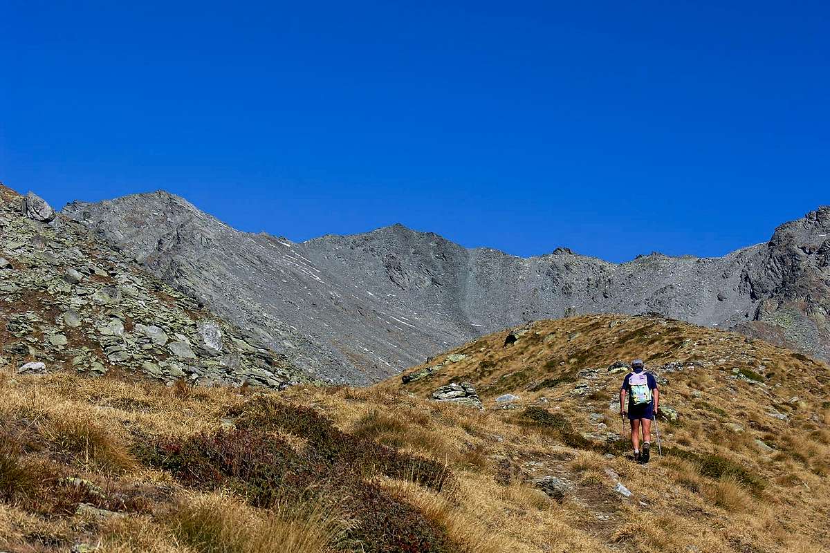
From the parking Quaye (about 1.650 meters) continue through the farm road, addressing himself to the North, enters and travels along the Menouve Valley or of Menovy passing to the West and high above the eponymous Torrent. Leaving the upper left corner of the Alps Combe German and Plan Bois (1.893m) the same reaches the next Menovy Pasture (1.913m) to the West at the next junction abandon the branch that leads to Trecaudette Pastures (2.133m) and continue instead with the lower one to the great Alp of the Arvus (1.983m), where the dirt road ends. From this climb with a small unnumbered trail that goes above the grassy headland coming to a small basin where there are the ruins of an old pasture, just below that of Molline Vieille (Old Molline; 2.295m) with a path parallel to and West of the Torrent of Molline homonymous Vallon continue with the path n° 21 reaching the Molline Bivouac (2.415m; opened in 2005; 1h'45/2h'00 from the signal no transit), adjacent to the Mountain Molline. The trail ends here even numbered but continues with smaller and closer and closer to the river and then crossing through the path between small vallons and grassy humps reach a crossroads at 2.519 meters. Leaving the path to Northwest, becomes a track and up to Molline Hill (2.915m), continue instead of few traces in the middle of the stony ground and, by means of an additional very small walloon, to reach the final stretch below the pass. This is steeper and, in the beginning of the season, covered with hard snow and then only with caution to reach the Annibal Pass (2.992m; 1h'45/2h'00; 4h'00/4h'15 in total from the cartel prohibition). From the hill climb the short, "rotten and elementary East Crest in less than a quarter now easily leads to Summit, formed by a dome of scattered boulders and debris.
Dal parcheggio di Quaye (1.650 m~) continuare tramite la strada poderale che, indirizzandosi a Settentrione, entra e percorre il lungo Vallone di Menouve oppure Menovy passando alta ed ad Ovest sopra l'omonimo Torrent. Lasciando in alto a sinistra le Alpi di Combe German e Plan Bois (1.893 m) la stessa raggiunge il successivo Alpeggio di Menovy (1.913 m); al bivio successivo abbandonare ad Ovest il ramo che conduce all'Alpe Trecaudette (2.133 m) e continuare invece con quello più in basso verso la grande Alpe dell'Arvus (1.983 m), dove la strada poderale termina. Da questa salire con un sentierino non numerato che risale il soprastante promontorio erboso arrivando ad una piccola conca dove si trovan i ruderi d'un alpe antica, appena sottostante quella di Molline Vieille (2.295 m); con percorso in parallelo ed a Ovest del Torrent de Molline continuare nell'omonimo Vallone con il sentiero n° 21 raggiungendo il Bivacco di Molline (2.415 m; aperto nel 2005; 1h'45/2h'00 dal cartello di divieto di transito), attiguo alla Montagna di Molline. Qui termina anche il sentiero numerato che però prosegue con dimensioni più ridotte e, avvicinandosi sempre di più al torrente ed in seguito attraversandolo, tramite il percorso tra valloncelli e gobbe erbose raggiunge un bivio a 2.519 metri. Lasciando a Nordovest il sentiero che, diventando una traccia, sale al Col Molline (2.915 m), continuare invece su scarse tracce in mezzo alla pietraia e, per mezzo d'un ulteriore valloncello, raggiungere il tratto finale sottostante al colle. Questo è più ripido ed, in inizio di stagione, ricoperto da neve dura e quindi richiede prudenza per raggiungere il Col d'Annibale (2.992 m: 1h'45/2h'00; in totale 4h'00/4h'15 dal cartello di divieto). Dal colle risalire la corta, "rotta" ed elementare Cresta Est che in meno di un quarto di ora facilmente conduce alla Cima, formata da una cupola di massi sparsi e detriti.
Difficulty
The route can be considered from EE/F.
L'itinerario è da classificarsi da EE/F.
Equipment
Hiking gear.
Da Escursionismo.
Huts
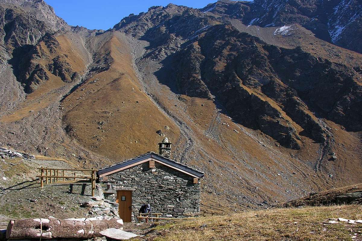
Bivacco Molline (2.415m) Vallone di Menouve
Campings
Remember that free camping is forbidden (except for emergency reasons, over 2.500m, from darkness until dawn).
Mountain Conditions
You can get meteo information at the official site of the Regione Valle d'Aosta:
Parents refers to a larger category under which an object falls. For example, theAconcagua mountain page has the 'Aconcagua Group' and the 'Seven Summits' asparents and is a parent itself to many routes, photos, and Trip Reports.

 4479 Hits
 86.37% Score
 22 Votes