
|
|
Mountain/Rock |
|---|---|
|
|
45.97538°N / 7.38551°E |
|
|
Summer, Fall |
|
|
11283 ft / 3439 m |
|
|
Overview
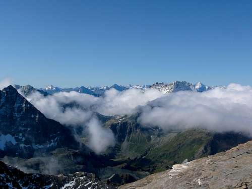
Small mountain located west of the Glacier du Giétro, in between the Grand Combin and La Ruinette. Not a high mountain, nor a difficult one, but it still offers a nice and pleasant climb (ideal for acclimatization, from Cabane des Dix or from Cabane de Chanrion) with some very rewarding views towards the Mont Blanc de Cheilon, La Ruinette, Grand Combin, Barrage du Mauvoisin, the Italian Alps, in good weather many of the high Pennine Alps,...
 From the Col du Mont Rouge.
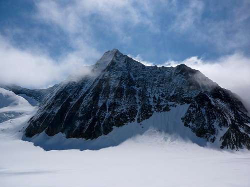 From Mont Rouge du Giétro, the north face of La Ruinette.
Getting There
To get to the Mont Rouge du Giétro there are three acces routes. The first comes from the Cabane des Dix. From the hut you have to cross the Col de Cheilon (3237m) and the Glacier du Giétro to the Col du Mont Rouge (3326m), where the climb starts. About 2 hours For how to get to the Cabane des Dix, see Cabane des Dix. Being roped up and wearing crampons is needed to cross the glacier (for crossing the Glacier du Giétro as well as for the last part of the Glacier de Cheilon to the Col de Cheilon). A second acces route starts at the Cabane de Chanrion (2462m); after which you have to cross the Col de Tsofeiret (2628m), the Col de lire Rose (3115m), and finaly the Col du Mont Rouge (3326m). To ge to the Cabane de Chanrion take a look at http://www.chanrion.ch/AccesEnEte.aspx (different routes from the Barrage du Mauvoisin). A last way of getting at the start of the climb is via the Barrage du Mauvoisin (1976m) over the Col du Giétro (3107m) and on to the Glacier du Giétro. From the Col du Giétro you can either choose to start climbing the northridge or you can cross the Glacier du Giétro to the Col du Mont Rouge and start the climb there (south-eastridge)(crampons and ice axe are needed for the Glacier, just as being roped up. This part of the Glacier du Giétro has much more crevasses than the upper part (which you cross when comming from the Col de Cheilon)). The Barrage du Mauvoisin can be reached by car and lies at the end of the Val de Bagnes (same valley as Verbier). The Val de Bagnes can be reached from Switzerland via Martigny or from Italy (Aosta) via the Col or Tunnel du Grand Saint-Bernard. When comming from the Barrage du Mauvoisin one has to remember this is an high alpine route over snow and glacier. Thus, a very early start is recommended (it's not a short afternoon trip).
Red Tape
No red Tape.
Routes
- SE ridge (F, easy): 30-45 minutes from the Col du Mont Rouge untill the summit at 3439m. From the Col du Mont Rouge you turn west onto the ridge. From then onwards one just has to follow the south-eastridge untill the summit. Easy, but it offers some very fine views towards the Grand Combin (West), the impressive north face of La Ruinette (East) and the Lac du Mauvoisin far below. An easy route, but mostly on slate, and therefore not always very solid. As the ridge can sometimes be rather narrow one always has to be careful.
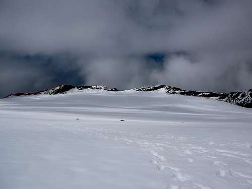 Mont Rouge du Giétro and the Glacier du Giétro seen from the Col de Cheilon.
After reaching the summit you can either turn round and return the same way or you can continu the ridge further down the north ridge. At first the ridge becomes quiet narrow for a bit, the second part however is more wide and becomes more a hike than a real climb. Still, continuing the ridge instead of turning back from the summit back to the Col du Mont Rouge is much more pleasant (as it offers more variation).
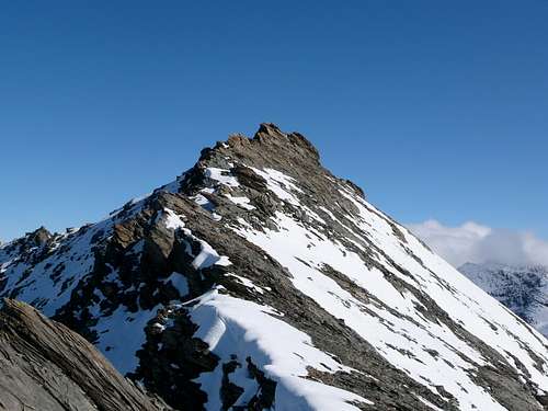 The last part of the ridge.
Under normal conditions this is a rocky ridge. However, as it is situated above 3000 meter it can always be covered (partially) with snow, even in summer. In such case, crampons can be useful (just as being roped up). This ridge can also be climbed reversed, starting on the north ridge and descending to the Col du Mont Rouge on the south ridge. - E face (F, easy): 15-30 minutes from the Glacier du Giétro. Really not recommended due to loose rocks. Easy but rather dangerous (not much variaton and the views aren't as rewarding as on the ridge). Material needed: crampons, rope, ice axe and basic glacier equipment for the Glacier (might be needed on the ridge as well).
Accomodation
At Cabane de Chanrion (www.chanrion.ch) At Cabane des Dix (www.cabanedesdix.ch)
When to climb
Summer and Autumn. Might be done in spring as well (tourskiing).
Maps and guidebooks
Maps: 1346: Chanrion (1/25000) Guidebooks: Guide des Alpes valaisannes 2 Du Gd-St-Bernard au Col Collon Maurice Brandt SAC/CAS