Introduction
After a superb summer season in alpine terrain, we found ourselves hungry to snag one more alpine rock route before the fall snows. We scoured through the various mountain ranges close to Salt Lake City and zeroed in on Mount Whitney. We hoped the late season would make wilderness permits more accessible, while avoiding the early morning line for a same-day permits. We were fortunate to find available permits, so we made our reservations and hit the road.
Click for the Full Trip Report on my photography website.
Approach to Upper Scout Lake
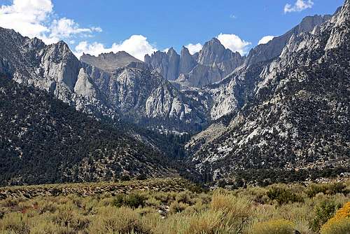
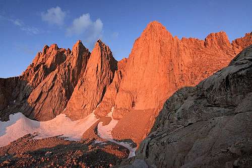
![East Buttress, Mt. Whitney]() Mount Whitney.
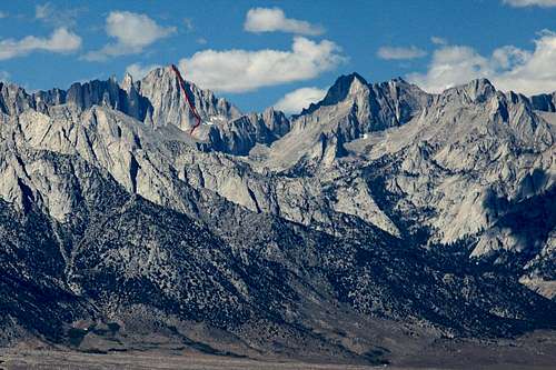
Mount Whitney.![East Buttress, Mt. Whitney]() East Buttress route (red line).
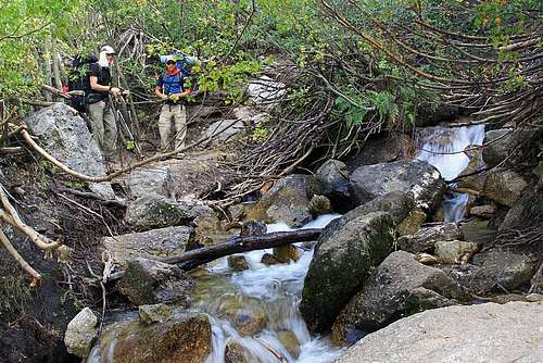
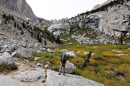
East Buttress route (red line).![East Buttress, Mt. Whitney]() Lush trail in the North Fork of Lone Pine. It was a perfect afternoon for hiking.
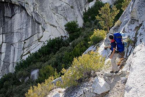
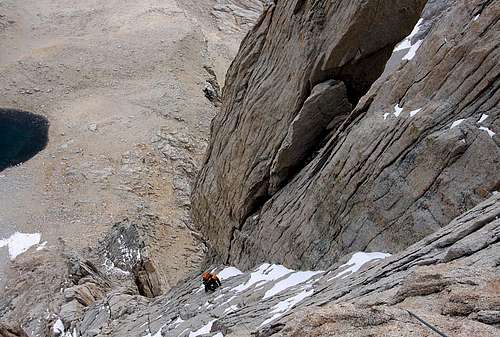
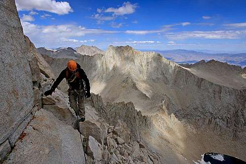
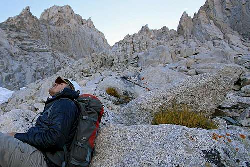
Lush trail in the North Fork of Lone Pine. It was a perfect afternoon for hiking.![East Buttress, Mt. Whitney]() The ledges. We were fortunate to arrive and help a desperate hiker find the proper descent route. He had just thrown his backpack off the ledges in dangerous location, while hunting for the proper route down. He was off route in some exposed terrain.
The ledges. We were fortunate to arrive and help a desperate hiker find the proper descent route. He had just thrown his backpack off the ledges in dangerous location, while hunting for the proper route down. He was off route in some exposed terrain.![East Buttress, Mt. Whitney]() Lower Scout Lake with fall colors.
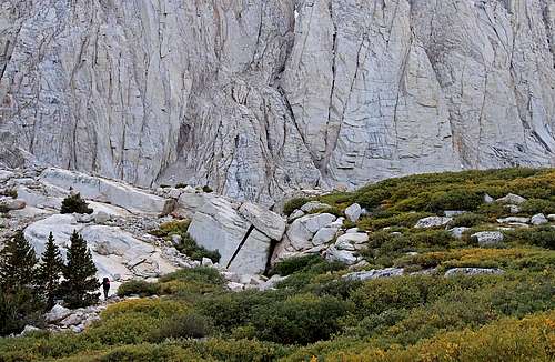
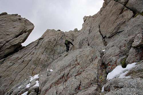
Lower Scout Lake with fall colors.![East Buttress, Mt. Whitney]() Hiking toward Upper Scout Lake.
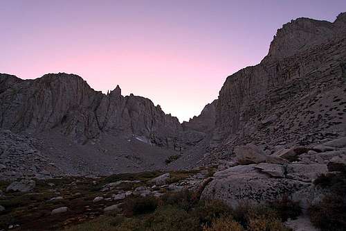
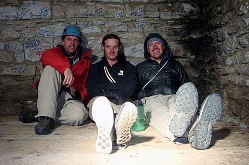
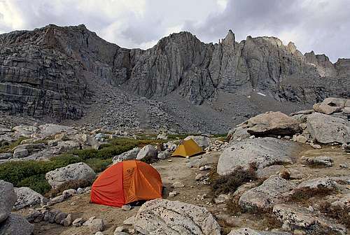
Hiking toward Upper Scout Lake.![East Buttress, Mt. Whitney]() Dusk at Upper Scout Lake. A stunning, comfortable location to camp.
Dusk at Upper Scout Lake. A stunning, comfortable location to camp.East Buttress Route
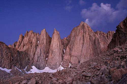
![East Buttress, Mt. Whitney]() We left camp around 5:30 a.m. and caught the first light of dawn on the profile of Mount Whitney.
We left camp around 5:30 a.m. and caught the first light of dawn on the profile of Mount Whitney.![East Buttress, Mt. Whitney]() Sweet Alpenglow.
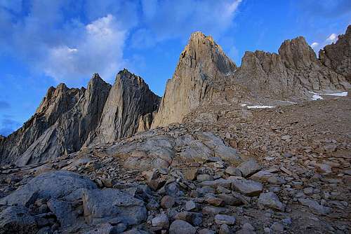
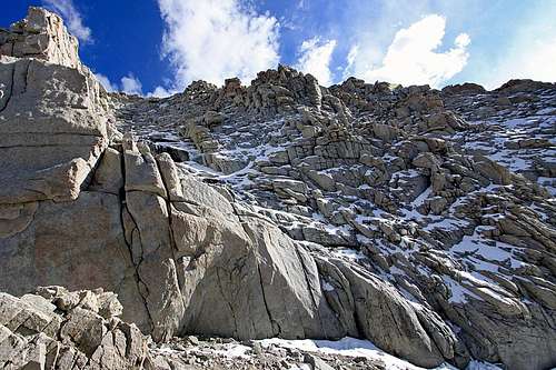
Sweet Alpenglow.![East Buttress, Mt. Whitney]() East Buttress as seen from Iceberg Lake. The clouds were moving from the southeast, which allowed us to watch for threatening weather. There were dark cells over the desert, so we kept close watch.
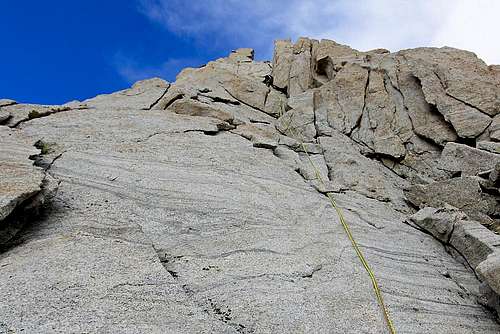
East Buttress as seen from Iceberg Lake. The clouds were moving from the southeast, which allowed us to watch for threatening weather. There were dark cells over the desert, so we kept close watch.![East Buttress, Mt. Whitney]() Pitch 1. The rock is as good as advertised.
Pitch 1. The rock is as good as advertised.![East Buttress, Mt. Whitney]() Looking down pitch 1. The morning warming up in the sunlight.
Looking down pitch 1. The morning warming up in the sunlight.![East Buttress, Mt. Whitney]() Atop pitch 2. Looking across the face of Whitney.
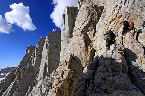
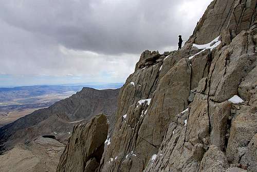
Atop pitch 2. Looking across the face of Whitney.![East Buttress, Mt. Whitney]() Pitch 3. Although sunshine was abundant over Whitney, the clouds were beginning to close in around us.
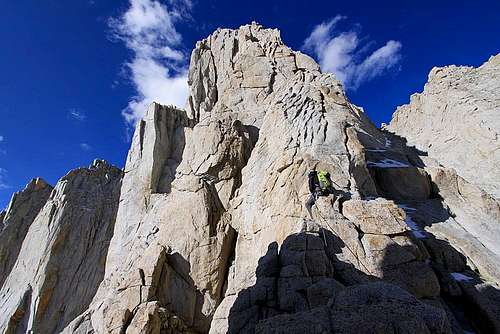
Pitch 3. Although sunshine was abundant over Whitney, the clouds were beginning to close in around us.![East Buttress, Mt. Whitney]() Climbing up pitch 4. Exciting exposure.
Climbing up pitch 4. Exciting exposure.![East Buttress, Mt. Whitney]() Quite cold, but the climbing was superb.
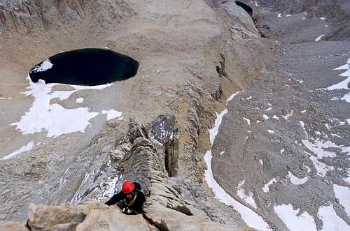
Quite cold, but the climbing was superb.![East Buttress, Mt. Whitney]() Looking down pitch 4 & 5. Small patches of snow still remained from a storm the prior week.
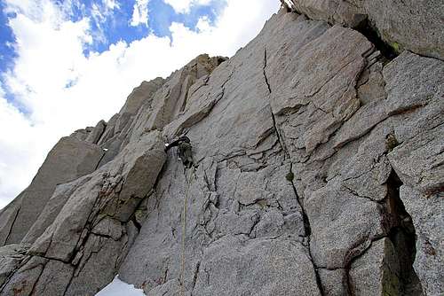
Looking down pitch 4 & 5. Small patches of snow still remained from a storm the prior week.![East Buttress, Mt. Whitney]() Pitch 5 & 6. A bit tricky in places to avoid the ice in the cracks and behind the flakes.
Pitch 5 & 6. A bit tricky in places to avoid the ice in the cracks and behind the flakes.![East Buttress, Mt. Whitney]() Belaying on the East Buttress with heavy clouds looming.
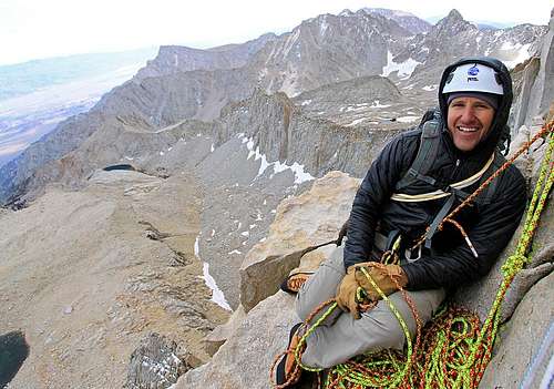
Belaying on the East Buttress with heavy clouds looming.![East Buttress, Mt. Whitney]() Pitch 8. This was a cold pitch, but the clouds magically began to brake apart giving us hope for some sunshine.
Pitch 8. This was a cold pitch, but the clouds magically began to brake apart giving us hope for some sunshine.![East Buttress, Mt. Whitney]() Astounding alpine terrain in the High Sierra. Mount Russell in the background.
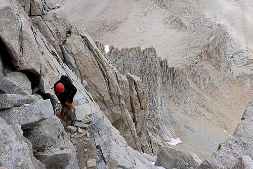
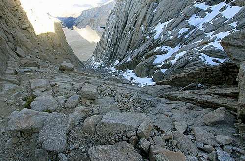
Astounding alpine terrain in the High Sierra. Mount Russell in the background.![East Buttress, Mt. Whitney]() After pitch 8, we packed the gear to scramble the last few hundred feet.
After pitch 8, we packed the gear to scramble the last few hundred feet.![East Buttress, Mt. Whitney]() Mostly 4th class terrain with scree ledges to the summit.
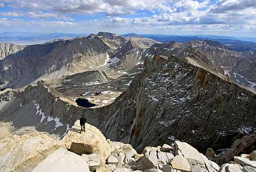
Mostly 4th class terrain with scree ledges to the summit.![East Buttress, Mt. Whitney]() The summit, and not a soul in sight. Apparently this solitude can be rare on the top of the lower 48.
The summit, and not a soul in sight. Apparently this solitude can be rare on the top of the lower 48.![East Buttress, Mt. Whitney]() Summit Panorama (click to view the large image).
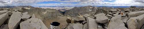
Summit Panorama (click to view the large image).![East Buttress, Mt. Whitney]() The temperature was substantially warmer in the summit hut. Nice place to refuel.
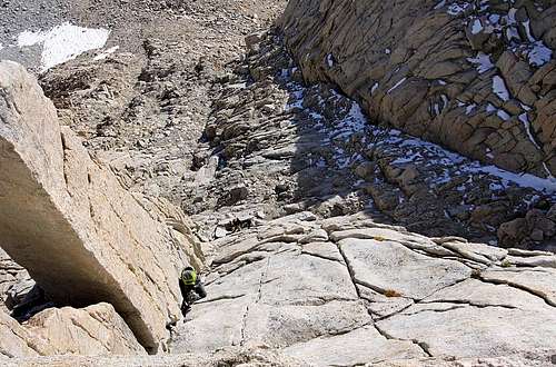
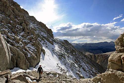
The temperature was substantially warmer in the summit hut. Nice place to refuel.![East Buttress, Mt. Whitney]() For the descent, we used the Mountaineer's Route. The upper half was dusted in snow and verglas. A bit sketchy.
For the descent, we used the Mountaineer's Route. The upper half was dusted in snow and verglas. A bit sketchy.![East Buttress, Mt. Whitney]() Afternoon sun on the Mountaineer's Route descent.
Afternoon sun on the Mountaineer's Route descent.![East Buttress, Mt. Whitney]() Bottom half of the Mountaineer's Route.
Bottom half of the Mountaineer's Route.![East Buttress, Mt. Whitney]() Tired, but happy. At this point, all I could think about was a hot meal at camp.
Tired, but happy. At this point, all I could think about was a hot meal at camp.The Day After
![East Buttress, Mt. Whitney]() The next morning, we had plans to climb Mount Russell. Those plans quickly faded with a large approaching storm.
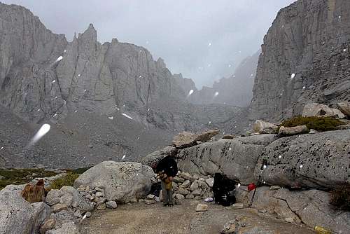
The next morning, we had plans to climb Mount Russell. Those plans quickly faded with a large approaching storm.![East Buttress, Mt. Whitney]() We took it easy all morning, until Mother Nature forced us to move out.
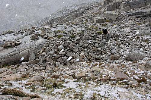
We took it easy all morning, until Mother Nature forced us to move out.![East Buttress, Mt. Whitney]() Graupel snow as a parting gift.
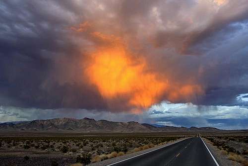
Graupel snow as a parting gift.![East Buttress, Mt. Whitney]() Fire in the sky, near Death Valley. It's crazy to consider on the summit of Whitney we were freezing, while driving through Death Valley it was 106 degrees. All in 24 hours.
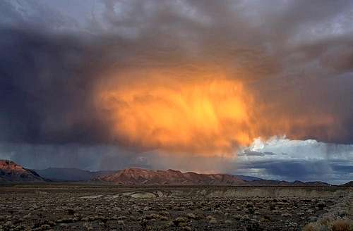
Fire in the sky, near Death Valley. It's crazy to consider on the summit of Whitney we were freezing, while driving through Death Valley it was 106 degrees. All in 24 hours.![East Buttress, Mt. Whitney]() Ridiculous beauty on the ride home.
Ridiculous beauty on the ride home.


Comments
Post a Comment