


-
 3971 Hits
-
 83.1% Score
-
 16 Votes
|
|
Mountain/Rock |
|---|---|
|
|
45.80090°N / 7.39099°E |
|
|
Aosta Valley Quart Valpelline Municipalities |
|
|
Spring, Summer, Fall, Winter |
|
|
9606 ft / 2928 m |
|
|
Note
|
La montagna chiama i suoi figli, ed essi rispondono fedelmente al suo appello… Osvaldo Cardellina, Diario alpinistico, 1964-65 Page texts: @ OsvaldoCardellina "Osva", passed away on May 2, 2022. Page owners: Christian Cardellina e Osvaldo Cardellina. Any updates from September 12, 2022: Antonio Giani, page administrator, friend and climbing companion. Testi della pagina: @ OsvaldoCardellina "Osva", scomparso il 2 maggio 2022. Proprietari pagina: Christian Cardellina e Osvaldo Cardellina. Eventuali aggiornamenti dal 12 settembre 2022: Antonio Giani, amministratore della pagina, amico e compagno di salite. |
Watershed Overview

We continue the search for mountains that that are not well known and even less busy. Although this certainly appears to be a mountain little popular and even less frequented. Located on the spur dividing the Central Valley of Dora Baltea to the South by the long Valpelline to the North, is "compressed" between the watershed more Western or Becca Roisan, Becca Viou (2.856m), Mont Mary (2.815m), Pointe de Chamerod, Les Prèles (2.945 meters about), Unnamed Quota 2.888 meters and Tête Arpisson (2.856m) and the Eastern, after the twins Tops Western and Eastern of Tsaat a l'Etsena splits: a branch is directed towards North-nordovet towards Punta Henry and Becca Conge reaching the important Saint Barthélemy Hill (2.645m), leading in Valpelline; the other, after the eponymous hill, salt neighbors Becchi of Fana, from Western Antesummit (2.945 meters about) of which falls to the South a long and more "sweet" ridge, which would separate the Comba Sénevé (West) from Dèche, which reaches Croix de Fana (2.212m) above the triple Village of Trois Villes (Porsan, Davisod and Fonteil). Surely this is one of those Summit "for Amateur", which still allow space for exploration.
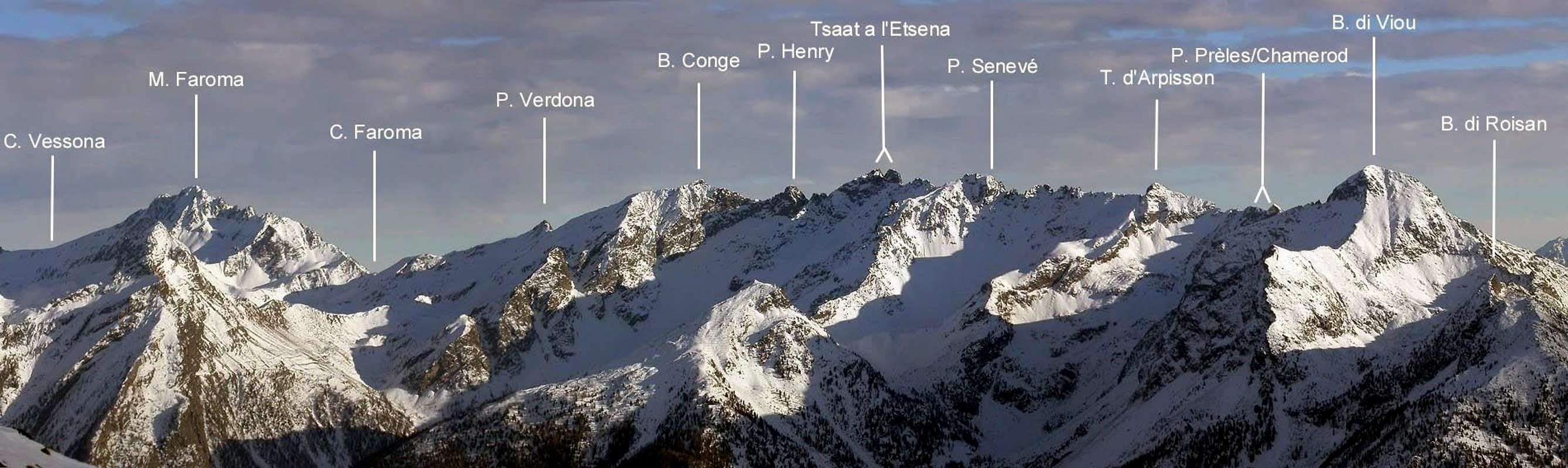
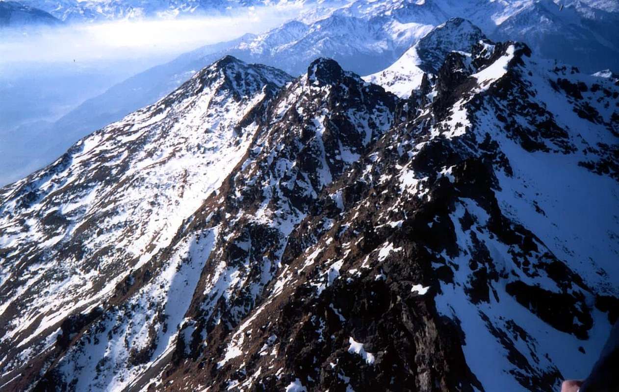
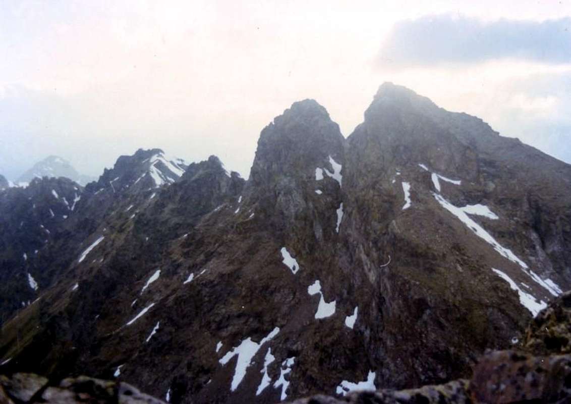
This appears to be the fourth Summit for elevation, after Tsaat to the Etsena (Eastern 2.973/5 meters about and Western 2.967m), Becca Conge (2.954m) and Becchi of Fana (2.951m), all of this long before the same is coastal hikes in the "Gothic" pyramid of Mont Faroma (3.073m) then head to the famous Becca Luseney (3.504m) and conclude towards the Petites and Grandes Murailles over the long watershed between Valpelline and Valtournanche Valleys. A magical bond that connects the old Town of Aosta with the much older pyramid of the Matterhorn in a perfect marriage between the Valley of Dora Baltea, Valtournanche and valleys that unfold until the gleaming glaciers of Monte Rosa. Short Description Historical Topographic By Eastern Collar of Senevé 2.845/50 meters about it climbs a Crest West-southwest brief but steep and uneven, so much that the Abbé Joseph Maria Henry, first explorer of this small mountain range, held it completely impracticable. He has been probably climbed for the first time leak rope in summer 1972, partially crossed in descent and slope by the Senevè he again later in the same year and repeated, in integral crossing by Becca of Roisan to Croix de Fana, in current twenty years; less difficulty of the expectation, asks for prudence for the scarce rock quality, rather crumbled and broken with material suspended. The mountain, the Vertex of which is found "extended" to the West, introduces two slopes; one to South of broken rocks sprinkled by grassy lines that with a spur, just delineated and that it finishes on the East Crest to little distance from the Peak near an Antesummit North 2.926 meters around, he can constitute the Standard. The 08 th of Oct 1972 had been climbed by Osvaldo Cardellina and Camillo Roberto Ferronato in slope and descent with departure from Chamerod, in that that constitutes the second or the first ascension of the mountain (in the 1972 slope it misses the precise date). In the occasion he was partially crossed in descent and then climbed the Crest West-southwest. Always with this itinerary, but more towards the South Face, the first winter ascension happened from Osvaldo Cardellina, solo, in December 30 th, 2007. A brief Crest East league this to the Unnamed Top 2.945/50 meters about, the first of two Tsaat, beyond which the watershed is divided into two opposite directions, reaching the Saint Barthélemy Hill in the Northeast and the Croix de Fana in South-southeast. The other slope, turned toward North, he is constituted not by very steep rocky ribs and with lines of splinters up to the small terminal tower formed by steep rocks; he can be, to our notice, proper for the Ski-Mountaineering in the correct season, and with due caution after complete transformation of snow cover since the Walloon Arpisson is long and exposed to snowslides and avalanches. Surely it is as grueling climb because of the significant difference in height and shown as OSA (Excellent Skiers Mountaineers).
Continuiamo la ricerca di montagne sconosciute e molto raramente frequentate. Anche questa sicuramente risulta esserne una poco popolare ed ancora di meno visitata. Situata sul contrafforte divisorio la Valle Centrale della Dora Baltea a Mezzogiorno dalla lunga Valpelline a Settentrione, risulta "compressa" tra lo spartiacque più Occidentale (Becca di Roisan, Becca di Viou, Mont Mary, Punta di Chamerod, Les Prèles, Quota Innominata 2.888 metri e Tête di Arpisson) e quello Orientale che, dopo le due gemelle sommità della Tsaat a l'Etsena, Ovest ed Esi, si sdoppia: un ramo s'indirizza verso Nord-nordovet in direzione di Punta Henry e Becca Conge raggiungendo l'importante Colle di Saint Barthélemy, che conduce in Valpelline; l'altro, dopo l'omonimo colle, sale ai vicini Becchi di Fana, dall'Antecima Ovest dei quali scende verso Sud una lunga e più "dolce" cresta, atta a separare la Comba di Senevé (Ovest) da quella Dèche, che raggiunge la Croix de Fana (2.212 m), al di sopra del triplice Villaggio di Trois Villes (Porsan, Davisod e Fonteil). Risulta essere la quarta Sommità per elevazione, dopo la Tsaat a l'Etsena (2.973/5 metri circa), Becca Conge (2.954 m) e Becchi di Fana (2.951 m), di tutta questa lunga costiera prima che la medesima si rialzi nella "gotica" piramide del Monte Faroma (3.073 m), per poi dirigersi verso la famosa Becca di Luseney (3.504 m) e concludere verso le Pt. e Gr. Murailles tra la Valpelline e la Valtournanche. Un magico legame che connette la vecchia Città d'Aosta con la ben più antica piramide del Cervino in un ideale connubio tra la Valle della Dora, la Valtournanche e le Valli del Rosa. Trattasi d'una di quelle Sommità "per Amatori" concedenti ancora spazio per l'esplorazione.
Breve descrizione Storico-Topografica Dal Colletto Orientale di Senevé 2.845/50 metri circa sale una Cresta Ovest-sudovest breve ma ripida ed accidentata, tant'é che l'Abbé Joseph Maria Henry, primo esploratore di questa piccola catena montuosa, la riteneva completamente impraticabile. E' stata probabilmente salita per la prima volta dalla cordata dell'estate 1972, parzialmente percorsa in discesa e risalita dalla Punta di Senevè ancora nello stesso anno ai primi d'Ottobre e ripercorsa, nella traversata integrale dalla Becca di Roisan alla Croix de Fana, di giusto venti anni dopo; meno difficile del previsto, richiede prudenza per la qualità della roccia, alquanto sgretolata con materiale sospeso. La montagna, il vertice della quale trovasi proiettato e quasi "disteso" ad Occidente, presenta due versanti; uno a Sud di rocce rotte cosparse da tratti erbosi che, con uno sperone appena delineato verso Sud-sudest e terminante sulla Cresta Est a poca distanza dalla Vetta presso un'Antecima Nord 2.926 metri circa, può costituire la Via Normale. Fu salito l'8 d'Ottobre 1972 da Osvaldo Cardellina e Camillo Roberto Ferronato in salita e discesa con partenza da Chamerod, in quella che costituisce la seconda o la prima ascensione della montagna (nella salita del 1972 in verità manca la data precisa). Nell'occasione venne percorsa parzialmente in discesa e poi salita la Cresta Ovest-sudovest. Sempre con questo itinerario, ma più verso la Faccia Sud, avvenne la prima ascensione invernale da parte di Osvaldo Cardellina, solo, il 30 Dicembre 2007. Una breve Cresta Est la lega all'Innominata Quota 2.945/50 metri circa, prima delle due Tsaat, oltre le quali lo spartiacque si divide in due opposte direzioni raggiungendo il Colle di St. Barthélemy a Nordest e la Croix de Fana a Sud-sudest. L'altro versante, rivolto verso Settentrione, è costituito da costole rocciose non molto ripide e con tratti frantumati fino alla torretta terminale formata da rocce più ripide; può essere, a nostro avviso, adatto allo Sci-Alpinismo nella giusta stagione e con le dovute cautele previa completa trasformazione del manto nevoso, poiché il Vallone di Arpisson é lungo ed esposto a valanghe. Sicuramente risulta come ascensione estenuante a causa del notevole dislivello da superare ed indicata ad OSA (Ottimi Sciatori Alpinisti).
![]()
Senevé Comba with farms dirt road from Davisod (Trois Villes), by emilius
![]()
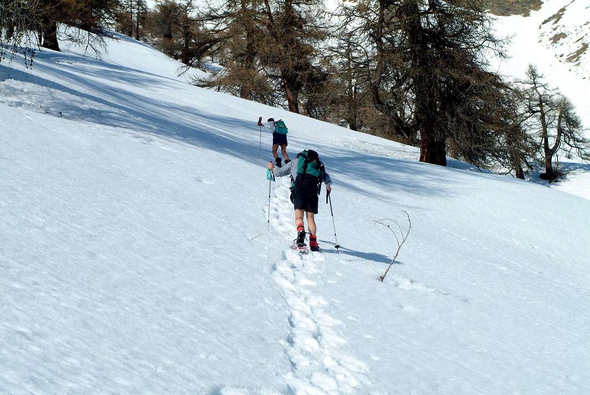
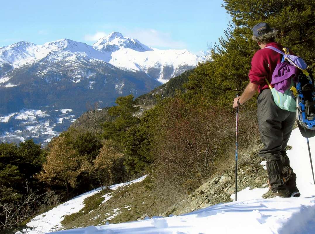
To Cénevé Comba from Prayon Farm & Chamerod by Snowshoes, by emilius
![]()
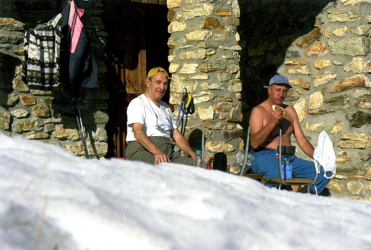
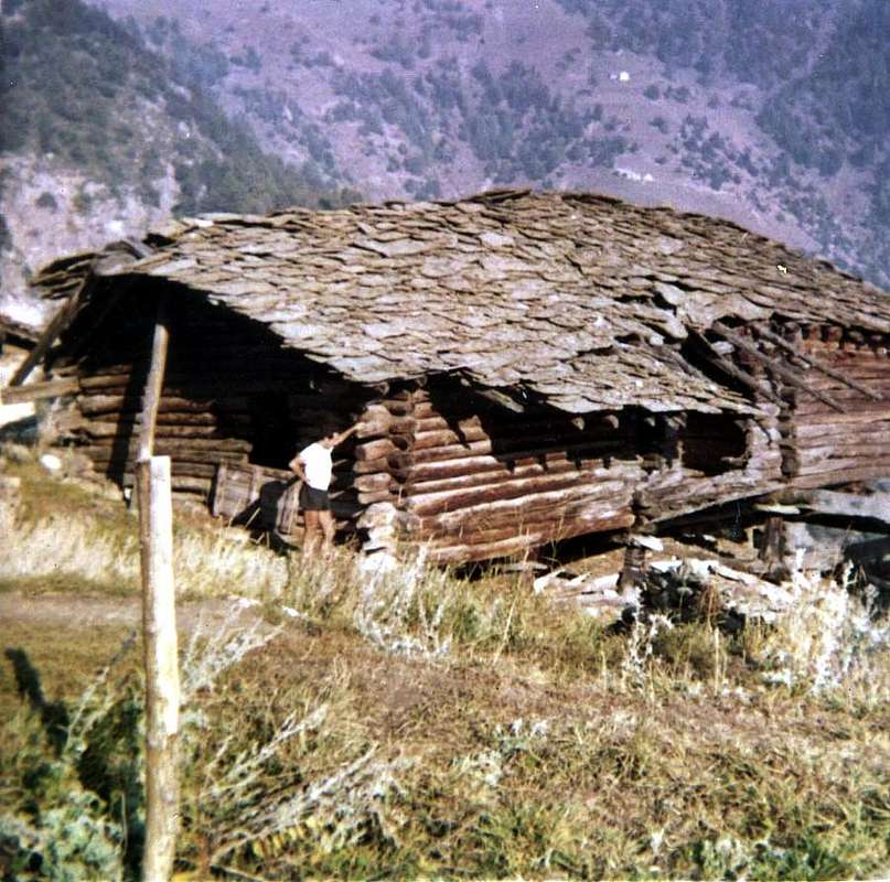
Chamerod Village, destroyed and today restructured, by Roberto Ferronato
![]()
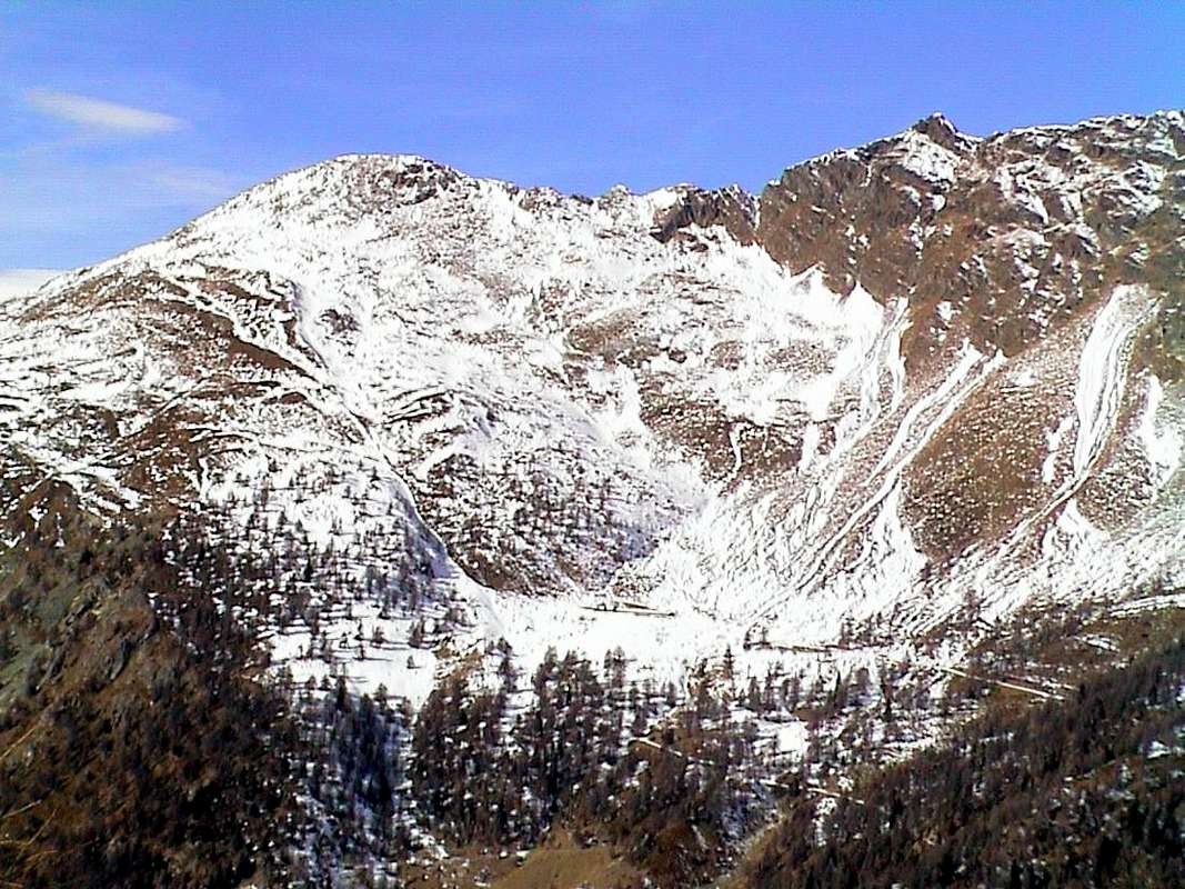
Watershed between Cénevé (right) & Arpisson, by Osw
![]()
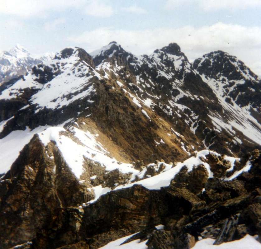
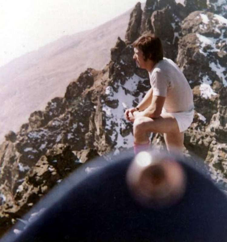
On Summit of Punta Senevé in Autumn 1972, by Osw
![]()
Watershed Northwest Slopes by Northwest, by emilius
![]()
Cénevé Basin towards Mont Fallère Group, by emilius
First Ascents
- First on Summit: Renato Quendoz and Jules Jorrioz, (Summer or Autumn 1972?), with crossing from Tête d'Arpisson up to the Western Tsaat a l'Etsena, with descent by E-SE Edge.
- In Winter: Osvaldo Cardellina, lone, (Dec 30th, 2007), from Prayon, Les Ayettes, Borrely Pastures, Chamerod Village, through Senevé Alp and by Southern Slope.
- South-southeastern Spur: Osvaldo Cardellina and Camillo Roberto Ferronato, (Oct 08th, 1972), from Chamerod Village, through Senevé Alp and by South-southeast Spur.
- Southern Face: Osvaldo Cardellina, lone, (Dec 30th, 2007), from Prayon, Les Ayettes, Borrely Pastures, Chamerod Village, through Senevé Alp.
- West-Southwestern Crest: (probably) Renato Quendoz and Jules Jorrioz, (Summer or Autumn 1972?), with traverse from Tête d'Arpisson, discarding to the left or North the Senevé Spire or Cénevé Bell Tower, to Punta di Senevé, with traverse to Senevé Hill (2.910/15 meters about) and Unnamed Quota 2.945/50 meters about and Western top of Tsaat a l'Etsena. (Surely): Osvaldo Cardellina and Camillo Roberto Ferronato, (Oct 08th, 1972), in descent from Punta di Senevé to Collar 2.845/50 meters about with return in ascent through the same route to Summit.
- First repetition or second ascent of Senevé Bell Tower: Osvaldo Cardellina and Alessandro Cardellina, (July 18th, 2005), from Chamerod Village towards Quota 2.888 meters, after the first ascent on South Face of the same, through before the Western Crest and after by Northwestern Face, in ascent and in descent, during the crossing up to the Punta di Senevé; in descent S-SE Rib to Senevé or Cénevé Alp.
- Northwestern Face: unknown but various Ski-Mountaineers (personally seen by me on Mid Nineties?), from Valpelline through Arpisson Comba.
- Great Traverse. from Becca Roisan-Quota 2.494 meters-Becca Viou-Mont Mary-Chamerod Point-Les Prèles Points-Tête d'Arpisson-Quota 2.888 meters-Senevé Point-Quota 2.945/50 meters about-Tsaat à l'Etsena West and East-Becchi di Fana-Croix de Fana: Osvaldo Cardellina, lone (Oct 11th, 1992), from Blavy Hamlet to Trois Villes Villages.
Getting There
BY CAR:
- From TORINO, MILANO, etc: Motorway A5. Exit at IVREA or Quincinetto (PIEDMONT).
- From IVREA Town: in West (Southern side) towards Pont Saint Martin, Donnas, Bard, Champdepraz, Pontey, Fénis, Nus to Quart-Villefranche and Saint Christophe Municipalities (Eastern Side). From Courmayeur Resort: in East towards Pré Saint Didier, Morgex, Arvier, La Salle, Saint Pierre, Sarre, Aosta to Saint Chistophe and Quart Municipalities (Western Side).
- North-northeastern Sides: From Aosta Town to Verrès Municipality From Saint Christophe-Prevot (about 640m), reached by Regional Road from Aosta, to Sorreley Village; from this, with Municipal, towards Veynes Fraction. From subsequent alternative before Lumian (1.025m): *** in East deviation to Cretallaz, Jeanceyaz, Morgonaz Villages at the entrance on Senevé Comba). On asphalt road in Northwest, to Parléaz Village (1.274m), Blavy Hamlet (1.475m) and, through dirt road or path, to Viou Alpages, in Blavy Viou small Basin. From Quart-Villair towards Epilaz, Argnod Villages or from State Road n°26 nearby La Plantaz (540m), with Regional and Municipal Roads, towards Chétoz, Vignil, Fornail, Ville sur Nus-Planeville, Buignod, Porsan Villages to Trois Villes-Avisod Village (1.398m). From this to Senevé Alps (2.206m), in Senevé Comba. From Quart to Fonteil with previous route; from this through dirt road, towards La Seyvaz (2.184m), Valchourda Alps (2.392m), in Comba Dèche. From Nus-La Plantaz in State Road to Ville sur Nus-Planeville (1.113m); from this, towards Buignod, Avion (1.312m) Villages. Also from Porsan through Trois Villes (1.398m), Avion, fork (1.250m) to Effraz Village (1.487m), with Municipal Roads. From this to Ronc (1.737m), Machaussy Alps, in Effraz Comba.
- Specific Road: just after Quart Fractions (Etolin, Vieille Morte, la Plantaz-Chétoz (better), turn to the left or North-northeast, towards Trois Villes (two parkings). Or with alternative road: from Aosta East toll of the highway follow on the right side toward Quart (556m near the Region Amérique); after the roundabout follow up toward Villair. After passing Argnod (857m) and Ville sur Nus (1.106m) turn to the left to Trois Villes Avisod (1.391m) wherefrom you must start walking. Or by Nus adjacent Commune.
- From FRANCE: through the Mont Blanc Tunnel to Entrèves-crossroads to Vény/Ferret Valleys - Mountain Guides of Courmayeur - La Saxe Rock Gym - Courmayeur. By Little Saint Bernard Pass, closed since November until half May to La Thuile Valley - Pré Saint Didier - Courmayeur. It is not necessary to take Motorway A5: you can drive on SS.26, in the direction of AOSTA - IVREA - TURIN.
BY PLANE:
- Aeroporto "Corrado Gex" Saint Christophe (Aosta).
Approaches
Approach A (from Trois Villes Villages) Avisod Hamlet (1.390m; beautiful small church in the meadow back 1398 meters, just to East) to take toward West the dirt road, leaving on the left the alternative for Valseinte shortly after (1.399m; attainable with beautiful walk through the path that from the beautiful one and restructured Castle of Quart (740m) it transits for the Oratoire de Saint Emeric (1.140m) with a slendid walk); to continue instead more toward Northwest progressively inserting himself in the Basin Senevé, leaving in low the Alps Chacotte (1.426m) and Séchot (1.409m). To revolve the wooded strata of the Slope Southwest of the Croix de Fana (2.212m; beautiful walk with departure from Trois Villes-Fonteil) and, crossing some small torrential furrows, to reach the Champchamoussin Pasture before Lower and immediately than Upper (1.856m); from this, always with slope in diagonal but more towards Northwest, to reach the Alpe of Latta or Lattaz (1.930m; today almost in complete ruin), underlying to the With the Cornet (2.272m), and the following double and wide hairpin bend to altitude 2.036 meters. To continue, same direction, toward the Chavod Pasture (2.038m) and the following winding road in form of acute angle to quota 2.097 meters; from this the dirt road changes direction in Northeast reaching the following of 2.148 meters, where the path n° 1 arrive that it goes down from the aforesaid hill. From here the road it decidedly turns to West and it reaches shortly time the important Senevé Alp, recently restructured (2.199m; E; 2h'00/2h'30; there is no other possibility of course, because the path has been progressively in the time cleared by the farms dirt road). Note: This beautiful approach can also be carried out in winter with Skiing or Snowshoeing starting from the small Village of Avisod (the second of three of Trois Villes).
-
![]()
On Senevé Alp from Davisod Hamlet (Trois Villes) Snowshoe, by self-timer -
Avvicinamento A (dai Villaggi di Trois Villes) Dal Villaggio di Avisod (1.390 m; chiesetta nel dosso prativo 1.398 metri, subito ad Oriente) prendere verso Occidente la strada poderale, lasciando poco dopo sulla sinistra il bivio per la Valseinte (1.399 m; raggiungibile con bella passeggiata tramite il sentiero che dal bel e recentemente ristrutturato Castello di Quart (740 m) transita per l'Oratorio di Sant'Emerico (1.140 m) con una splendida passeggiata/escursione); continuare invece più verso Nordovest inserendosi progressivamente nella Conca di Senevé, lasciandosi in basso le Alpi Chacotte (1.426 m) e Séchot (1.409 m). Aggirare le falde boschive del Versante Sudovest della Croix de Fana (2.212 m; bella passeggiata con partenza da Trois Villes-Fonteil) ed, attraversando alcuni piccoli solchi torrentizi, raggiungere l'Alpe Champchamoussin di Sotto e subito dopo di Sopra (1.856 m); da questa, sempre con salita in diagonale ma più a Nordovest, raggiungere l'Alpe di Latta o Lattaz (1.930 m; oggi quasi in completa rovina), sottostante al Col Cornet (2.272 m), ed il successivo doppio e largo tornante a quota 2.036 metri. Proseguire, stessa direzione, verso l'Alpe di Chavod (2.038 m) ed il successivo tornante in forma di angolo acuto all'altitudine di 2.097 metri donde la strada cambia direzione in Nordest raggiungendo la successiva di 2.148 metri, ove arriva il sentiero n° 1 discendente dal suddetto colle. Da qui la medesima volge decisamente ad Ovest e raggiunge in breve tempo l'importante Alpe, da poco ristrutturata, di Senevé (2.199 m; E; 2h'00/2h'30; non esiston altre possibilità di percorso, poiché il sentiero è stato cancellato progressivamente nel tempo dall'abbastanza recente strada poderale). Nota: questo bell'avvicinamento può essere effettuato anche in inverno con gli Sci o le Racchette da neve partendo dal Villaggio di Avisod (il secondo dei tre di Trois Villes).
Approach B (from the Hamlets of Crétallaz-Jeanceyaz-Morgonaz through the Municipal Road by Saint Christophe) From Prayon Farm (1.128m), almost at the end of the Municipal Road that goes by St. Christophe Common, along the farms private dirt road, at the hairpin bend just over the water intake, towards Les Ayettes (1.463m) and Bor(r)elly (1.477m) Pastures at the entrance on Senevé Basin, Western side or Chamerod's, reaching, always towards the North, this ancient village where once (until the Seventies) there were two wonderful wooden "Rascards"with stone base (1.615m, E; 1h'15/1h'30, the sign ban immediately after the water intake of Prayon Farm). If you want you can avoid reaching the same continuing left before of 200 meters about on the above dirt road that, after a wide bend crossing two unimportant torrents and passing over the Alp Tsamp Dèsott or Tsamp des Eaux (*** for an existing source just above 1.660/70 meters about GPS; private and always closed, owned by Aldo Barmasse that in winter "beats" the farm road with the snowmobile), to Alp Les Preyes or Les Prèles and also, on the spot, Priles (1.802m), just beyond which is terminated. From this point to the North part of a small path unnumbered that, almost immediately past right an ancient ruin, is introduced into the overhanging woods; climbed the same with tight bends (path not easy to detect in the presence of snow) and with a final hairpin out on the lawns and most recently with a right diagonal in the midst of these towards the Alp Cénevé (2.206m; source immediately to the West at a water intake; E; 2h'30/2h'45, increasing by about an good hour in the event of snow). This approach is more direct but also more tiring than with long diagonal from Avisod of Trois Villes. Note: also this approach is already in a splendid outing with snowshoes usually starting from just above Prayon and passing through the alps above or with shortcuts.
Avvicinamento B (dai Villaggi di Crétallaz-Jeanceyaz-Morgonaz con la Strada Comunale da Saint Christophe) Dalla Fattoria di Prayon (1.128 m) tramite la strada poderale, presso il tornante a gomito appena oltre la presa d'acqua, per i successivi Alpeggi di Les Ayettes (1.463 m) e Bor(r)elly (1.477 m) all'ingresso nel Bacino di Senevé, settore Occidentale o di Chamerod, raggiungendo, sempre verso Settentrione, questo antico villaggio, dove una volta (fino agli anni Settanta) esistevano due splendidi "Rascards" in legno con basamento in pietra (1.615 m, E; 1h'15/1h'30 dal cartello di divieto di transito subito dopo la presa d'acqua). Volendo si può evitare di raggiungere il medesimo svoltando a sinistra appena 200 metri circa prima sulla soprastante poderale che, dopo un largo tornante, superando due torrentelli secondari e passando sopra l'Alpe Tsamp Dèsott o Tsamp des Eaux (*** per una sorgente esistente poco sopra 1.660/70 metri circa GPS di proprietà di Aldo Barmasse che in inverno "batte" la strada poderale con la motoslitta), raggiunge l'Alpe di Les Preyes o Les Prèles ed anche, in loco, Priles (1.802 m), poco oltre la quale essa termina. Da questo punto s'indirizza verso Nord un sentierucolo non numerato che, passando quasi subito accanto ad un rudere, si introduce progressivamente nel bosco; risalito lo stesso con stretti tornanti (percorso non facile da individuarsi in presenza di neve) e con un ultimo tratto più ripido esce sui prati ed infine con un diagonale verso destra in mezzo a questi verso l'Alpeggio di Cénevé (2.206 m; sorgente subito ad Ovest presso una presa d'acqua; E; 2h'30/2h'45, aumentando di circa una buona ora con neve). Questo avvicinamento risulta più diretto ma anche più faticoso rispetto a quello in diagonale da Trois Villes. Nota: anche quest'avvicinamento consiste già in una spledida gita con racchette da neve in genere partendo da Prayon, passando dalle alpi di cui sopra o con scorciatoie.
Route
Outline what the true "Normal Route" this mountain is not easy thing. Surely it is not the path followed by the probable first climbers in the summer of 1972 in long crossing from Tête d'Arpisson and then, after the two Brèches and the small and acute Campanile (Bell Tower) or Spire of Seneva through the short but steep and quite challenging West Ridge-sudovest. In our opinion, the most logical and simple is that by means of the Spur South-southeast that "sinks" on the stonyground of the Comba Sénevé, just to the Northeast of the eponymous alp. This route was traveling just a few days later the first ascent and does not present undue difficulty but simply requires the ability to know how to choose the path in the midst of rocky slopes covered with debris and grass "Ollina" rather slippery and therefore dangerous. Consequently, and also this route goes discarded in the snow presence, especially when present in large amounts and with the "swollen" for the excessive danger of snowslides and avalanches. With this purpose, during the first winter 2007, was used side by side immediately to the West, via a spur into the South Face less obvious, shorter and steeper but certainly safer. In the latter case, agrees to make the ascent on the other side that is starting by Valpelline and along the Comba or Walloon Arpisson, although it is not exempt from significant objective dangers even during the approach. In any case, to go up in the winter you have to know the territory well, in its particular features in relation to the period and the snow was in place; otherwise it is better to give up the climbing where showing considerable signs of danger.
Thus becomes a trip Ski-Mountaineering, despite requesting it carefully and precise evaluation of the snow conditions, especially towards the end of the slope but where to the Northwest a rib rocky allows you to "lean" on the left. As regards the first hypothesis also from Senevé Basin and through the South-southeast Spur, reaching the base of the same from Alp through the screes towards the Northeast. Reached the basis of, where this ends with a big jump of yellowish rock of thirty metres, around the same just left taking on edge of the spur that follows faithfully and easily to its end and without fixed course but following a logical sequence in passages; arrived over the Crest East-southeast, which comes from the two Tsaat a l'Etsena (East West) and subsequent Unnamed Quota 2.945/50 meters about, follow it for a short time and, after passing a small Antetop that gives the impression of being the Summit, you reach the real Vertex (EE/A/F+; 2h'00/2h'30 by Cénevé Alp). Downhill: the same way, or if the snow ever more dangerous with each passing hour, you should go down through the West-southwest Ridge until the East Brèche nearby the Little Bell Tower or Spire Sénevé (2.875/7 meters about); this down to the couloir between the East and West Forks leaning on rocks of one of the two sides.
Delineare quale sia la vera "Via Normale" a questa montagna non é cosa facile. Sicuramente non lo é con la via seguita dai probabili primi salitori nell'estate del 1972 in lunga traversata dalla Tête d'Arpisson e quindi, dopo le due Brèches ed il piccolo ed acuto Campanile o Guglia di Seneva, tramite la corta ma ripida ed abbastanza impegnativa Cresta Ovest-sudovest. A nostro avviso la più logica e semplice risulta quella per mezzo dello Sperone Sud-sudest che si "affonda" sulle pietraie della Comba di Senevé, appena a Nordest dell'omonimo alpeggio. Quest'itinerario venne percorso pochi giorni appresso alla prima salita e non presenta soverchie difficoltà, ma semplicemente richiede la capacità di saper scegliere il percorso in mezzo a pendii rocciosi ricoperti da detriti ed erba "ollina", piuttosto scivolosa e quindi pericolosa. Di conseguenza ed altresì questa via và scartato in presenza di neve, soprattutto quando presente in grande quantità e con delle "gonfie", per l'eccessivo pericolo di slavine e valanghe; all'uopo, durante la prima invernale del 2007, fu utilizzato il versante subito a fianco ad Ovest, tramite uno sperone meno evidente sul Versante Sud, più corto e più ripido ma certamente più sicuro. In quest'ultimo caso quasi convien d'effettuare la salita sul versante opposto, ovvero partendo dalla Valpelline e percorrendo la piuttosto lunga Comba o Vallone d'Arpisson, non esente pur esso da notevoli pericoli oggettivi anche durante l'avvicinamento. In ogni caso per salire in inverno bisogna conoscere bene il territorio nelle sue peculiarietà in rapporto al periodo ed alla stato dell'innevamento in atto; altrimenti é meglio rinunciare alla salita se molto pericolosa.

Diventa in questo modo una gita di Sci-Alpinismo, pur essa richiedente cautela e precisa valutazione delle condizioni nevose, soprattutto nella parte finale del Versante Nordovest, ove però una costola rocciosa consente d'"appoggiare" sulla sinistra. Per quanto concerne la prima ipotesi ovvero dalla Comba di Senevé tramite lo Sperone Sud-sudest, raggiungere la base dello stesso attraversando dall'alpe le pietraie verso Nordest. Raggiunta la base del medesimo, dove questo termina con un grande salto di roccia giallastra d'una trentina di metri, aggirare il medesimo subito sulla sinistra portendosi sul filo dello sperone, che si segue fedelmente e facilmente sino al suo termine e senza percorso obbligato ma seguendo una successione logica nei passaggi. Raggiunta la Cresta Est-sudest, che proviene dalle due Tsaat a l'Etsena, la si segue per breve e, dopo aver oltrepassato una piccola Antecima, con l'impressione d'essere in Cima, si giunge alla vera Vetta (EE/A/F+; 2h'00/2h30 dall'alpe). In discesa: con la stessa via, oppure in caso di neve sempre più pericolosa con il passare delle ore, conviene scendere tramite la Cresta Ovest-sudovest fino alla Brèche Orientale vicino al Campanilino o Guglia di Senevé (2.875/7 metri circa); da questa scendere per il canalone tra le due forcelle appoggiandosi sulle rocce di uno dei due lati.
Difficulties & Equipment
From F+ to PD- for the Route A or "Standard Via" (South-southeast Spur).From F+ to PD/PD+ for all the Routes.
Da F+ a PD- per la Via A o "Via Normale" (Sperone Sud-sudest).
Da F+ a PD/PD+ per tutte le altre vie.
For High Hiking, better with rope if with snow. Or in the winter skiing or snowshoeing with sticks.
Da Alto Escursionismo, meglio con corda se con neve. Oppure in inverno sci o racchette da neve con bastoncini.
You can get meteo information at the official site of the Regione Valle d'Aosta:
- "Guida della Valpelline" de l'Abbè Joseph-Marie Henry - Societè Editrice Valdotaine 1925 II Edition e Collana Reprint Musumeci (1986).
- "Guida dei Monti d'Italia - Alpi Pennine (Vol. 2)" di Gino Buscaini - Club Alpino Italiano/Turing Club Italiano, Luglio 1970 (In Italian).
- "80 itinerari di Escursionismo Alpinismo e Sci Alpinismo in Valle d'Aosta", di Osvaldo Cardellina, Ed. Musumeci, Giugno 1977 (in Italian); seconda Ed. Luglio 1981; terza Ed. Luglio 1984; (in French), prima Ed. Febbraio 1978; seconda Ed. Marzo 1980.
- "Dove andiamo in montagna? in Valle d'Aosta" di Domenico Caresio Edit. Tipografia Ferraro Ivrea, Marzo 1996.
- "Diari Alpinistici" di Osvaldo Cardellina e Indice Generale accompagnato da Schedario Relazioni Ascensioni 1964-2019 (unpublished).
-


- Kompass "Breuil/Cervinia-Zermatt" Carta turistica 1:50.000.
- I.G.C. Istituto Geografico Centrale "La Valpelline" (carta n° 115) Map1:30.000.
- I.G.M. Istituto Geografico Militare - Map 1:25.000.
- L'Escursionista Ed. Rimini "Gran San Bernardo-Ollomont" (carta n° 5) 1: 25.000.
- REGIONE AUTONOMA VALLE D'AOSTA the official site.
- FONDAZIONE MONTAGNA SICURA Villa Cameron, località Villard de la Palud n° 1 Courmayeur (AO) Tel: 39 0165 897602 - Fax: 39 0165 897647.
- SOCIETA' DELLE GUIDE DELLA VALPELLINE Etroubles-Strada Nazionale, n° 13 - Tel +39 0165 78559 - Valpelline-Loc Capoluogo, n° 1 - Tel +39 0165 713502 (AO) Italia.
- A.I.NE.VA. (Associazione Interregionale Neve e Valanghe).
- Protezione Civile Valdostana località Aeroporto n° 7/A Saint Christophe (Ao) Tel. 0165-238222.
- Bollettino Meteo (weather info) Tel. 0165-44113.
- Unità Operativa di Soccorso Sanitario Tel. 118.