
|
|
Mountain/Rock |
|---|---|
|
|
39.81400°N / 105.716°W |
|
|
12884 ft / 3927 m |
|
|
Overview
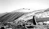
Witter Peak is located in Arapaho national forest, just north of the town of Empire Colorado. Witter is located just off of the continental divide on the same mountain range as Mt. Bancroft and James Peak. While Witter is not the tallest mountain in the area it is, in my opinion one of the most rewarding summits offering a variety of both technical and walk up routes. One of the added advantages of climbing this mountain is the solitude, while there is a small cairn at the top of the mountain there is not much of a path leading to it, from any direction. So if you like to “bushwhack it” it and enjoy solitude give Witter a try.
 |  |  |
Getting There
There are other ways to obtain the summit of Witter but the easiest starts at the Bill Moore Lake TH. The road (dare I say road) is actually a 4 wheel drive path. The Bill Moore Lake loop is rather popular with 4 wheeling enthusiasts; this has much to do with the very large mud hole just below Bill Moore lake. 4 wheel drive is not necessary but highly recommended if you don’t want to walk a long ways. Most 4 wheel drive SUV’s will be able to get fairly close to the TH but there is a very steep portion that may require good tires (a locking differential wont hurt either!), my friends stock Pathfinder just barley made it up this portion.
Take I-70 west from Denver toward Georgetown. Just a few miles before the town take exit 233 onto interstate 40. Follow this into the town of Empire. In the middle of the town take Park Ave, follow the road until it turns into North Creek Rd (FDR 171.1). Continue on this road until you get to the top of a ridge, follow this north, staying on the east side of the ridge (FDR 171.2) just a little past it. There will be three junctions fairly close together, take a left on each of these. This will take you to FDR 183; follow 183.1 to Bill Moore Lake. There should be plenty of parking at the lake and just a little bit further down the road by the mud hole.
Road Length: About 6 miles
Elevation Gain: Around 3000ft
Route Info
The trail starts off going around the southern part of Bill Moore Lake around the shoreline. The Non-technical route follows the Valley floor, there is some what of a trail but much of it relies of the hiker to do a little route finding around some of the obstacles (streams, steep sections and scree). The route is fairly straightforward; as you can see your path of accent the whole route, just remember to keep heading west. There are a couple of choices you can make: continue on to the saddle between Mt. Flora and Witter Peak (Continental Divide) or you can branch off to the short scree field that goes up the South west side of the mountain. Which ever you choose just make sure to be careful and have a safe trip!!!!!
Current Weather Conditions for Empire.
Red Tape
There are no permits are fee's for this area.
Witter Peak resides in bothClear Creek County and Arapaho National Forest.
For information and contacts.
When To Climb
This mountain is usually climbed when there is access to the trailheads (no snow on the 4x4 routes). While a winter approch via Bearthound Pass is possible, it is prone to deep snow and high winds. The best times to climb are late June to mid September. Or when ever the 4x4 road is snow free.
Camping
Dispersed camping is aloud in the area. There are a number of good places to camp along the valley floor just past Bill Moore Lake, offering both shelters from wind and great views
Regulations and rules on dispersed camping.