-
 8715 Hits
-
 89.01% Score
-
 28 Votes
|
|
Mountain/Rock |
|---|---|
|
|
48.80578°N / 113.71946°W |
|
|
Glacier |
|
|
Hiking, Scrambling |
|
|
Summer, Fall |
|
|
7445 ft / 2269 m |
|
|
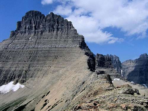
NEITHER TRUE SUMMIT NOR TYPICAL DAY HIKE!(Clicking on pictures will enlarge them, and also bring up information such as peak IDs.)
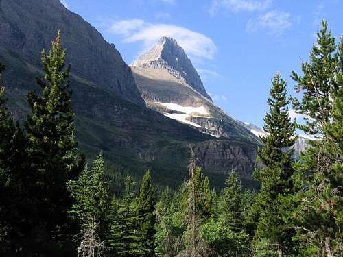
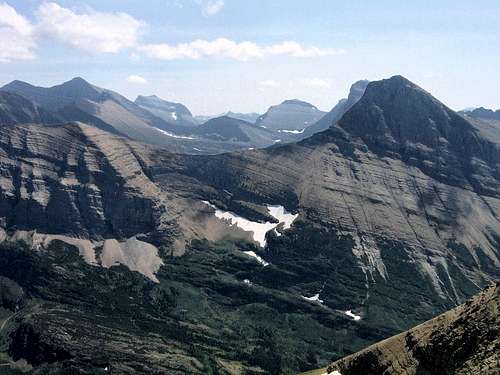
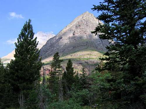 Bullhead Point comes into view; the siren call of Mount Wilbur close behind.
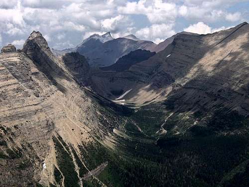
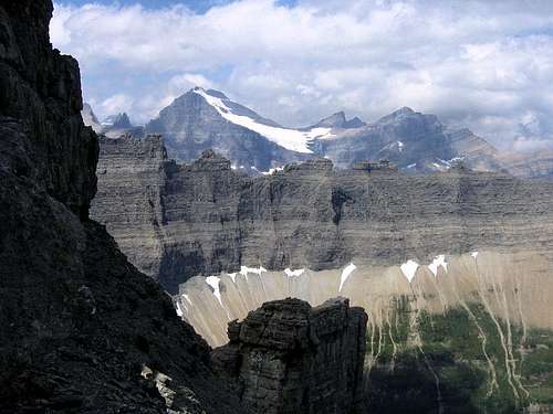
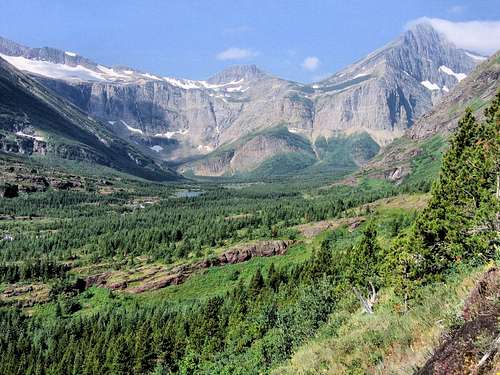 As we begin climbing, the Swiftcurrent Basin becomes breathtaking in its beauty!
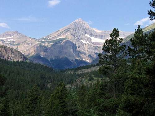
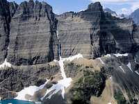
 A bit higher, Wilbur's shoulder sets off Swiftcurrent Mtn.
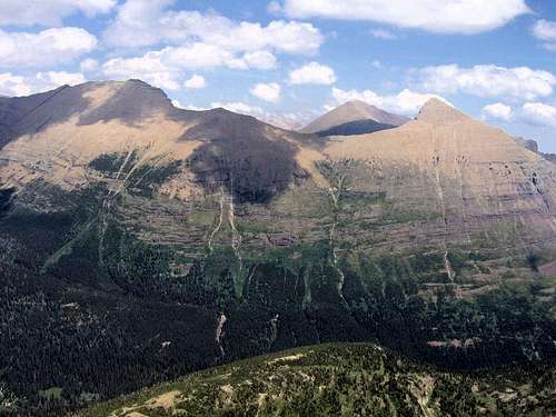
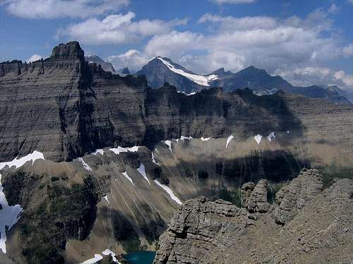
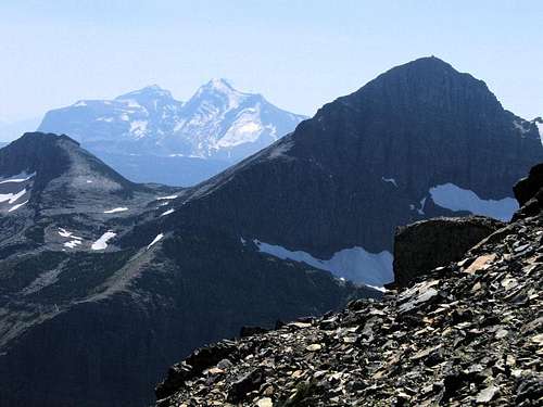
...and in conclusion, a nice reminder of what it's all about... 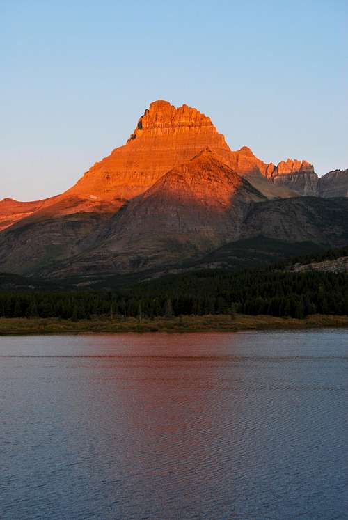 At days end, this nice photo by distressbark brings us back to theby now distant morning, where it all began. At days end, this nice photo by distressbark brings us back to theby now distant morning, where it all began.Route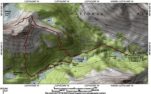 Bullhead Point/Wilbur Day Hike. Bullhead Point/Wilbur Day Hike.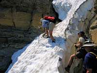 Chopping steps across a snow-filled couloir.
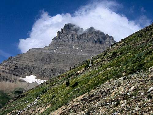
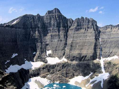
Red Tape, Wildlife, & Cautions Section
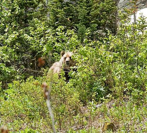
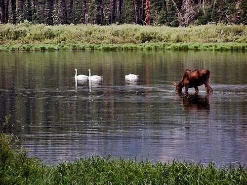
No permits required, but you must pay a park entry fee, which is $25 for one week, or $35 for an annual pass. Registration for day climbs in Glacier National Park is recommended, but not mandatory. Probably anyone prone to climbing in this part of the country already knows this, but the Northern Rockies are full of wildlife. Always be aware, and don't do anything stupid, like—for example—feed the bears, think that a mountain lion is even remotely related to your pet cat, or run up to a moose (moose are quite unpredictable, irritable, and very dangerous). And never, ever, EVER forget you're in grizzly country; they insist on being left alone—disagreement on that point is not an argument you'll win! Bear spray and noise should be part of every GNP foray you make into the back country. Black bears will be found in the forests, grizzlies commonly venture onto the above-timberline tundra, sometimes, when in pursuit of such delicacies as ladybugs or cutworm moth larva, even to the summits! Also note that improperly stored food in park campgrounds (i.e., scraps left around the table or campfire, or edibles in your tent rather than your car) will subject you to a $50 fine. If you wander off, leaving your pack unattended, and there is food in it which attracts the attention of, for example, a bear, it is also a fine. Folks, the Park Service is serious about not providing human food access to the critters! When to Climb, & Climbing ConsiderationsFrom late June/early July (during this time frame expect LOTS of snow in the high elevations) to early fall, depending on snow conditions. Traditional climbing season in the Northern Rockies is July, August, and September—with September weather becoming progressively colder and more unstable (sometimes dramatically so: PAY ATTENTION!) as the month progresses—but does of course vary from year to year. There are occasional winter climbs in the park, but not often, and then only by well-equipped, area-wise, extremely competent individuals. Basically, most of GNP is inaccessable through the winter, and avalanche danger, to put it mildly, is extreme almost everywhere. CLIMBING CONSIDERATIONS Because of the nature of the rock, there are special considerations regarding climbing in Glacier National Park, and grading systems unique to the Park have been developed by both J. Gordon Edwards and the Glacier Mountaineering Society. Anyone doing more than just "trail" hiking in this part of the Rockies should read the excellent and important information put together by Fred and Moni Spicker. Much—if not most—of the rock in GNP is sedimentary and rotten, and you need to know about it: Glacier National Park Rock & Grading Systems. Camping & LodgingThe Many Glacier Campground (sometimes referred to as the "Swiftcurrent Campground"—$20 per day—no reservations, first come first served basis) makes for a good, quick beginning to this climbing day hike! There are numerous campgrounds available within Glacier National Park. At Many Glacier there also are cabins with and without baths, a motel and a fancy hotel. There are showers available, and a restaurant immediately off the Swiftcurrent camping area. There are also many campgrounds—USFS, KOA, and private commercial—as well as motels just outside the park on both the west and east sides. Click here for General Camping Information, and click here for Current Site Availability in specific campgrounds. There are many accomodations and campgrounds on the Blackfeet Indian Reservation, which juts against the GNP eastern border, and includes the towns of East Glacier Park, Saint Mary, Browning, and Babb. Additionally, the park has a network of Backcountry Campsites, which are pretty much a requirement for multi-day treks; some of these are by reservations, some are first come, first served. There are application and length of stay restrictions; it's important to check the above link for relevant information. Current Conditions/Web CamsWeather page—an overview, plus current conditions and forecast This is the New NPS Web Cam Page.
External Links/Additional Information/Items of Related Interest
In TributeOn March 1, 2011, Vernon Garner, Saintgrizzly, left us after losing a bold, inspiring fight against pancreatic cancer. Or maybe he won, for he is at last free of his pain and has "shuffle[d] off this mortal coil." Vernon was an important contributor on SummitPost, but beyond merely making good, informative pages, he actually inspired many who read his work. No one put more work into his or her pages than Vernon did, and many of those pages, especially those related to Glacier National Park, the place he loved above all others, are works of art in both the writing and layout. More than one person has wanted to visit Glacier or go back to Glacier largely due to what he shared about that magnificent place. Many people on SP counted Vernon among their friends, and many more saw him as one of the best, one of those who exemplified the spirit of this site. He was one of the best of us, he will be missed, and he will not be forgotten. As a tribute to him, Vernon's pages will remain in his name. Any member who sees a need for an addition or correction should please contact site management via the "Send PM to the Elves" feature. Rest well and climb on, Vernon. |