|
|
Mountain/Rock |
|---|---|
|
|
48.83715°N / 114.0241°W |
|
|
Flathead |
|
|
Hiking |
|
|
Summer, Fall |
|
|
9638 ft / 2938 m |
|
|
Overview
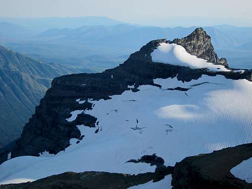
Vulture Peak is one of the North Fork massifs visible from many parts of the park. Its remoteness requires several days of off-trail trekking to be able to attempt this climb. With its phenomenal views it is well worth the effort.Getting There
While Vulture Peak is clearly visible from the North Fork, the best access point is from the Gyrfalcon basin. This is best accessed via West Flattop, Trapper Peak, and the Honey-Muhn lake basin just to the west of Trapper. West Flattop can be accessed from Packer’s Roost, Goat Haunt, or Logan Pass with a solid day of hiking and a bit of bushwhacking (not bad by Glacier standards). It requires at least two days of largely off-trail travel to reach the Gyrfalcon basin, so excellent navigational skills are crucial and a deep familiarity with the park is ideal. A GPS is an incredibly valuable tool to have on this trip. J. Gordon Edwards has additional information on accessing the Gyrfalcon basin, though note the West Flattop trail has been abandoned since his writing. However, fleeting portions of it can be found, especially the half mile section that ascends from Kootenai Pass. Try this GPS point to locate the bottom of the trail: UTM Zone 12N 287554 5414389 (NAD 83) and the top: 12N 287249 5414604.Route
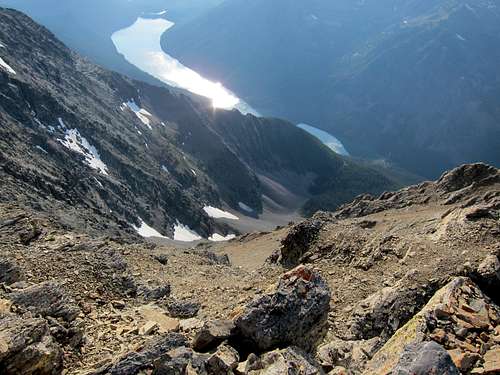
As with any mountain, there is more than one way to the top. Vulture has been climbed by people with access to a boat on Quartz Lake. Not having a boat would require a substantial bushwhack to access a route that contains class 4 and apparently endless scree on this side of the mountain, which looked utterly unappealing to this author from the Vulture summit (see additional image at the bottom of the page). The Gyrfalcon Lake approach is much more highly recommended. As mentioned, consult J. Gordon Edwards for details on the numerous approaches into the Gyrfalcon basin (1. Northern traverse of Thunderbird and The Guardhouse from Brown Pass. 2. Bushwhack from Waterton (not recommended). 3. Bushwhack from Logging (really not recommended). 4. Hike in via West Flattop, Trapper Peak, and the Honey-Muhn Basin (highly recommended).)The route from Gyrfalcon is largely class 2 with a bit of class 3. This route can be completed in a half day from the lake.
These pictures were taken in mid-August in a heavy snow year. Though it did not present any problems or necessitate ice axes, late season snow should be a consideration in the timing of this climb. As viewed from the lake, there is a prominent knob on the ridge to the left (southeast) of the summit. The route begins along the lake shore and follows any navigable, slanted rock slab to the saddle between the knob and the bulk of Vulture peak.
From this point Edwards says you can ascend the largely class 3 ridge. Just above the saddle we encountered substantial class 4 and abandoned any attempt at the ridge entirely. Luckily the south face of Vulture beyond this point is largely class 2 with a bit class 3. It is classic Crumbles National Park loose scree and talus so bring your trekking poles!
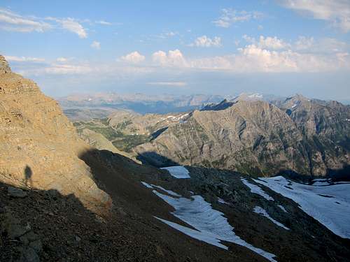
We traversed on the talus below the cliffs, as seen in the picture on the right, and begun angling upwards as soon as we felt comfortable. The summit lies to the northwest so continuous angling is required. We obtained the wonderously solid ridge (compared to the rest of the mountain) about a quarter mile from the summit. Gaining the ridge sooner would be possible with more exposure to class 3 terrain and less to class 2 terrain.
Camping
You will need an undesignated backcountry permit.Red Tape
You’ll need to pay the park entrance fee and obtain a backcountry permit for wherever you decide to camp.External Links
Glacier National Park's Backcountry Camping PageThe Climber's Guide to Glacier National Park by J. Gordon Edwards
Side trip suggestions
Summitting Trapper Peak on the way into Gyrfalcon is really a requirement of the route if you're coming from the 50 mountain/Packer's Roost area. Cliffs and vegetation make any route not including the summit quite difficult. Navigating the ridge to Geduhn from Trapper is possible, though it may involve one small class 4 section.From Gyrfalcon Lake, Nahsukin and Redhorn make an excellent day. Though Nahsukin is much shorter than nearby Vulture, like Trapper, it's location makes the views incredible. The ridge between Nahsukin and Redhorn is easily walkable. Redhorn is the only peak in the park more than 4 miles from a trail! (thanks DK) From Redhorn you can drop into the Carter Glaciers area and explore northwards towards Jefferson Pass. Traversing along the series of lakes below Redhorn and Nahsukin makes for an interesting return to Gyrfalcon. We did not discover a good route from the saddle between Carter Glaciers and Redhorn down to the first lake - I'm not sure a route exists that doesn't involve some steep sidehilling on bear grass - but that section is short and worth enduring to see the lakes and not gain the ridge again. If you're all the way back there, might as well spend some time exploring! I'd recommend 6 days total if you're starting and ending at Packer's.


