Overview
![]() Layout designed for best viewing on a "1024 x 768" screen.
Layout designed for best viewing on a "1024 x 768" screen.
Cataract Mountain in September

|
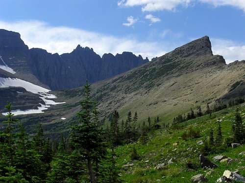
Cataract Mountain is located near Piegan Pass on the east side of the continental divide in Glacier National Park. The featured view from Cataract is the nearly 3,000 foot southeast face of Mount Gould. Located at the top of two water filled valleys that drain snowfields and glaciers, the trail approach to Cataract Mountain holds views around every corner.
To view additional photos related to the text please follow the links that are
CAPITALIZED.
To visit Glacier National Park is to enter a place where Heaven touches Earth
affording brief glimpses into the Wonders of Creation.
|
Why The Name Cataract Mountain?
Internet search results yield no known record of the reason for naming this peak Cataract Mountain.
Place Names of Glacier National Park states that George Bird Grinell named this mountain Cataract Mountain. We also learn that the Blackfoot name,
Inikokaup or Buffalo Painted Lodge as the mountain was called this for a reference to a tipi of a Medicine Man.
Looking at the English name reveals some interesting information. By looking at the derivation of
cataract we find that Cataract derives from the Latin
cataracta meaning "
waterfall" and the Greek
kataraktes and
katarrhaktes, from
katarassein meaning "
to dash down" (
kata-, "down";
arassein, "to strike, dash").
It just so happens that there
are WATERFALLS that dash down the steeps around Cataract. Some of them can be seen from the summit of Cataract Mountain. Looking across the valley to the Garden Wall reveals a number of waterfalls which validate the name for this unique mountain. The route to Cataract from Siyeh Bend also has numerous streams and waterfalls. Perhaps this is the reason this unique peak was given this name.
![Piegan Falls]() Piegan Falls. Piegan Falls. |
![Siyeh Creek]() Siyeh Creek along the trail. Siyeh Creek along the trail. |
![Many Glacier Valley]() Waterfalls coming off of Garden Wall. Waterfalls coming off of Garden Wall. |
The named waterfalls near Cataract include: Morning Eagle Falls, Feather Plume Falls and Grinnell Falls on the North side of Piegan Pass which together form Cataract Creek as it flows into the Many Glacier valley. On the south side of Piegan Pass the most obvious water fall is Piegan Falls which come from Piegan Glacier in the hanging valley on the northeast side of Piegan Mountain. There are also other waterfalls closer to Siyeh Bend but they are more difficult to see due to vegetation blocking the view.
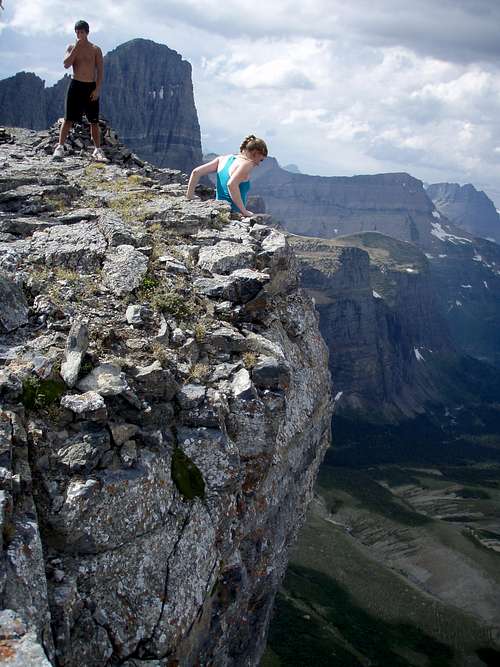
Melaine and Mike on the summit of Cataract with The Garden Wall in the Background, echoguy photo.
![Looking over the edge of Cataract with Gould in background.]() |
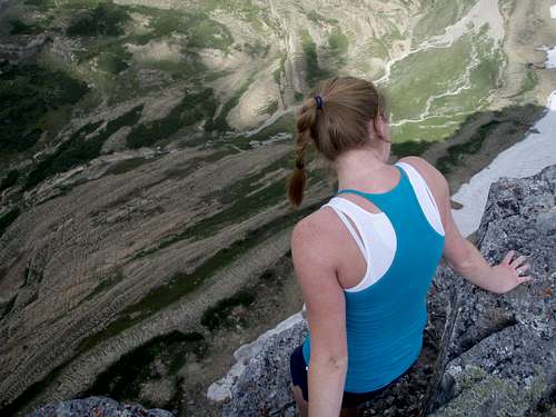
Standing on the summit of Cataract Mountain feels odd. At a very respectable 8,180 feet the only thing it towers above is a portion of the valley floor some 1,500 feet below the summit, yet surrounding it are peaks that stand over 9,000 feet and one, Siyeh, that is over 10,000 feet in elevation. This produces an incongrous juxtaposition, feeling high above the valley but much lower than the surrounding peaks.
Steep walls surround Cataract Mountain and the views........................................... well take a look for yourself!
Melaine looking down 1,500 feet to the valley floor, echoguy photo.
![The Face of Cataract]() |
![Cataract Cliffs]() The view of the face from Cataract, photo by Vantana. The view of the face from Cataract, photo by Vantana. |
![Many Glacier Valley]() Many Glacier and The Garden Wall. Many Glacier and The Garden Wall. |
![Pollock from Cataract]() Pollock Mountain from Cataract. Pollock Mountain from Cataract. |
Surrounding Cataract Mountain are: Siyeh, Matahpi, GTTS, Piegan, Pollock, The Bishops Cap, The Garden Wall, Mount Gould, Angel Wing, Grinnell Peak, Grinnell Point, Many Glacier Valley, Henkel. Distant views include Blackfoot and Jackson basins and the numerous peaks towards the east central areas of Glacier.
The nearly 1,500 foot face of Cataract does not nearly rival the 4,100 foot drop off of Siyeh to Cracker Lake or the 3,000 foot drop from Mount Gould but it is rather impressive to stand beneath it and look up at the summit.
Another family friendly route that gains a little over 2,300 feet in about 5 miles. Don’t let the Family Friendly moniker dissuade you from making this trip. It is great off-day stretch for hardcore climbers as well.
Cataract Mountain is not a featured peak in J. Gordon Edward's, A Climber's Guide To Glacier National Park. The only mention is made on page 266 in the description of the Piegan Pass Route for climbing Mount Siyeh which starts on the south side of Cataract Mountain where it connects with Siyeh. Flora
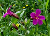
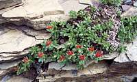
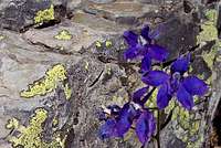
Wildflowers abound in years of adequate moisture. Some years like 2008 yield wildflowers for longer than usual.
![Explorer s Gentian]() Explorer's Gentian Explorer's Gentian |
![Lewis Monkey Flower]() Lewis Monkey Flower Lewis Monkey Flower |
![Red Sedum]() Red Sedum Red Sedum |
![Mountain Douglasia]() Mountain Douglasia Mountain Douglasia |
![Yellow Columbine]() Yellow Columbine Yellow Columbine |
![Low Larkspur]() Low Larkspur Low Larkspur |
Getting There
![Garden Wall and Gould from Cataract]() Garden Wall and Mount Gould from Cataract. Garden Wall and Mount Gould from Cataract. |
![Cataract Mountain from Piegan Saddle]() Cataract from Piegan Saddle Goat Trail Cataract from Piegan Saddle Goat Trail |
![Going-to-the-Sun from Gould]() Cataract from Mount Gould. Cataract from Mount Gould. |
Glacier National Park’s Cataract Mountain is located in Northwest Montana. Getting to Montana is not an easy task, but it is worth the effort. Information on visiting Northwest Montana and all of the other things to do can be found at Visiting The Flathead Valley.
Glacier International Airport serves as the air hub for northwestern Montana. Horizon, Delta Connection and Northwest Airlines service this area. Rail service via Amtrak arrives daily from Minneapolis or Seattle stops in East Glacier, Essex, West Glacier and Whitefish. The valley is also served by bus service. If you are interested in rental cars upon your arrival they can be secured in the Flathead Valley near Glacier International Airport.
The major highways serving northwest Montana include Montana State Highways 2 running east and west and Highways 83 and 93 running north and south. Glacier National Park is located 160 miles north of Interstate 90 which runs through the southwestern portion of Montana.
Click here for Road Information regarding conditions, repairs and delay schedules as well as estimated opening dates.
Glacier's Shuttle System
![Siyeh Bend Shuttle Stop]() Siyeh Bend Shuttle Sign
Siyeh Bend Shuttle Sign
The 2010 shuttle system runs from July 1 to September 6, 2010.
Glacier National Park began offering a FREE shuttle service in 2007. This is a great option for exploring the park. The shuttle runs the entire Going-to-the-Sun Highway from St. Mary on the eastern border of Glacier to Apgar, near Lake McDonald, on the park’s western boundary. Some climbs are close enough to the shuttle route and are short enough in time requirements to allow use of the shuttle service. Piegan is one such climb. The earliest shuttle’s depart from Apgar at 7:00 a.m. and generally take 1.5 to 2 hours to reach Logan Pass due to road construction on the Westside of the Logan Pass.
Trips from St. Mary are generally less lengthy and take an average of 60 minutes from St. Mary to Logan Pass. The first shuttle departs St. Mary at 7:00 a.m. The last shuttles depart from Logan Pass at 7:00 p.m.
The Park Service recommends being prepared to wait for shuttles with proper clothing, foot gear, water, snacks and other gear such as sun screen.
See the Glacier National Park’s website for more information at Shuttle Service.
Red Tape
![Cataract MT]() Cataract Mountain from the Piegan Pass Trail, Vantana photo.
Cataract Mountain from the Piegan Pass Trail, Vantana photo.
For all of the rules and regulations for Glacier National Park please visit the park website.
Vehicle single entry fee for Glacier National Park is $25.00 for 7 Days, $12.00 per person for single hiker, motor biker or bicyclist. An "America The Beautiful Federal Lands Recreational Pass" for goes for $80.00 which gives entrance to all National Parks, National Forests, BLM, US Fish & Wildlife, and Bureau of Reclamation sites for one year from date of purchase. See Plan Your Visit for other information regarding all of the National Park entrance fee information.
If you are planning on visiting Waterton Park make sure you have a passport to simplify crossing the border.
You do not have to register for day climbs in Glacier National Park but it is recommended. Backcountry travel regulations can be found at Backcountry Travel. There is also information from the Park Service on Mountain Climbing in Glacier.
As with all hiking and climbing in Glacier National Park use caution and practice good manners with the wildlife. You are in bear country. Carry your bear deterrent spray, don’t hike alone and make some noise. For more information please go to the Park's website for Bear Information. The U.S. Forest Service also has helpful information on Grizzly Bear Management.Route Information
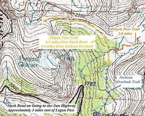
![Cataract Trail Map]() Trail Topo
Trail Topo
Distance to summit
4.5 mile on Human Trails
.5 miles of class 2 scrambling
Elevations:
Total elevation gained: 2,330 feet
Siyeh Bend: 5,850 feet
Piegan Pass: 7,570 feet
Cataract Summit: 8,180 feet
An up-to-date guidebook for this route can be found in Climb Glacier National Park, Routes for Beginning and Intermediate Climbers; Volume 1: Logan Pass, The Garden Wall, and Siyeh Bend. Purchase it when you arrive in northwestern Montana or purchase it on-line at Climb Glacier National Park.
Trail Directions: Total Elevation Gain This Leg: 1,720 feet
Walk along Siyeh Creek then uphill to the first trial junction. At this junction the correct trail follows the left fork as you walk below Going-to-the-Sun Mountain and Matahpi on the right and Piegan Mountain and Piegan Glacier on the left. The PIEGAN PASS SIGN is 2.8 miles from Siyeh Bend. At this junction take the left fork again. The right fork leads through Preston Park to Siyeh Pass and a route for Siyeh Mountain. In 1.8 more miles Piegan Pass will be reached. Guard your belongings from ANIMALS while resting in rocks at Piegan Pass, the MARMOTS are quite used to humans and will get into your pack looking for salt or food.
![Summit Route Topo]() Summit Route Topo
Summit Route Topo
Off Trail Directions: Total Elevation Gain This Leg: 610 feet
The off trail route gains 610 feet to the summit of Cataract Mountain. The ROUTE CLIMBS ALONG THE RIDGE from the highpoint of the Piegan Pass trail.
Avoid the temptation to ascend or descend on other routes. Ascending too early can lead to CLIFFS that can easily be avoided by waiting to ascend until reaching Piegan Pass. A descent on other routes to the north and south leads to STEEP CLIFFS AND LOOSE SCREE FIELDS. Descending through the grass slopes seen from the summit may seem reasonable but that decision leads to LOOSE BOULDER FIELDS that are unstable and a slope that is considerably steeper than the ridge route.
Side Trips to Some of Glacier’s Featured Peaks:
Within easy reach are Piegan Mountain, Pollock Mountain and Bishops Cap. While approaching on the trail to Cataract the routes for Going-to-the-Sun, Matahpi and Mount Siyeh are passed by.
Alternate Approaches
Include trail from Many Glacier's Grinnell Glacier Trail as well as off-trail approach via Lunch Creek to Piegan-Pollock Saddle and then DOWN TO PIEGAN PASS.
One interesting geologic feature is the FRACTURE OF THE DIORITE SILL on Cataract's northwest face. This was pointed out by Fred Spicker.
Special Considerations:The rock in Glacier Park is widely varied and it is not unusual to find several different types of rock on any given route. Know your rocks and be certain of your safety. J. Gordon Edwards has an excellent section in his guidebook on rock and climbing safety. Be safe and know your limitations as well as those who are climbing with you. Also refer to the following links for further details: GNP Rock and Grading System and the GMS Climbing Guidelines. When to Climb
This route could be climbed as early as May and as late as October depending upon snowfall from the previous winter.
If earlier or later climbs are planned be prepared to deal with a lot of snow and significant risks of avalanches.Weather and Camping
![Siyeh Bend from Cataract]() Siyeh Bend from summit of Cataract, britishbulldog33 photo.
Siyeh Bend from summit of Cataract, britishbulldog33 photo.
Montana gets its share of interesting weather. On June 8, 2008 over 2” of snow fell in the Flathead Valley and up to 24” inches of new snow in the Glacier National Park high country.
In some years there is record snowfall in the mountains of western Montana. In the recent years all of the northwest Rocky Mountains have been under severe drought conditions. The winter of 2007-2008 finally broke the string of below average snow fall and there is still snow lingering in the high country in spots that usually don’t have snow in mid summer. This certainly has helped hold the wildfires at bay.
Any climbing or hiking in Glacier is much more pleasant if the weather cooperates. To see the latest weather visit Glacier Park Weather.
![No Camping]() No Camping at Logan Pass
No Camping at Logan Pass
There is no camping available or allowed at Cataract Mountain.
Camping at Logan Pass is not permitted.
The options for camping include:
GNP Campground Information, USFS Campgrounds, Camping on the Blackfeet Reservation or East Glacier Campgrounds Equipment
![Loose Rocks on Cataract]() Cataract Mountain has a lot of loose rock on the approach bring sturdy footwear!
Cataract Mountain has a lot of loose rock on the approach bring sturdy footwear!![Cataract Mountain]() Part of the NE Face of Cataract
Part of the NE Face of Cataract
Crucial gear includes: bear deterrent spray, water, sturdy footwear and a camera. There is water available at Siyeh Bend in Siyeh Creek make sure you have a water filter unless you want beaver fever.
Hiking poles will help stabilize footing while ascending and descending on the unstable rocks on the lower portion of Cataract. External Links
Glacier National Park in Pictures
Glacier Mountaineering Society
Logan Pass Trails
Visit Montana
 23491 Hits
 91.75% Score
 36 Votes


