I have been requested to split my previous Area page of Gran Paradiso Group because of its too big dimensions: consequently its consultation was difficult in particular for the SPers without fast connection to the net
What's New
CHRONOLOGICAL DEVELOPMENT
February 10, 2006: growth of this page from a rib of Gran Paradiso GROUP, which consultation was difficult because of its too big dimensions, in particular for the SPers without fast connection to the net.
March 15, 2006: The page isn't yet finished, but thanks to the important contribute by Andrea Perino the backbone of the page now exists.
March 17, 2006: added by Andrea the section: "Historical Outlines"
November 06, 2006: added some informative shots concerning summits, lakes and bivouacs thanks to parteripario
February 11, 2007: added the section "Panoramic views"
Further specific information concerning single summits belonging to the Gran Paradiso Group posted in SP can be obtained from the following interactive list, ordered according to the submission date:
Interactive map showing location, name and height of the summits posted on SP
Overview
The Southern sector of Gran Paradiso Group can be considered as a distinct subgroup of the massif for three main reasons.
The first one is its belonging of the southern sector to Piemonte (Piedmont), whereas the Northern sector is included in Valle d’Aosta: the W-E main ridge is the borderline between the two Regions.
The second one is the climate: in fact it is under the influence of the humid and warm southern currents coming from both Pianura Padana and the relatively nearby Mediterranean Sea, whereas the northern sector is usually protected by the main ridge. Therefore the weather is usually more cloudy and rainy on the southern side than on the northern one. On the other hand, for the same reason, in the piedmontese valleys the hiker can find a variety of flowers and trees in larger number than in the northern valleys.
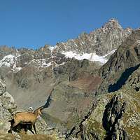
The third reason is the quality of the rock: in fact, in all the northern sector of Gran Paradiso Group the summits are very seldom composed of solid rock, (with few exceptions: the main summit of Gran Paradiso, the nearby Becca di Moncorvè, ...), whereas in the southern sector many mountains are worldwide-known for climbing routes on a good and sometimes excellent gneiss (i.e. Cima di Courmaon, Becchi della Tribolazione, Becco di Valsoera, Monte Nero, Punta Destrera, Gran Carro, Cima Fer, …).
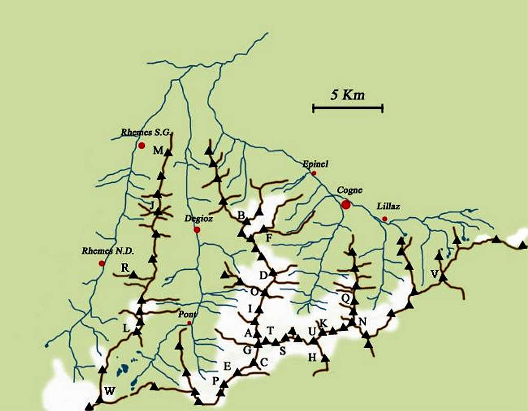
In the Piedmontese sector, starting from Valle dell'Orco, the main valley that runs from east to west (main built-up area: Ceresole Reale), a series of secondary valleys originate, directed approximately northwards: the "valloni" of Ribordone, Soana, Campiglia, Forzo, Eugio, Piantonetto, Noaschetta, Gias della Losa, Goi, Ciamousseretto, Roc, all divided by ridges less imposing than the ones in the Valle d'Aosta sector.
In particular Valle dell'Orco played a fairly important role in the history of rock climbing in Italy in the 1970s, while in the Vallone del Piantonetto one can find fantastic gneiss not only on the Becco di Valsoera, Becco della Tribolazione (as already pointed out) but also on many other local summits, drops up to 700 m and all kinds of difficulties.
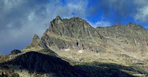
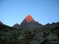
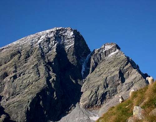
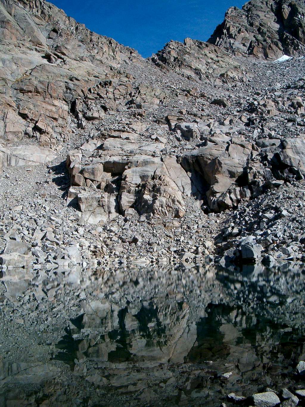
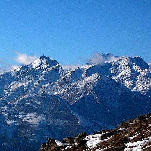
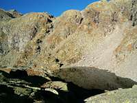
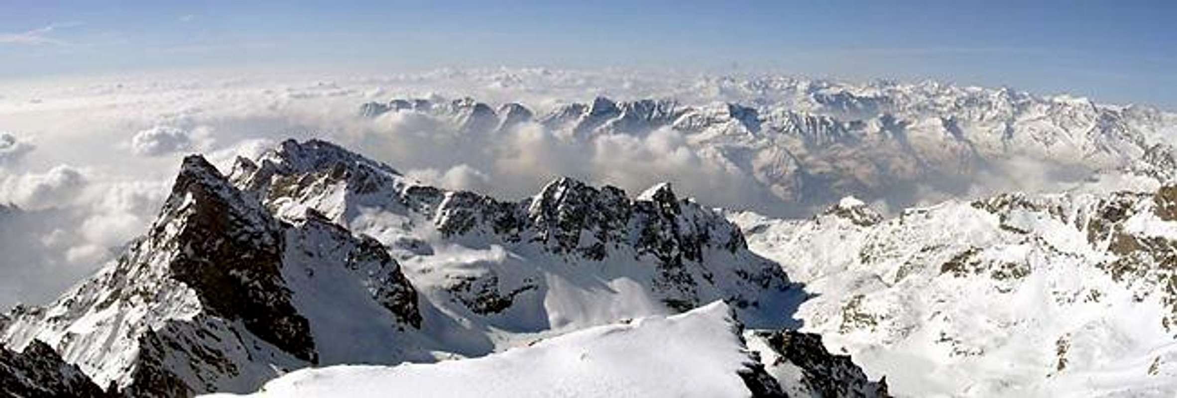
Southern side of Gran Paradiso Range seen from La Cialma 2193 m
SUMMITS
PASSES
1 – Ciarforon 3642 m.
1 – Colle del Ciarforon 3317 m.
2 – Tresenta 3609 m.
2 – Colle di Moncorvè 3294 m.
3 – Becca di Moncorvè 3875 m.
3 – Colle del Gran Paradiso 3345 m
4 – Gran Paradiso 4061 m.
4 – Colle della Becca di Moncorvè 3851 m.
5 – Cresta Gastaldi 3894 m.
5 – Colle dell’Ape (Col de l’Abeille) 3873 m.
6 – Punta di Ceresole 3777 m.
6 – Colle Chamonin 3698 m.
7 – Testa della Tribolazione 3642 m.
7 – Colle della Luna 3542 m.
8 – Testa di Valnontey 3562 m.
8 – Colle Baretti 3432 m.
9 – Becca di Gay 3621 m.
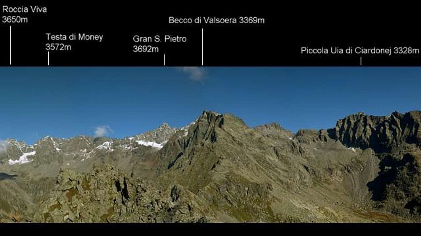
10 - Roccia Viva 3650 m.
11 - I Gemelli 3610/3618 m.
12 - Punta Elter 3603 m.
13 - Becco della Pazienza 3606 m.
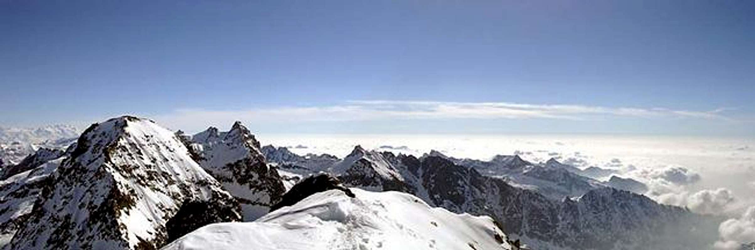
Panoramic Views from South
Panoramic view of Gran Paradiso Group from South (Monte Soglio): moving the cursor you can see the overall view
Panoramic view of Gran Paradiso Group seen from Cima delle Chiose, between Soana and Chiusella Valleys (Piemonte): moving the cursor you can see the overall view
Panoramic view of the summits at the head of Ribordone Valley, seen from Cima Loit: moving the cursor you can see the overall view
Getting there
BY CAR
Coming from Torino: motorway A5 towards Aosta - take exit "S. Giorgio Canavese" and follow the road SS n°460 towards Ceresole Reale as far as Pont Canavese (461 m)
Going North along ValSoana, after Ronco Canavese (956 m) get to Valprato Soana (1113 m): at a fork, going NE takes you to Campiglia Soana (1350 m), while going NW takes you to the upper valley to Piamprato.Before Ronco Canavese, turn left and go into the Valle di Forzo as far as the homonymous village (1180 m )
After Pont Canavese, continue along the SS n° 460 until Sparone (525 m): turn right and go into the Valle di Ribordone to get respectively Talosio, Schiaroglio, and Santuario di Prascundù.
After Locana, when you arrive at the village of Rosone (715 m), 16 km after Pont Canavese, take a small road on the right, following the sign "Vallone di Piantonetto": the road ends near Teleccio Lake(1870m).
After Noasca, the road climbs into a 5 kilometres long tunnel and then arrives at the upper wide basin where, on the shore of an artificial lake, there is Ceresole Reale (1613 m), 33 km after Pont Canavese.
From Ceresole starts a controversial road that enters Gran Paradiso National Park and, after Serrù Lake and Agnel Lake, climbs up to Colle del Nivolet (2612 m).Luckily the old absurd project to continue the road on the other side, in order to connect with Pont (Valsavarenche) through the Piani del Nivolet, was stopped in time. Actually the cars must stop at Serrù Lake in the crowded periods of July and August, and there is a bus service to get Nivolet Pass.
BY TRAIN and BUS
From Turin: local railway up to Pont Canavese, then bus (GTT - Tel. 011/5215523-57641 - 800990097) to Campiglia Soana and Ceresole Reale.
Handmade map of the Gran Paradiso National Park. In red the limits of the Park, in black the border between the northern sector (Valle d'Aosta) and the southern one (Piemonte)
Historical Outlines
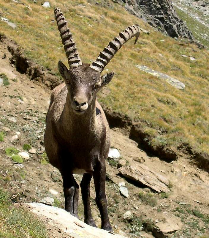
Before Roman invasion, all the valleys of the Gran Paradiso area were inhabited by a Celtic population called Salassi. The Romans exploited a lot of mines to extract lead, copper and gold. Just this precious metal gave the name to the Orco Valley: in fact in the local dialect the namesake river was called in the past "Eva d'Or" (gold water) due to the abundance of traces of gold into its water. After the fall of Roman Empire these valleys were almost uninhabited and often became hide-out of bandits. Under the Savoia Kingdom, after the suggestion of Giuseppe Zumstein part of the actual Park area in the niniteenth century was declared Royal Hunting Reserve, giving to the local populations the possibility to earn working to the building of houses and many kilometres of trails, useful to the King Vittorio Emanuele II to reach the hunting places with all his suite and equipments. Since his descendants were not involved in hunting, the reserve became National Park (1922). During the 2nd World War, almost all these valleys were base and hide-out of partisans; at the same time the animal of the Park (steinbocks and chamoises) reduced to few hundreds, risking to disappear. After 1945, thanks also to the work of prof. Renzo Videsott, Director of the Park until 1969, this danger was avoided and during the last years the Gran Paradiso National Park has contributed to the growth of tourism, with consequent advantages for the local population. The alpinistic activity began later than in the other parts of the Alps: the first ascent in the Group can be considered Torre Lavina by P.B. Chamonin and P. Chanoux 81856); after that other alpinists (Frassy, Baretti, Barale, Martelli) in the years between 1866 and 1874 climb Monveso di Forzo, Tresenta, Punta Fourà, Ciarforon, Testa di Money, Roccia Viva, Punta di Ceresole. In 1875 Vaccarone climbs Becca di Gay, Becco Meridionale della Tribolazione and opens the "Piedmontese route" to the summit of Gran Paradiso. The collection of summits and routes proceeds till today, with a drastic increment of the difficulties after the '70s when the "Nuovo Mattino" rock-climbing movement forges a new generation of climbers which find, on the walls of Orco and Piantonetto Valleys, an ideal field of play (see the section "VALLE dell'ORCO, the Small Italian Yosemite Valley").
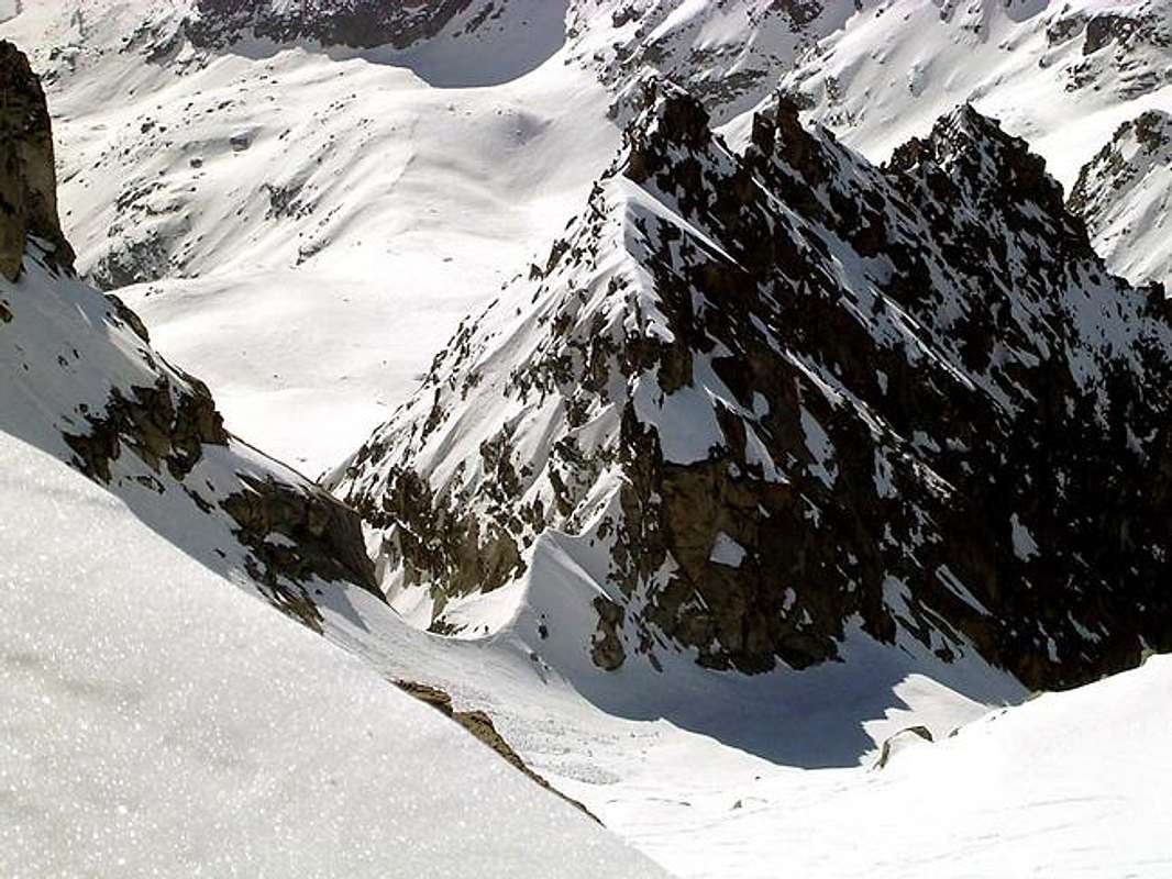
Ridges of the Southern Sector of Gran Paradiso Group
All the ridges start from the WE main ridge of the Group and run approximately from North to South.
Ridge Mare Pércia - Punta Rocchetta
Starting from Mare Pércia (3385m), a short ridge leads to:
Colle della Terraor Colle della Rocchetta (2911m)
Punta Rocchetta (2922m)
watershed Alpe del Medico Basin - Vallone del Roc
It starts from Testa del Grand Etret (3201m); going southward, one meets:
Colle della Porta (3002m)
La Cuccagna (3175m)
Colle di Courmaon (3077m)
Courmaon (3162m)
La Ciarma (2552m)
Colle Sià (2274m)
La Merola (2251m)
The southern side of La Merola forms the "Parete di Balma Fiorant," consisting of remarkable walls, whose different sectors bear the names of Parete delle Aquile (Eagles Wall), El Caporal (The Corporal) and El Sergent (The Sergeant)
Watershed Vallone del Roc – Vallone di Ciamosseretto
It is the ridge that starts from Ciarforon (3640m) and slopes down towards SE to the Orco Valley.
The main summits and passes (from N to S) are:
Colle della Torre (3185m)
La Torre (3225m)
Piccola Torre (3073m)
Bocchetta (2837m)
Cresta di Ciamosseretto: ridge with many summits, the highest one is 2784 meters o.s.l.
Punta di Ciamosseretto (2488m)
Watershed Vallone di Ciamosseretto – Valloni del Goui & di Noaschetta
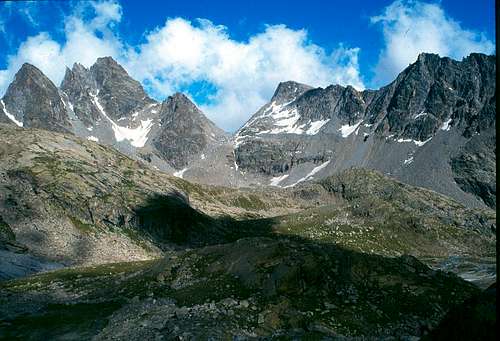
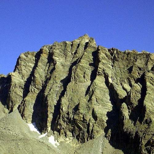
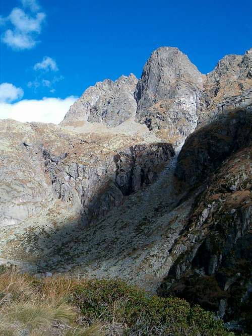
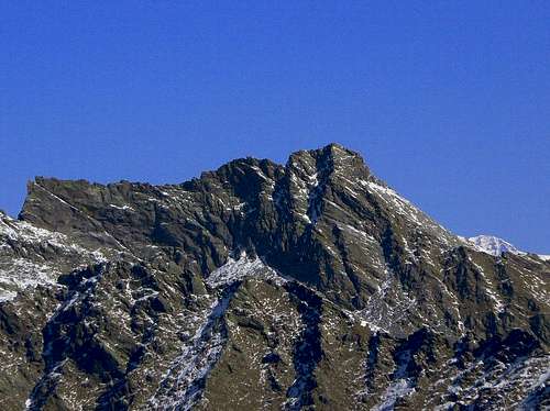
Cresta dei Proches (3223 m) seen from Alpe La Motta in the Noaschetta Valley
It starts from La Tresenta (3609m) and slopes down towards SE to the Orco Valley
Main summits and passes (from N to S):
Bocchetta di Goui (3139m)
Cresta di Prosces: a 5 Km long ridge with many summits, the highest one is 3223 meters o.s.l.
Bocchetta del Ges (2692m): a wide trail runs through this pass
Becco dell’Alpetto (2801m)
Monte Castello (2612m): many rock-climbing itineraries cover its E and S vertical walls made of an excellent gneiss.
Punta di Ceresole SSE spur
A ridge starts from Punta di Ceresole towards SSE, then it disappears under the rests of the Noaschetta Glacier and re-appears shaping a rocky mountain called Deir Vert (3202m).
Watershed Valloni di Noaschetta & del Gias della Losa – Piantonetto Valley
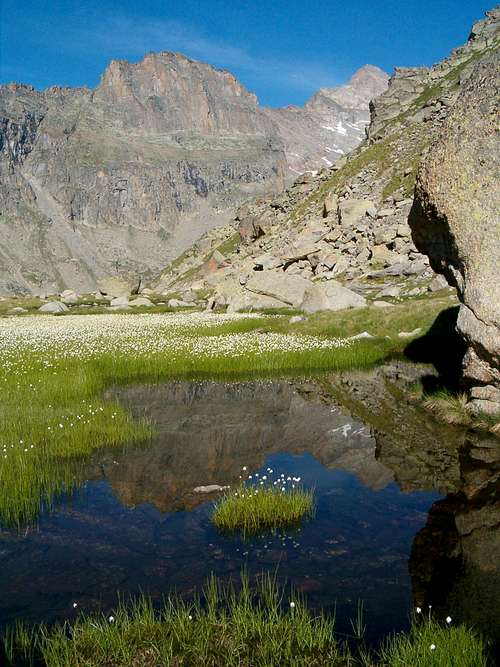
Becco Meridionale della Tribolazione, Punta delle Carnere, Becca di Gay and Monte Nero in Piantonetto Valley
It starts from the ridge that connect Becca di Gay and Roccia Viva; the first part divides Vallone di Noaschetta from the Piantonetto Valley, whereas the second part turns towards ESE dividing Piantonetto Valley from Orco Valley
Main summits and passes (from N to S):
Colle della Losa (3127m)
Becchi della Tribolazione: it is a sequence of four peaks
Becco Settentrionale della Tribolazione (3292m)
Punta Pergameni (3300m)
Becco Centrale della Tribolazione (3206m)
Becco Meridionale della Tribolazione (3360m)
The last summit, apart from being the highest one, is also the most famous climbing peak of the entire Graian Alps.
A secondary short ridge starts from it and culminates in Punta delle Carnere (2845m)
The main ridge follows with:
Colle dei Becchi or Colle di Noaschetta (2990m): it is the shortest passage to get the Ivrea Bivouac from the car parking of Teleccio Lake
Blanc Giuir (3222m): interesting climbing routes on its SW wall.
From here two ridges start:
a first one goes South-West and culminates in a series of unnamed summits above 3000 meters
a second one, going southward, includes in sequence:
Torri del Blanc Giuir (2724m)
Trasen Rosso (3060m)
Bocchetta della Drosa (2675m): useful to get most of the climbing routes of Gran Carro
Gran Carro (2988m): interesting and known climbing routes on its W wall
Punta del Carro (2777m)
Costa delle Fontane Fredde: long ridge covered of grass and trees, it divides Piantonetto Valley from Orco Valley.
Another short range going southward starts from Testa di Money (3572m), on the main West-East ridge of Gran Paradiso Group; it divides the upper part of Roccia Viva glacier from Piano delle Agnelere and includes:
Torre Rossa del Piantonetto (3450m)
Bocchetta di Monte Nero (3278m)
Monte Nero (3422m)
Watershed Piantonetto Valley – Valsoera Valley
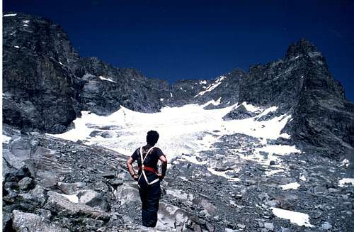
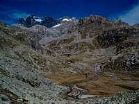
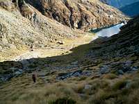
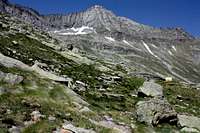
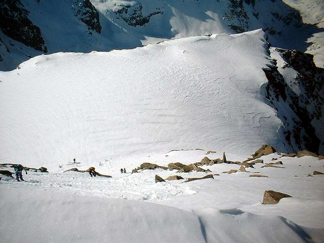
Panorama from Teleccio valley
Starts from Punta Scatiglion (3407m) and slopes down southwards
Main summits and passes (from N to S):
Punta di Teleccio (3310m)
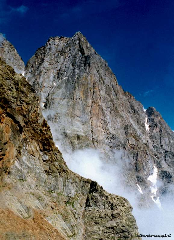
Becco di Valsoera (3369m): called also “Les Drus” of Gran Paradiso, thanks to its SW wall and W offset. Many difficult rock-climbing routes cover its walls, especially the SW.
Bocchetta di Valsoera (2683m): this pass is used to get Pocchiola-Meneghello bivouac close to Valsoera lake in the namesake valley.
Punta di Cialma Nova (2815m)
Punta di Fioni (2384m)
Subgroup Ciardonei-Gialin-Colombo
Punta Gialin 3270m
From Cima Occidentale di Valeille (3357m) starts a ridge that becomes very complex, originating several watersheds and relative valleys: the most important one is Ribordone Valley.
Ciardoney Pass (3152m): it is the easiest passage to connect Piantonetto and Valsoera valleys to Forzo and Soana valleys.
Piccola Uja di Ciardoney (3328m)It has a solid rock with some interesting climbing routes. A short ridge starts from here southwards, originating:
Punta Settentrionale di Valsoera (3234m)
Punta Meridionale di Valsoera (3038m)
Punta di Motta (2916m)
Going eastwards from Piccola Uja, one meets:
Grande Uja di Ciardoney (3325m)
Colle di Motta (3001m)
Punta Gialin (3270m)
In correspondence of this summit a secondary watershed slopes down southwards in direction of the Orco Valley, which highest summit is Moncimour (3167m): from here the ridge forks in two branches.The first one includes the following summits and passes:
Destrera Pass (2539m)
Monte Destrera (2596m): many difficult climbing routes on the excellent rock of its W wall
Cialma Linsor (2436m)
The summits and passes along the second ridge are:
Punta Virginea (2874m)
Alpuggio Pass (2560m)
Punta Rossa (2656m)
Praghetta Pass (2359m)
Punta Praghetta (2383m)
Colmetta (2183m)
From Punta Gialin the main watershed proceeds towards SE and one meets:
Gialin Pass (3070m)
Braias Pass (3002m)
Cresta Braias (3028m)
Lago Gelato Pass (2957m)
Piata Lazin (3055m)
From Piata Lazin a secondary ridge starts eastwards; it is named
Costa Vargnei (2838m)
Southwards of Piata Lazin one meets:
Bocchetta Fioria
Punta Lazin (2735m)
Punta Boiretto (2818m)
Here the watershed has another fork:
Watershed Eugio Valley – Ribordone Valley
Watershed Ribordone Valley – Soana Valley
that corresponds also to the vertex of the Ribordone Valley, an important valley entirely included in the southern sector of Gran Paradiso Group.
1. Watershed Eugio Valley – Ribordone Valley
Main summits and passes:
Bocchetta di Boiretto (2282m)
Monte Arzola (2158m)
Busiera Pass (1700m)
Punta Busiera (1815m)
Roc delle Teste (1790m)
Vardlà Pass (1640m)
Cima Tiriol (1601m)
Testa di Pertià (1454m)
Truc Bose (1392m)
2. Watershed Ribordone Valley – Soana Valley
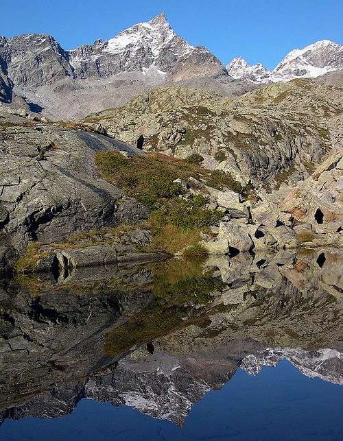
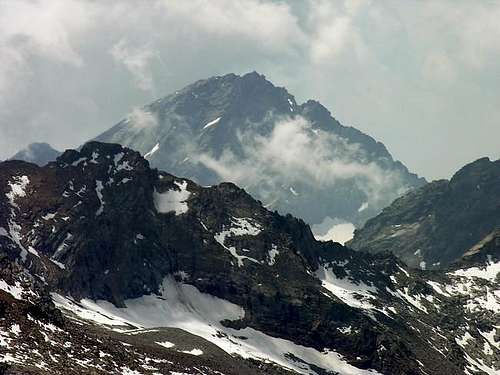
From left: Monte Colombo 2848m, the summit of Gran Paradiso covered of clouds and Piata di Lazin 3055m
Main summits and passes:
Bocchetta di Lazin (2724m)
Monte Colombo (2848m): it is one of the most climbed mountains in the Gran Paradiso southern sector; the view from the summit is spectacular and its normal route is easy; it has also some nice rock-climbing routes on a solid rock.
Bocchetta di Ciaval (2600m)
Punta Perra (2683m)
Punta Manda (2640m)
Punta Sili (2546m)
Colombo Pass (2326m)
Punta del Vallone (2479m)
Colle del Crest (2000m)
Cima Rosta (2173m)
Cima Loit (2036m)
L’Uja (1834m)
Punta d’Arbella (1879m)
Watershed Forzo Valley- Campiglia Valley
It starts from Torre di Lavina (3308m) and slopes down towards SE
Main summits and passes:
Cadrega Pass (2756m)
Cime di Cavallo (2847m)
Punta Tressi (2865m)
Bocchetta del Cucco (2461m)
Cima Fer (2646m): classic rock-climbing route on its E ridge
Watershed Campiglia Valley – Piamprato Valley
It is a short ridge that starts from Rosa dei Banchi (3164m) and slopes down southwards
Main summits and passes:
Borra Pass (2578m)
Punta dell’Orletto (2469m)
Monte Civetto (1965m)
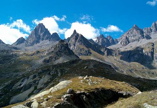
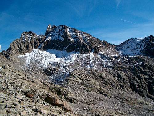
WE Main Ridge of Gran Paradiso Group seen from South
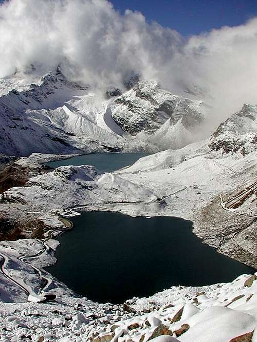
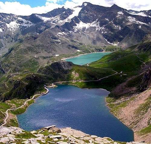
Lakes of Gran Paradiso southern sector
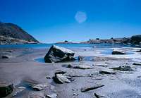
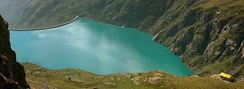
The number of the lakes is larger in the southern sector than in the northern one: both natural lakes and reservoirs are included in the list.
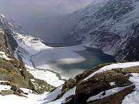
Lakes on the southern side of the watershed between Piemonte and Valle d'Aosta, beyond Nivolet pass
AGNEL 2284 m and SERRU' 2240 m LAKES
There are many other natural lakes and reservoirs:
lago di Ceresole Reale
laghi di Comba
laghi di Gias di Beu
laghi di Ciamousseretto
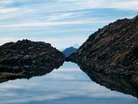
lago di Gay
lago di Teleccio
lago della Balma
lago di Valsoera
lago di Motta
lago d'Eugio
lago Nero
lago Losere
lago Gelato
lago Lazin
Lago Pian delle Mule
Lago della Muanda
Lago Valletta
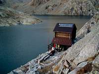
Refuges and Bivouacs
REFUGES
Rifugio Pontese 2217 m Tel. +39 0124 800186
In Val di Piantonetto: at the beginning of the Piano delle Muande di Teleccio, above the Teleccio reservoir (accommodates sixty, ten in winter room)
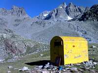
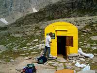
BIVOUACS
Pier Mario Davito 2360 m
Near mountain huts of Lavinetta, inside Vallone di Lavina (sleeps four)
Gino Revelli 2610 m
Near Pian delle Mule lake, inside Vallone di Ciardonei (sleeps six)
Gino Carpano 2865 m
At the head of Vallone di Piantonetto, at the foot of the east side of Monte Nero (sleeps nine)
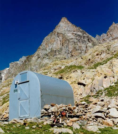
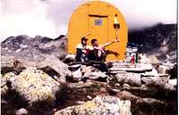
M. Pocchiola - G. Meneghello 2440 m
At the head of Valsoera, on the shore of the Valsoera lake (sleeps fourteen)
Ivrea 2770 m
At the head of Vallone di Noaschetta, below Gay lake (sleeps nine)
Ettore and Margherita Giraudo 2630 m
At the head of vallone del Roc, near Piatta Lake (sleeps six)
Pian della Ballotta 2470 m
At the head of Valle dell'Orco, above Serrù lake. It is an unattended refuge (sleeps twelve)
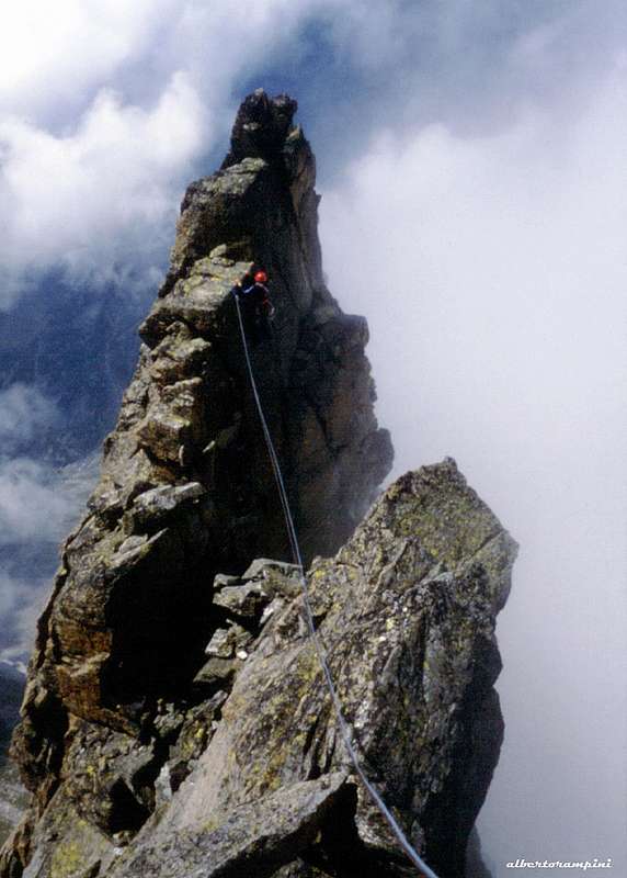
Images of Becca di Gay climb along the Normal Route by gmg
Climbing the couloir along the Becca di Gay Normal Route
Entering in the couloir of the Becca di Gay normal route
The top of the couloir of the Becca di Gay normal route
The top of the couloir from the upper glacier
Last meters of the Becca di Gay normal route
From left: Becco Merdionale della Tribolazione, Blanc Giuir and valle di Noaschetta
Roccia Viva from the summit of Becca di Gay
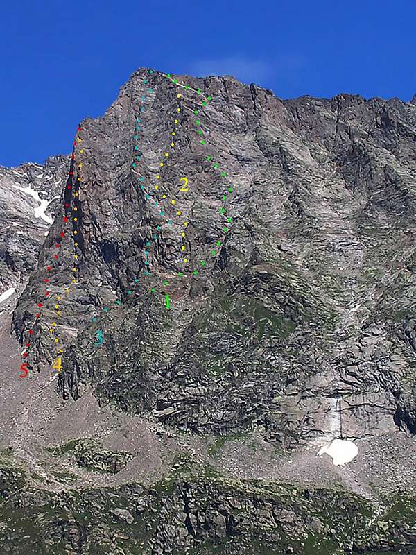
VALLE dell'ORCO, the Small Italian Yosemite Valley
Caporal - Valle dell'Orco (Piemonte, Italy)
Overlooking Valle dell'Orco, the southern aspect of the insignificant grassy summit of La Merola (2251 m) forms the "Parete di Balma Fiorant," consisting of remarkable walls made of augen gneiss (gneiss occhiadino). These walls played a fairly important role in the history of rock climbing in Italy in the 1970s. Starting from the right, the different sectors bear the names of Parete delle Aquile (Eagles Wall), El Caporal (The Corporal) and El Sergent (The Sergeant), in playful allusion to the famous El Capitan in Yosemite Valley. Choosing among the many routes a few historical ones:
EL CAPORAL
Via dei tempi moderni, TD,1972
Via dei camini, D+,1972
Via dello Scudo, TD,1973
Spigolo SE, TD, 1973
Via del sole nascente, ED, 1973
Diedro Nanchez, ED-, 1974
Itaca nel sole, TD+, 1975
Il lungo cammino dei Comanches, ED-, 1977
EL SERGENT
Via Cannabis, TD+, 1973
Fessura della disperazione, ED, 1974
PARETE DELLE AQUILE
Via delle Aquile, TD, 1974
Via della Grotta Fiorita, TD, 1975
Books and Maps
BOOKS
E. Andreis, R. Chabod, M.C. Santis "Guida dei Monti d'Italia - Gran Paradiso Parco Nazionale" Club Alpino Italiano / Touring Club Italiano, 1980 (in Italian)
L. Zavatta Le valli del Gran Paradiso e la Valgrisenche, guide dell'Escursionista, 2003 (in Italian)
M. Oviglia Rock Paradise Arrampicate classiche, moderne e sportive nelle valli del Gran Paradiso, Collana Luoghi Verticali, Edizioni Versante Sud, 2000 (in italian) suggested by Gasgenova
A. Gogna, G. P. Motti, "Escursioni ed arrampicate nel Canavese",Tamari Editori (in Italian) suggested by Brenta
MAPS
Kompass Gran Paradiso Valle d'Aosta Sentieri e rifugi-Carta turistica 1:50000
IGC-Istituto Geografico Centrale Valsavarenche Val di Rhêmes Valgrisenche Carta dei sentieri e dei rifugi 1:25000
IGC-Istituto Geografico Centrale Gran Paradiso La Grivola Cogne Carta 1:25000
I.G.M. -Istituto Geografico Militare Foglio 41 1:25000 I NO La Grivola - I SO Gran Paradiso - I NE Cogne - I SE Torre del Gran San Pietro - II NO Fornolosa - II NE Ceresole Reale - III NE Colle del Nivolet - IV NE Rhêmes Saint George - IV SE Rhêmes Notre Dame
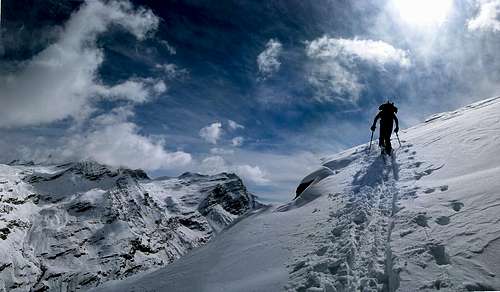
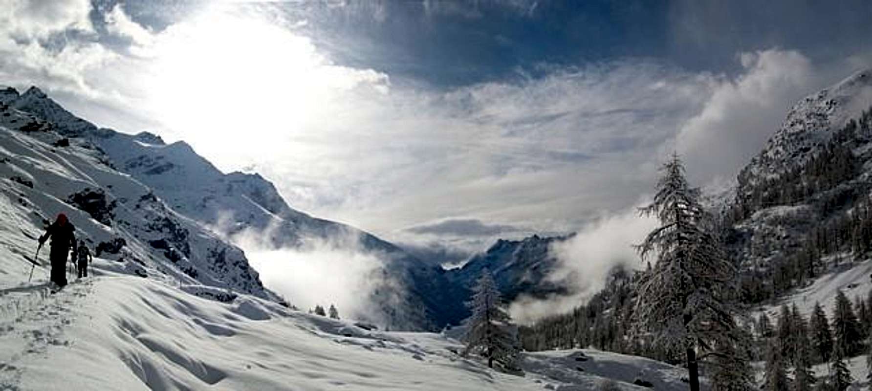
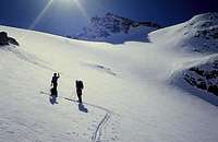
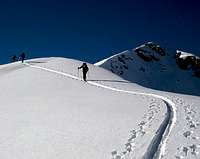
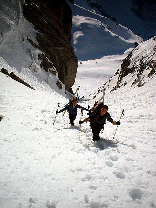
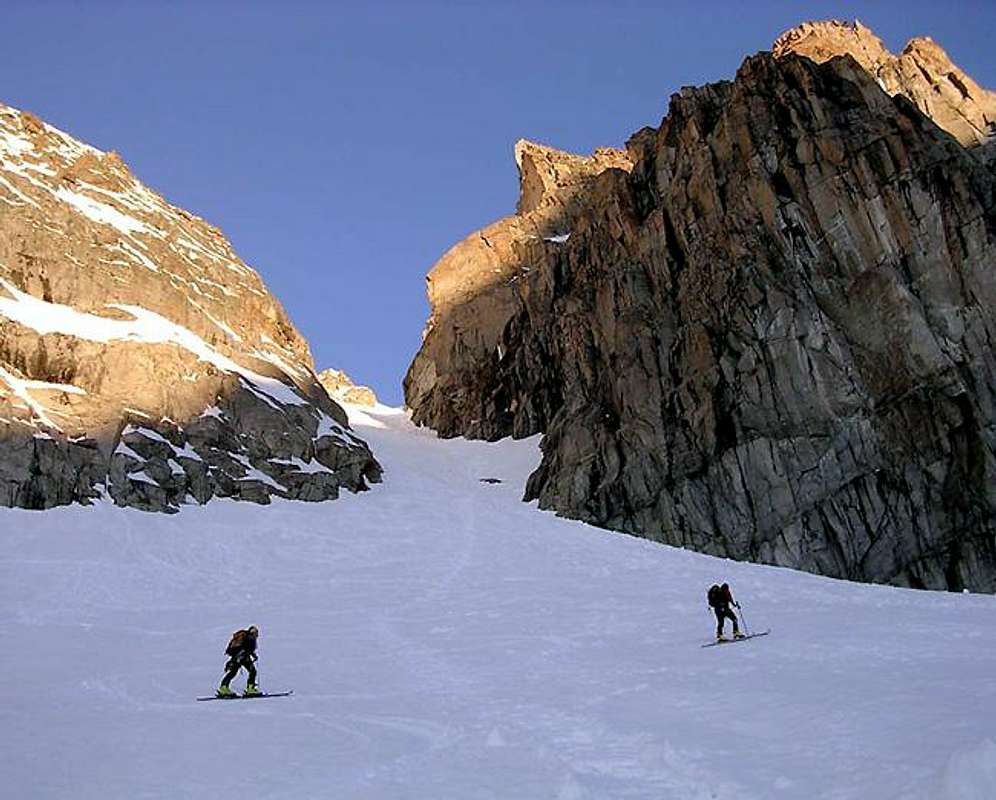
Ski mountaineering in Orco Valley
Meteo
Weather forecasting concerning both Piemonte and Valle d'Aosta can be found at nimbus.it
External links
P.N.G.P. official site It's the official site of the Parco Nazionale del Gran Paradiso ( in five languages)
parco.nazionale.gran.paradiso Another complete site concerning the Gran Paradiso National Park, with a lot of information (in three languages)
A mass balance 2002/2003 of Ciardoney glacier An evaluation of the status of Ciardoney glacier (on the Southern side of Gran Paradiso Group), that in the hot 2003 summer regressed 28 m and its depth decreased up to 4 meters
Children refers to the set of objects that logically fall under a given object. For example, the
Aconcagua mountain page is a child of the 'Aconcagua Group' and the 'Seven Summits.' The
Aconcagua mountain itself has many routes, photos, and trip reports as children.
Parents refers to a larger category under which an object falls. For example, theAconcagua mountain page has the 'Aconcagua Group' and the 'Seven Summits' asparents and is a parent itself to many routes, photos, and Trip Reports.


 25493 Hits
 88.61% Score
 27 Votes


")