
-
 14758 Hits
-
 83.69% Score
-
 17 Votes
|
|
Mountain/Rock |
|---|---|
|
|
39.71027°N / 105.92124°W |
|
|
Grand County |
|
|
Hiking, Mountaineering, Sport Climbing, Mixed, Scrambling, Skiing |
|
|
Spring, Summer, Fall, Winter |
|
|
13220 ft / 4029 m |
|
|
Overview
 Hagar Mountain Hagar Mountain |
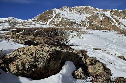
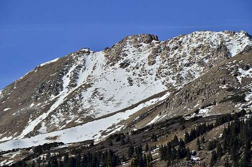
Elevation: 13220 ft / 4030 m Summit Coordinates: 39.71027°N -105.92124°W Rank in CO: 466 of 637 13er Rank in CO: 413 of 584 13er Rank in Range: 41 of 59 Hagar Mountain (13220 ft) is climbed from Dry Gulch, 4 miles west of Bakerville on I-70. After .02 mile keep to the north side of the creek , eventually reaching summit on it’s ridge. Citadel Peak (13294 ft) between Hagar Mt. and Pettingell Pk can be climbed from either. There is some tricky rock scrambling near the top. The entrance to Dry Gulch is flanked by Mt. Trealease (12,477 ft) and Mount Bethel (12, 705), the latter named for a prominent CMC’er who was responsible for bestowing names on several Front Range Peaks early in the century. Both are steep and easy ascent from a mile up gulch.
 Hagar Mountain. Hagar Mountain. |
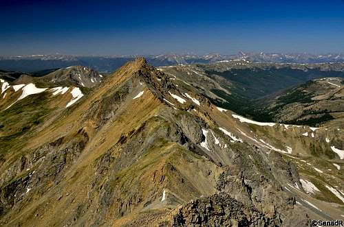 Hagar Mountainn from The Citadel. Hagar Mountainn from The Citadel. |
 Dry Gulch Trail. Dry Gulch Trail. |
 ''Golden Bear Peak'' ''Golden Bear Peak'' |
 Full view of Mount Hagar Full view of Mount Hagar |
 Direct line to the top. Direct line to the top. |
 Bellow Ridge Bellow Ridge |
 Interesting clouds. Interesting clouds. |
 Bellow summit Bellow summit |
 - View of Mt. Citadel. - View of Mt. Citadel. |
Getting There
From I70, between Bakerville and the Eisenhower - Johnson Tunnel, take Exit 216. The exit road passes south under I-70 on its way to Loveland Pass. Instead, turn right north and then northeast and park alongside a neglected access road, blocked to vehicles in about a half mile. Trailheads: Herman Gulch Driving from the Denver Metro direction (east): Drive west on I-70. At the Georgetown exit (Exit 228), continue on I-70 for 9.5 more miles and exit at Exit 218. This is the next westbound exit after the Bakerville exit. After exiting, turn right, and immediately make another right. The trailhead parking area is 200 ft. ahead. Driving from Silverthorne (west): Drive east on I-70 going through the Eisenhower Tunnel. From the east end of the tunnel, continue 2.9 miles and take Exit 228. Turn left, and drive under the Interstate. Take the first available right turn. The trailhead parking area is 200 ft. ahead. Dry Gulch From I-70, take Exit 216 (US 6, Loveland Pass) which is approximately 2 miles to the west of the Herman Gulch exit (Exit 228). On the northwest side of this complicated interchange, north of I-70, just to the right of the westbound exit ramp, is a gravel frontage road that parallels the westbound lanes of the Interstate. Drive northeast up this road for 0.6 miles to a gate. Park on the side of the road. Continue on foot up the gravel road. The road will begin to curve in a northerly direction and enter trees. Eventually the road will bring you to some sort of cleared construction yard. Dry gulch is the drainage before you to the northwest.
Red Tape
Mt. Hagar is located within the Arapaho National Forest. Dogs must be kept on a leash. Please observe any additional posted regulations, and practice leave no trace ethics. The area is not within a designated Wilderness Area, and therefore does not benefit from those protections. Clear Creek Ranger District Arapaho National Forest View Larger Map
Camping
Due to its great accessibility, Mt. Hagar is most often climbed together with some other peaks in the area. However, camping is allowed in the National Forest which surrounds the area. Good camping spots can be found in Herman and Dry Gulches. In the case of Herman Gulch, you probably would want to venture a ways off trail due to the traffic that the area's trails see. Be sure to follow any fire regulations and leave no trace of your visit.
External Links
I-70 at Eisenhower Tunnel Web Cam
The Weather Channel for Loveland Ski Area