
-
 68332 Hits
-
 96.63% Score
-
 61 Votes
|
|
Mountain/Rock |
|---|---|
|
|
39.64400°N / 105.848°W |
|
|
Summit County & Clear Creek |
|
|
Hiking, Mountaineering, Scrambling |
|
|
Spring, Summer, Fall, Winter |
|
|
13427 ft / 4093 m |
|
|
Overview
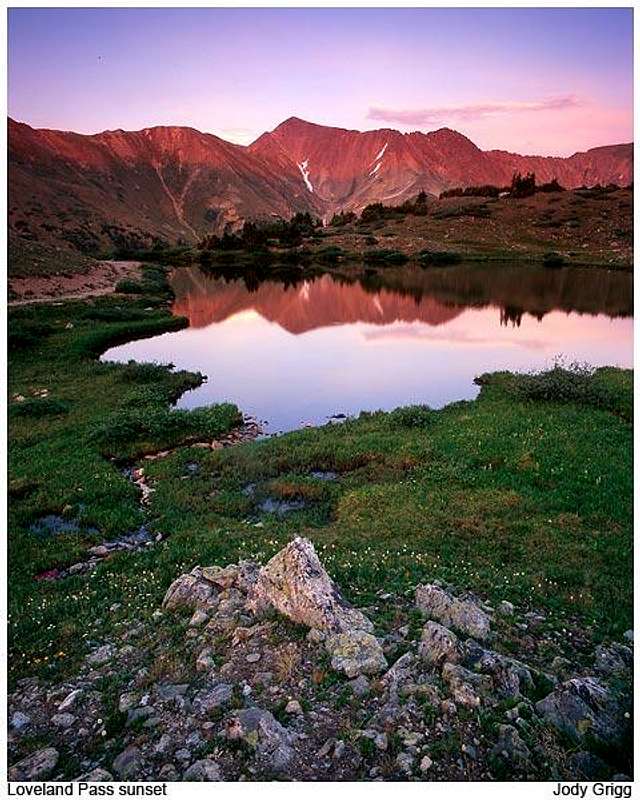
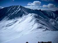
Grizzly Peak from near Loveland Pass | yorksman
Barely missing the list of the 300 highest peaks in Colorado, Grizzly Peak is a popular winter outing for residents of the Front Range. This mountain sits high and proud along the Continental Divide, along the border of Summit County and Clear Creek County, barring the way from Loveland Pass to twin fourteeners Torreys Peak and Grays Peak. The mountain rises ruggedly above Chihuahua Lake and forms a dramatic backdrop to those approaching Arapahoe Basin Ski Area along Hwy 6.
Rank: 302nd highest peak in Colorado
Prominence: 847 feet
USGS Quad: Grays Peak
Planning Map: Trails Illustrated #104 Idaho Springs | Georgetown | Loveland Pass
Rank & Prominence: Lists of John
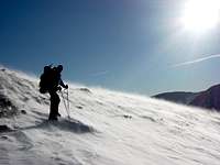
 Ski descent route | Coloradoclimber Ski descent route | Coloradoclimber |
 Chihuahua Lake below Grizzly | gimpilator Chihuahua Lake below Grizzly | gimpilator |
Getting There
Grizzly Peak from Loveland Pass | yorkman
LOVELAND PASS (Standard Route)
From the East:Drive west on Interstate 70. As you approach the Eisenhower Tunnel, take the exit for Loveland Pass. The exit channels you under the highway. Go right and take Highway 6 past the Loveland Ski Area and follow the road to the top of Loveland Pass and park.
From the West:Take I-70 through the Eisenhower Tunnel. Just beyond the tunnel, take the Loveland Pass exit, make a hard right, passing the Loveland Ski Area entrance and go to the top of Loveland Pass and park. You can also take Highway 6 from Dillon through Keystone resort to the top of Loveland Pass.
GRIZZLY GULCH
Follow I-70 to Exit 221 (east of the Eisenhower Tunnel). Head south on Rt 321 (Stevens Gulch Road).
CHIHUAHUA LAKE
From US Hwy 6 (Loveland Pass Road) east of Keystone Ski Resort, take Rt 5 (Montezuma Road) along the Snake River to FS 214. Follow FS 214 past the Lenawee Trailhead to the Chihuahua Gulch Jeep Road.
Red Tape
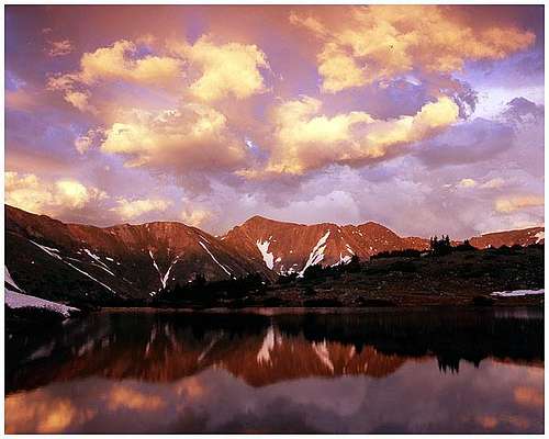
Sunset on Grizzly | JonBradford
| Grizzly Peak is blessedly free from Red Tape. There is no private property near the summit or along primary routes to the summit. There are no fees to park at primary trailheads indicated in the "getting there" section, and no fees to recreate in this area.Please follow LNT (Leave No Trace) principles: 1. Plan Ahead and Prepare 2. Travel and Camp on Durable Surfaces 3. Dispose of Waste Properly 4. Leave What You Find 5. Minimize Campfire Impacts 6. Respect Wildlife 7. Be Considerate of Other Visitors |
 Early morning ski | coloradoclimber Early morning ski | coloradoclimber |
 Grizzly and wildflowers | mtelbertman Grizzly and wildflowers | mtelbertman |
Weather & Seasons
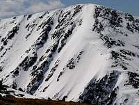
Click image for avalanche forecast |
Thanks to proximity to Loveland Pass Road (US 6), Grizzly Peak is accessible year-round. - Many peak hikers purposely save Grizzly Peak as a winter trip, in part due to its accessibility even in snow season. Check the weather and avalanche conditions before heading out, however. The winds on this ridgeline can be relentlessly brutal, and the cornices don't suffer fools. - In the summer, the Loveland Pass area peaks are a nice place to cool off and enjoy the mountain air with minimal effort. |
 Click image for weather forecast |
Camping & Lodging
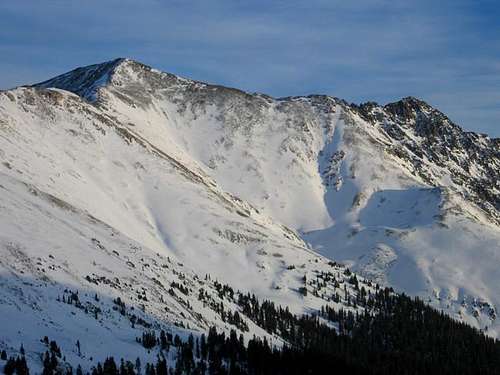
Grizzly Peak | Steven Cross
Continental Divide winter | Old Ickabod
Many (most?) folks aspiring to summit this peak will do so either as a resident of or visitor to one of the Front Range metropolitan areas (such as Denver, Colorado Springs, Fort Collins or Boulder), and thus few will need overnight lodging.
Camping: Camping in the area is very limited and there is no campground in Loveland Pass.
Hotels and Bed and Breakfasts: The nearby town of Georgetown has a few hotels, B&Bs and inns to choose from. Visit this TripAdvisor page for more information on lodging in the area.
VWLover - Aug 30, 2016 11:38 pm - Hasn't voted
Lewanee TrailheadI believe the Lewanee Trailhead is off of FS 260, not 214.