
-
 451 Hits
-
 74.92% Score
-
 5 Votes
|
|
Mountain/Rock |
|---|---|
|
|
39.81296°N / 105.50602°W |
|
|
Gilpin County |
|
|
Hiking |
|
|
Spring, Summer, Fall, Winter |
|
|
9210 ft / 2807 m |
|
|
Overview
Maryland Mountain
Front Range, Colorado
Elevation: 9210 ft / 2807 m
Distance: 3.4 mi (RT)
Elevation Gain: 968 ft
Elevation Min/Max: 8,218 to 9,210 ft
Trailhead Lat/Long: 39.81150, -105.49678
|
|
Getting There
Hidden Treasure Trailhead:
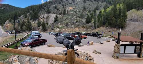
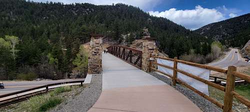
From Central City/Blackhawk, head north on Highway 119 for about half a mile to the Hidden Treasure Trailhead on the east side of 119. This is a large parking area with big signs so you can't miss it.
Bates Hill Park Trailhead (coming soon)
The Bates Hill Park Trailhead will be located at the intersection of Gregory Street and High Street. Once established, the trailhead will provide parking with a bike and pedestrian trail system connection near the Gregory Street Plaza through the Bates Hill Park, leading to Chase Gulch Roadway.
|
|
Route
|
|
|
|
My 3D Alltrails route/map: LINK
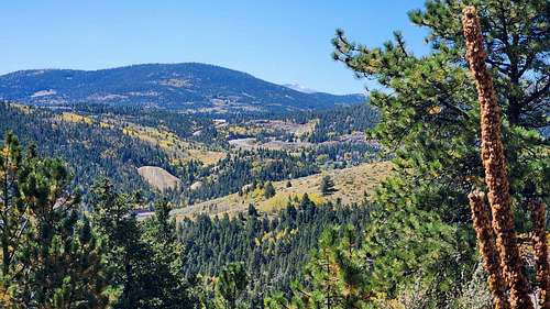
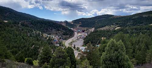
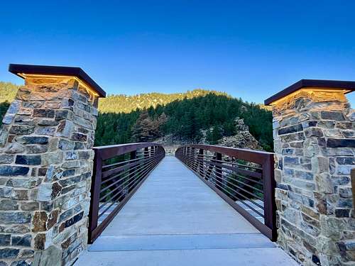
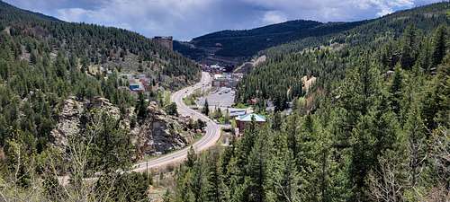
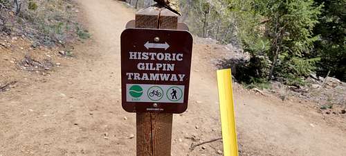
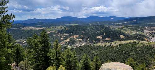
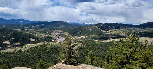
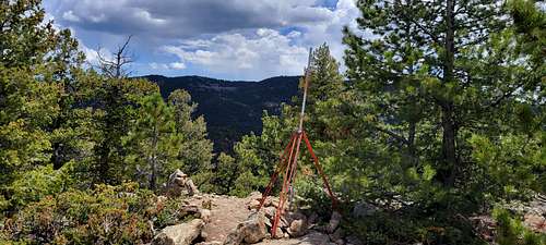
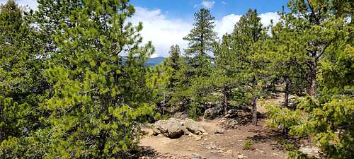
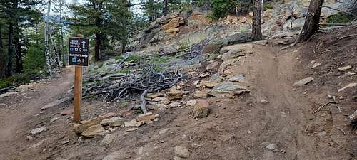
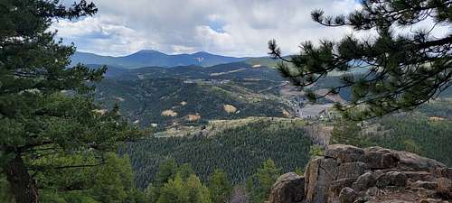
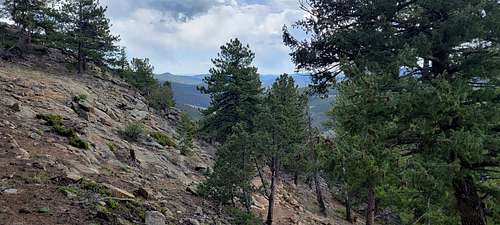
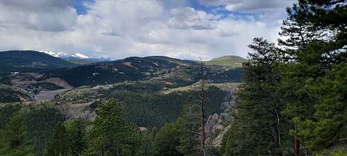
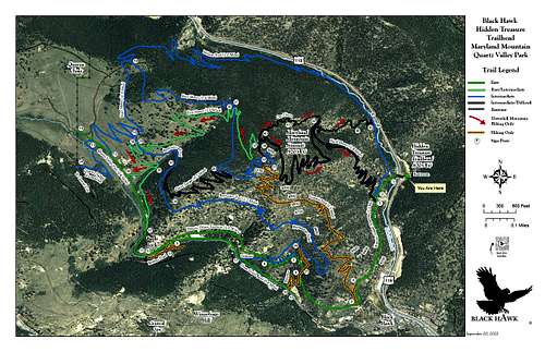
Quartz Valley Park is a newly developed open space just north of the casinos in Blackhawk. The park is built along the slopes of Maryland Mountain 9210 ft and looks to be a former mine site. The park caters to hikers and mountain bikers with trail system that provides many hiking & biking options. The main access is via the Hidden Treasure Trailhead built on State Highway 119. Maryland Mountain is the centerpiece of this park and the Summit Trail is route designated for hikers. The summit boasts nice views of the Mt. Evans Massif and the James Peak Wilderness to the west. Many open space parks have "hikers only" trails, but Maryland Mountain has a "hikers only" trail and a "bikers only" trail to the summit. This ensures that both user groups can reach the summit without conflict. To reach the Summit Trail, cross the pedestrian bridge over 119 and hike south along the Historic Gilpin Tram Trail. This wide trail is open to all users and provides a good warm up before you start the ascent. The trails are well marked so you'll know when you reach the "Summit Trail." The Summit Trail is well constructed and provides a steady uphill hike with plenty of switchbacks and viewpoints along the way. As you hike, you are treated to views of Blackhawk, the hillsides surrounding the city, and the Front Range Mountains. The views from this trail are a stark reminder of the tremendous amount of mining in this area, both historically and currently. That being said, the trail is beautiful with aspens, pine forests, rock formations, and vistas. As you near the top of the mountain you'll intersect the Easy Money Trail, turn right, head around the bend and turn right again onto the trail leading to the summit. The rocky summit has more big views as a nice reward for your hard work. On the way down, you can turn the hike into a longer loop by following the Easy Money Trail. The Hard Money Trail is reserved for bikers. The Easy Money Trail takes you to the western side of the park which I haven't explored yet but results in a much longer hike. If you head back down the Summit Trail then your hike will clock in at about 3 1/2 miles and a bit less than 1,000 ft of elevation gain. A nice workout and scenic hike.
|
|
|
|
Red Tape
|
|
|
|
Maryland Mountain Quartz Valley Open Space Park is an outdoor day-use recreation park for walking, hiking, running, mountain biking, picnicking, and wildlife observation. In 2020, the City of Black Hawk opened the Hidden Treasure Trailhead and corresponding bridge linking to the City’s open space.
The trail system weaves around and through Maryland Mountain, Chase Gulch, Quartz Valley, and the historic narrow gauge Gilpin Tramway. Hikers and bikers will enjoy vistas and panoramic views of Black Hawk, Central City, and the northern rural regions of Gilpin County. The park also includes interesting historical sites, such as the Bonanza Mill, the Belden & Tennal Stamp Mill, the Robert Emmet Mine, and the Queen of the West Mine, to name a few.
The Maryland Mountain trail system has opportunities for various levels of interest and ability. Whether you are hoping to complete a leisurely mile or a longer summit climb, you will surely find a piece of Black Hawk’s rich history and abundant beauty during your outdoor adventure.
Know Before You Go:
Trail etiquette is important for the enjoyment and safety of all trail users. Be considerate of others and let nature's sound prevail on the mountain. Avoid loud voices and noises, allowing others to enjoy the scenery and beauty. Planning is an important step in being prepared and ready for your adventure.
Dawn to dusk
The park is open from dawn to dusk. Determine how many hours of daylight you have when you begin your adventure. From there you can determine the appropriate time to head back out toward the trailhead. Make sure to return to the trailhead before dark.
Leash your pet
All pets must be on a leash while in the park. Control your pet around other visitors and their pets. And please make sure to pick up any waste left by your pet and dispose of it properly. Doggie stations are located at the trailhead and on the Historic Gilpin Tramway trail.
Running at large is prohibited. It is unlawful for any person to permit any dog to run at large. A dog shall be deemed to be running at large when not under the control of the owner, possessor, or keeper of such dog either by leash, cord, or chain not more than 10 feet in length that is being held and controlled by such person. (Black Hawk Municipal Code Sections 7-69 and 10-29.)
Pack it in. Pack it out
Restrooms and trash receptacles are located only at the trailhead. Pack out all trash, leftover food, litter, and pet waste.
Leave no trace
Preserve the past: examine, but do not touch cultural or historic structures and artifacts. Capture what you see with a photo, but leave rocks, plants, and other natural objects as you find them.
Fuel your adventure
Bring along water and snacks to fuel your outdoor activities. Water is not available at the trailhead or in the park, so bring plenty of water from home to keep you and your pets hydrated.
Be weather-ready
Leading up to your hike, and again a few hours before, check the weather. This will give you valuable information on how to dress and what to pack. Be prepared with the right gear for the current or changing weather conditions. Carry a hiking backpack with a small first aid kit, poncho, and other essentials.
Right of way
Hikers coming uphill have the right of way. If you're descending the trail, step aside and give space to the people climbing up. Cyclists yield to hikers going in either direction, coming to a full stop and stepping to the side to give the right of way. When hiking in a group, always hike single file, never taking up more than half the trail space, and stay on the trail itself. If visiting in large groups, consider splitting into smaller groups.
Respect wildlife
Observe wildlife from a distance. Do not follow, try to approach, or taunt wild animals in any way. Never feed wild animals. Feeding wildlife can damage their health, alter natural behaviors, expose them to predators and other dangers, and they can become aggressive.
Wildlife commonly found in the park include deer, elk, bear, mountain lion, moose, coyote, fox, songbirds, waterfowl, and raptors. Colorado Parks and Wildlife offers tips and advice for rewarding, safe, and responsible wildlife viewing.
Trail closures
During the development of the Maryland Mountain Quartz Valley Open Space Park trail system, the City utilized existing historic mining routes along with cutting new trails. Trail maintenance, trail building, and fire mitigation efforts will continue throughout the trail system. As such, trail closures may take place periodically to accommodate this work. Please be attentive to marked trail closures as we work to build a sustainable trail system.
Trail conditions
Hiking and biking conditions will vary throughout the seasons. Be especially mindful of possible trail conditions in the winter months and if there has been recent rainfall. Trails could be snow-covered, icy, or muddy. Maryland Mountain offers several trails with good southern exposure, however many areas along the south side will still be spotty with mud and snow cover after a weather event. Hikers should be prepared with the right footwear, ice cleats, and possibly trekking poles. Mountain bikers are encouraged to follow well-known trail etiquette and avoid riding on soft, muddy trails, which can lead to ruts and erosion. Whether hiking, running, or biking, it is your obligation to modify your route or not go at all if you know a trail is not in ideal condition for your planned activity. When route modification is necessary, please stay on established trails.
Non-emergency park concerns can be reported to:
Black Hawk Dispatch Center 303-582-5878
Routes
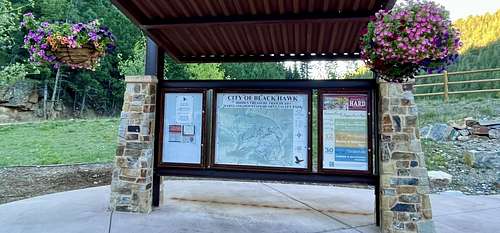
Download a printable trail map before you arrive at the trailhead. A QR code is also available at the trailhead to simply scan with your cell phone. Pre-plan your route, making considerations for the time and distance you would like to cover, elevation gain, and your skill level. Let someone know of your hiking plans.
 |
When to Climb
All four seasons.
Camping
Additional education resources
- National Park Service: Hike Smart
- US Forest Service: Safety
- US Forest Service: Getting ready for the outdoors
- Colorado Parks and Wildlife: Trails
External Links
https://www.alltrails.com/trail/us/colorado/maryland-mountain
https://www.hikingproject.com/trail/7101344/maryland-mountain
https://www.peakbagger.com/peak.aspx?pid=40574
https://www.listsofjohn.com/peak/3925