
-
 30408 Hits
-
 82.47% Score
-
 15 Votes
|
|
Mountain/Rock |
|---|---|
|
|
58.44080°N / 134.6447°W |
|
|
Hiking |
|
|
Summer |
|
|
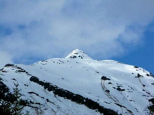
4228 ft / 1289 m |
|
|
Overview
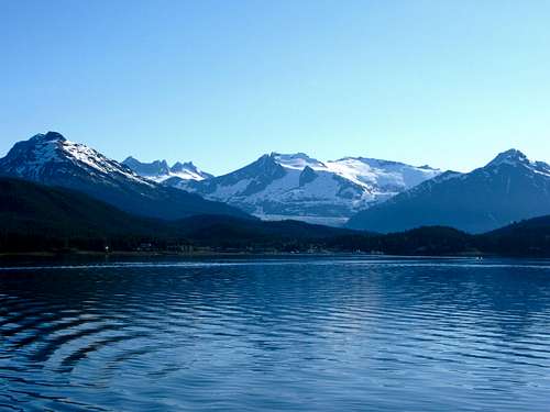
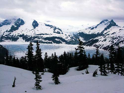
McGinnis Mountain stands humble in a popular backdrop at the foot of Alaska’s Coastal Range. Its scene: the famous Mendenhall Glacier soaks up much of the attention in the area as well as Mount Wrather, which are located center stage. To the right, the bold Mount Bullard obstructs the view of the monster known as The Nugget Towers. Left of the glacier the infamous Mendenhall Towers raise proudly and the jagged Stroller White Mountain continue the impressive skyline. Stroller White is situated next to McGinnis Mountain.
Though McGinnis is in a popular area, it does not see too much traffic. Most hikers in this vicinity will make a detour to the Mendenhall Glacier or stop at the end of the Forest Service trail rather than continuing to the summit.
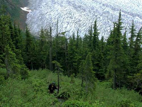
Those that do pursue the summit will experience a steep ascent of nearly 3,200 feet in roughly 5.5 miles. Though McGinnis is not a technical mountain, please note the route up McGinnis is steep and has no switch backs. Also, route finding is extremely important since the trail is faint and seldom used.
Getting There
From Downtown Juneau, take Egan Drive North. Make a right on Mendenhall Loop Road. After 2.2 miles turn left to stay on Mendenhall Loop Road. Turn right on Montana Creek Way. Continue on Montana Creek Road past Skaters Cabin. The road will dead end at the West Glacier Trail trailhead.
Routes
Hiking McGinnis is typically done by taking the West Glacier Trail to the McGinnis Route. From the parking lot, take the West Glacier Trail for 3.4 miles until it ends. A sign will indicate “End of Forest Service Trail”. From that point follow the rock band and faint trail directly up the east, northeast slope. The trail continues all the way to the summit. Look for markers on the descent- it is very easy to get off trail!
*Also note that the West Glacier Trail will fork around 2 miles in. Keep left to avoid a detour to the glacier.
When to Climb
Because McGinnis is located in the heart of the Tongass National Forest, one of the world’s largest temperate rainforests, the climbing season is extremely short. Snow can linger well into June and create dangerous snow bridges and potential for wet-slides. The winters are consistently wet and because of the steep terrain, avalanche potential is common. The best time to climb is late June through late August. Monsoon season typically starts around early September.
Red Tape
There are no fees. Please keep pets leashed; there are many bears in the area.
Camping
Mendenhall Lake Campground- $10 per night and walking distance to trailhead.
What to Bring
Bring bear spray- there are many in the area. Dress appropriately. The rains are very consistent and can easily penetrate through your gear. When I climbed McGinnis I dressed in clothing that I allowed to get wet- wool is great as it keeps you warm. Then as I broke tree line, I changed into dry clothes and rain gear. Waterproof boots are necessary and gators help keep your socks dry. I learned to wear them under my pants so the water wouldn't soak from my pants into my socks. Bring extra dry/warm stuff.
External Links
For more information about mountains in the area contact the members of Juneau Alpine Club.