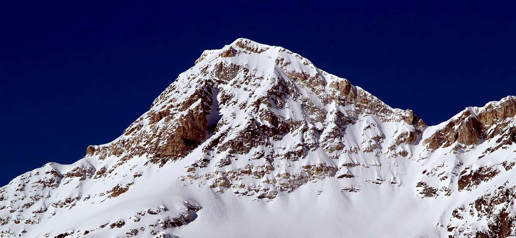
This mountain is placed at the Southern end of the Petites Murailles, between the Tour and Col du Créton (N) and Col du Château des Dames and Château des Dames (S). It is made by whitish metamorphic limestones (herefrom comes its name). Very fine views upon Mont Braoulé, Dents des Bouquetins and Monte Cervino.
Montagna posizionata al termine delle Petites Murailles tra la Tour e il Col du Créton a nord e il Col du Château des Dames e l'omonima vetta a sud. Formata da calcari metamorfici biancastri (donde il toponimo). Ottime le vedute sul Mont Braoulé, Dents des Bouquetins e sul Monte Cervino.
First Ascents
First on the summit: Unknown.
In winter: Unknown.
N Arête: Clemente Emilio Biressi, Ottavia and Giacomo Dumontel, (Jul 14th, 1904), in descent.
NW slope: Osvaldo and Alessandro Cardellina, (Sep 01th, 1996).
Getting There
BY CAR:
From Torino, Milano, etc: Motorway A5. Exit at Aosta Est.
From Switzerland: through the Grand Saint Bernard Tunnel or the namesake pass.
From France: through Mont Blanc Tunnel or Petit Saint Bernard Pass. It isn't necessary to take Motorway A5: you can drive on SS.26, in the direction of Aosta.
BY PLANE:
Aeroporto "Corrado Gex" Saint Christophe (Aosta).
Route
From Aosta-Est highway exit follow along the SS.27 toward Gran San Bernardo Tunnel for about 10km and leave it turning to the right toward Valpelline (964m). Don't follow to Ollomont (1.335m) but toward Bionaz (1.606m), and, on the left side up to the wide car parking on the western side of the huge dam of Places Moulin (1.968m).
Dall'uscita del casello autostradale di Aosta-Est, proseguire sulla SS.27 in direzione del tunnel del Gran San Bernardo; dopo circa un decina di chilometri svoltare sulla destra verso il Paese di Valpelline (964 m) e, dopo averlo superato ed aver ignorato il bivio sulla sinistra che conduce all'abitato di Ollomont (1.335 m), proseguire verso il Paese di Bionaz (1.606 m). Continuare sulla sinistra sino all'ampio parcheggio posto sul lato occidentale del gigantesco sbarramento di Places Moulin (1.968 m).
Itinerary
From Places Moulin (1.968m) walk along the dirt road on the N side of the lake to get the Rifugio Prarayer (2.005m), then a path to the border of the larches wood, Bois de Grand Plan. Pass to the right of the fork for Rifugio Aosta, walk on toward East and pass the Pastures of Gordzé (2.154m), Deré la Vieille (2.254m) and Bella Tsa (2.474m). Cross the stream and follow toward the lateral right moraine of Château des Dames Glacier. Ascend the glacier toward the Col des Dames (beware of crevasses) along slopes whose slant is between 25°-35°. Just before the pass, leaving to the left the NW side, go straight on along the slopes leading, on mixed terrain, to the South Summit (3.400m) and, in a short time along the SW ridge, to the summit.
Descent: along the easy and short N ridge, made of whitish rocks, down to the Col du Créton where is placed the Bivouac Laura Florio (3.320m - 9 beds), and on easy snow slopes back to the previous route.
Da Places Moulin (1.968 m) percorrere la strada poderale a nord del lago artificiale, che conduce al Rifugio Prarayer (2.005 m), per il sentiero alle pendici del bosco di larici Bois de Grand Plan. Lasciare a nord il bivio per il Rifugio Aosta, salire verso est e superare gli Alpeggi di Gordzé (2.154 m), Deré la Vieille (2.254 m) e Bella Tsa (2.474 m); oltrepassare il torrente e proseguire sino alla base della morena laterale destra del Ghiacciaio del Château des Dames. Risalire il ghiacciaio verso il Col des Dames (attenzione ai crepacci) con pendenze che variano dal 25°-35°. Prima del colle, lasciato a sinistra il versante NW, salire direttamente il pendio che porta all'Anticima Sud (3.400 m) su terreno misto, donde in breve per la cresta SW si raggiunge la cima.
Discesa: per la facile e breve cresta Nord di roccette bianche e frantumate al sottostante Col du Créton, ove è posto il Bivacco fisso Laura Florio (3.320 m - nove posti) e per facili nevati all'itinerario di salita.
Difficulty
This route can be considered F+.
L'itinerario è classificato F+.
Gear
High mountain gear: Rope, iceaxe and crampons.
Da alta montagna: Corda, piccozza e ramponi.
Campings
Remember that free camping is forbidden (except for emergency reasons, over 2.500m, from darkness until dawn).
Mountain Conditions
You can get meteo information at the official site of the Regione Valle d'Aosta:
A.I.NE.VA. (Associazione Interregionale Neve e Valanghe).
Useful numbers
Protezione Civile Valdostana località Aeroporto n° 7/A Saint Christophe (Ao) Tel. 0165-238222.
Bollettino Meteo (weather info) Tel. 0165-44113.
Unità Operativa di Soccorso Sanitario Tel. 118.
Acknowledgements
I am greatly indebted to my friend "Osva" for the detailed description of the route. In addition i want to thank Gabriele Roth for the translation of the text from italian.
Parents refers to a larger category under which an object falls. For example, theAconcagua mountain page has the 'Aconcagua Group' and the 'Seven Summits' asparents and is a parent itself to many routes, photos, and Trip Reports.

 7510 Hits
 87.31% Score
 24 Votes