
-
 23362 Hits
-
 82.05% Score
-
 15 Votes
|
|
Mountain/Rock |
|---|---|
|
|
39.80640°N / 105.5781°W |
|
|
Clear Creek & Gilpin |
|
|
Hiking |
|
|
Spring, Summer, Fall, Winter |
|
|
10081 ft / 3073 m |
|
|
Overview
Mount Pisgah summit diary
Rank: 2267th highest peak in Colorado
Prominence: 421 feet
USGS Map: Central City
Planning Map: Trails Illustrated #103 | Winter Park, Central City, Rollins Pass
Profile photo by Kiefer Thomas
![Mount Pisgah summit]()
Mount Pisgah summit
![Mount Pisgah from the south]()
Mount Pisgah from the south
Mount Pisgah sits a few miles due-west of Central City, which is approximately 38 miles or 45 minutes from Denver via I-70 west. Paved Roads reaching the vicinity of Mount Pisgah are CR 275 (Fall River Road) from the south and CR 279 from the east. From either one of these roads, depending on snow conditions, use either a 4x4 or your boots to reach the mountain.
Getting There
Mount Pisgah summit
Mount Pisgah from the south
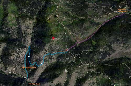 This map outlines two primary approaches to Mount Pisgah
Routes Overview
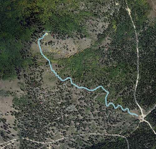
This topo traces the John Hicks Trail to the summit of Mount Pisgah

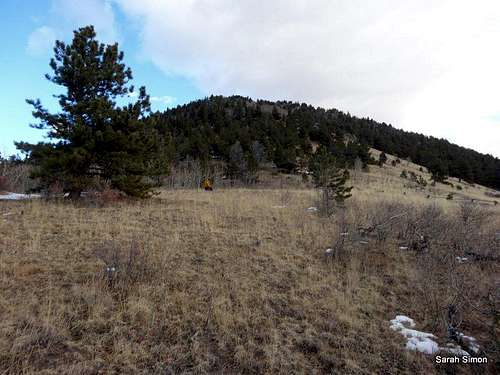
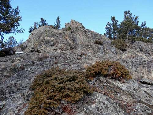
Looking up at the summit

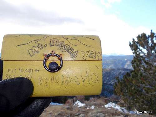
Summit ammo can

John Hicks Trail

John Hicks Trailhead

Mount Pisgah from the east
From Fall River Road
Route Stats from FallRiver Road
Roundtrip Distance: 6 miles
Elevation Gain: 1,650 feet
· Take I-70 to Exit 238 (Fall River Road - paved)
· Travel north approximately 4 miles to HamlinGulch Road (dirt) which may be marked Rt 276.
· From here, the road conditions, your vehicle and your preference for walking vs. hiking will dictate how you proceed.
· Head north on Hamlin Gulch Road to a major south-turning switchback. DO NOT continue north onthe4 private drive which is gated a few yards up.
· After heading south for a while, the road trends mostly east across the southern flank of Mount Pisgah.
· A connector footpath (visible possibly only with snow) should take you northeast to the John Hicks parking and trailhead at the southeast foot of Mount Pisgah. Follow the trail to the summit of Mount Pisgah.
From Columbine Campground
Route Stats from Campground
Roundtrip Distance: 4 miles
Elevation Gain: 1,030 feet
Directions(Courtesy of National Forest Service): From I25 in Denver, take 6th Ave West to state Highway 6, through Clear Creek Canyon. Proceed north on State Highway119, turn left on Gilpin County Road 279 (Gregory St. next to BullwackersCasino) in Black Hawk, follow signs to Central City. Gregory St. changes to Lawrence St, at Central City limits, then changes to Eureka St. midway thru central City. Proceed on Eureka St. until the road turns to gravel \& follow signs to campground. The campground is located 2 miles northwest of Central City on County Road 279. Two and one-half miles northwest of Central City via GilpinCounty Road 3 on Forest Road 176. At the top near the cemeteries, follow the signs to the campground.
From just south of the campground on CC2, followFSR 739.1 (???) southwest to the southeastern foot of Mount Pisgah. There you will find the parking area and trailhead for the Hicks Trail which takes you to the summit of the peak.Red Tape

From nearby Bald Mountain

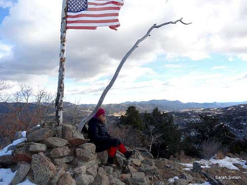
Flag at the summit
Weather and Seasons
 Click for weather forecast |
Mount Pisgah is by all means a year-round mountain. Autumn may very well be the best time of year to visit this peak, as the weather is still pleasant, the roads passable and the crowds manageable. Summertime will bring dense crowds and heavy ATV traffic. A visit in Winter or Spring when the roads are snow-clogged could result in long approaches on Forest Service roads (generally not a particularly interesting pastime). |  Click for weather forecast |
| Pleasant views from the summit of Mount Pisgah | ||
 |
 |
 |
Camping
Rocks on southeast slopes
Per The National Forest Service
Located west of Denver and two miles northwest of Central City, Colorado, in a grove of aspen and lodgepole pine. The campground is split into two loops. There are a total of 46 sites available, 41 are suitable for RV camping and 5 are more suitable for tents. Facilities provided include restrooms and water. Each site contains a tent pad, fire grate, and picnic table.
Some first come, first serve sites may be available. Sites may be available on a first come, first served basis outside the reservation season. Firewood sold at the campground. There are no electric/water/sewer site hook-ups at this campground. Activities include "Peak to Peak" highway and 4-wheeling nearby. Campground is popular with OHV's users.
Reservations: Accepted
Fees: $17 per site per night
Open Season: May through September
Usage: Heavy
Restrictions: A single site may hold up to five people. Tents must fit on the pads provided. RVs, trailers or other vehicles must fit on the parking spur because driving or parking off-road is not permitted. The parking length ranges from 25 to 55 feet.
Closest Towns: Central City/Blackhawk, CO
Water: hand water pump/spigot
Restroom: Vault toilet
Operated By: American Land & Leisure
Information Center: Clear Creek Ranger District, 101 Highway 103, Idaho Springs, CO 80452 Phone 303-567-3000; Contact Us
Other amenities: The site has picnic tables fire grates.
andy@andygerber.com - Jul 12, 2016 11:19 am - Hasn't voted
Notes on coming in from the campgroundFSR 739.1 starts before the campground and is marked as "Yankee Boy". Do *not* take the closed road closer to the campground. You will be sharing FSR 739.1 with lots of ATVs if you hike it on foot.