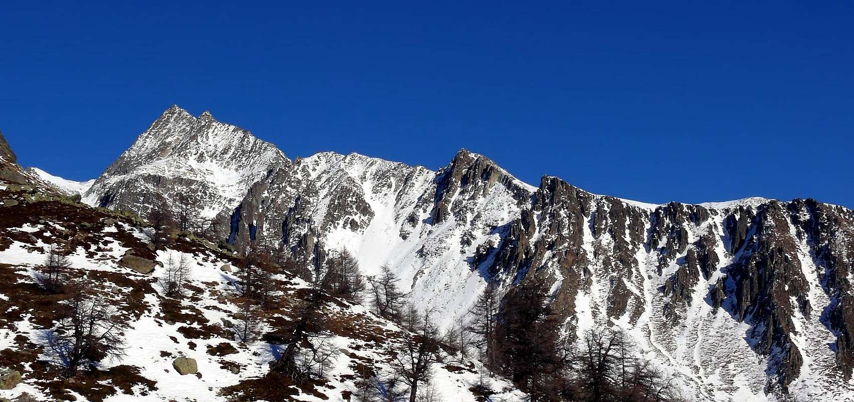
Beautiful mountain to south of the most famous Becca Rayette (3.529m), on the crest that goes down toward the inhabited area of Bionaz. A little frequented for the length of the approach but above all for the dangerousness of the street to access the Bas Glacier de Chardoney. From his/her peak a good panorama can be admired.
Bella montagna subito a sud della più famosa Becca Rayette (3.529 m), sulla cresta che scende verso l'abitato di Bionaz. Poco frequentata per la lunghezza dell'avvicinamento, ma soprattutto per la pericolosità della via per accedere al Bas Glacier de Chardoney. Dalla sua vetta si può ammirare un ottimo panorama.
First Ascents
First on the summit (N-NE Arête, normal route): Louis Kurz, Henry Riekel and muntain guides Joseph and Justin Bessard, (Aug 14th, 1892).
In winter?: Albert Deffeyes, Basilio Ollietti and Guido Perolino, (Mar 28th, 1929).
S Wall: Albert Deffeyes, Basilio Ollietti and Guide Perolino, (Mar 28th, 1929).
S-Arête: Gino Buscaini and Rudolf Dotterweich, (Jul 29th, 1969).
W Slope (Couloir): Gino Buscaini and Rudolf Dotterweich, (Jul 29th, 1969), in descent.
W Wall (Direct route to S summit): Gino Buscaini and Silvia Metzeltin, (Jul 06th, 1970).
Getting There
BY CAR:
From Torino, Milano, etc: Motorway A5. Exit at Aosta Est.
From Switzerland: through the Grand Saint Bernard Tunnel or the namesake pass.
From France: through the Mont Blanc Tunnel or Petit Saint Bernard Pass. It is not necessary to take Motorway A5: you can drive on SS.26, in the direction of Aosta.
BY PLANE:
Aeroporto "Corrado Gex" Saint Christophe (Aosta).
Route
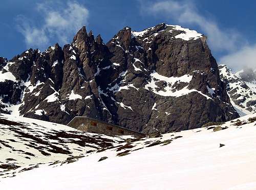
From highway toll of Aosta Est follow the SS27 of Gran San Bernardo Tunnel, drive for about ten km and turn, to the right, toward Valpelline (964m), pass through it and follow for Oyace (1.377m). Once in Dzovenno (1.575m), turn to the left toward the small Village of Ruz (1.697m), park the car and start walking along a comfortable dirt road leading to the Baou de Bouque (2.129m) and to the Berrier Pastures (2.192m)(1h'30).
Dall'uscita del Casello Autostradale di Aosta Est, proseguire sulla Strada Statale n°27 in direzione del tunnel del Gran San Bernardo; dopo circa un decina di chilometri svoltare sulla destra verso il Paese di Valpelline (964 m). Dopo averlo superato ed aver ignorato il bivio sulla sinistra che conduce a Ollomont (1.335 m), proseguire verso l'Abitato di Oyace (1.377 m). Raggiunta la Frazione di Dzovenno (1.575 m), svoltare a sinistra verso il piccolo Villaggio di Ruz (1.697 m); qui posteggiare l'auto e iniziare la salita a piedi lungo la comoda strada poderale che conduce all'Alpeggio Baou de Bouque (2.129 m). Dopo averlo oltrepassato, si raggiunge poco dopo l'Alpeggio di Berrier (2.192 m), (1h'30).
Itinerary
From Alpe Berrier (2.192m) start walking along the path East of the Vertsan Stream and go on up to the Alpeggio di Chardoney (2.520m), passing through a wide grassy plain (about 500 meters) with many springs. Walk up along the Vertsan Basin toward the snow fields of Chardoney Inferiore or Chardoney Peak. Not to reach them, but to turn northeast surpassing rocky the bands and snowy channel reaching the Glacier of Inferior Chardoney 3.000m~ (very exposed to the fall of stones of the Crest South West of the Mountain Deer. Where it died the mountain guide Ettore Bionaz of the Valpelline). To turn northeast passing under the wall of the Mountain Deer to reach the Pass (3.390m~) between the Knot of the Rayette and the same (crevasses!) to go back the Crest snowy North North-East (30°/35°), then with for secure and easy route (I°) to reach the north point, the more raised one. The south point is at a distance at about 40 meters and is easily attainable (5h'00/5h'30 from Ruz).
Descent: from the same route.
Dall'Alpe Berrier (2.192 m) prendere il sentiero a est del Torrente Versan risalirlo sino all'Alpeggio di Chardoney (2.520 m), dopo aver superato un ripiano erboso di circa 500 metri con molte sorgenti. Risalire la Comba di Vertsan puntando decisamente verso la Chardoney Inferiore o Pic de Chardoney in direzione di nevati. Non raggiungerli, ma voltare a nord-est superando le fasce rocciose e canalini nevosi raggiungendo il Ghiacciaio di Chardoney Inferiore 3.000 m~ (molto esposto alla caduta di pietre della Cresta Sud-Ovest del Monte Cervo. Vi perì la guida Ettore Bionaz della Valpelline). Girare a nord-est passando sotto la parete del Monte Cervo raggiungere il Colle (3.390 m~) tra il Nodo della Rayette e lo stesso (crepacci!) risalire la cresta nevosa Nord Nord-Est (30°/35°), poi con per percorso sicuro e facile (I°) raggiungere la Punta Nord, la più elevata. La Punta Sud dista a circa 40 metri ed è facilmente raggiungibile (5h'00/5h'30 da Ruz).
Parents refers to a larger category under which an object falls. For example, theAconcagua mountain page has the 'Aconcagua Group' and the 'Seven Summits' asparents and is a parent itself to many routes, photos, and Trip Reports.

 8324 Hits
 86.37% Score
 22 Votes