
-
 23233 Hits
-
 85.87% Score
-
 21 Votes
|
|
Mountain/Rock |
|---|---|
|
|
43.66170°N / 115.8761°W |
|
|
6396 ft / 1950 m |
|
|
Overview
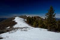
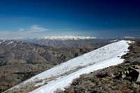
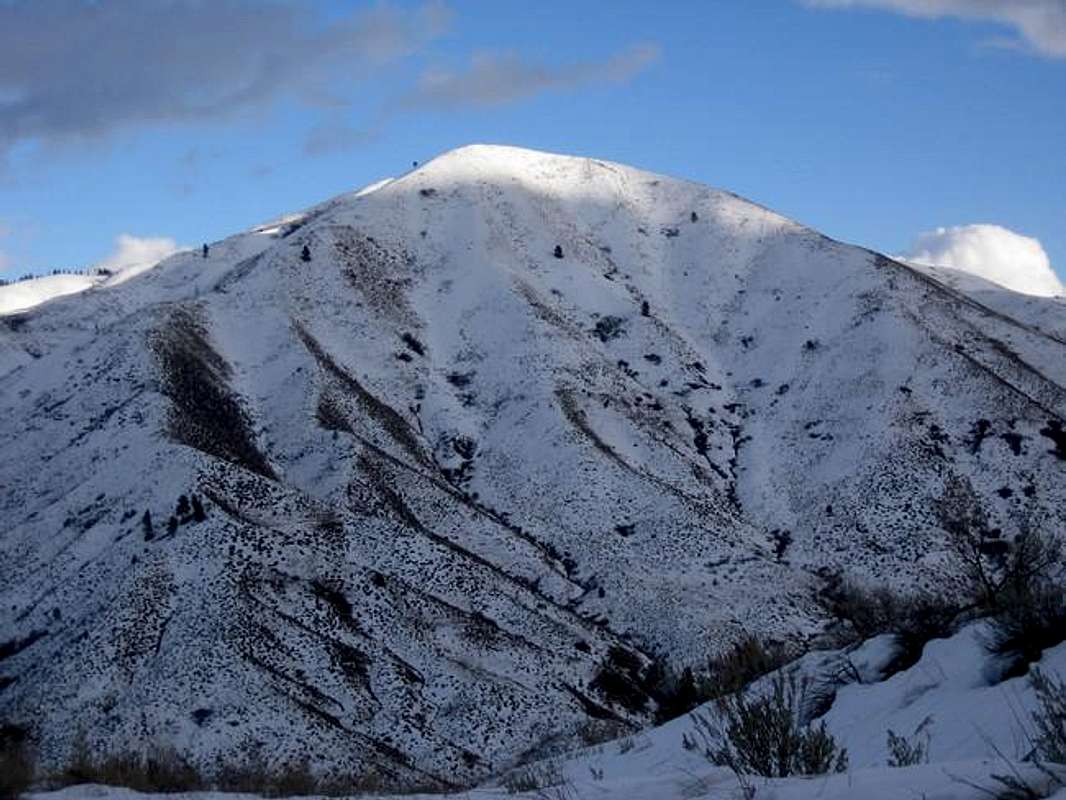
On the east side of Heinen exists the Cottonwood Ranger Station and one of the few trailhead and foot trails in the Boise Mountains. The single-track trail leads up to Thorn Creek Butte. One of the major roads, the South Fork of Thorn Creek, was washed out in the mid 1990's and never repaired. This used to be an easy northern approach to Heinen. The summit of Heinen affords great views of Shafer Butte, Cervidae Peak, Thorn Creek Butte, and Pilot Peak. On clear days, the Sawtooths are visible to the northeast.

Nearby Baldy is the site of a government plane crash in the 1960's. A military plane was making it's way from the Horseshoe Bend area (from the northwest) during a raging storm. Just before colliding into the upper side of the mountain, the pilots ejected to safety. There are still remnants of the plane near the top of Baldy. Baldy sits above ID-21 just past Robie Creek and is blocked off by private property from that direction.
Here are the approaches on Mt. Heinen:

1) South Ridge (Class1-2) - Along the Middle Fork of the Boise Road, past Arrowrock Dam, park near the Irish Creek Campground. Follow the ridge to the northwest and just east of Irish Creek along a steep Jeep road. Crest at point 5402 and follow the ridge along points 5599 and 6137 until you reach the summit.
Total Mileage / Distance: 4.5 miles / 3880 feet (one-way)
2) East Ridge (Class 2) - Along the Middle Fork of the Boise Road, past Arrowrock Dam, take the Cottonwood Creek road north. 1.3 miles north of the Ranger Station park your vehicle. Be wary of nearby private land. Hike the east ridge above Toms or Garden Gulch. Avoid the gulleys to avoid the brush. This provides a short, but steep approach.
Total Mileage / Distance: 2.5 miles / 3330 feet (one-way)
3) North Ridge via Minneha Creek (Class 1) - Minneha Creek is right off ID-21, 0.75 miles past the Grimes Creek turnoff. Park off the highway and follow Minneha Creek through a basalt canyon for 0.6 miles. The valley then opens up. You can see the damage here from a major wildfire many years ago. This area is home to the Lewis Woodpecker, Mountain Lions, Deer, Elk, and Coyote. Take the prominent perpendicular valley to the south of the main Minneha Valley and make your way via old jeep roads up onto the ridges. Follow the ridges (many options) to the highest point south. Continue up a very steep Jeep road until it peters out near point 5180. From here the peak is clearly visible. Hike cross country to point 5249 for 2.4 miles staying north and above Smith Creek. This will put you directly north of Heinen. Hike the ridge to the summit. Note: in the upper reaches of the main Minneha Creek exists remnants from an abandoned nudist camp. Still visible are a tennis court, swimming pool, building foundations, and many other unknown objects.
Total Mileage / Distance: 7.5 miles / 5185 feet (one-way)
3) Northwest Ridge via Dunnigan / Smith Creek (Class 1)- This is a "poach" route and is not recommended because of private property issues. On ID-21, just past Dagget Creek, turn right onto Dunnigan Creek Road. Park at the "T". The route follows a Jeep road up Dunnigan Creek up to some switchbacks that go up and over to Smith Creek. Just northwest of Heinen, there is a saddle and flat area. Ascend the northwest ridge to the summit.
Total Mileage / Distance: 8 miles / 5760 feet (one-way)
First ascent was accomplished by Native Americans. The first modern day ascent is unknown, but was most likely by the first explorers, settlers, miners, and trappers in the region. There are significant mining remnants in the area.
 |  |  |  |
Getting There
Road Approach
- For the South and East Routes- Take ID-21 north from Boise and turn off right at the Spring Shores Marina / Arrowrock Dam Road and follow that road for 14 miles to Irish Creek or 18 miles to the Cottonwood Ranger Station.
- For the Minneha Creek Approach- Take ID-21 north to near Mile Marker 30 and park near the seasonal gate.
Maps:
USGS Dunnigan Creek Quad, Arrowrock Reservoir NE Quad, Grape Mountain Quad |  |
Red Tape
There are no hiking or parking regulations or fees. No fires are allowed in this area.
When To Climb
Year Round climbing possibilities. Winter ascents are more challenging- snowshoes may be required.
Camping
Camping
- There are many drive-in camp sites along the Middle Fork of the Boise / Arrowrock Road
Mountain Conditions

National Weather Service Current Forecast for Mt. Heinen:
External Links
- NWS Forecast
Heinan Forecast