
-
 41302 Hits
-
 90.47% Score
-
 32 Votes
|
|
Mountain/Rock |
|---|---|
|
|
43.60520°N / 116.0613°W |
|
|
5904 ft / 1800 m |
|
|
Overview
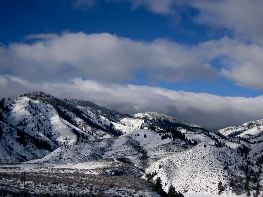
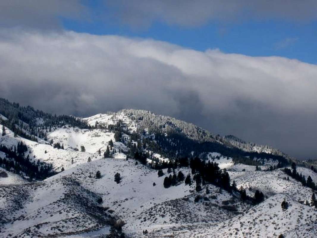
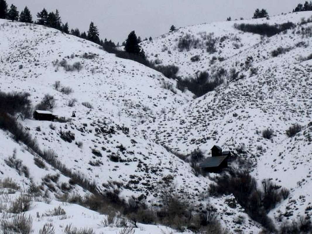
Lucky Peak is what would be classified as a heavily used mountain. It offers numerous hiking and mountain biking trails on virtually every side of the peak. Since the 1800's Lucky Peak's slopes have seen extensive mining- there are remnants of over 9 mining sites on it's slopes, including a well preserved Adelmann Mine Group, complete with 2 standing structures. Each summer and fall, the summit is home to the Fish & Game / Boise State University Bird Banding Project. The summit also contains numerous radio towers and repeaters; it's northern slopes contain a wireless internet tower that provides rural DSL to mountain communities up ID-21.
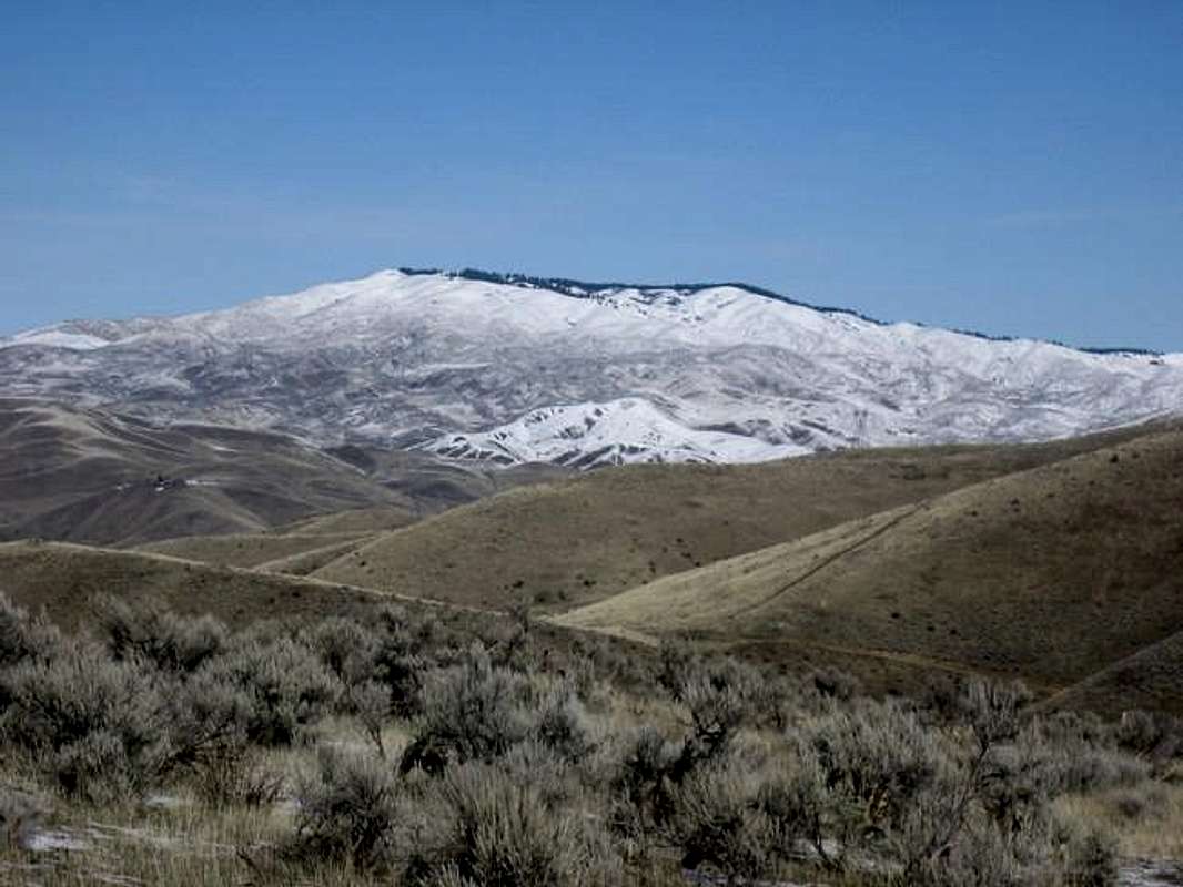
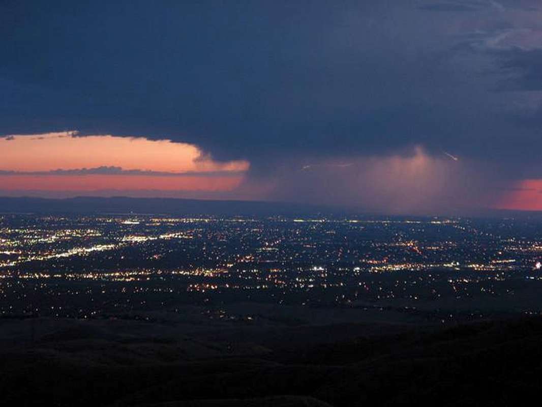
Despite all the usage, this mountain still provides excellent, easily accessible, training opportunity in a peaceful environment. The rolling hills offer over 3500 feet of elevation gain from the valley floor in about 5.6 miles. One can utilize the numerous trails and 4WD roads in an excellent training regiment, preparing most of the winter and early spring for the larger, snowbound mountains of the higher country. In December and January Boise is often shrouded in fog, a worsening condition known as the inversion. Lucky Peak often pokes above this layer of cold air and offers a good escape from this condition. Lucky Peak is the southernmost flank of the Boise Front Range.
Trails / Routes
- Council Springs (Squaw Creek) Trailhead- Easiest access from the Boise area- starts off Warm Springs Ave. Provides superb trail running, mountain biking, or hiking. Reaches the summit in 3512 feet of gain in 5.6 miles. This route is often snow free for 80% of the climb.
- Cobb Trail from Highland Valley Road- starts just 1.7 miles SW of Council Springs. Follow the trail up the old Highland Valley Road. Take first left onto the Cobb Trail. (Or go straight to access South Ridge). From the top of the Cobb Trail, either take the upper Council Springs Route (left) or access the South Ridge by staying right. Follow the South Ridge to the summit in 3495 feet of gain in 6.7 miles. Lots of variations here.
- Highland Valley Road (ID-21)- starts just south of Hilltop on ID-21. Trail starts flat and then ascends the South Ridge. Other options include returning to the valley via Cobb Trail or making the summit via upper Council Springs. Reaches the summit via South Ridge in 2677 feet of gain in 5.5 miles.
- Adelmann Mine Route (ID-21)- starts just north of Hilltop at the Fish & Game / Boise Wildlife Management Office. Pass through the Fish & Game area and climb jeep road past well preserved mining area. Trail joins the South Ridge or continues through the Ponderosa Pines onto the north side of Lucky Peak. Reaches the summit in 2530 feet of gain in 4.4 miles.
- Aldape Summit Route- This route starts just west of Aldape Summit, where the Robie Creek run crests. At one time, the landowner was cool with access through this section. Apparently there are some restrictions now, but with a little detouring you can avoid any trespassing. Follow the ridge south into the pines and onto the summit. Reaches the summit in 1713 feet of gain and just 3.3 miles. This route is snowbound for much of the winter.
- Rocky Canyon Route- This route starts 1.6 miles east up Rocky Canyon past the overhead power lines or 1.9 miles west of Aldape Summit. Follow a jeep trail from the turnoff on the right from Rocky Canyon. The route gains a prominent east-west ridge that runs parallel and above Rocky Canyon (ridge is just south of Rocky Canyon). The ridge joins the north ridge of Lucky Peak and gains the summit after 2630 feet of elevation gain in 4.2 miles. The upper part of this route is snowbound for much of the winter.
- Complete Boise Ridge Traverse- the grand daddy of local mountain bikes or trail runs. Starts in town, ascends Lucky Peak, down to Aldape Summit, up and over Eagleson Summit, down and up to Deer Point, then up Shafer Butte and down around Mores Mountain , then down to Harris Creek Summit where you can get easily picked up (or descend down to Horseshoe Bend or Centerville to a phone and food). This epic and grueling trip may require water caching during hotter weather. Total Elevation Gain: 10,450 feet in 39.5 miles
- Other routes include the road that starts just north of the Fish &Game start, and there is a trail just on the east side of Aldape Summit that also goes.
Bird Banding Project on Lucky Peak
Every summer there is a songbird, raptor and owl survey that takes place on the summit of Lucky Peak. It has been noted that many songbirds seem to frequent the Lucky Peak area because it lies within the birds migration path. The Lucky Peak ridge is a prominent land feature along their routes. The birds are captured in a series of mist nets that are strategically placed around the summit in various locations. Every 20 minutes, the volunteers check the nets and record the birds vital statistics such as age, size, type, and fat content on the head (age indicator). The birds also receive a tiny leg band, denoting where they were netted. Often birds are netted with leg bands already on them from other locations throughout the U.S.
This study helps determine the population fluctuations and migration patterns of songbirds. Similar studies regarding raptors and owls also occur here. The project is run through the Idaho Department of Fish & Game and accepts volunteers each year to assist.
More information: Boise State Songbird Monitoring or Idaho Fish & Game

Mining
In 1877 on Deer Creek (lower slopes of Lucky Peak near Mores Creek) a gold lode was discovered. The productivity of this mine caused K.P. Plowman to bring in an arastra and mill in 1881. From this, the Lucky Peak (then known as Shaw Mountain) area was explored for it's mining potential. In 1891, the Black Hornet Mine (shown on the USGS map still) was highly profitable and attracted some Denver investors who bought it for $100,000. The mine produced over $400,000 in it's brief time. There is still remnants of the mine there now in the form of a foundation and trash thrown into a creek bed. With some digging and exploring one could find old bottles or tools in this area. The Adelmann Mine (also on the east side) came later in the 1900's and at least two of it's building remain well intact..
Other Mines on the slopes of Lucky Peak: Queen, June, Golden Eagle, 20th Century, Last Hope, Picket Pin, Golden Star, and Equitable Group.
Lucky Peak was named after all these mining areas in the spirit and sense of the boom to bust days.
Fish & Game
Beside the Bird Banding Project, Idaho Fish and Game has a utility office located on the east side of Lucky Peak right off ID-21 near Hilltop. ID-21 sees 100+ deer deaths from vehicle each year and Fish & Game is tasked with cleaning up the road kill. They take the carcasses about 1 mile up the trail behind their Lucky Peak location. This giant bone yard makes for a macabre setting if you pass it hiking or biking. It also attracts birds of prey and other predators.
Maps: USGS Lucky Peak Quad, USGS Robie Creek Quad
 |
 |
 |
 |
 |
Getting There
Trails are accessed from Warm Springs Avenue (east of Boise), ID-21 (northeast of Boise) or Rocky Canyon Road (off Shaw Mountain Road)

Mountain Conditions
National Weather Service-Boise
Red Tape

No permits of any kind are required. No fees or passes are required. Be wary of hunters, 4-wheelers, and dirt bike enthusiasts.
When To Climb
Standard climbing season is year round although the upper 1/3 of Lucky Peak can be snowy from Dec-Feb. The north side can be snowy from Nov-Apr.
Camping
No campfires in this region! Nice camp spots are found in the pines near the summit or just north of Lucky Peak.