
|
|
Mountain/Rock |
|---|---|
|
|
46.06559°N / 7.43334°E |
|
|
Mountaineering |
|
|
Spring, Summer |
|
|
11227 ft / 3422 m |
|
|
Overview
Small, beautiful mountain in the Val d'Hérens with some spectacular views (especially on the Aiguilles Rouges d'Arolla).
Mostly done together with Pointe de Vouasson (3490m) and Mont de l'Etoile (3370m).
Not the most challenging mountain in the region, on the contrary, but it is still a rewarding climb, especially when done together with Pointe de Vouasson and Mont de l'Etoile.
In spring this should be a very beautiful skitour.
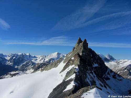 Aiguilles Rouges d'Arolla from Pointe de Darbonneire
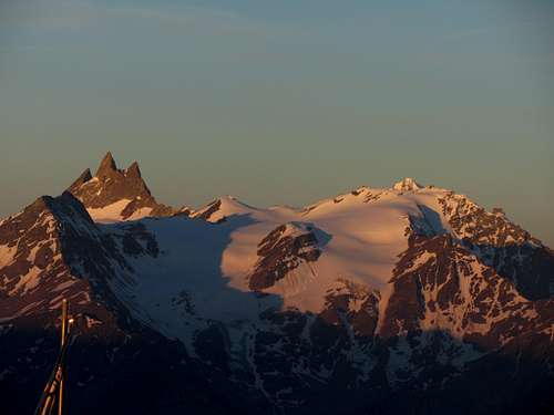 Mont de l'Etoile, Aiguilles Rouges d'Arolla, Pointe de Darbonneire and Pointe de Vouasson (from Cabane des Becs de Bosson)
Getting There
Starting point for the Pointe de Darbonneire is the Cabane des Aiguilles Rouges (2810m). In spring (for skiing) it is possible to start in La Gouille (1834m) or Arolla (2006m). When there is not to much snow (late summer) it should be possible to start in La Gouille or Arolla as well. However, almost everyone starts at the Cabane des Aiguilles Rouges.To reach the Cabane des Aiguilles Rouges you can start in Arolla or La Gouille (via Lac Blue). Approximately 3 hours (a bit longer if you start in La Gouille).
The hut can also be reached from the Cabane des Dix, via the Col des Ignes (3183m), Pas de Chèves (2855m) or Col de Riedmatten (2919m)(4-5h).
From the hut you follow the white-blue marks untill you reach the Glacier the Vouasson (ca. 3300m), staying on the right side of the Pointe de Darbonneire. Walk westward past the Pointe de Darbonneire untill you reach the Col Nord de Darbonneire (3363m). After reaching the Col Nord you scramble up the rigde leading to the summit, a fairly easy scramble (ca. 15-30min from the Col). ca. 2h from the hut.
- North face (when there is still enough snow on this face): F
If there is still enough snow on the north face of the Pointe de Darbonneire you can go directly to the summit (15-30min from the base), in stead of going to the Col Nord first. When most snow is melted it's more difficult to take the north face due to lots of loose rocks (ca. 2h from the hut).
- Col Sud de Darbonneire: F
Start following the white-blue marks, but instead of keeping right of the Pointe de Darbonneire, go left of the Pointe de Darbonneire. Cross the Glacier Supérieur des Aiguilles Rouges untill you reach the Col Sud de Darbonneire (3336m). Fairly easy scramble (appr. 100m of elevation) towards the Pointe de Darbonneire. A liitle bit more difficult than the other routes as the Glacier des Aiguilles Rouges is a bit steeper and has more crevasses than the Glacier the Vouasson (ca. 2h from the hut).
Material needed:
glacier equipment, rope, ice axe, crampons,...
 Red: north face; green: Col Nord de Darbonneire; purple: Col Sud de Darbonneire (seen on the way to the Pointe de Vouasson). Normally there isn't as much snow as we encountered.
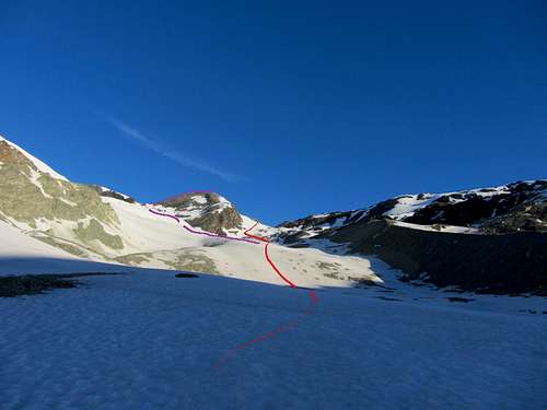 Purple: Col Sud de Darbonneire
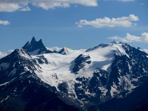 Red: north face; green: Col Nord de Darbonneire
Guidebooks:
Guide des Alpes valaisannes 2
Du Gd-St-Bernard au Col Collon
Maurice Brandt
SAC/CAS
or
Guide des Alpes Valaisannes 3
Du Col Collon au Theodulpass
SAC/CAS