
-
 594 Hits
-
 76.66% Score
-
 7 Votes
|
|
Mountain/Rock |
|---|---|
|
|
39.83318°N / 106.11769°W |
|
|
Hiking |
|
|
Spring, Summer, Fall, Winter |
|
|
10686 ft / 3257 m |
|
|
Overview
Prairie Mountain
Elevation: 10686 / 3257 m
CO Rank : 1950
CO Prominence Rank : 2832
Counties: Grand and Summit
Quad: Ute Peak
Nearby Peaks: Ute Peak
Line Parent : Williams Benchmark
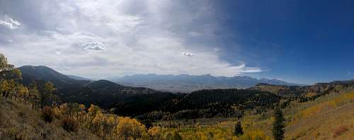
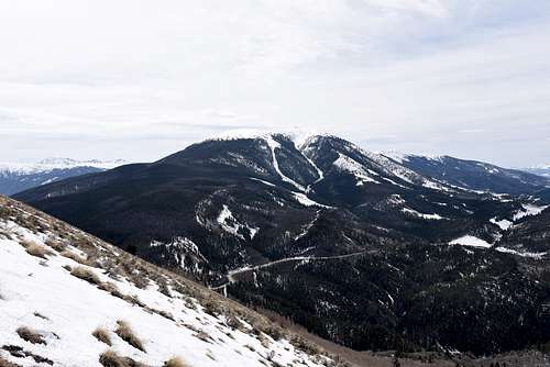
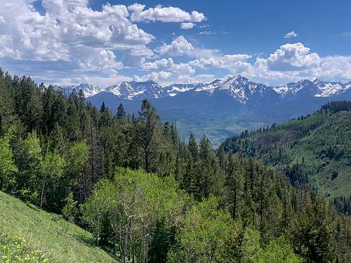
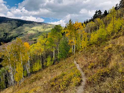
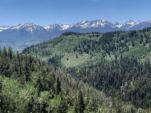
Prairie Mountain is a peak inside of Arapaho National Forest, nested just northwest of Ute Pass. This little mountain will offer you nice hike year round with fantastic views from te top. Best time to hike this mountain is spring and summer if you like to enjoy wildflowers, but at same time it will bring you joy in fall enjoying season change with some very beutiful and recognizable Colorado fall collors.
Getting There
|
|
|
Ute Pass is a popular scenic route for locals that is used to travel between the towns of Parshall and Silverthorne. This road and all of its beauty has so much to offer for anyone who chooses to travel along its path.
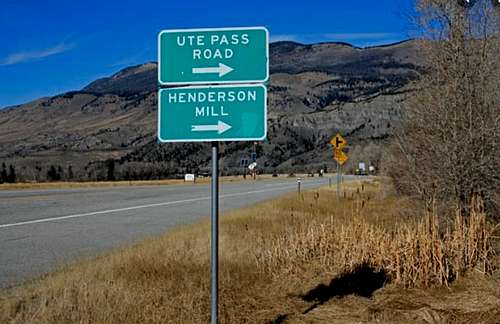
Driving this scenic road provides the opportunity to explore both the Arapaho and Roosevelt National Forests. Hiking is easily accessible in many areas, and you should definitely check out the Ute Pass Hiking Trail as well as Ute Peak. Fly fishing and spin fishing are also available, as you will have access to the Colorado and the Blue River. You will pass by Williams Fork Reservoir and a short detour away is Green Mountain Reservoir in Heeney. Be sure to take a peak at Henderson Mill to experience some of Colorado’s rich mining history. Ute Pass is not far from the town of Granby, and is accessible off of US Highway 40 in Parshall.
- From Granby :
Head west towards Parshall and turn off Hwy 40 just east of Parshall onto CR3. Winding through the Williams Fork Valley, you’ll pass the Henderson Mill up over the top of Ute Pass and descend down to Hwy 9, which lies in between Silverthorne and Kremmling. You can turn right onto Hwy 9 and head through Kremmling on your way back to Granby and Winter Park, or you can turn left on Hwy 9 and you run into Dillion and Silverthorne. From there you can pick up I-70 East and you catch Hwy 40 at exit 232 to head over Berthoud Pass back to Winter Park.
- From Denver:
Take I-70 west to Highway 9, then turn onto Ute Pass. It runs all the way up to Parshall, Colorado on Highway 40. From Hot Sulphur Springs in Grand County, head west on Highway 40, and take Ute Pass south. No matter where you start, this 27.2-mile-long road offers pristine views of true Rocky Mountain wilderness.
Route
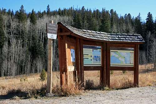
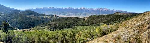
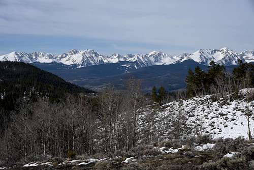
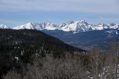
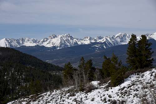
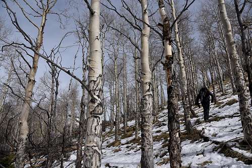
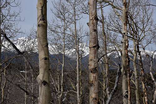
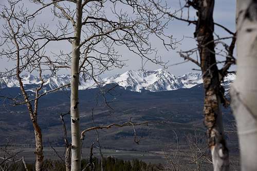
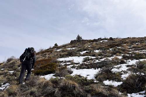
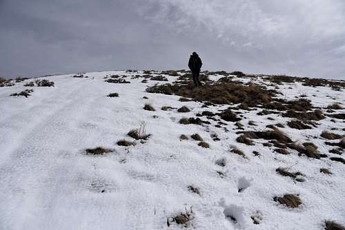
This is easy and very simple hike, from Ute Pass Trailhead follow trail heading nortwest. Trail is pretty much well beaten path that goes around actual butit doesn't go to the summit. Approximatelly after .09 you shoud leave trail and aim for the summit. Some navigation and bushwacking involved, but once above treeline it's pretty much tundra walking on gentle slope to get to summit. Views from top of Prairie Mountain are excellent especially looking toward Gore Range. This mountain can be hike year around.
|
|
|
|
|
|
|
|
|
|
|
Red Tape
Be sure to review and follow Leave No Trace principles to keep our land Grand! Whatever your means for exploration, it pays to be prepared on the trail or in the backcountry. Some tips may not surprise you, like you should always tell someone where you're going and when you expect to return. But if you're just starting out, it's best to know more than the location of your trail head. As with any form of exercise, consider expert advice before you begin.
To be adequately prepared for a wilderness hike, there are 10 essentials systems you should always carry:
- Navigation: compass and maps
- Sun Protection: sunscreen, hat, polarized sunglasses
- Insulation: extra clothing/layers
- Illumination: headlamps or flashlights
- First Aid: kit or supplies
- Firestarter: waterproof matches, lighters, flint, trioxane tablets
- Repair Kit: tools, a multi-tool with a knife, duct tape
- Nutrition: at least an extra day's worth of food
- Hydration: a means of treating water, one extra water bottle, know your closest water sources
- Emergency Shelter: a tarp and ropes, space blanket, even a large plastic bag
At altitudes above 8000 feet, oxygen deprivation can cause altitude sickness, which is common and easily treatable, but can be life threatening in some cases. Work towards higher elevation changes over several hikes, plan short trips until you are acclimated and use heavily trafficked trails until you know your limitations. If you feel short of breath, fatigue or headache, take a break until it passes or move to a lower altitude. If your symptoms worsen or include chest tightness, dizziness, loss of appetite, cough or confusion- immediately seek medical attention.
Be prepared for Colorado's ever-changing weather conditions. Afternoon thunderstorms are common in the summer months. You should be especially cautious when you're going on a summit hike. Bring your ten essentials and begin early enough to be off the mountain by noon. In winter, check avalanche conditions before you depart and carry the recommended safety equipment. View current weather conditions here.
When to Climb
All four seasons.
|
|
|
Camping
External Links
https://www.listsofjohn.com/peak/2640
https://www.peakbagger.com/peak.aspx?pid=58608
https://www.gaiagps.com/hike/poi/united-states/colorado/arapaho-national-forest/prairie-mountain/
Prairie Mountain - Colorado | peakery