
|
|
Route |
|---|---|
|
|
34.80100°N / 111.753°W |
|
|
Trad Climbing |
|
|
Spring, Summer, Fall, Winter |
|
|
5.6 (YDS) |
|
|
2 |
|
|
II |
|
|
Overview
Courthouse Butte may have been the first technical summit climbed in Sedona, with the original South Bowl Route first climbed in the 1930s! It fits the definition of an adventure climb, with a long and convoluted approach and plenty of scrambling, with only a fraction of the ascent involving technical climbing. While I wouldn't recommend this route for the quality of the rock climbing itself given the short pitch, the overall route is challenging and fun, and brings you to the small sandstone summit block of an iconic Sedona Summit with outstanding views across Arizona's Red Rock Country.
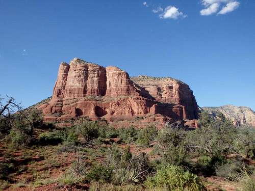
Courthouse Butte South Bowl
Getting There
From Interstate I-17, exit for Oak Creek Village heading on Route 179 towards Sedona, drive 8.4 miles passing through the village of Oak Creek through several roundabouts to the Bell Rock Vista and Trailhead. Park here. If the lot is full, you can drive another mile further north to the Courthouse Vista and Trailhead, although this will add distance to your approach. A Red Rocks (or America the Beautiful) Pass is required at both lots.
Route Description
Once you've found the use trail, follow it up some fractured cliffs bands to the left to get above the first rock layer. Traverse back east and look for some steep class 3 lines just past a large dry waterfall to get you to the next tier. This part is well traveled with occasional ducks, as there are some nice ruins tucked into the rock face at the top of this series of ledges.
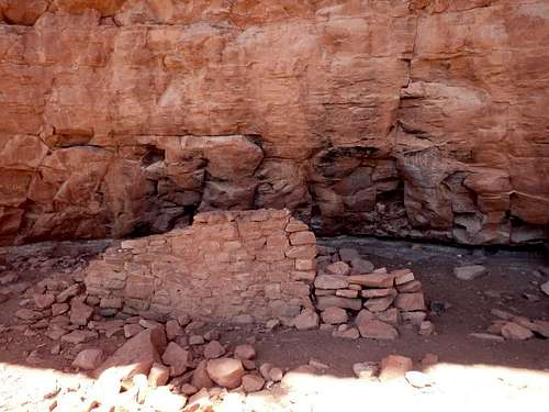
Ruins in the South Bowl
Just east of the ruins is the base of the first section of tougher climbing, although I doubt many, if any, parties rope up here. The route climbs about 80' up a pseudo-arete just left of a prominent dry waterfall. I would put it at mix of exposed class 3 and class 4/5.easy, with the only unnerving part being trusting the fractured sandstone. Two old pitons are hammered into the rock at the top of the pitch, which, if you trust, you can use to rappel the large dry falls next to the pitch.
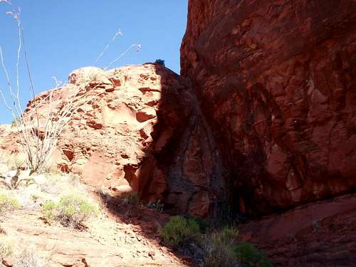
Base of the pseudoarete
Above the arete is a larger series of flat slabs. Hike the easy sandstone slabs directly up and into the bowl angling slightly left, and scramble up the next set of cliff bands to reach the next large, flat tier. This last part is a bit tedious. The upper bowl is split by two rock fins, one large one up and to the left, and a smaller one up and to the right, which is just under the upper technical pitch. The goal is to follow use trails through the worst brush of the climb, following mainly the low point of the bowl up to the highest ledge below the summit cliffs. Resist the tenancy to try and find a line on the right side of the bowl- sharp holly and scattered cacti grow right up against the rock making it a miserable bushwack. If you can find the use trail at the base of the bowl, you'll save yourself a lot of trouble. Once at the upper band at the head of the bowl, traverse east to the base of the rock pitch, hugging the rock face to stay above the brush.
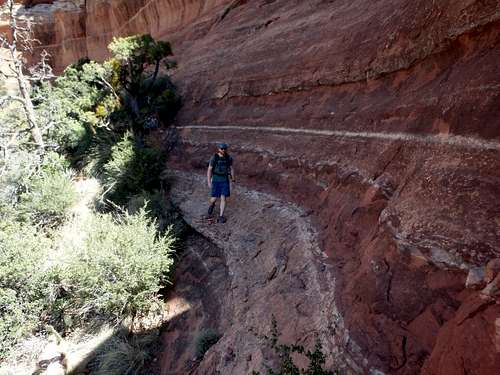
Too much brush!
Traversing out of the bowl and hitting the corner, you should reach smooth slabs and the start of the 5.6 pitch. The pitch itself is about 50', with easy slabs lower down, a short 10-12' section that is about ~5.3 to a small landing below the crux. The crux is a mantle move that many people feel is a bit sandbagged, with a bolt about 3/4 up the sandstone face, and a piton just below the last move. The tricky section is reaching the lip just below the bolt. As of 2017 there was a fixed static rope is place to help out, but I would not depend on it for protection being battered by the elements day in and day out, only a bit of an aid when clipping the bolt.
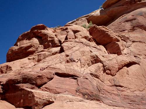
Base of the pitch. You can see the fixed line running through a break in the mantle move higher up.
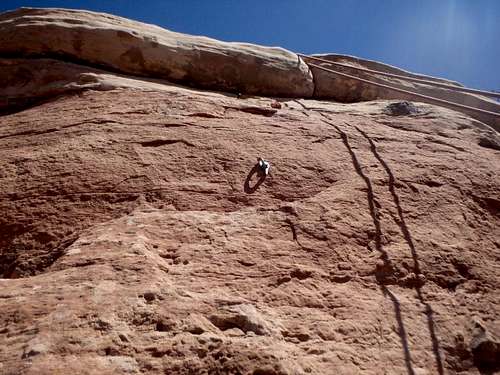
Just below the crux.
Once above the crux there's a monster two bolt anchor with a lot of webbing. If any of the webbing looks suspect, I would have some extra on hand to replace it. Above the crux, it's still another 400' of easy class 2 with the occasional scrambling to reach the summit, a pale sandstone block with some small caves tucked beneath. A summit register should be tucked in the summit cairn.
Essential Gear
A 40 meter rope should get you to at least the easy slabs at the base of the upper pitch. At least a 50 meter is needed if you plan to rappel the lower pitch off the pitons, although I used a 60 so I can't say the 50 would definitely be long enough lower down.
Don't count on the integrity of the fixed line if present, it is completely exposed to the elements and should not be trusted to hold a fall.
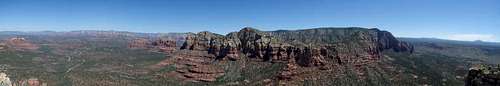
Summit Panorama