
-
 58131 Hits
-
 90.07% Score
-
 32 Votes
|
|
Route |
|---|---|
|
|
44.13720°N / 113.7794°W |
|
|
Hike/Scramble |
|
|
Most of a day |
|
|
Class 3/4 |
|
|
Overview
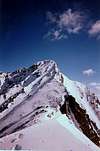
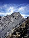
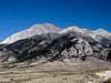
The southwest ridge of Borah Peak, more commonly referred to as "Chicken-Out Ridge", is the primary route used to ascend the peak. The route is short but involves considerable elevation gain, making for a continuously steep hike.
The route ascends over 5200 feet elevation to the summit in less than 3.5 miles of trail.
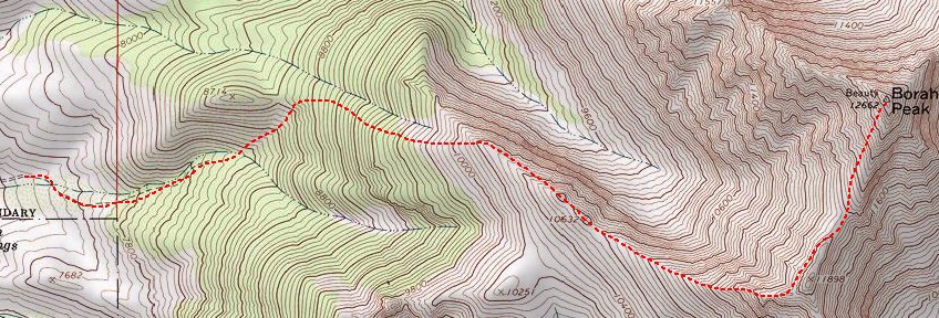
Map of the southwest Ridge route
 |
 |
 |
 |
 |
Approach
Refer to the main page 'Getting There' section for directions on reaching the trailhead.
 |
 |
 |
 |
 |
Stats
One-Way Hiking Distance: 3.4 miles
Elevation Gain: 5,212 ft.
Average Gain per Mile: 1,533 ft.
Trailhead Elevation: 7,450 ft.
Summit Elevation: 12,662 ft.
Route Description
This route begins at an elevation of ±7,200 feet. The steep but well maintained trail leaves the trailhead parking/turn-around area and ascends the sagebrush & grass slopes to the ridge.
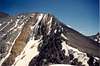
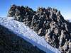
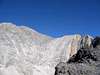
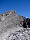
The first 2,500 vertical feet follow a steep trail without switchbacks. At about 10,200 ft, you'll reach treeline. Follow the knife-edge ridge up to the exposed "Chicken-out Ridge." This part of the climb has acquired a nasty reputation, but if you have any climbing/scrambling experience at all, you won't have any trouble. Continue following the ridge to a high point (not yet the summit), then descend a couple hundred feet to the base of the final summit ridge. Scramble up this for about 800 vertical feet to the summit.
The round trip should take the average hiker 10 to 12 hours, but fast climbers can easily do the round trip in 5 hours or less (in good conditions).
 |
 |
 |
 |
 |
Essential Gear
Early in the season an ice axe and crampons are essential. Many people will also want a rope. During heavy snow years an ice axe will be useful for crossing the snow bridge well into the summer. No special gear will be necessary in later summer.
Treking poles may be very useful on the descent.