
-
 6695 Hits
-
 86.37% Score
-
 22 Votes
|
|
Mountain/Rock |
|---|---|
|
|
46.38730°N / 11.72470°E |
|
|
8648 ft / 2636 m |
|
|
Overview
Geographical Classification : Eastern Alps > Dolomites > Marmolada Group > Spiz del Malinvern

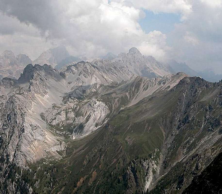
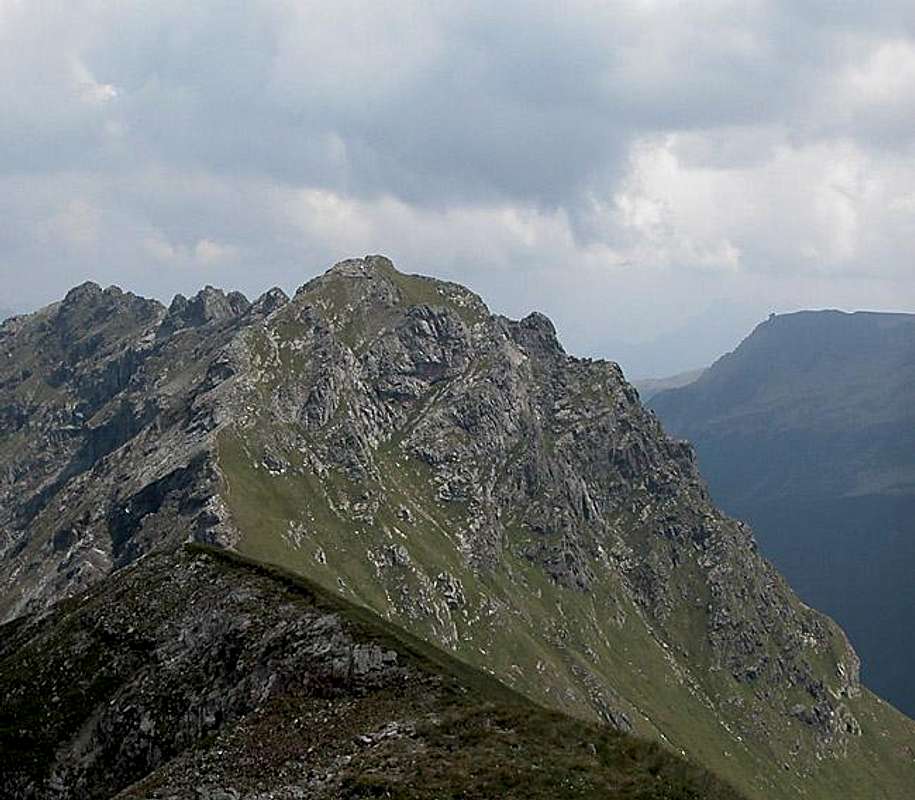
Spiz del Malinvern is the highest summit on the Monzoni Ridge in the Marmolada Group of the Dolomites. When seen from the north it catches your eyes - a north face of dark volcanic rock set between the porphyrry summits of the Rizzoni Crest and the white limestone-like Dolomite of Vallaccia. From the south, where the mountain towers above Val di San Pellegrino, it is covered with grass slopes, albeit very steep ones.
To reach Spiz del Malinvern you must account for a very long day. The mountain is located right in the middle of the Monzoni Ridge and there are only two reasonable ways to climb it - both sides of the ridge. While there are some scrambles which head for the cols between the mountains these cannot be recommended. Very loose and brittle rock make them very dangerous. So the starting points are the both endpoints of the ridge, Punta delle Selle in the east and Forcella la Costella to the west. Both are connected by a ridge ferrata, the "Alta Via Bruno Federspiel", which is an easy but strenuous hike with a couple of nicely exposed climbing sections. You will find firmly fixed cables on the Rizzoni Crest east of Spiz del Malinvern.
By far the most dangerous part of the Federspiel Ferrata, however, is the unprotected part around Spiz del Malinvern. The trails rund directly above the 100m - 200m drops of the north face and while the ascent can be done easily from either side the descent along the western ridge is tough. The scree covered rock is slippery even in dry conditions and I would not want to get down there in wet weather. There are four rappelling anchors on the western side of the summit which might facilitate the descent - if you have been lucky enough to bring a long rope.
Speaking of the weather - you should only climb Spiz del Malinvern in perfect weather conditions. The Ridge traverse takes about 4 hours but the ascent to either of the starting points 2 - 3h in addition. You must account for a long 9h hiking day if you want to do the whole ridge and return to your starting point. In case of sudden thunderstorms there is an escape route from Spiz del Malinvern, heading southwest along the ridge of the Pale Rabbiose. The first part starting from the summit looks easy enough but once you get to the Pale Rabbiose the rock gets very fragile and chossy. Moreover trails end there and you need good routefinding skills to make it into Valle di San Pellegrino below.
All this makes Spiz del Malinvern a very solitary destination. In late July 2005 we encountered no other climbers on the whole Monzoni Ridge and even if some venture out on the route the length of the ridge ensures that you won't get bugged. Views are fine and completely unexpected for those who think they know the Marmolada Group but you can decide for yourself in the following section.
 |
 |
 |
 |
 |
The summit views
Sas de AdamPiz BoèColacSas di RocesCroda NeraRoda de MulonPala di VernelGran VernelPiccolo VernelSas dal PiefPala di CarpellaPunta del OrtMarmoladaGrande e Piccolo LasteiCostabellaPunta de le ValateCima UomoPunta delle SellePunta AllochetR i z z o n i C r e s tSpiz di TariciognCol Margherita
 |
 |
 |
As said above the views of the Marmolada Group from this vantage point are fine and rather unexpected. Naturally from everywhere else Marmolada draws the attention but from Spiz del Malinvern to the far south-west of the group the Queen of the Dolomites is just too far off. Which leaves the other closer peaks for better inspection.
During our climb we had a bit of bad luck - hazy views in all directions. The Pale di San Martino Group was virtually invisible and the other groups could only barely be made out in the mist.
 |
 |
 |
 |
Getting There
There are two possible trailheads for the climb along the Monzoni Ridge: Passo di San Pellegrino to the south-east and Malga Crocifisso in Val di San Nicolò to the north. Depending on what you want to do one might be preferrable to the other.
The usual itinerary calls for a climb along the Costabella ridge to Passo delle Selle where you can find accommodation in a rifugio. Then the climb along the Monzoni Ridge to Vallaccia along Alta Via Federspiel and back by Valle Gardecia and Valle delle Selle. If you want to do a day tour you better start from Malga Crocifisso. But then you're in for a long day with 1700m overall elevation gain!!
Passo di San Pellegrino
- From the North (Brenner / Brennero)
Follow motorway A22 down to Cornedo (north of Bozen / Bolzano). There turn east on SS241 (Dolomite Highway) across Karerpass / Passo Carezza to Vigo di Fassa. At Vigo turn southward on SS48 which leads you to Moena. In the centre of the town SP346 turns off eastward in direction of Passo San Pellegrino. Park your car at the free lot near the hospice and take trail 604 to Passo le Selle - From Verona
Take A22 north until the exit Ora / Auer. There turn east on SS48 direction Val die Fiemme which in the end will take you to Moena. Turn onto SP346 east in the centre of the town. For the remainder follow the instructions above.
Malga Crocifisso
- From the North (Brenner / Brennero)
Follow motorway A22 down to Cornedo (north of Bozen / Bolzano). There turn east on SS241 (Dolomite Highway) across Karerpass / Passo Carezza to Vigo di Fassa. At Vigo turn northward on SS48 which leads you to Pozza. In the centre of the town a small road leads into Val di San Nicolò. From Malga di Crocefisso you can take advantage of a shuttle service to Malga Monzoni saving you 30 - 45min. - From Verona
Take A22 north until the exit Ora / Auer. There turn east on SS48 direction Val di Fiemme which in the end will take you to Pozza. Turn east into Val di San Nicolò.
 |
 |
 |
 |
Red Tape
There is no red tape here. Part of the Federspiel Ferrata (the eastern one) runs along and through old WW I fortifications. Look but don't touch - there are quite a number of signs explaining the war history.
When To Climb
The best climbing time is June through September. Winter ascents with skis or snowshoes are possible but don't use the ridges. Rather try to reach Spiz del Malinvern directly from Valle di San Pellegrino via Val Ricoletta, which heads up the slopes directly to the summit.
Accommodation
Camping
The closest campground is Vidor in Val di San Nicolò. Its address and the ones for the other nearby campgrounds are:
- Vidor
Località Vidor
Pozza di Fassa
Tel.: +39 0462.763247
Fax: +39 0462.764780 - Catinaccio
via Avisio 15
Pozza di Fassa
Tel.: +39 0462.763305
Fax: +39 0462.763501 - Soal
via Dolomiti 32
Pera di Fassa
Tel.: +39 0462.764519
Fax: +39 0462.764609 - Camping Eden
Via Pecol 2
32022 Falcade
Tel.:+39 0437 599138
Fax: +39 0437 599138
Other accommodation
The best information on boarding houses and hotels can be found on www.dolomiti.it. The site is not complete – you might find more information on local tourist web sites, but it already offers an impressive list. The following listing gives you an overview for the surrounding villages and towns:
Val di Fassa
Agordino
Weather Conditions
Passo di San Pellegrino is the border between Belluno and Trentino. Spiz del Malinvern is located a bit to the north-west of the pass so that both weather forecasts apply here:
Weather conditions in Belluno: www.meteoalpin.com. For the english text you have to scroll down the right frame.
Weather and avalanche conditions in Trentino: www.meteotrentino.it
Weather conditions Dolomites:www.dolomitimeteo.com
Maps 'n' Books
Books:
- Vie Ferrate
- Hülslers Klettersteigführer
E.E.Hülsler
Bruckmann Verlag
ISBN: 3 7654 4161 9
- Hülslers Klettersteigführer
- Hiking and Trecking
- Höhenwege in den Dolomiten
H. Dumler
Bruckmann Verlag
ISBN: 3 7654 3860 X - Dolomiten
P. Fleischmann
Kompass Verlag
ISBN: 3 8705 1409 4 - Dolomiten 4
F. Hauleitner
Rother Verlag
ISBN: 3-7633-4061-0
- Höhenwege in den Dolomiten
Maps:
- Val di Fassa, Marmolada, Gruppo di Sella
Kompass Map WK 686
ISBN: 3 8549 1768 6
Scale: 1:25000 - Sellagruppe / Gruppo di Sella
Kompass Map WK 59
ISBN: 3 8549 1066 5
Scale: 1:50000