Flipping Holmes - March 29th, 2014
I was long overdue for peaks, and especially P2K’s. My last was a month and a half ago on Gass, an eternity compared to most of my years in Utah. The interim had certainly not been wasted, fruitful weeks indeed exploring some P1K’s and spending QT in the Utah’s amazing National Parks and Monuments, even some basic tourist shit that I secretly and occasionally crave. Then the first weekend of March Madness kept me in the city for all day Basketball binge watching, which I certainly don’t consider time wasted.
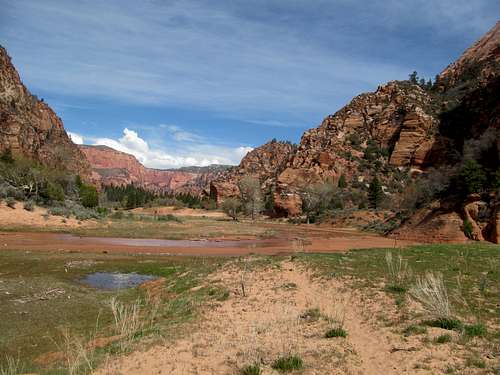
The elite eight gave me some breathing room, with only two games each during the weekend, and I hoped to hit up two peaks in the Henry’s. Greg had always raved to me about how much he loved that mountain range and how he wished to go back, but I hadn’t thought much of the range since taking a couple of my then New Yorker friends up that peak. However, glimpsing the “Little Rockies”, the rugged twin beacons of Mt’s. Holmes and Ellsworth while traversing the Waterpocket Fold along Upper Muley Twist had satiated my interest. I waffled about on Friday, observing faltering weather reports for southern Utah and balancing my need for basketball along that of these two intriguing hermit peaks. However, a good hotel deal at the Ticaboo Lodge sealed the deal; what was this, a relatively upscale hotel located past the middle of nowhere, perfectly situated for both peaks as well as for TV’s and National Semifinals once I was done climbing.
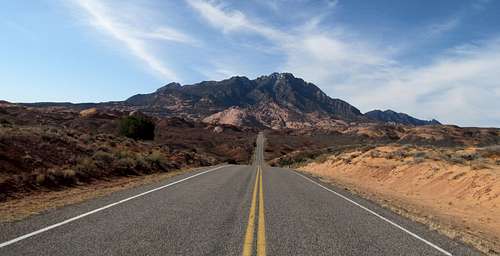
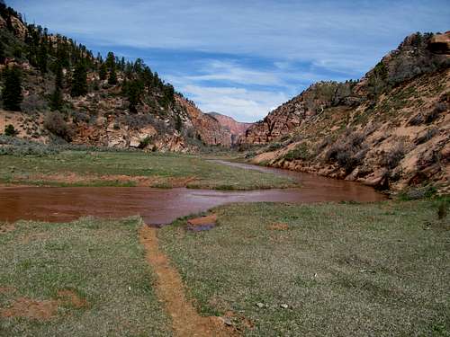
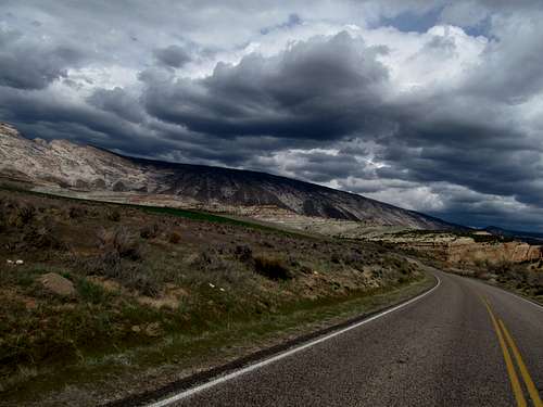
Utah 276 was new territory for me; true to their history I considered the Henry’s still a blank spot on the map. Despite seeing it in my atlas it still defied belief to travel a paved highway so deep into this mysterious land past the tourist “services” at Hanksville and into the unknown, winding by and past the Henry’s straight to the trailhead for Holmes off the side of the highway.
Using’s Greg’s directions on SP and my own GPS markings I parked and continued a bit further down the highway, descending a drainage and following the sparse cairns to find the 4WD road that leads to the standard North Ridge route. A couple of hikers had started off while I was putting my boots off, and I caught up to them crossing a steep dry wash during the road walk. How shocking it is to encounter other hikers on such a remote and obscure peak, especially ones who were intent on the same end destination. There were from Colorado, had climbed their fair share of technical peaks (including the Canadian Rockies), and had cliffed out then run out of time on Ellsworth the day before.
I chatted with them a bit before hurrying on, eventually separating with them in the slickrock section intent on finishing the peak before tip off of the basketball games.
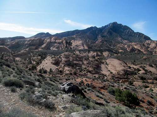
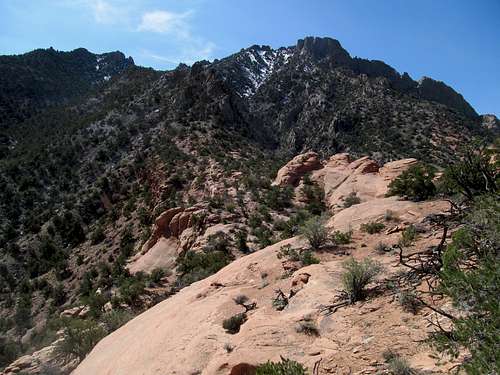
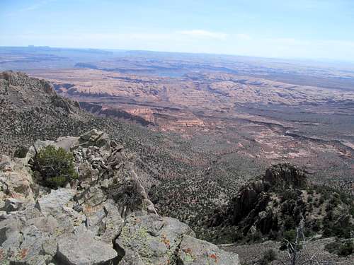
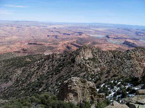
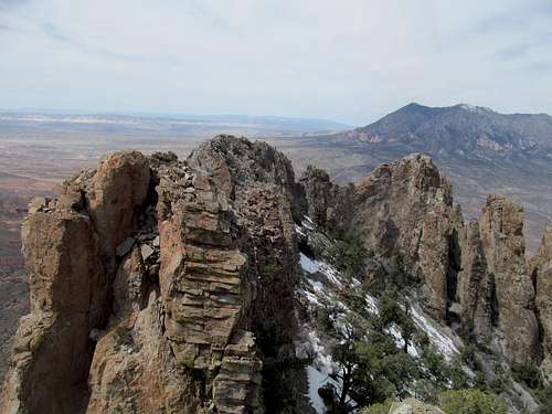
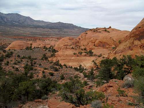
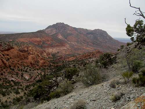
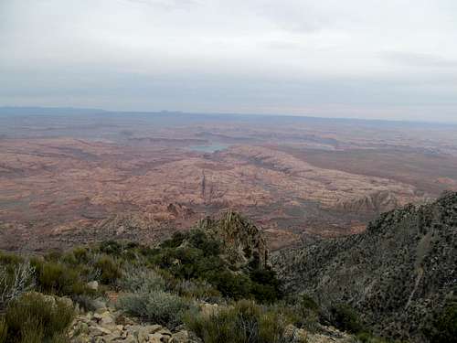
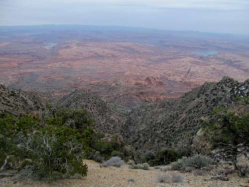
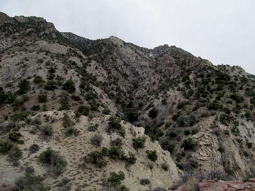
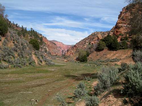
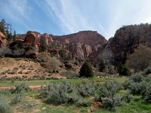
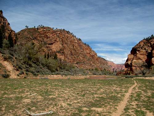
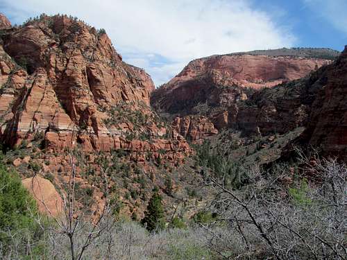
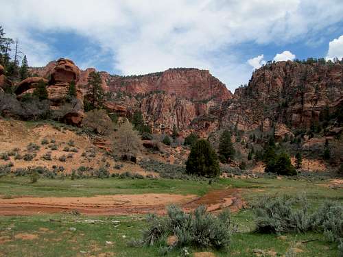
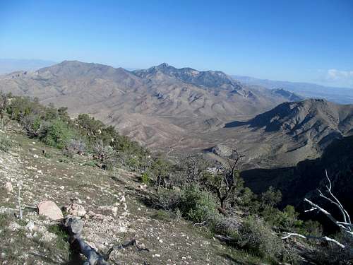
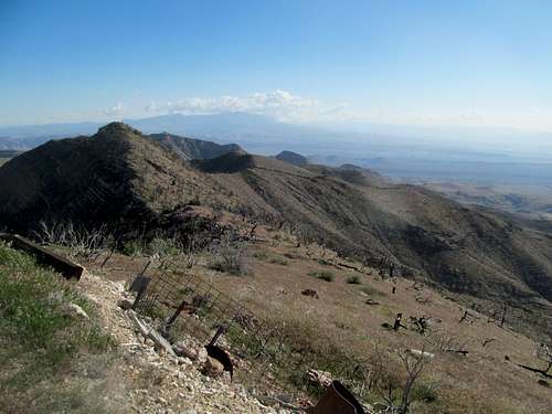
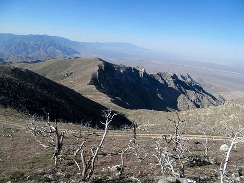
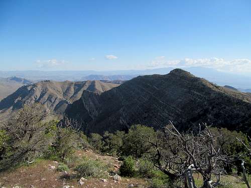
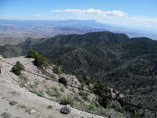
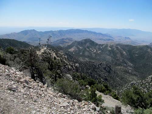
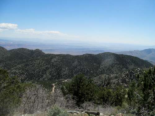
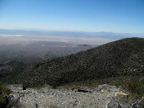
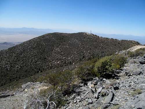
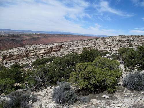
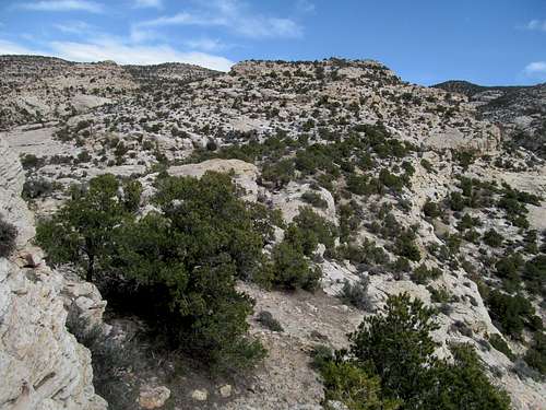
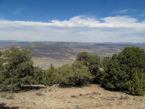
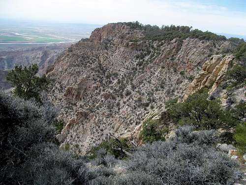
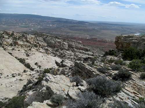
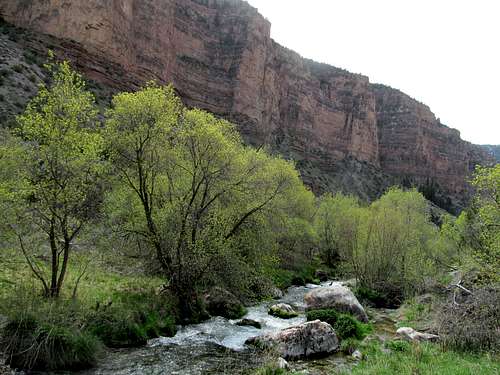
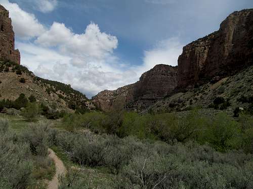
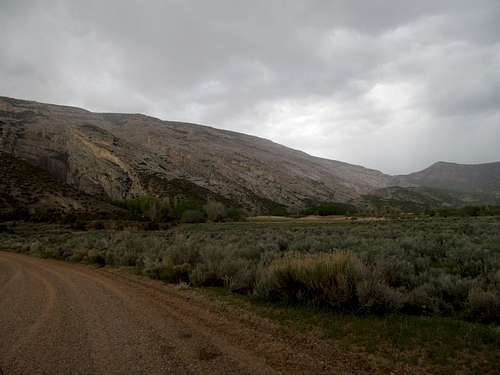
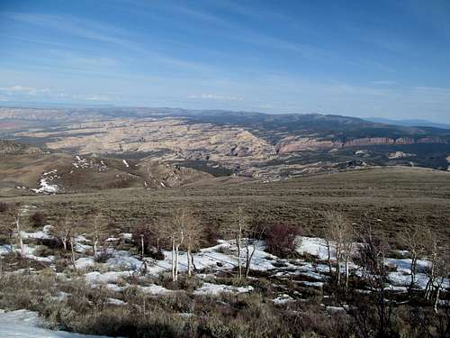
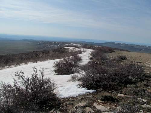
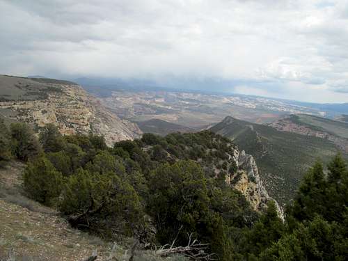
The lower part of Holmes is a spectacular destination unto itself, packed with rock fins and formations worthy of Zion or any of Utah’s other national parks and monuments; indeed they appear to be a mere extension of the labyrinthine canyons surrounding Lake Powell just to the south. The routefinding wasn’t all that straightforward, requiring some through the wider part of the sandstone ridge, with the choice to stay closer to the rockier ridge crest or stray left at the risk of sidehilling.
I enjoyed a barstool podcast enroute, remembering even vividly today reliving at the time talk of the March Madness games I had watched the weekend before while being forced to undergo some painful scree sidehilling as I approached the sharp pinnacles described in the beta. After rounding it on the left I crossed a narrow fin connecting the lower slopes that I had just ascended to the higher half of the mountain.
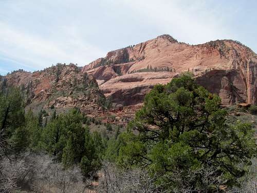
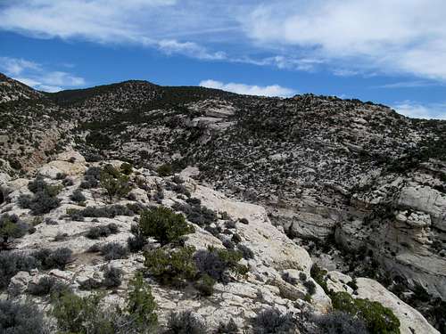
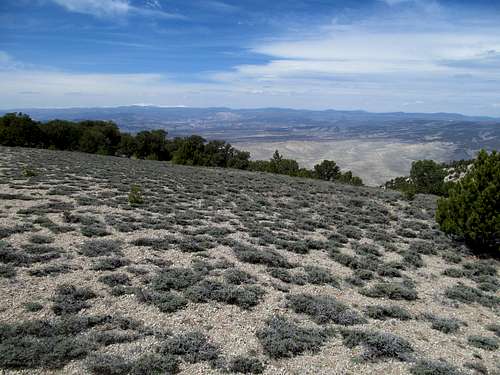
I sweated out the rest of the climb, enjoying the first tentative balmy embraces of summer. The remaining ascent was basic desert shit, exceedingly sleep, somewhat loose, a nonstop grind ameliorated by the steady approach towards the giant rock pinnacles guarding the summit via the parallel ridge.
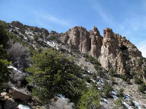
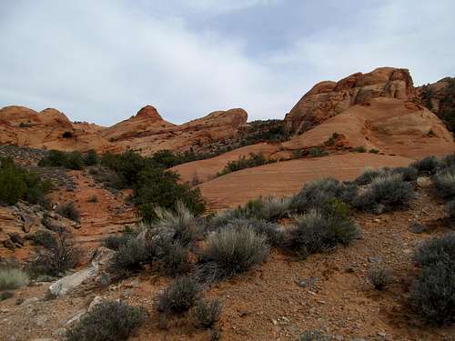
The route ended below the steep but safe gully described by Greg’s SP route. I clambered up knowing the end was nearing, climbing a steep ledge near the top that I later was able to avoid on the way down.
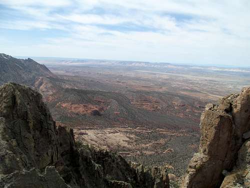
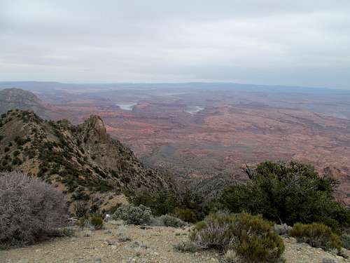
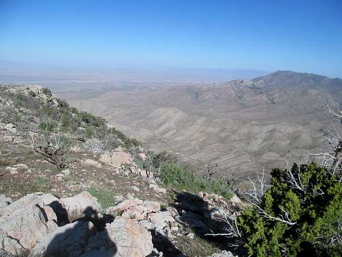
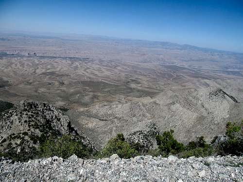
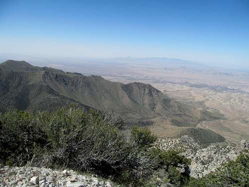
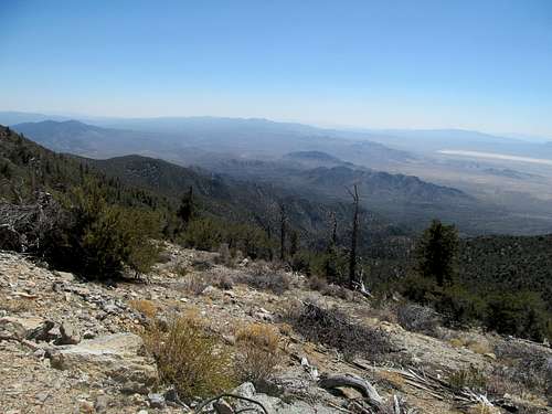
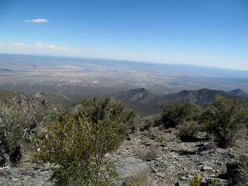
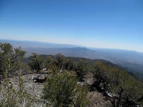
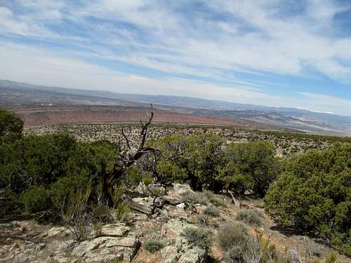
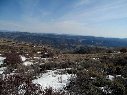
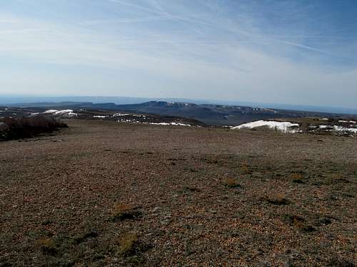
As described the summit was small but scintillating, with views of the multiple summits of Holmes as well as panoramic perspectives of the entire Lake Powell region of Utah. It was a special summit, but I dared not dally too long, for if the vertigo didn’t have a powerful enough effect, the impending Elite 8 tip off did.
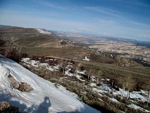
I gingerly made my way down amidst promiscuous picture taking, eventually greeting the two other climbers separately, one maybe seven hundred feet or so from the top, the other near the bottom of the steep section. The latter had decided that he had had enough for the day, and we chatted mountains for awhile before I started back and found myself lost near the midway pinnacle traverse, having strayed too far to the left near where the pinnacles cliffed out. I wandered to and fro several times before backtracking far enough to find the way around.
The bottom slickrock was fun to descend, offering a variety of options. Routefinding still remained a light challenge due to the fact that the end of the 4WD was not obvious, partially due to the fact that it was slightly hidden in a notch, the rest attributable to the fact that I hadn’t paid close attention when hiking up with the two Coloradans.
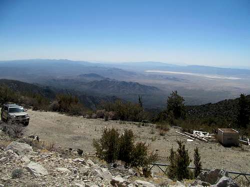
I eventually rediscovered the jeep road and followed it back to my car. The Ticaboo Lodge was a wonderful establishment in the middle of the nowhere. The sports bar on the complex grounds would have been a good place to watch the games but it was still closed for the season, so I enjoyed the games in my room along with the delicious and ample food from the adjacent restaurant.
Edging Ellsworth - March 30th, 2014
This particular weekend in the Henry’s marked an important beginning for me. The past summer I had burned through numerous audiobooks, including Stephen King’s Dark Tower Series servicing the bulk of my hours driving and hiking solo. With Barstool’s podcasts covering only a couple hours a week at most I needed more filler; fortunately I had discovered that my favorite sports radio show from decades past, the Big Show with the Big O (Glenn Ordway), was back in online and on demand form after an involuntary hiatus (he was shitcanned). This was perfect for me and set a pattern for the rest of my time out west, in which I caught up on long hours of sports radio after having used up the few barstool podcasts from the preceding week during the first hours of the drive.
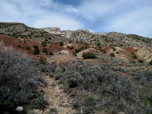
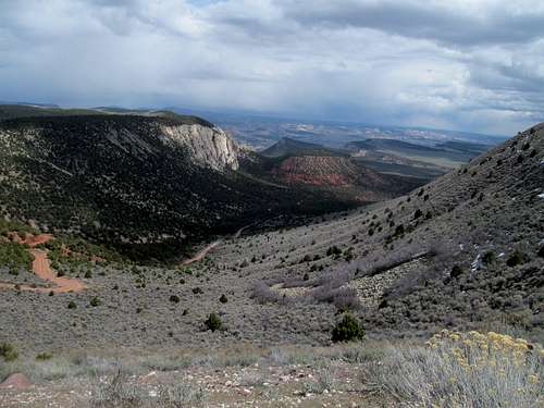
Once more I relived the first weekend of March Madness, this time from the perspective from the Big O and his sadly size diminished (internet) radio cohosts. The chatter of their gossip about the other sports personalities in town (including Felger and Mazz, whom I mostly can’t stand) filled my headphones along with Bruins and Celtics talk as I made my way towards the Ellsworth trailhead the next morning. As I listened to the Big O urge calm amidst the loss of Aqib Talib I was equally dismayed by the inability of my 4Runner, or rather my driving skills, to make the initial steep climb up Ellsworth’s access road. Despite reports of its difficulty, I had garnered an extra hour or so of sleep on the vaguely hopeful notion that I could surmount that initial patch of rough road and make it to the 4WD TH. Instead, I had to park above the highway as I started towards Ellsworth on a dark and ominous morning.
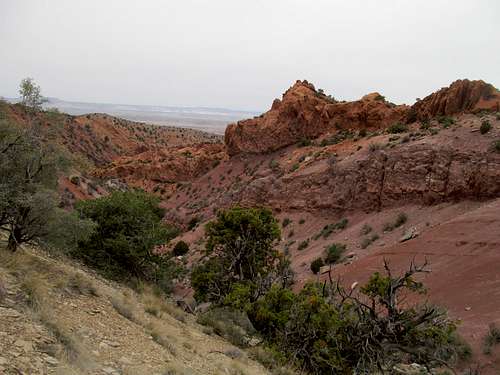
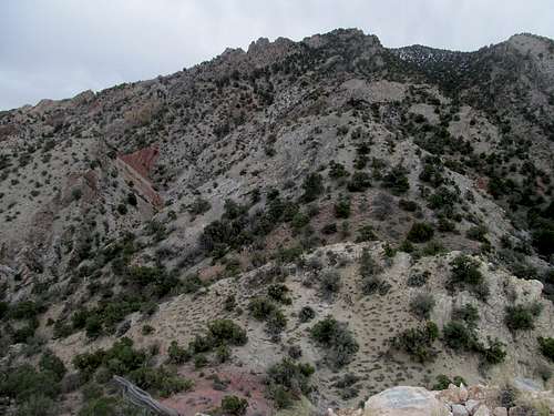
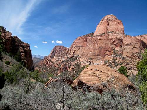
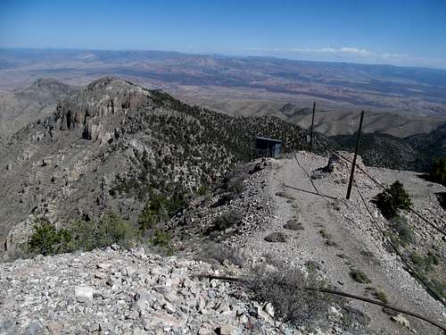
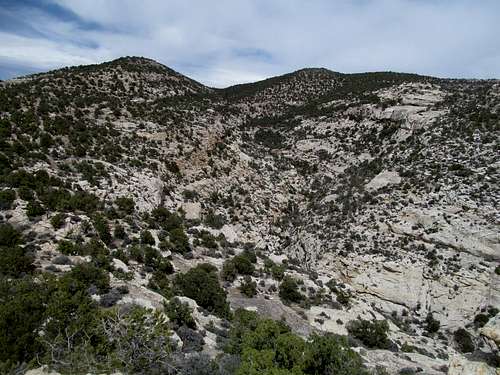
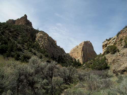
I had a bit of rare luck with the wind, with the bulk of the mountain blocking the southerly gales during my ascent. I followed the road to its end, where I found the transition from road to route a little tricky to navigate. A small but gnarly bump stood between me and mountain proper after crossing a cool red dirt saddle; I first tried following a climbers trail up but it seemed to peter out at the edge of a small cliff. I retreated down maybe 70 feet or so, trying the gully to the right to no avail. After some back and forths I eventually ended up back atop the bump, where finally I found a small dirt path leading around the right side of the cliff and down to the route proper.
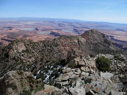
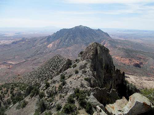
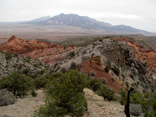
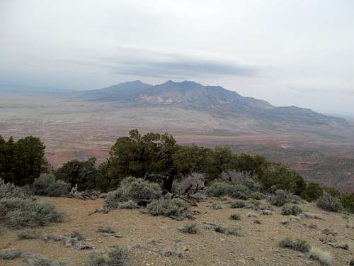
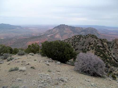
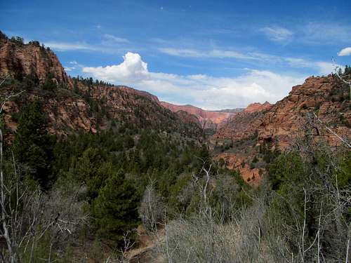
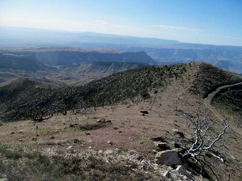
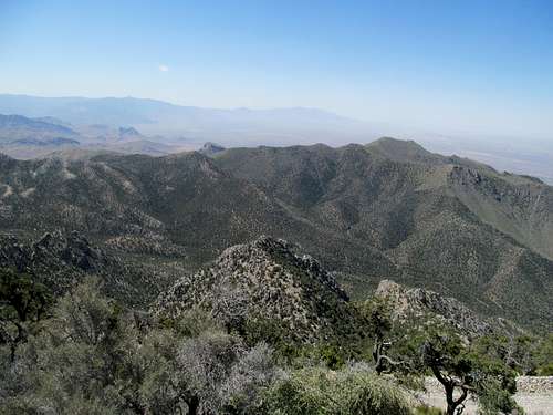
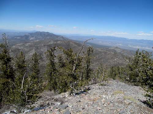
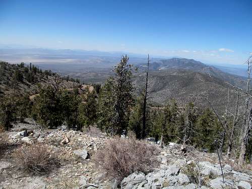
There seem to be three separate flanks up Ellsworth’s north side. While the mountain looks like your typical dull desert bump from the highway, up close you can see the complexity of the terrain. I saw in particular the middle ridge that came down directly from the summit and understood how those two Coloradans who found themselves ascending that vector could have gotten cliffed out before reaching their end goal.
My ridge stood before me, the leftmost of the three, hitting the summit crest east of the highpoint. I followed the sometimes there oftentimes not climbers trail, hitting a couple of the slabby sections mentioned in the route descriptions.
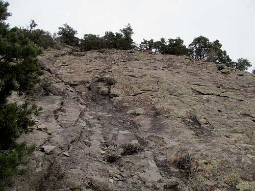
The scrambling was fun and easy enough for me to defer looking for the circumventing trail, and the good solid rock here reminded me almost of the few rare White Mountain scrambles up in New Hampshire.
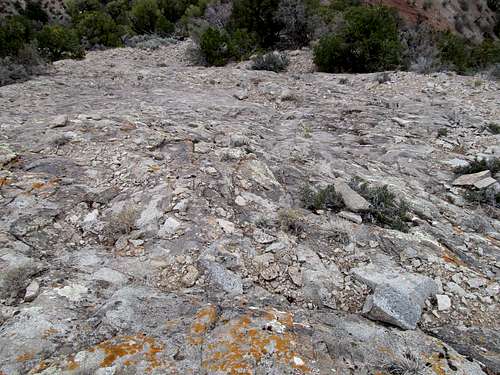
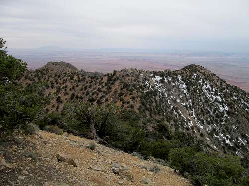
Most of the route further up wasn’t as fun. Steep, loose, and never ending are apt terms to describe it. Despite a few narrow spots, one in particular where it takes a sharp turn left, the ridge is broad enough for you to pick your poison: loose or looser.
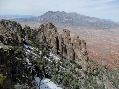
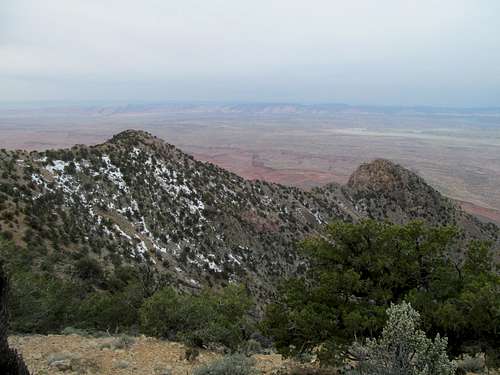
Some pinnacles and more steep slopes greet you as you near the top of the ridge. The summit seems closer than it is, a tantalizing and frustrating prospect for someone who's just realizing that he's probably gonna miss the start of the day's first basketball game.
Finally atop the summit ridge, where brush in a few narrow spots still made things more difficult than they had to be, before an interview with Matt Light accompanied me to the summit.
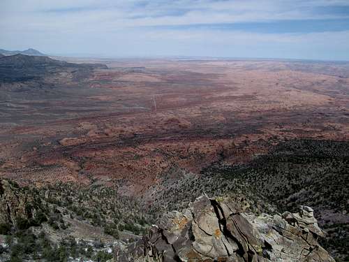
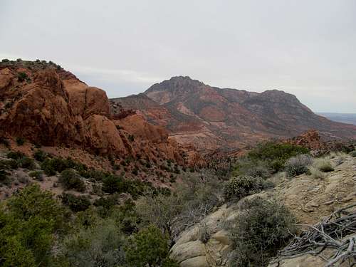
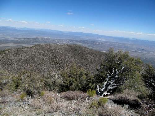
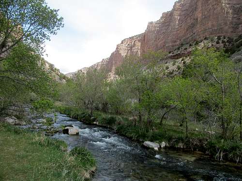
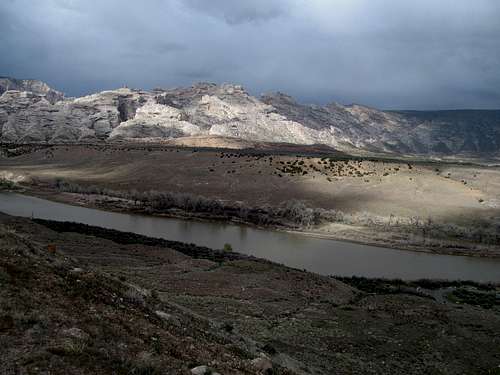
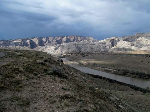
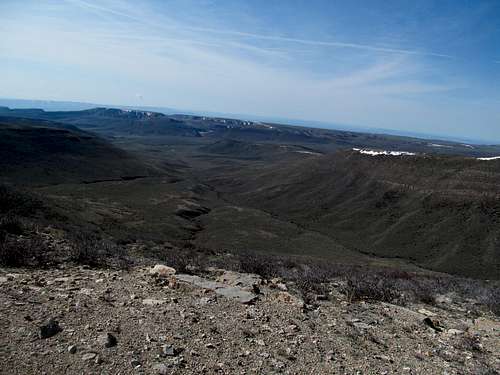
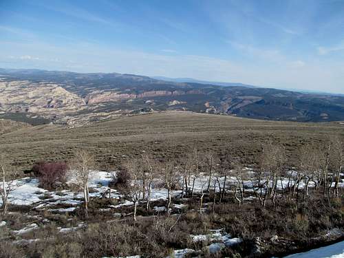
The skies threatened but never stormed, and the low and dark cloud cover provided a different summit backdrop over the Henry’s and the buttes over Lake Powell.
But basketball was calling, and I did my best to follow my GPS tracks down the way I came. At least the scree made for a faster trip down, and the scrambling down was just as easy as on the way up.
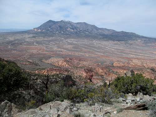
A slight breeze blew at my back as I walked the road back to the 4Runner, admiring the ominous clouds that eventually cleared over Mt. Hillers to the north.
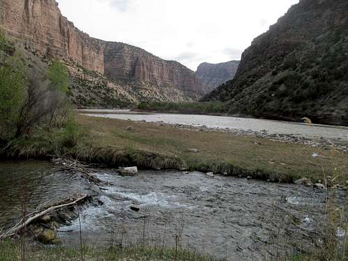
My drive back to Green River was a surreal one. By the time I was driving alongside Pennell the storm around me raged in ways I'd never seen before; Martian dust in every shade ranging from orange to red to brown whirled around me in every direction and blew visible columns and drifts across the highway.
Past this otherworldly tempest I reached the closest bar in what passes for a downtown in town (Ray’s Tavern I believe). The beers were beers and the burgers were good, and above all the Michigan Kentucky game was a classic that I enjoyed before driving through another storm, this a classic Utah spring squall, over Soldier Summit back into SLC.
Hopping around Zion - April 12th, 2014
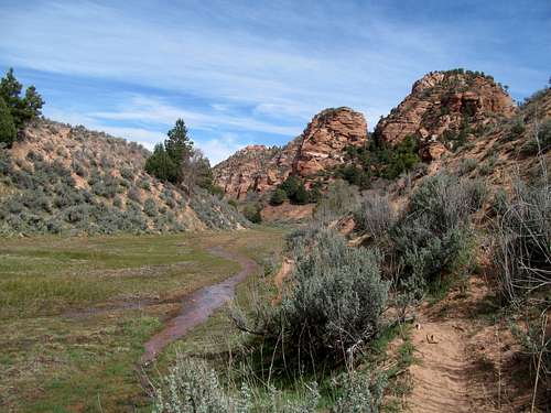
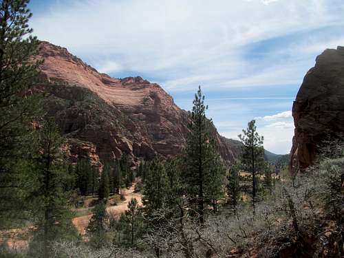
The next weekend I was back in Boston for drinking and friends’ birthday shenanigans. A week later once more bad weather forced me south. Greg had done part of the Zion traverse earlier in the Spring, from Kolob all the way to Zion Canyon. I had always been fascinated by the West Rim Trail, but he said that he felt the Hop Valley section was more spectacular. Never one to doubt what was always sound advice, I took heed and made my way down.
The views were outstanding starting from the scenic though rutted Kolob Reservoir road accessing the trailhead, but then reality seemed to set in as the first miles of the trail were kind of dull and sandy, the latter making for more wear on my legs. Going south to north, I ran into many runners presumably pursuing the traverse.
The trail encounters a jeep track as it descends into the valley, which bloomed in the full lushness of spring.
Intermittent creeks flowered through the canyon bottom, which were lined by neatly red shelved cliffs while the distant towers of Kolob loomed in the distance.
At times the trail got sandy, and other times faded into sandy drifts completely. The views were breathtaking and intimate at the same time.
Eventually you reach the end of the canyon, where you ascend into a small pine forest and crest some hills before a steep decline, switchbacking down into the depths of La Verkin Creek.
Here I intersected the route I had travelled five years before on one of my first forays into the Utah wilds, hiking the 15 mile roundtrip to Kolob Arch a day after my first Vegas bachelor party, on the first of five consecutive days visiting each of the state's five national parks.
It would behoove me writing this back east to feel nostalgic about this, and indeed I do. But in that time and place one year ago I only felt mild bewilderment at my lack of any real sense of déjà vu.
The hike back up was mildly painful in the afternoon sun, and the wading through sand tiresome on the way back despite the scenery.
I checked into St. George and got some food before making the jaunt to nearby Snow Canyon, a state park known by the locals for its national park level scenery. After a couple loop hikes which involved banging my right knee painfully on a boulder, I limped my way to an early curfew knowing I wasn’t missing much of that vaunted St. George nightlife.
Scrubbing West & Highland - April 13th, 2014
Scrub Benchmark
I knew sports free weekends were fleeting while the Bruins were hot, which is why I decided on a three peak day Sunday, not even realizing that this was my only weekend between the Final Four and the Hockey Playoffs. Though they lacked in excitement, they were still P2K’s, and with the limiting weather further north it was time to finally put away Scrub and West near St. George.
First up was Scrub, which featured a fascinating post dawn drive through the Joshua Trees of the Woodbury WSA loop road. The access road was good, but the summit side road soon got too rocky for my britches after a few miles, and I left the 4Runner to get in a healthy 6 mile round trip road walk for the peak.
Once more, nothing exciting, but the views are enlightening. The stretch through the Virgin River Gorge in Arizona between St. George and Mesquite is one of the more fascinating, and to the casual driver, inscrutable stretches of Interstate Highways in the country, and the views from Scrub offer up a revealing bird's eye perspective of the area from the north, reaching all the way down the range to Bangs and Virgin Peaks further south. The Mormon Range hovered to the west, while Signal and the Pine Valley Range dominated the view over the relatively paltry cliffs of Zion.
West Mountain Peak
Backtrack the road, backtrack driving the road, and then driving north past the pretty Gunlock Reservoir to the West Mountain Peak access road, which had thoroughly defeated my Camry in winter a few years before. This time it was smooth sailing until the last few miles when the road got really rough. After an initial steep and rocky ascent the track improved slightly before reverting to par, and I parked at a wide switchback to walk up the last curves, gaining maybe 500 feet in the afternoon sun to get the comparable yet different views of this small corner of Utah.
To the north, the anonymous mountains west of Cedar City stretched their way to the Nevada line, and around me I observed similar views aside from Scrub now standing between me and I-15 in Mesquite.
While I can't say the summit views weren't good, I have to say the best part of this peak were the views along its flanks and saddles, observing the fragile pine trees flanking the rocky colorful upper slopes of this sky island. I sped back to the highway followed it north through the pretty yet tragic site of the Mountain Meadows Massacre, where evergreens bloomed in a fertile terrain, to drop into the barren confines of the Utah West Desert.
Highland Peak
I swung west, hitting a small mountain pass near the state line then dropping into Pioche, where the afternoon sun still allowed for some breathing room for me to drive up Highland, a major Nevada prominence peak and range highpoint. I managed to get up the occasionally rocky road all the way to the summit without issue; with the lack of material snow on a northfacing road I would guess that it gets at least some requisite maintenance during the spring, but despite the smooth ride for my 4Runner I would advise against taking a passenger car to the summit.
I had a few drinks of cheap scotch at the top, gazing at Indian Peak back in Utah, the distant visages of Troy and Currant Peak to the northwest (where I couldn’t tell how much snow remained on their upper reaches), and the Pine Valley Range, still visible despite being a state and worlds away.
There wasn’t much in Pioche on a Sunday besides the opportunity to get some gas station junk food. Wilson Peak, another Nevada prominence peak and range highpoint, beckoned on the way back, but with sun on its way down, the peak as well as nearby Cathedral Valley State Park would have to wait for another day. I would have the chance to get some more Nevada peaks before moving back east, but still have much unfinished business, especially the Chokecherry/Irish/Badger/Pahroc clump here in this southeastern edge of the Silver State.
Split Decision - April 18th, 2014
And such is the nature of time as Hockey Season snuck up on me by Easter Weekend. I had Good Friday off but vacillated between destinations, having to allow in my schedule for Playoff Games against the Red Wings on both Friday and Sunday. After tentatively planning for the Chokecherry Peak area near Pioche NV, I instead decided on Vernal, having never seen the Dinosaur Area before outside of a brief foray on Zenobia Peak four years prior. Friday would be Split Mountain, which I hoped that despite its 13 miles and non-linear route-finding, would allow me to be down in time for an afternoon puck drop.
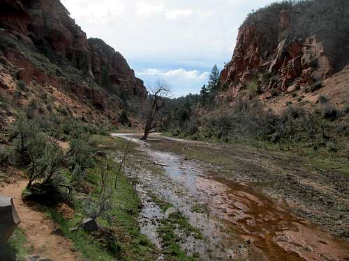
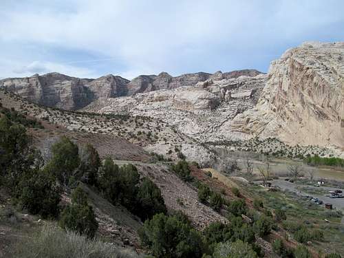
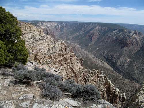
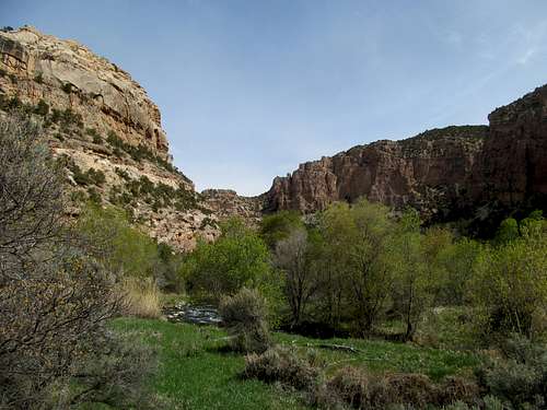
I first need to point out that seeing the jawdropping convolutions of South Split from the highway driving into Dinosaur is a near life-changing experience. It is geology laid bare for you, but rather than the grand and almost abstract form of a place like the Grand Canyon, the formations here are intimate, cramped, and infinitely schizophrenic.
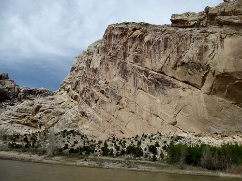
Even with a 4Runner I always count a paved access road a bonus, and the parking lot right at the edge of the Green River for the Desert Voices Trail was as breathtaking as it gets, the terrain leaving little breathing room from the immediacy of the river to the sheer and crooked canyons rising directly from the water.
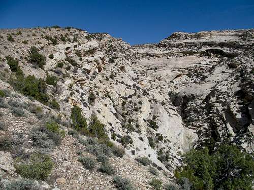
The trail takes you away from the chaos, following its intent as a simple easy desert nature/interpretive trail gently coursing through the barren dunes out of sight from the river and the canyon. Following the use trail in and around a narrow wash after the trail diverted south wasn’t much of a big deal, but the trick was to find the right canyon and ridge to leave the trail and begin the climb up the scaly south ridges of the massif.
Months ago I would have had to try and best commit the route descriptions to memory, take screenshots, and guess. A tradition I still followed, especially the screenshots part, but it was nice to have the ability to preprogram waypoints marking key departures, turns, and benchmarks for the route, etc.
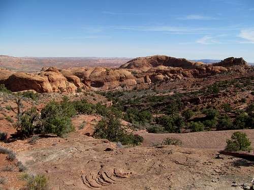
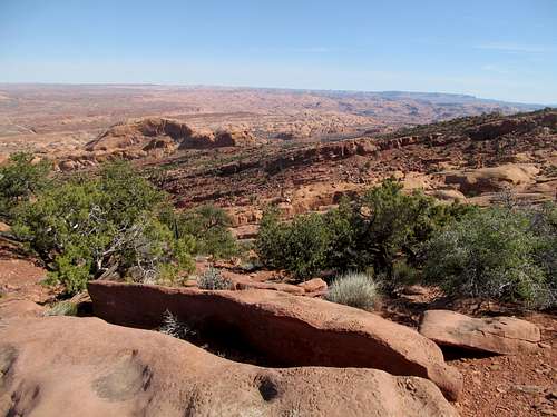
With that I was able to identify the right incline for the standard route and start the ascent through the soft dirt terrain until the geology transitioned to rocky ledges and lonely vegetation. The impressive canyon to the right opened itself up alongside the bird’s eye view of the encircling ridges, the distant Uintas, and the Green River winding all the while.
The terrain consisted of some minor ups and downs and some ledge hopping scrambles…basic desert shit, and an easier alternative could always be found. I approached the upper plateau forest with trepidation.
In past trips I’d be wandering blind, but now I could test the effectiveness of the new GPS. Even though I knew the general direction of the summit, it helped me determine things like how wide the turn to make and helped me make slightly more educated guesses on which one of the bumps ahead were likely the summit.
The mild traverse through the woods, occasionally on a climbers trail, slowed the flow of time. Views opened up occasionally to the north and west, but it is when you approach the summit area that the enormity of the place grabs you, the bizarre convergence of water and rocks entwined in a transitory tango.
I tried to hit the waypoint marking the true highpoint but the GPS always seemed to shift it slightly beyond my grasp, so I double and triple checked each high area, including the summit area further off to the east, and took care taking pictures alongside the cliffs overlooking the river and the trailhead below.
I was probably a mile along retracing my route through the elevated forest before I realized that I had left my hiking sticks (ski poles really) behind. They had accompanied me on many a trip, all the way from the beginning of my odd little hobby, and I would miss them rest of the summer. I debated returning to reclaim them and would have were it not for the impending Bruins game.
I reluctantly left them behind, hopeful that perhaps another peakbagger may find them handy someday.
I strayed a little too far to the left on the descent down the southern flank, edging closer to the side drainage and having to do some steeper scrambling to regain the route.
I looped around a little back on the Desert Voices Trail, then returned to the Visitor Center.
Unfortunately the big hall exhibit of dinosaur bones was closed, so I did the little trail through the badlands near by the Visitor Center instead, then headed back to Vernal.
My minor first world woes continued, as neither my shit motel nor the bar in town had the NBC Sports Network, but they facilitated my hookup to their wifi and I streamed a tough overtime loss to the Red Wings on my phone while chomping down on sandwiches and beer.
Jones Hole Sanctuary - April 19th, 2014
The other day I woke early after a night of weekday drinking in Hoboken, and my first thought was that I could get to work early enough to grab a Taco Bell breakfast. While fast food here at home is always a shameful concept, it carries less social baggage in Utah, and for me personally, perfectly rationalized when on the road and a hurry, especially when I’m leaving SLC at 3 AM and the only thing open for breakfast and coffee is a Mickey D’s or 7-Eleven.
So the timing of the Taco Bell breakfast was appropriate, harkening back to my first guilty splurge there for breakfast that Saturday in Vernal. To balance things out I additionally got coffee at one of the many little impromptu coffee/donut stands in town, and have to say that my German Chocolate Donuts were quite delish.
I would have to work off the calories on a trail rather than a peak. It sucked that the one Bruins-free day of the weekend was accompanied by the most unsettled weather forecast, but it gave me a chance to check out the Jones Hole trail, an under the radar gem near the fish hatchery north of town in Dinosaur. The weather forecast was better up north, and I figured the canyon would provide shelter during a potential storm.
The drive was scenic. After having to wait, then find dirt road detour to bypass a never ending cattle run, I passed high plateaus, scenic buttes, obscure box canyons, and finally descended steeply into a grand chasm whose terminus marked the fish hatchery parking lot.
The route is a little hard to keep track of through the development of the hatchery but was easy to follow past that. And there’s not much I can say about this trail except extoll its simple beauty and sublime brilliance.
You start at the bottom of the canyon and follow Jones Hole Creek through the ravine about 4.5 miles to its terminus with the Green River.
I probably hit this trail at the perfect time of year, and the entire stroll was a delight as I savored the constant trickle of the running creek, the mild, dare I say even slightly humid air, and the smell of spring amidst the budding trees and the occasionally muddy path.
A worthy sidetrip took me to Ely Falls, and I backtracked to the main trail. A few miles later I emerged from the canyon into an open pasture, where the main trail splits into smaller tributaries, any one of which took you through a thick grove of willows to the Green River.
Here the scene was calm, serene, at peace. And I enjoyed a brief respite of the same before restlessness took me back the way I came.
With some time to kill in the early afternoon I got lunch back in town, did some grocery shopping, then headed back to the main monument. After finally checking out the dinosaur bone exhibit I did a few afternoon hikes, walking the short trails to Hog, Box and Daniels Canyons.
The storm finally came, a light refreshing drizzle, and I drove east into Colorado through a tranquilly stormy evening to settle into the small hamlet of Dinosaur.
There was only one bar in town, the Dinosaur Bar and Grill. My plans involved hitting the bar early for the game, so I needed to scout it out and make sure that it had a TV, beer, food, etc. The locals were a little local-y, but the burger was one of the best I’ve ever had. I’d now have to revisit this bar Sunday for more than just a hockey game.
Tankapalooza - April 20th, 2014
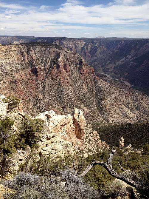
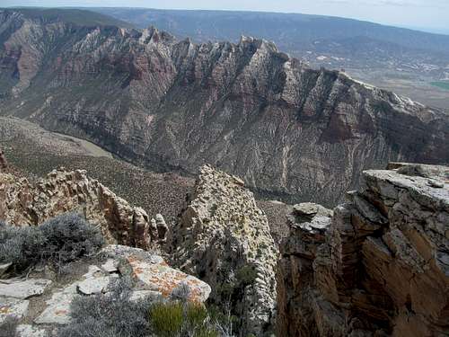
Now the reasoning for coming to Dinosaur was the immediate proximity of the town to both Tanks Peak, an easy drive up for jeep track walk up peak I’d do in the morning. Then depending on how I was doing on time, I could check out any of the features of the national monument on the Colorado side, including Harpers Ferry, Ruple Point, Echo Park, or even the entire Yampa Bench Road, before heading back to town for Game 2.
I slept in after staying up downloading software trying to recover some pictures from Split that I had accidentally deleted during the transfer from camera to laptop.
Following Dean's directions I was tempted to tempt the 4Runner over the jeep track section to the drive up summit, but after briefly surveying the road I opted to walk most of the rough patches, putting me more behind schedule.
A few ups and downs took me to the very broad summit of Tanks. The views were great, especially down into Harpers Corner, the Yampa River and Bench, and north towards the Zenobia portion of the park. But to get all the views I had to round the entire summit plateau, trudging each edge looking for the best view, even postholing through some holdover snow on the northwest side of the peak.
It was an unsettling Colorado experience, the bare sagebrush slopes more akin to Nevada than the 14er capitol of the country.
With all circumnavigation of the summit I ended up walking almost 8 miles round trip, and thus had time only for a hike to Harpers Corner to round out the day.
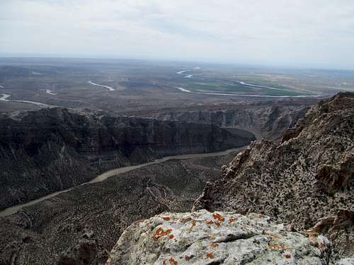
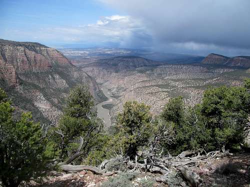
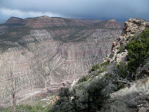
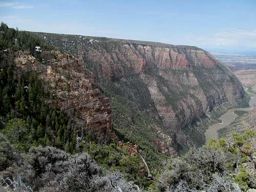
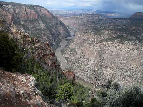
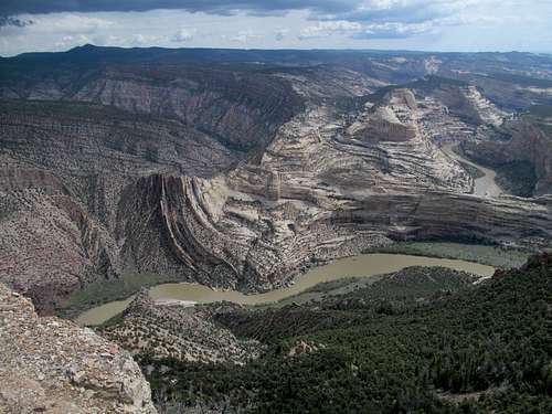
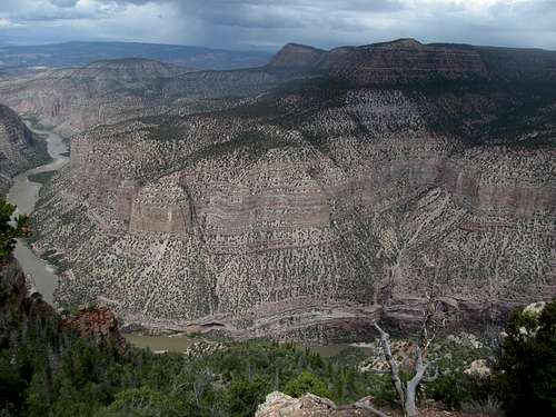
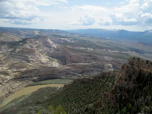
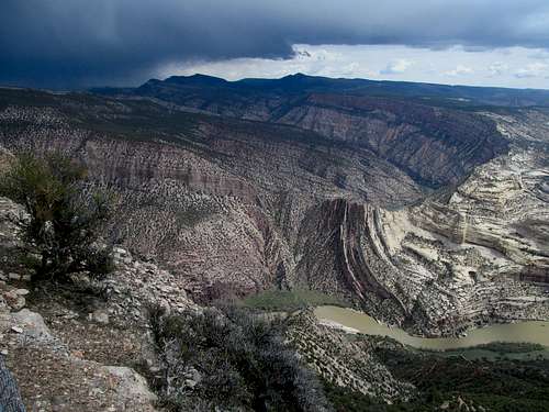
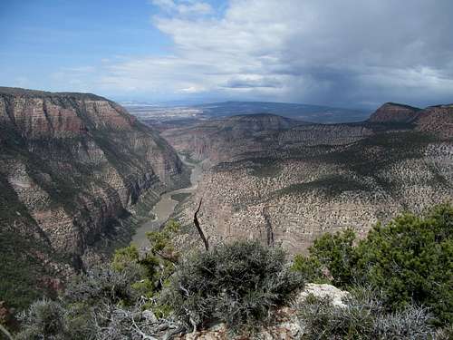
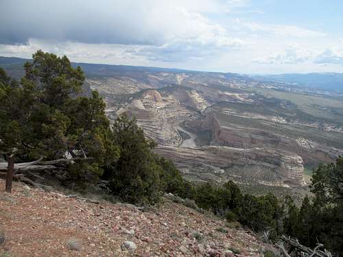
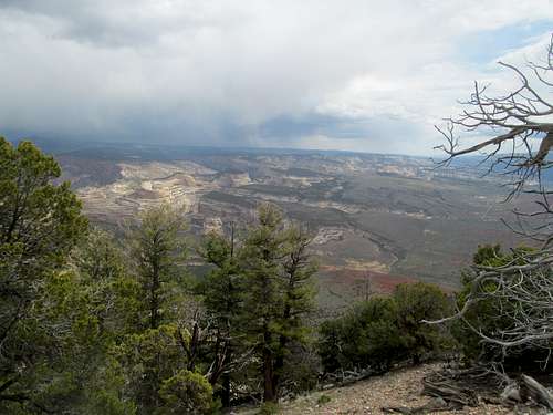
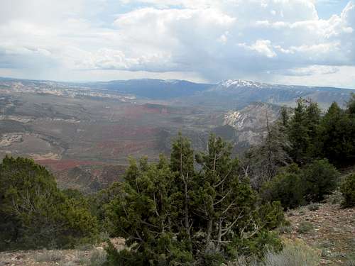
I barely had time to enjoy the scenic drive, hurrying not just because of hockey but also with a cautious eye over the very dark and threatening clouds over the horizon. Thunderstorms are equally dangerous whether you're on a remote ridge or at a popular national park viewpoint, but luckily the weather held as I parked and rushed down the quaint little trail to what SP member Scott here calls the most scenic viewpoint in the national park system.
I'll let the pictures do the talking. It was apparent by the time I reached the end of the trail that the storm was temporarily stuck on the north side of the river.
I imagined the Uintas, unseen over the horizon, likely getting socked by snow and hammered by lightning, (something I would experience in real life five months later).
I took special satisfaction identifying Tanks rising above the Yampa Bench. For most, it's just a nameless bump in the ridge, but having hit it earlier in the morning via a pretty boring route it was neat to see its actual prominence as a rather imposing highpoint on the Yampa ridge, justifying its place as a P2K.
I imagined the Uintas, unseen over the horizon, likely getting socked by snow and hammered by lightning, (something I would experience in real life five months later).
Back to the bar after a few stops at the viewpoints on the Harpers Corner road. Once more the burger was delish; the owner of the bar was actually in and flipping them herself, the small daytime crowd chattier, and I enjoyed a scintillating Bruins win amid a fun atmosphere despite, as is often the case, the resident crackpot eventually pivoting the conversation towards weird alcohol and tinfoil-hat fueled arguments.
I took the scenic route back via US-191 traversing through the eastern Uintas and Rainbow Gorge, arriving back in SLC after an exhausting but rewarding three day weekend.
Comments
No comments posted yet.