
-
 2314 Hits
-
 84.82% Score
-
 19 Votes
|
|
Mountain/Rock |
|---|---|
|
|
45.79278°N / 7.78494°E |
|
|
Mountaineering |
|
|
10030 ft / 3057 m |
|
|
Overview
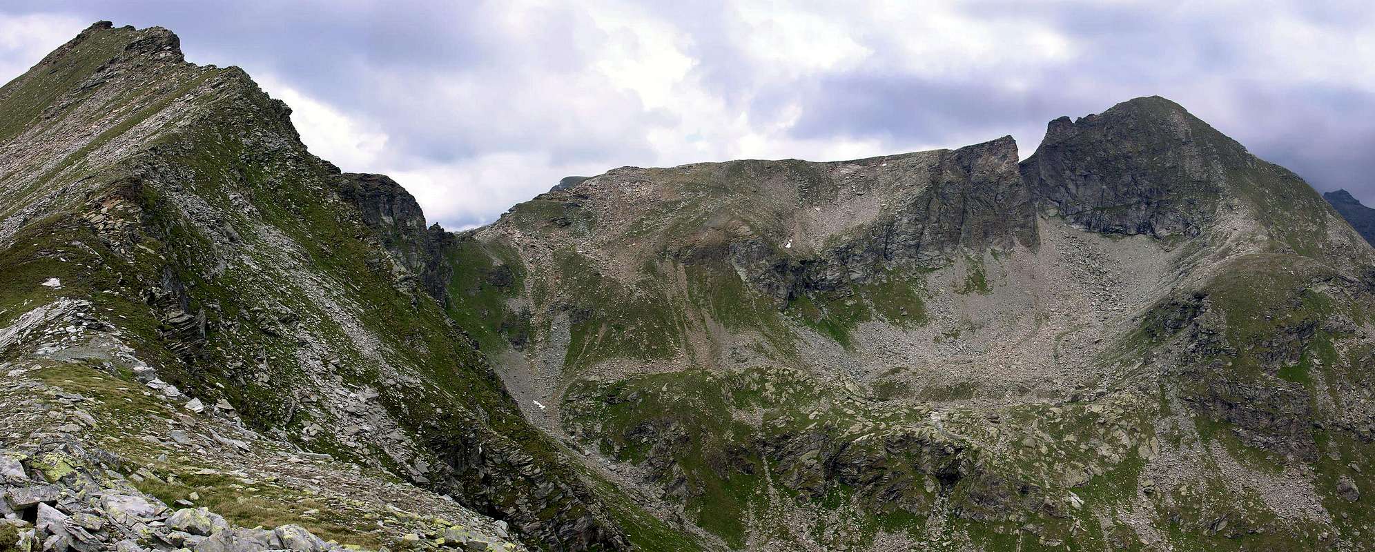
Massive triangular Summit placed on the watershed Ayas Valley and Valley of Gressoney or of Lys and more precisely amongst the Vallons of Mascognaz above Champoluc (West, 1.568m) and Pinter-Freide overlying the resorts of Noversch and Alpenzù (Est; 1.537m, 1.779m) in Lys Valley. Topographically is formed by three ridges of which the last or Eastern Valley descends to the latter, while the Northwest and Southwest head up to the Valley of Ayas. The first of these reaches the "Colli" or Passes of Pinter (2.777m), under the Testa Grigia (Gray Head), and Mascognaz (2.859m) and Perrin (2.635m) after the Grande Cima. While the third or the Southwest is addressed towards the carving called and known as Passo di Valfredda (2.805m) after having jumped the rounded "Spallone" (Great Shoulder) 2.920 meters. Beautiful views towards the North on the Testa Grigia (3.314m) and in background on the entire Monte Rosa Mountain Range, as well as above the two adjacent Valleys Ayas and Lys.
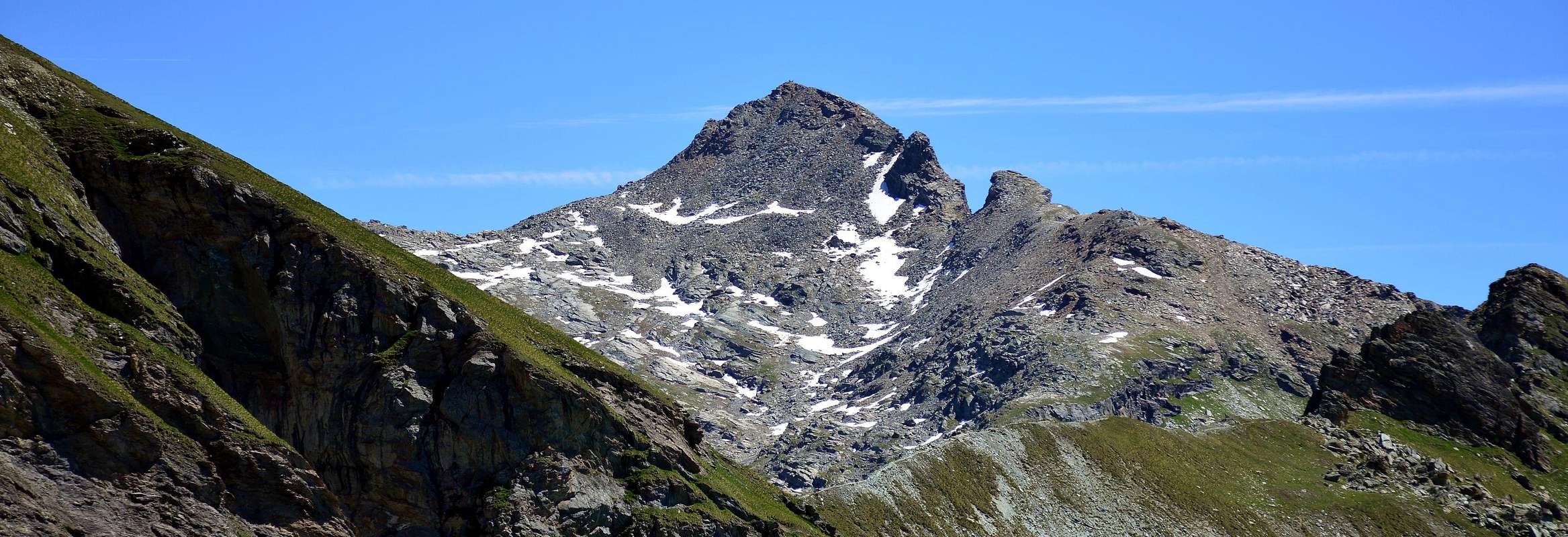
Massiccia cima triangolare collocata sullo spartiacque Valle d'Ayas/Valle di Gressoney e più precisamente tra i Valloni di Mascognaz sopra Champoluc (Ovest; 1.568 m) e di Pinter-Freide soprastanti le località di Noversch e Alpenzù (est; 1.537 m, 1.779 m) in Valle del Lys. Topograficamente risulta essenzialmente formato da tre creste delle quali l'ultima od Orientale scende verso questa seconda vallata, mentre quelle Nordovest e Sudovest si dirigono verso la Valle di Ayas. La prima di queste raggiunge i Colli o Passi di Pinter (2.777 m), sotto la Testa Grigia o Grauhaupt, e di Mascognaz (2.859 m) e di Perrin (2.635 m) dopo la Gran Cima. Mentre la terza o Sudovest si indirizza al piccolo intaglio conosciuto come Passo di Valfredda (2.805 m) dopo avere scavalcato l'arrotondato Spallone 2.920 metri. Belle vedute verso Settentrione sulla Testa Grigia (3.314 m) e più in lontananza sull'intera Catena del Monte Rosa, nonché al di sopra delle due valli adiacenti di Ayas e del Lys.
First Ascents
- First on the Summit: Unknown.
- In winter: Osvaldo Cardellina and Emilio Bertona, Jan 07th, 2001, in ascent from Estoul Hamlet.
- Northwest Crest (Mascognaz Pass): Agostino Ferrari, lone, Jul 30th, 1897, in ascent and descent.
- Southwest Face (from Palasina Hill): Osvaldo Cardellina and Marco Cossard, Aug 10th, 1973, in ascent from Mascognaz Village (Champoluc).
- Traverse: (Corno Vitello-Punta di Valfredda through Southwest/North-northwest Ridges): Osvaldo Cardellina and Emilio Bertona, Sep 09th, 2001, from Estoul Resort round trip into Palasinaz Vallon.
- Great Traverse: (Corno Vitello-Punta Palasina-Punta del Lago-Corno Bussola-Quota 2.899 metri): Osvaldo Cardellina, Roberto Stella (until Corno Bussola) and Gianfranco Vicentini (until Punta del Lago), Jul 07th, 2002.
Getting There
BY CAR:
- From TORINO, MILANO, etc: Motorway A5. Exit at IVREA or Quincinetto (PIEDMONT).
- From IVREA Town: in West (Southern side) to Pont Saint Martin, Verrès Municipalities in East from Aosta Town.
- From Courmayeur Resort: in East-southeast to Aosta, Nus, Chatillon, Saint Vincent, Verrès Municipalities.
BY PLANE:
- Aeroporto "Corrado Gex" Saint Christophe (Aosta).
Approach and Route
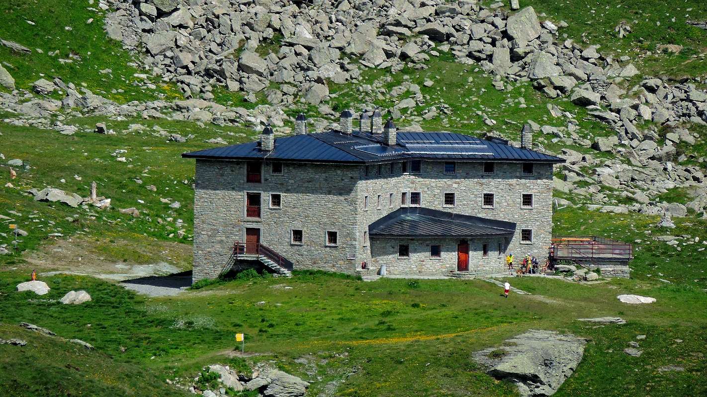
Approach through Palasinaz Vallon: from Brusson Commune to Estoul Village (+; 1.818m; great parking; panels and variaous signals) with the Regional Road; from this, in North through dirt road concomitant with the trail n° 5, towards Fenillettaz Pastures (1.840m), following alternative (1.882m; signal no transit for unauthorized means), Fontaine (1.903m), Chanlochère (2.012m), fork 2.029 meters, Chavanne (2.107m) Alpages, alternatives 2.103, 2.209 meters nearby Litteran Lake (2.226m), fork 2.231 meters. From the latter continue on the farm dirt road that with a long diagonal followed by a few bends goes towards the above Arp Refuge (2.439m; 1h'30/2h'00). From the refuge continue towards the North with the trail n° 5A/5B passing quickly the three Freida Lakes (2.544m, 2.575m, 2.589m) up to the collar-depression 2.823 meters on the watershed. Leaving to the right the deviation with small path n° 5A for Valfredda Pass (2.807m), continue instead towards the Northeast at first on the tread of ridge and then under the crest until reaching the 2.923 meters altitude and discarding just the left (West) that the 2.972 meters. Along the last easier tract reach the Summit (EE/F/F+; 3h'15/3h'45 from the beginning of dirt road nearby Estoul Village).
 |
 |
 |
 |
 |
Avvicinamento dal Vallone dal Vallone di Palasina: dal Villaggio di Estoul (1.818 m; grande parcheggio con pannelli con segnalazioni varie) dapprima verso Nordovest poi Nord tramite la Strada Regionale; dal villaggio, con direzione a Settentrione per mezzo della poderale concomitante al sentiero n° 5, in direzione degli Alpeggi di Fenillettaz (1.840 m), successivo bivio (1.882 m; segnale di divieto al transito per i mezzi non autorizzati), e le successive Alpi di Fontaine (1.903 m), Chanlochère (2.012 m), bivio 2.029 metri, Chavanne (2.107 m), biforcazioni (2.103, 2.209 metri) nelle vicinanze del Lago Litteran (2.226 m), seguente bivio 2.231 metri. Da quest'ultimo continuare con la strada poderale che con un lungo diagonale seguito da alcuni tornanti prosegue verso il soprastante Rifugio Arp (2.439 m; 1h'30/2h'00). Dal rifugio continuare verso Settentrione con il sentiero n° 5A/5B passando in breve tempo i tre Laghi di Freide (2.544 m, 2.575 m, 2.589 m) fino a raggiungere il colletto 2.823 metri sullo spartiacque. Lasciando a destra la deviazione con sentierucolo n° 5A per il Passo di Valfredda (2.807 m), continuare inveceverso Nordest dapprima sul filo di cresta e poi sottocresta fino a raggiungere la quota 2.923 metri e scartando appena sulla sinistra (Ovest) quella 2.972 metri. Con l'ultimo più facile tratto raggiungere la Sommità (EE/F/F+; 3h'15/3h'45 dall'inizio della poderale presso il Villaggio di Estoul).
Difficulty
This route can be considered F/F+.
L'itinerario è da da classificare in F/F+.
Equipment
For Hiking or Mountaineering; with rope, ice-axe and crampons in snow presence.
Da Escursionismo od Alpinismo; con corda piccozza e ramponi se con neve.
Huts
Campings
Remember that free camping is forbidden (except for emergency reasons, over 2.500m, from darkness until dawn).
Mountain Conditions
- You can get meteo information at the official site of the Regione Valle d'Aosta:
- Valle d'Aosta Meteo
- Meteo: You can find more weather information on the website 3B Meteo:
- Meteo Brusson
Webcam
- WEBCAM on Aosta Valley:
- Webcam
Books and Maps
BOOKS:
- "Guida delle Alpi Occidentali" di Giovanni Bobba e Luigi Vaccarone C.A.I. Sezione di Torino Volume II (parte II), 25 Maggio 1896.
- "Diari Alpinistici" di Osvaldo Cardellina e Indice Generale accompagnato da Schedario Relazioni Ascensioni 1964-2019 (unpublished).
- "Guida dei Monti d'Italia" Alpi Pennine (Vol.2) di Gino Buscaini - Club Alpino Italiano/Turing Club Italiano, Luglio 1970 (In Italian).
 |
 |
 |
MAPS:
- I.G.C. Istituto Geografico Centrale Torino "IVREA-BIELLA e Bassa Valle d'Aosta" 1:50.000.
- I.G.C. Istituto Geografico Centrale Torino "Cervino e Monte Rosa" 1:50.000.
- L'Escursionista editore "Alte Valli d'Ayas e del Lys" Carta dei sentieri (8) 1:25.000.
Important Information
- REGIONE AUTONOMA VALLE D'AOSTA the official site.
- FONDAZIONE MONTAGNA SICURA Villa Cameron, località Villard de la Palud n° 1 Courmayeur (AO) Tel: 39 0165 897602 - Fax: 39 0165 897647.
- A.I.NE.VA. (Associazione Interregionale Neve e Valanghe).
Useful numbers
- Protezione Civile Valdostana località Aeroporto n° 7/A Saint Christophe (Ao) Tel. 0165-238222.
- Bollettino Meteo (weather info) Tel. 0165-44113.
- Unità Operativa di Soccorso Sanitario Tel. 118.
Acknowledgements
I am greatly indebted to my friend "Osva" for the detailed description of the route and translation into English.