-
 13854 Hits
-
 81.84% Score
-
 14 Votes
|
|
Mountain/Rock |
|---|---|
|
|
40.49807°N / 112.17977°W |
|
|
Hiking |
|
|
Spring, Summer, Fall, Winter |
|
|
9070 ft / 2765 m |
|
|
Overview
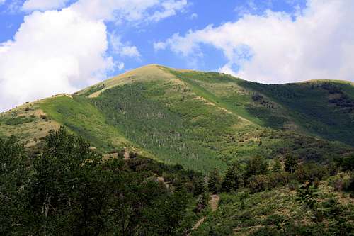
West Mountain, at 9,070 feet, is the only mountain in the Oqurrih Range that you can drive nearly all the way to its summit. This mountain was named after the first mining company ever created in Utah known as "The West Mountain Mining Company". Eventually this company changed their name to the now world famous Kennecott Mining Company. Being the most accessible mountain also makes this the most visited mountain of the otherwise lonely Oquirrhs. From the summit there are impressive views of the nearby Stansburry Range as well as the surrounding peaks of the Oquirrhs. Although these views are impressive the most dominating view is of the open pit mines of the Kennecott Mining operation looming above Salt Lake City. Only at West Mountains "Kennecott Overlook" can one truly grasp the size and scale of the copper operation taking place there on a day to day basis. Dispite being the most accesible mountain, everywhere excluding the dirt access road, the parking lot, and the trail between its twin summits is considered not just pivate property, but worse yet Kennecott Property. Whether you are new to the Oquirrhs, or just new to the mountains in general, West Mountain is the perfect place to get a handle on what the Oquirrh Range has to offer. The view to the south of Butterfield Peak, Lowe Peak, Kelsey Peak, White Pine Peak and the Tooele Cirques
Getting There
From I-15 get off at the 12300 South Exit. Turn west and follow 12300 South as it becomes 12600 South. Shortly after Bangerter Highway start looking for a street on your left named "Herriman Main Street". Make a left at this intersection.After passing some schools and Herriman's version of a main street, continue driving on the same road as it becomes 13100 South. At a 25mph curve in the road look for the unmarked entrance to Butterfeild Canyon.
Much like the Scenic Aspen Grove Loop in American Fork Canyon, this road is very narrow. Although it is paved all the way to the pass, rocks from the side hills cover the road making it appear like a dirt road at times. Watch for mountain bikers, wildlife as well as other vehicals while driving this road. Once at the pass make the obvious right turn up the dirt road to the Kennecott Overlook and park there.
[img:644272:aligncenter:medium:The Butterfield Canyon road]
Red Tape
As mentioned above, West Mountain is covered in private property. Excluding the dirt access road, the parking lot and the trail between the twin summits, everywhere else (Bishop Gulch, Spring Gulch, and Shingle Gulch) is well marked No Trespassing. Hunting, camping, fires and fireworks are NOT allowed on West Mountain.[img:671340:aligncenter:medium:Luckily for these deer hunting is not allowed on West Mountain. Photo Credit Wasatchvoyage]


