
|
|
Mountain/Rock |
|---|---|
|
|
38.81440°N / 107.145°W |
|
|
12385 ft / 3775 m |
|
|
Anthracite Range Overview
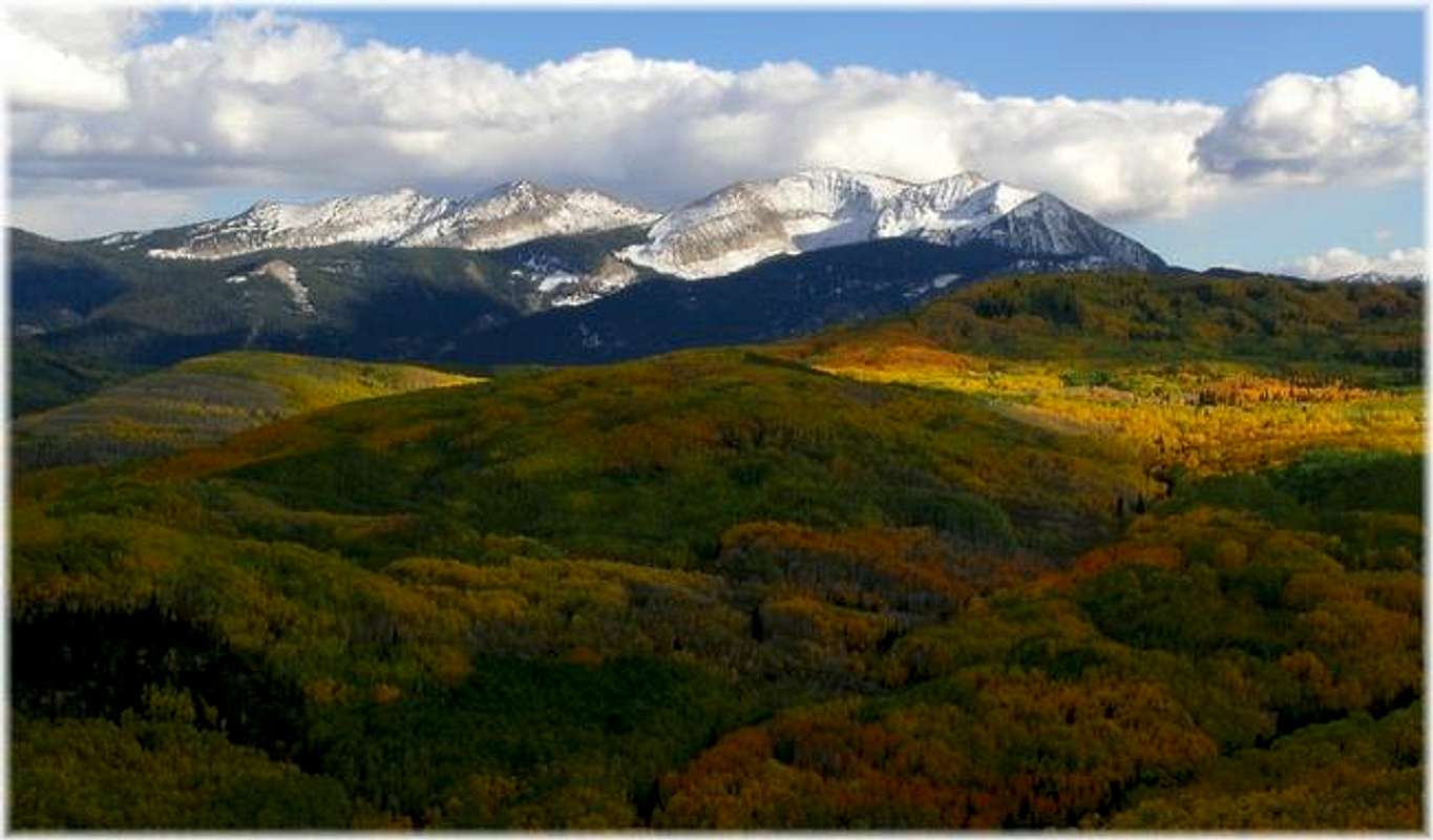
The flowing aspen forests west of Kebler Pass form one of Colorado’s most memorable landscapes. During the cool temperatures of fall, expansive aspen groves create a patchwork quilt of gold and green as thousands of aspen trees change color en masse; only until another harsh winter arrives to create a different kind of beauty. Tucked inside the worlds second largest aspen stand are the glacially carved Beckwith’s, Mount Owen, Marcellina Mountain and the Anthracite Range.
The officially named Anthracite Range is a 4-mile long east-west curved mountain residing just south of the scenic Kebler Pass. This mountain harbors three noteworthy summits and only one of them is officially named. Anchoring the east end of the mountain is Ohio Peak at 12,271-ft. According to Ormes and Jacobs Guide to Colorado Mountains, Ohio Peak gets the nod as the most tempting highpoint because of its cascading waterfalls when viewed from the Ohio Valley. Residing about 2 miles west from Ohio Peak is the actual highpoint of the Anthracite Range, UN12,385. In between the two highest summits rests the lonely UN12,190. The connecting ridge between the three, requires almost 1000-ft of elevation gain, but looks like class 3 and 4.
Ohio Peak also has wilderness access, with public roads leading to attainable trailheads. However, a logical trailhead for the high point UN12,385 is likely located within private property of the fenced Lake Lilly area. My next visit to the Kebler Pass area will include an attempt of UN12,385 via the north ridge. Hopefully I come home with better and more accurate information on a starting point.
Lastly, the northern slopes of Ohio Peak are no doubt the perfect place to be during the first week of October. Earlier in the day, after a major ass whipping (failed attempt) from West Beckwith, it was an honor to share the following view with Jim from Ohio Peak. A view like that will do wonders to a bashed up and broken ego.
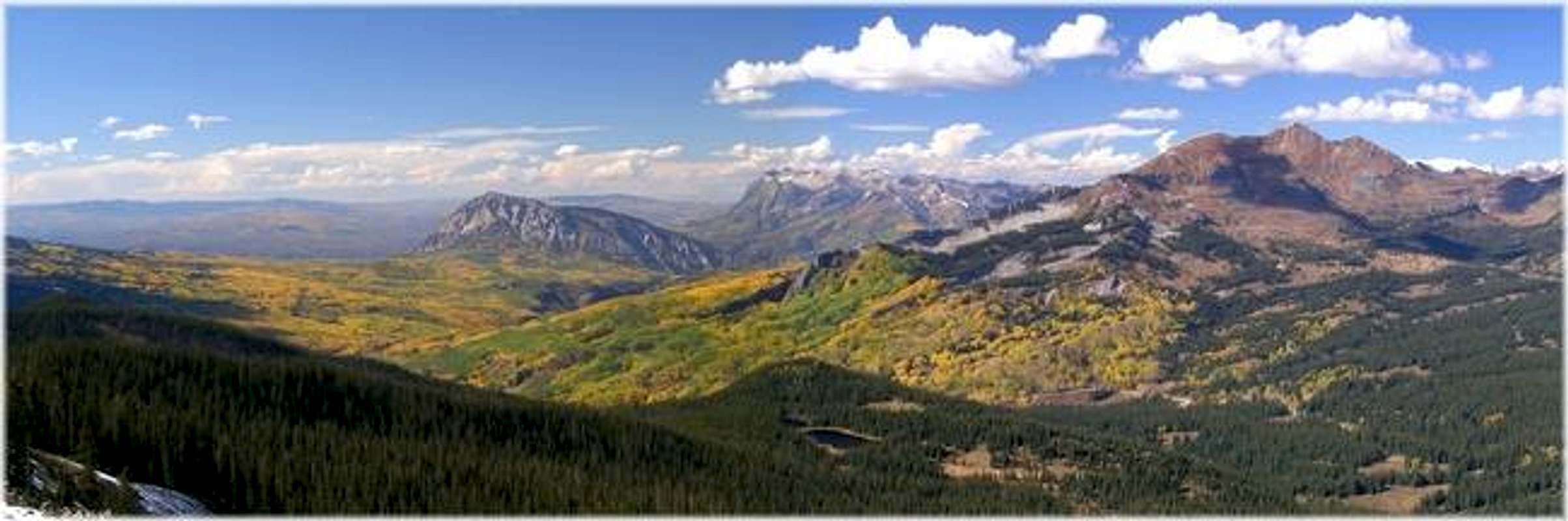
West Elk Overview
The West Elk Wilderness comprises a rugged, remote and mountainous area west of Gunnison Colorado. This wilderness encompasses 176,000 acres of Gunnison National Forest, making it the fifth largest wilderness in Colorado. This region lies south of Kebler Pass, which runs from Paonia State Recreation east to the tiny ski resort of Crested Butte and south to the Curecanti National Recreation Area. The volcanic ridges and long valleys of this pristine area offer an extensive selection of hiking and climbing. Because the area lacks fourteeners, centennial thirteeners and numerous alpine lakes you will get the benefit of hiking alone and away from the typical recreational visitor. The West Elks are outlined with tiny undeveloped towns like Crawford, Hotchkiss, Paonia and Somerset; thus freeing this wilderness from any major metro area.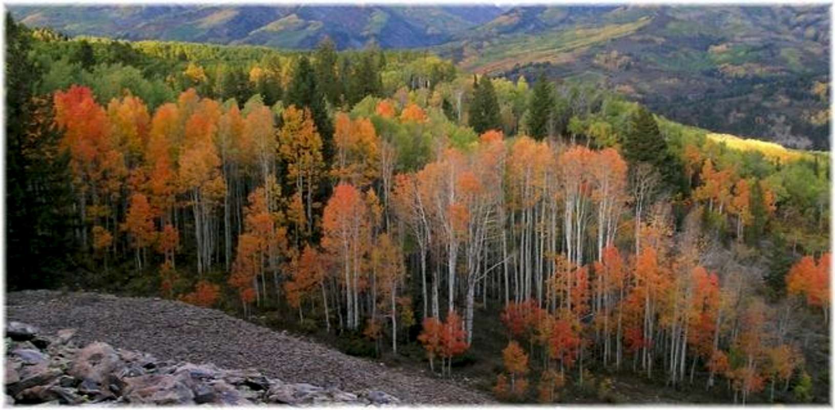
Getting There
Continue on 133 as it ascends up to McClure Pass. From McClure Pass descend 133 to Paonia Recreational Area. Once you have passed the reservoir, the road descends steeply down to your turn-off to Co.12 (Kebler Pass Road.)
Turn left on Co 12 and follow the road 15 miles and pass the well signed Lost Lake Slough Campground. Continue another 8.5 miles to Kebler Pass. Turn right on the Ohio Pass Road and 1.4 miles to Ohio Pass and park. There is ample parking here.
The Kebler Pass Road is passable for passenger cars. This road is also closed during the winter season, from mid November to early May. Call the Paonia Ranger District (970-527-4131) for up to date conditions.
Turn right (north) on Colorado 135 and drive approximately 20 miles to Crested Butte. At your first stop sign in town turn left on the Kebler Pass/Ohio Pass road. Follow the improved dirt road approximately 6.5 miles to Kebler Psss and turn left on the Ohio Pass Road. Follow the Ohio Pass Road 1.4 miles to Ohio Pass and park. There is ample parking here.
Gunnison National Forest-Red Tape
There are no fees to enter or hike this wilderness.For more infromation contact:
7 day forecast for Kebler Pass at 11,562-ft
Click here to view a 7-day forecast for the Kebler Pass area at 11,562-ft
Click image to enlarge

Camping is plentiful on Co. 12 (Kebler Pass Road). There are many places to car camp for the night off of the Kebler Pass Road.
When To Climb
Area Camping
Camping is plentiful on Co. 12 (Kebler Pass Road). There are many places to car camp for the night off of the Kebler Pass Road.Here are some links.