
|
|
Area/Range |
|---|---|
|
|
47.95674°N / 15.66323°E |
|
|
Hiking, Sport Climbing, Toprope, Via Ferrata, Skiing |
|
|
Spring, Summer, Fall, Winter |
|
|
4590 ft / 1399 m |
|
|
Overview
Gutensteiner Alpen is south of Wienerwald - mainly wooded. 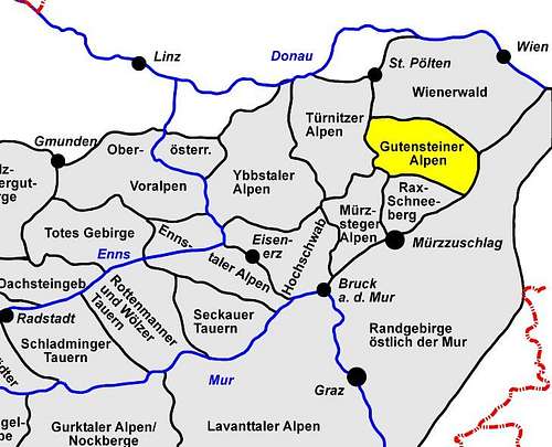
|
|---|
The borders of the Gutensteiner Alpen are the rivers or towns: Gölsen - Hainfeld - Triesting (border to Wienerwald) - Steinfeld - Ternitz - Puchberg -Sebastiansbach - (border to Rax - Schneeberg Group) - Mamauwiese - Klostertaler Gscheid - Voisbach - Schwarza - Tiesentalerbach - Wassertal - Seebach - St.Ägyd/Neuwald - Traisen till Gölsen
Some areas of the Gutensteiner Alpen are important recreational areas -
Hiking and Climbing at Hohe Wand;
Skiing at Unterberg;
Skitouring at Reisalpe, Hainfelder Kirchenberg, Unterberg;
Paragliding at Hohe Wand
Important natural parks
Naturpark Hohe Wand (located near Wiener Neustadt)
Gutensteiner Alpen are a part of the Northern Limestone Alps; mainly limestone and some conglomerate
The highest elevation in the Gutensteiner Alpen: Reisalpe (1399m) above sea level - in winter a nice (and short) skitour.
Climbing
see the link section for more informationIMHO most important:
Hohe Wand
 Duettsteig - Hohe Wand
 |  Hochemporverschneidung - Hohe Wand
 |  Kletterbrüderpfad - Hohe Wand
 |
|---|
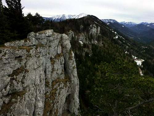
Dürre Wand
West of Hohe Wand, mainly hiking
 Dürre Wand
 |
|---|
Flatzerwand
Getting There (by car):
From Wiener Neustadt to Neunkirchen (via Highway S6 or via Bundesstrasse). From Neunkirchen head for Flatz. In the small town of Flatz follow the fingerposts to "Naturpark Flatzer Wand" - btw. limited parking space.
 Flatzerwand
 |
|---|
also nice areas near:
Fischauer Berge
Bad Fischau
Getting There (by car):
From Wiener Neustadt to Bad Fischau (via A2 exit Wöllersdorf) parking near the church - walk Blumentalgasse to the rocks. (limited parking space)
 Climbing near Bad Fischau
 |  Climbing near Bad Fischau
 |  Climbing near Bad Fischau
 |
|---|
Piestingtal
Hausstein, Kalkofen
near Muggendorf
 Kalkofen
 |  Kalkofen
 |  Kalkofen
 |  near Kalkofen
 |
|---|
Viae-Ferratae + Hiking
Via Ferrata:
quite a lot Viae Ferratae at
Hohe Wand (ranges from easy to very hard ones)
but also one at
Flatzer Wand and
Steinwandklamm
images of Steinwandklamm
Hiking:
a lot of marked trails are to find in the Gutensteiner Alpen
Myrafälle near Muggendorf
Skiing and Skitouring
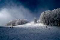
Skiing
Skigebiet Unterberg -
Skitouring
Hochstaff
nice and easy skitours at Reisalpe,
Hainfelder Kirchenberg
there is also a very easy and save ski tour to Unterberg
 Hochstaff
 |  Hochstaff
 | ||
|---|---|---|---|
 Unterberg
 |  Unterberg
 |  Unterberg
 | 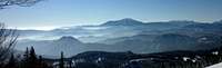 Schneeberg from Unterberg
 |
 Hainfelder Kirchenberg
 |  Hainfelder Kirchenberg
 |
Caves, Mountain Biking, Paragliding + Hang Gliding
Caves
near Hohe Wand around Dreistetten is
Einhornhöhle (show cave) - discovered in 1927, opened in 1930
Mountain biking
Some dirt roads are open for mountain biking
Paragliding + Hang Gliding
Hohe Wand is a well known area for paragliders and hang gliders
 Paraglider
 | 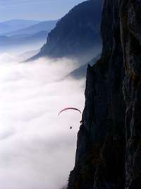 Paraglider at Hohe Wand
 |  Paraglider
 |
|---|
Getting There
Some parts of the Gutensteiner Alpen can easily be reached by public transport - areas near the Austrian Southern Railway or its branch lines (Leobersdorfer Bahn and Schneebergbahn): e.g. southern areas of Hohe Wand,other areas Areas mainly starting points for skitours are quite difficult to reach by public transport - e.g.: Hochstaff, Reisalpe, Unterberg.
Huts and Camping
Sorry no information about campgroundsSeveral B&Bs in the small towns of Gutensteiner Alpen.
There are several huts on the Hohe Wand Plateau, and in other areas (e.g. Öhler Schutzhaus, Unterberghaus, Hainfelder Hütte)
 Öhler Schutzhaus - Dürre Wand
 |  Gauermannhütte - Dürre Wand
 |
|---|---|
 Turmsteighütte- Hohe Wand
 |  Hubertushaus - Hohe Wand
 |
 Untersberg Schutzhaus
 |
Red Tape
AFAIK no red tapeExternal Links
climbing, skitouring, viae ferratae
Keltenkalk (Guidebook) climbing areas from Vienna to Semmering
www.bergsteigen.at offers a lot of climbing, viae ferratae, skitouring information (only in German)
Mountain biking
Moutainbiking in soutern Lower Austria (Niederösterreich) -
other links:
www.wieneralpen.at/leadersued/ covers the southern part of Lower Austria (Guternsteiner Alpen but also Rax-Schneeberg Area and Bucklige Welt)