
|
|
Area/Range |
|---|---|
|
|
47.94855°N / 18.94730°E |
|
|
Hiking, Skiing |
|
|
Spring, Summer, Fall, Winter |
|
|
3077 ft / 938 m |
|
|
Overview
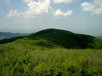
 West Börzsöny West Börzsöny |
 High Börzsöny viewed from Holló-kő
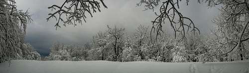 Winter mood in High Börzsöny
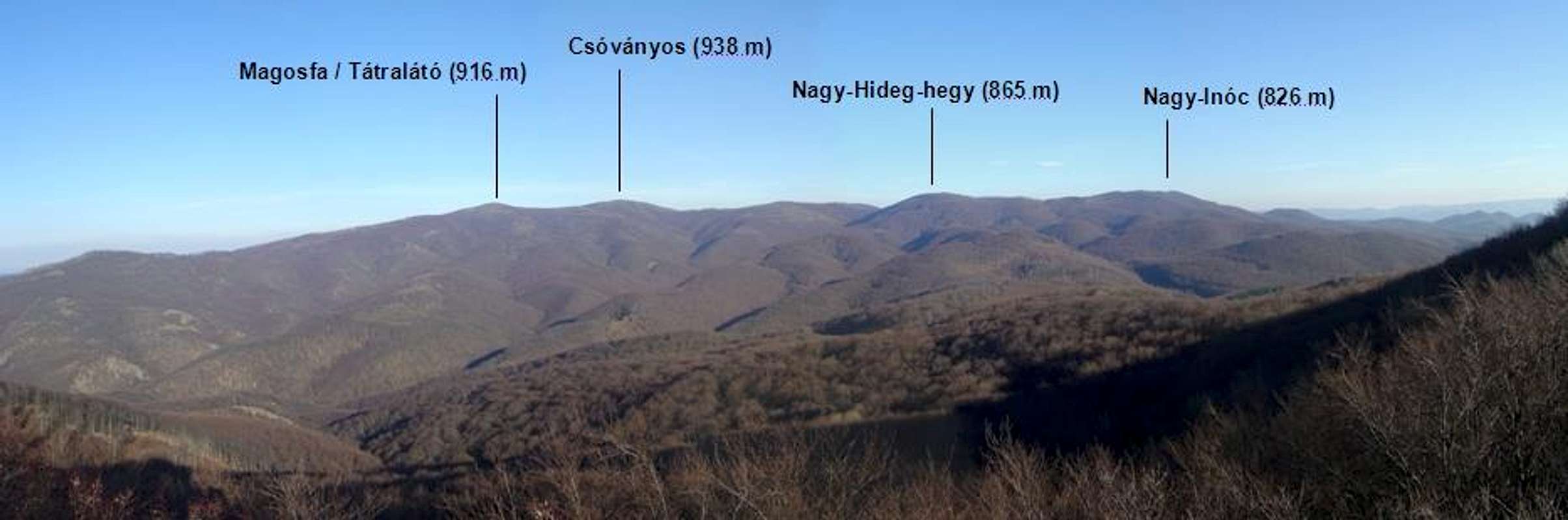
 The heart of a retired volcano (view from Csóványos)
Börzsöny is located in Northern Hungary, not far from the capital, Budapest. These mountains are the remains of an old andesite volcano, which was active from about 16 to 14 million years ago, in the Miocene epoch, when the Carpathian Basin was covered by a subtropic sea.
On the north and the west, Börzsöny is bordered by Ipoly /SK: Ipeľ/ river, which is also a state border between Slovakia and Hungary since WW2. On the south, Börzsöny is separated from the Visegrád Mountains by Danube river. Its eastern slopes are separated from the Cserhát hills by the Nógrád basin.
The area of Börzsöny is 600 square km, most of which is covered by forest.
In the medieval times gold, silver and further metals were mined here. Börzsöny was among the first places from where the element Tellurite was described in the late 18th century.
Despite the vicinity of the capital, the trails of Börzsöny are usually not too crowded, especially the north and west, which require more time and effort to approach. Smaller settlements are located only on the perimeter of the mountains, rendering Börzsöny a perfect place to escape from the rushing human world.
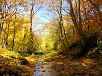
The mountains show a different face in each season. The busiest one is summer, with warm temperatures and long days. In wintertime, if snow is present, hikes can get challenging in the short daytime. Spring and autumn are also very nice with their flowers and coloured leaves, respectively.
 Csóványos Csóványos |
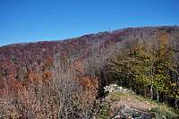
 East Börzsöny East Börzsöny |
 Winter scenery Winter scenery |
 West Börzsöny West Börzsöny |
 Nagy-Hideg-hegy Nagy-Hideg-hegy |
 Magosfa (Tátralátó) Magosfa (Tátralátó) |
The highest point of Börzsöny is Csóványos (938 m), followed by Magosfa (916 m, also called Tátralátó). In clear winter days, the High Tatras in Slovakia are possible to be seen from Csóványos. The rest of the mountains are lower than 900 m. Amongst these, Nagy-Hideg-hegy (865 m) is the most important, because of the tourist hut (open year-around) and ski slopes which are located there.

Activities
|
Hiking: There is an extensive net of signed trails, see this online map - the primary one is a section of the long-distance Hungarian Countrywide Blue Trail (connecting most of the major mountain areas of Hungary, it spans over 1100 km in total), but the others are not less interesting. Detailed transect for some routes (scroll down in the window opened by the links)
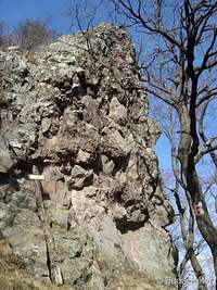
Climbing: There are just a few bare walls and towers in the region, but as the whole area is under nature protection (see Red Tape section below), climbing is not permitted. Skiing: In wintertime, if there is enough snow, the ski slopes of Nagy-Hideg-hegy and the forest ski trails (signed with X) are popular among skiers. Sports hiking / challenge hiking: I do not know whether this activity is practiced elsewhere or not - among Hungarians (both in and outside the country) it is quite popular, every weekend there is at least one event somewhere. The aim is to accomplish a prescribed route by hiking, within a fixed time frame. Calendar of events (in Hungarian). Geocaching: This activity gained popularity recently - more on Hungarian geocaching page.  Raven Rock - scenic lookout point of West Börzsöny Raven Rock - scenic lookout point of West Börzsöny |
 Andesite tower Andesite tower Frozen life Frozen life Winding creek Winding creek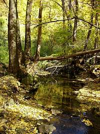 Deep in the forest Deep in the forest |
Getting There
 Narrow gauge rail
 Forest road
The most obvious starting point is Budapest. From here, villages of south and east Börzsöny can be accessed by train (for the east you'll have to change at Vác), for west Börzsöny you shall take the train all the way to Szob and switch to bus there (bus schedules are fitted to the train arrivals). Online train schedule and online bus schedule (only in Hungarian). Hints: honnan=departure, hova=destination, keresés=search.
From Kismaros, Nagybörzsöny, and Kemence there are narrow gauge railways that crawl a few kilometers up into the mountains (there used to be an extended silvicultural/mining railway transportation network, a fraction of which has been saved/restored in the previous decade and used nowadays for touristic reasons). Their schedule is fitted to the main touristic season (summer) and isn't as frequent as regular train service. The schedules are available in Hungarian and partly in English (the English version of the site is in construction). The line from Kismaros is referred to as Királyrét (after its the upper end).
The most popular starting/arriving locations for hikes are Nógrád, Diósjenő (regular train from Vác), Királyrét (narrow gauge rail from Kismaros), Kóspallag/Kisinóc (bus), Nagyirtáspuszta (narrow gauge rail from Nagybörzsöny) and Nagybörzsöny (train until Szob, then bus). All of these are accessible by car as well. If you plan to come by car (which is the most flexible option), check out a route planner like ViaMichelin.
Red Tape
 Pasque flower Pasque flower |
 After the rain After the rain |
 Late snowdrops Late snowdrops |
 Pasque flower Pasque flower |
The whole area of Börzsöny (together with major areas of Pilis and Visegrád Mountains) is included in the Duna-Ipoly National Park (established in 1997). Entry is free of charge.
 Messengers of Spring Messengers of Spring |
 Autumn colors Autumn colors |
 Summer life Summer life |
These mountains are one of the few remaining resorts for a range of rare and protected species (Lynx lynx, Rosalia alpina, Salamandra salamandra, Galanthus nivalis, Pulsatilla pratensis etc.) - respect yourself by respecting nature!
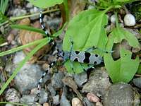 Rosalia alpina Rosalia alpina |
 A fat mushroom A fat mushroom |
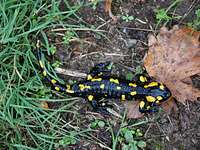 Fire Salamander Fire Salamander |
Accommodation
 Nagy-Hideg-hegy mountain hut
Camping is not allowed except for commercial campsites at the feet of the mountains (for example at Diósjenő and Kemence villages). There are a few forest houses which are available for tourists, but advance booking is required.
In the central region only one hut works, located on Nagy-Hideg-hegy. The hut offers accommodation for 40 persons. In the basement there is a restaurant, therefore it's often incorporated in the itinerary of hikers. In winter, if there is enough snow, two ski tracks attract skiers here.
Mountain Rescue and Weather
 En route to Csóványos
 Winter on Nagy-Mána
Börzsöny is not a dangerous place, but accidents may happen. In case you get in trouble and need help, the phone number of the Mountain Rescue is: +36203199853
Weather charts from the last 24 hours on Nagy-hideg-hegy (864 m).
 Winter view from Csóványos
Maps
 Digital elevation model - Börzsöny viewed from the south
Good quality topo maps of Börzsöny Mountains can be found both in printed and online form:
Paper maps:
- 1:40,000 by Cartographia, available here
- 1:30,000 by Szarvas-Faragó, available here
Online maps:
- turistautak.hu (zoom to see marked tourist routes)
- openmaps.eu (zoom to see marked tourist routes)
Miscellaneous
 Salgóvár
There are a few small fort ruins in Börzsöny.
One of them, Drégelyvár (near the villages of Drégelypalánk and Nagyoroszi) is known to every Hungarian for the story of a heroic battle. In 1552, an army of 12,000 (!) Ottoman invaders started siege of the fort. Captain György Szondi, with his 146 troops knew their fate, but did not surrender. They managed to withstand the siege for four days (6-9 of July), fighting till their last drop of blood. The fort was cannoned to ruins in the battle, and was never used again. Restoration of this historic site began in 1991.
Another one, called Salgóvár, is situated in the western part, on Vár-bérc (715 m). The natural rock on the mountaintop was fortified probably in the 13th century, then got demolished in 1424 as a punishment to the owner for making false money.
External Links
Duna-Ipoly National Park
Webcam at Nagy-Hideg-hegy (865 m)