

|
|
Area/Range |
|---|---|
|
|
48.15990°N / 24.50046°E |
|
|
Hiking, Skiing |
|
|
Spring, Summer, Fall, Winter |
|
|
6745 ft / 2056 m |
|
|
LukZem Videos
|
|
Overview
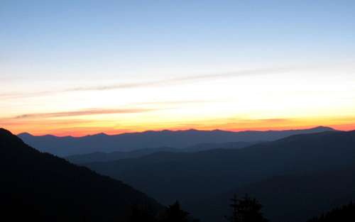
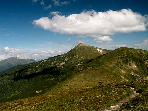
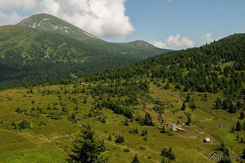
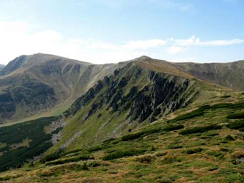
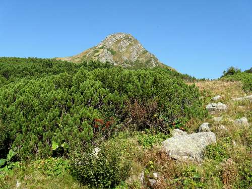
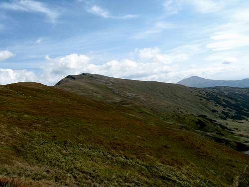
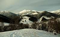
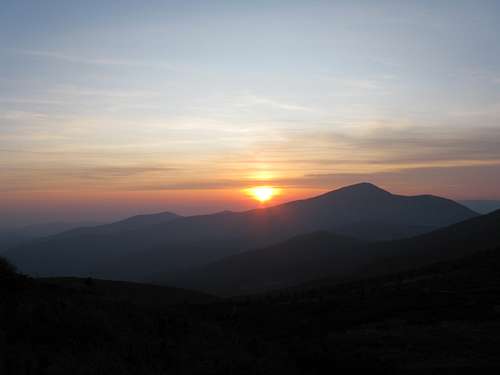
The Chornohora, which literally means Black Mountain, is the highest mountain range in the Ukrainian Carpathians. The length of the range is 40 kilometres; it contains a 20-kilometre-long section whose average elevation is 2,000m. According to most geographers, it belongs to the Eastern Carpathians, however, SP's Carpathians page splits the Eastern Carpathians in half and classifies all Ukrainian Carpathians as part of the Northeastern Carpathians. The mountains of Chornohora have an area of about 40 by 20 km, sitting between the valleys of the Black Tisa and the Black Cheremosh rivers (map), east of the Svydovets, whose the Chornohora is a higher and more rugged copy. The southeastern boundary of the Chornohora is formed by the White Tisa, the northestern boundary runs between the town of Vorokhta and the village of Verkhovyna (called Żabie by Polish people), along the depression that separates the Chornohora from the mountains of Pokutye (Pokuts'ki Karpaty). To the south of the Chornohora, islands of crystalline rocks come to surface within the Marmarosh Carpathians proper. Millions of years ago, the main ridge of what is now the Chornohora and the Svydovets was sawn in half by headward erosion of the Black Tisa. Centuries ago the valley of the Black Tisa served as an entrance to the Pannonian Plain for many a nomad tribe coming from the steppes of Eurasia, including those who founded the Kingdom of Hungary about a millennium ago. Looking at the Chornohora from the valley of the Black Tisa, the first impressive mountain in sight, which may appear to be the highest summit in these mountains, is the 2020 metres high Petros. Farther to the east, the actual highest summit, Hoverla at 2056m (according to measurements from year 2021), can be seen.
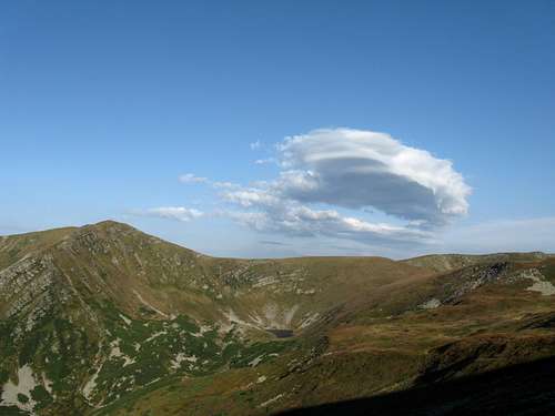
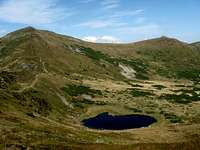
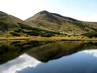
Both the peaks stand on the main ridge, which between them extends east to west, but at Hoverla takes a turn to the southeast. For several centuries, Hoverla and the rest of the main ridge of the Chornohora between Hoverla and Pip Ivan in the southeast marked the border between the kingdoms of Poland and Hungary. On the higher ground, some of the toponyms betray their Romanian, or Vlach, origins – see here. The rich history of the region transpires through the names of the highest summits: Petros at the northwestern end, Pip Ivan (pip = priest in Ukrainian) at the southeastern end, Hoverla in the center (discussed here). The upper sections of the valleys display traces of Pleistocene glaciers: cirques and troughs (U-shaped valleys) with steep, often rocky slopes and broad bottoms sometimes dotted with lakes or peat bogs; the uneven long profiles of the rivers, with occasional waterfalls, such as those on the Prut River. In the valley of the Prut the glacier was 6.5 km long. The tarns of the Chornohora are enchanting; what's more, some of them are believed to be enchanted! The highest mountain lake in the Ukrainian Carpathians is Lake Brebeneskul, which sits at 1800m.
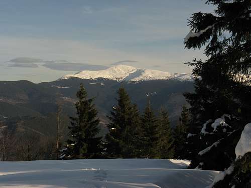
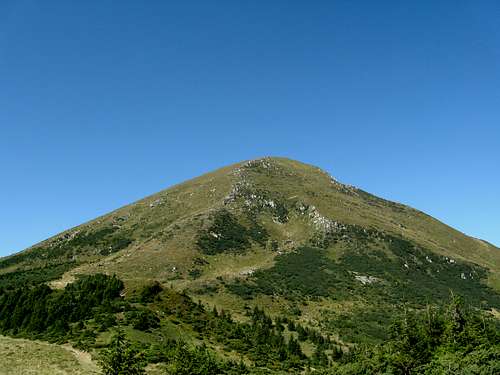
Mount Hoverla at 2061m is the highest point in both the Chornohora and Ukraine. For the Ukrainian people, the top of Hoverla is a symbol of greatness and pride. It is situated just on the border of the Transcarpathian and Ivano-Frankivsk regions. Its conical peak is surrounded by the Carpathian National Nature Park on one side and Chornohirskyi protected massif of the Carpathian Biosphere Reserve on the other side. The visitors are delighted to see the picturesque landscapes of alpine meadows, mountain lakes and forests. From the top of Hoverla it is possible to have a spectacular view of all the five summits reaching 2000 meters in elevation. In the table below are - listed from W to SE - the summits of the Chornohora which rise above 2000m.
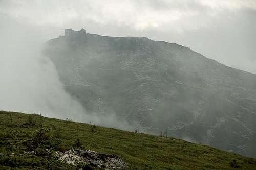
Chornohirskyi protected massif Prut waterfall Prut waterfall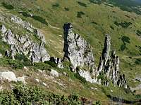 Shpytsy This is the part of the Carpathian Biosphere Reserve where the most unique biogeocenoses are protected and studied. It is situated on the southern side of the Chornohora, at 700-2061m and has an area of 16375 ha. Hoverla sits within the reserve.  Red deer Red deerThe main range of Chornohora is formed of sandstone (the major component of the Carpathian flysch, along with shale) of Cretaceous and Paleogenic age. The geomorphological features of the Chornohora have evolved since the Miocene epoch. The climate is moderately continental - from cool and humid to cold. Air temperature drops with altitude, whereas precipitation increases. According to data from the wheather station at Luhy at 613m, the average temperature of the coldest month (January) is 6.8 degrees Celsius below zero, warmest (July) 15.7 degrees, the average annual temperature is 5.4 degrees. The average annual amount of precipitation is 1001 mm. At the Pozhyzhevska weather station (1430m), the average temperature of January is 6.4 degrees below zero, July 11.5 degrees, the average annual temperature 2.8 degrees. The annual amount of precipitation increases up to 1465 mm. Large amount of precipitation results in a well-developed net of streams and rivulets. The headwaters of the White Tisa are located here.  Gentiana asclepiadea Gentiana asclepiadea Sorex alpinus Sorex alpinusTypical of the forest formations are light-brown and dark-brown mountain-forest soils. On the higher territory, peat-mountain-podzolic and mountain-meadow-brown soils prevail.The Chornohirskyi protected massif is characterized by a large diversity of vegetation and flora. The prevailing type of vegetation is forest. The pure beech forests are rarely found in the Chornohora, where the climate is cool, and they are restricted to the southern slopes. Mixed larch-conifer forest with beech, fir and spruce, which grow up to 1200m, are found within a wider altitudinal range.  Pinus Cembra on slopes of Kiedrowaty, shot in 1929 Pinus Cembra on slopes of Kiedrowaty, shot in 1929The zonal fir-groves of the climax character are found higher, forming the upper forest line, which runs at 1500-1600m.The climax communities of elfin woodland (Mugheta, Duschekieta and Junipereta) grow in the subalpine zone. The best preserved virgin forests of Chornohoskyi massif together with other virgin forests in Transcarpathia and Slovakia, were inscribed to the UNESCO's World Heritage List as Primeval beech forests of the Carpathians The grassy communities of Deschampsia caespitosa, Calamagrostis villosa can be found in many areas here. Fewer areas are occupied by Nardus stricta. The alpine meadows are formed by the communities of Carex sempervirens, Festuca supina and Juncus trifidus. The communities with the prevailing Carex curvula and Lerchenfeldia flexuosa are occasionally found. 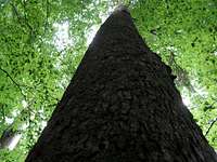 Fir tree 52 meters tall Fir tree 52 meters tallThe flora of the Chornohirskyi massif boasts a number of rare species, such as: Atragene alpina, Helleborus purpurascens, Leucanthemum waldschteinii, Listera cordata, Rhododendron kotschyi, Aconitum firmum, Anemonastrum narcissiflorum,Chrysosplenium alpinum , Gentiana acaulis, Gentiana verna, Melampyrum saxosum, Parageum montanum, Pedicularis verticillata, Polygonum viviparum, Pulmonaria fillarskiana, Rhodiola rosea etc... The nucleus (characteristic combination of species) of the Chornohirskyi massif's vertebrate fauna is formed by the species of taiga and alpine complexes. Higher up, at approx. 1800m, one can found a snow vole Chyonomis nivalis and alpine accentor Prunella collaris, entered into the Red Data Book of Ukraine. The typical bird representatives of the conifer and mixed forests are the following: three-toed woodpecker Picoidus tridactylus, goldcrest Regulus regulus , ring ouzel Turdus torquatus, black grouse Lyrurus urogalus lynx, bear etc. In general, fauna of the Chornohirskiy massif is represented by species which are typical of the forest zone across the Carpathians. Some vertebrate species, including endemic species which are tokens of the Ukrainian Carpathians, can be found only in the Chornohora. Historic borderline Ruins of the observatory on the summit of Pip Ivan Ruins of the observatory on the summit of Pip Ivan Czechoslovakia/Poland historic border post Czechoslovakia/Poland historic border postThe main ridge of the Eastern Carpathians used to be a borderline. Until the partition of the Polish-Lithuanian Commonwealth in 1772, it divided the commonwealth from the Kingdom of Hungary. After World War I the border remained in place, but the states it separated had changed: the whole area of what is today western Ukraine was divided between Poland and Czechoslovakia. In 1938-1939 the western part was re-annexed by Hungary until the end of World War II, when the whole region was snapped by the Soviet Union. Since the disassembly of the Soviet Union, the territory has been part of Ukraine. However, most of the characteristic granite border posts from the interwar period still stand all along the crest of the main ridge, and the ruins of the Polish Astronomical Observatory on the summit of Pip Ivan also remind us of the bygone days. |


Getting There & When (Not) To Go
 Towards Hoverla Towards Hoverla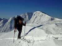 Cross-country skiing has a long history here Cross-country skiing has a long history here
|
Maps
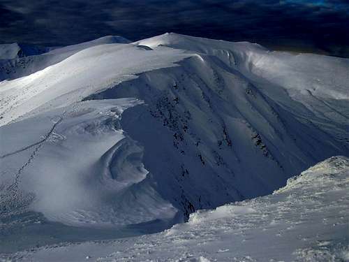
 Main ridge in winter Main ridge in winter White and Black Tisa rivers meet near Rakhiv White and Black Tisa rivers meet near Rakhiv
|
Red Tape
 Keveliv access point Keveliv access point Reddish winter Hoverla Reddish winter HoverlaThe Chornohora is part of the Carpathian Biosphere Reserve as well as the Carpathian National Nature Park. There are checkpoints, where you have to pay a fee for access to these protected areas. Access points to the Carpathian Biosphere Reserve:
Entry points into the Carpathian National Nature Park:
|
Accommodation
 Two Hoverlas? :) Two Hoverlas? :) Chatka u Kuby Chatka u Kuby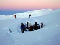 Winter camping Winter campingThe Chornohora mountain range has no real mountain huts, but there are two tourist bases near Hoverla.
Guesthouses, small mountain huts and similiar facilities:
|
Rescue Service & Weather
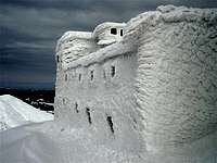 Pip Ivan Observatory Pip Ivan ObservatoryMountain rescue service
Duty officer at the Ministry of Emergency: (+380 312) 660 701, 660 114 or (+380 44) 247 3211 Emergency numbers of rescue services: 101
AccuWeather forecast for Verkhovyna |


Animated Snapshots
A series of animated snapshots from Chornohora by LukZem
Select External Links
- Chornohora trilogy by Stanisław Vincenz (in Polish): Part One - a must read for all who love these mountains
- Sofron Witwicki. Rys historyczny o Hucułach. Lwów 1862
- Trailer for a Hazajáró documentary
- Karpaty.net
palic - Oct 1, 2010 6:10 am - Voted 10/10
Ski touring in Cornogora regionSee: http://www.mountainski.eu/14/skialpinism-and-freeride-ukraina-2009, Dragobrat: http://mountainski.cz/25/skakani-na-lyzich-v-oblasti-dragobratu-na-ukrajine
MaksymKozub - Dec 16, 2011 1:16 pm - Hasn't voted
Telephone number formatThere are lots of useful phone numbers, but all of them in different formats. Funnily enough, even numbers which have exactly the same prefix are mentioned in different formats within the same line :): "Mountain rescue service Lviv tel.:00380 0322 395 470, (+38 0322) 395 070" In addition, the number in Vorokhta ("00380 - 034 - 344 11 49") is just plain wrong, because it has an extra "0". It should be either "...380 34..." or "...38 034...", but never "...380 034...". The source of this error is probably the fact that in Ukraine, there is "380" as the country code and "34" as the first digits of long-distance codes within Ivano-Frankivsk Oblast (Province), but when dialling long-distance within the country, "0" is added to city codes. I.e., you dial "034...) within Ukraine, but "...380 34..." from other countries. The best solution to avoid the mess would probably be just to put all numbers in the international format, clearly splitting the country code, city (or mobile operator) code, and the number itself. E.g. "(+380 342) 751 436" for Ivano-Frankivsk MRS, etc.
LukZem - Dec 17, 2011 12:28 pm - Hasn't voted
Re: Telephone number formatHi, Your corrections are greatly appreciated, since I have no experience with dialing these numbers. I added this chapter after receiving a brand new map, where there is a table with these numbers. Please check it right now and let me know if there are any mistakes. ???????
MaksymKozub - Dec 17, 2011 2:26 pm - Hasn't voted
Re: Telephone number formatMost of the numbers seem to be OK now, except for a couple of things. Zarosliak: not "803 434 415 91" but (+380 3434) 415 91. By the way, "8" as a prefix to dial long-distance has changed to "0" something like 1 year ago, so it would be impossible to dial it as "803434..." _even within Ukraine. "Duty officer of Ministry of Emergency - (+380 321) 660 701, 660 114 or (+380 442) 473 103" — those seem to be the numbers of two different offices. The last one seems to be for Kyiv. Although it would be possible to dial it the way you have put it, but Kyiv numbers have been 7-digit, nor 6-digit, since long ago, so it is not "(+380 442) 473 103" but "(+380 44) 247 3103". Actually, on their website they now have (at http://mns.gov.ua/content/contacts.html) 247-3211 as "Duty Shift Commander". The first two numbers are for Zakarpattia Oblast Department of the MRS, but the city code is wrong: it is not "321" but "312" i.e. they should be "(+380 312) 660 701, 660 114". The MRS currently lists those numbers for the regional Duty Shift Commander at their regional page (http://zk.mns.gov.ua/content/kontakt.html); the second number is listed as telephone/fax. Also, since you use mostly Ukrainian (not Russian) spelling for names on your Chornohora page, "Verchovina" should become "Verkhovyna" I believe :).
LukZem - Dec 17, 2011 3:29 pm - Hasn't voted
Re: Telephone number formatNow let's hope it is OK! Thanks very much for your responsibility.
MaksymKozub - Jan 3, 2016 1:37 pm - Hasn't voted
Dead link"A must read for all who love these mountains: Chornohora Trilogy" now points to a 404 page.
yatsek - Jan 3, 2016 2:27 pm - Voted 10/10
Re: Dead linkThanks. It seems the book can't be read online any longer. That's a pity.
yatsek - May 2, 2020 9:17 am - Voted 10/10
Re: Dead linkThe first part of the book is back online as a Wikipedia page - please see "Select External Links".